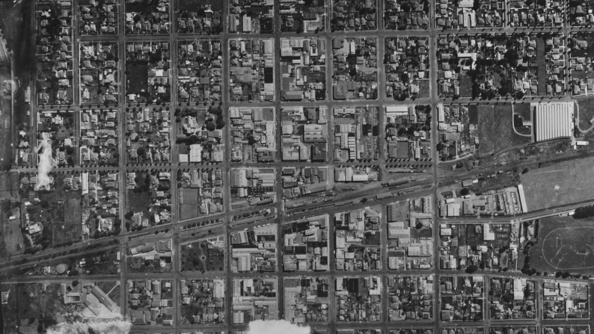
Hastings City Centre Aerial View
Original digital file
HolmanT2301_Photos_003.jpg
Non-commercial use

This work is licensed under a Attribution-NonCommercial 3.0 New Zealand (CC BY-NC 3.0 NZ).
Commercial Use
Please contact us for information about using this material commercially.Can you help?
The Hawke's Bay Knowledge Bank relies on donations to make this material available. Please consider making a donation towards preserving our local history.
Visit our donations page for more information.
Description
Vertical streets left to right – Prospect Road, Knight Street, Southampton Street, Eastbourne Street; Heretaunga Street in centre; Queen Street, Avenue Road, St Aubyn Street
Lower – Ellison Street, Victoria Street, Albert Street
Top right – Whitehead Road, Fitzroy Avenue
Horizontal streets top to lower – Nelson Street, King Street, Market Street
Railway Road running top of diagonal railway line; Russell Street below
Caroline Road on right
Lower – Karamu Road and Warren Streets
Lower right – Nelson Park athletics track; part of Wattie’s above it
Lower left – Central School


Do you know something about this record?
Please note we cannot verify the accuracy of any information posted by the community.