Hastings West Aerial View 1947

Original digital file
KaleHA1895-2_AerialPhotos_01.jpg
Non-commercial use

This work is licensed under a Attribution-NonCommercial 3.0 New Zealand (CC BY-NC 3.0 NZ).
Commercial Use
Please contact us for information about using this material commercially.Can you help?
The Hawke's Bay Knowledge Bank relies on donations to make this material available. Please consider making a donation towards preserving our local history.
Visit our donations page for more information.
Description
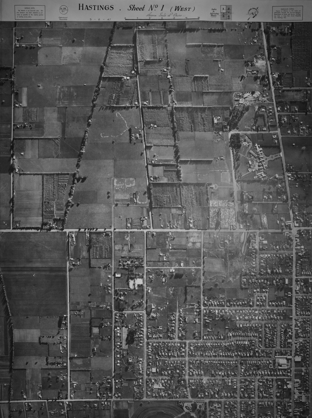
HASTINGS, Sheet No. 1 (WEST)
5-6-47
N.134
D1
Lower centre – Hawke’s Bay Jockey Club race track
Lower to top horizontal – Southland Road, Charles Street, Seddon Street, Lascelles Street, Pepper Street, Lovedale Road, Florence Place, Townshend Street, St Leonard’s Avenue, Kennedy Road, Davis Street, Stortford Street, Maraekakaho Road, Hastings Cemetery, Hawke’s Bay Fallen Soldiers’ Memorial Hospital, Canning Road
Left to right vertical – York Road, Wall Road, Oliphant Road, Gordon Road, Lowe Street, Cook Place, Henry Street, Francis Hicks Avenue), Southampton Street before extension, Lyndon Road, Eastbourne Street West, Heretaunga Street West, Orchard Road, Omahu Road
Subjects
Tags
Location
Hastings WestFormat of the original
Photographic printDate published
5 June 1947Accession number
557179Supporters and sponsors
We sincerely thank the following businesses and organisations for their support.


Do you know something about this record?
Please note we cannot verify the accuracy of any information posted by the community.