Kohurau-Tuna Nui Map 1953
Original digital file
patoka-kohurau-tunanui-map.jpg
Non-commercial use

This work is licensed under a Attribution-NonCommercial 3.0 New Zealand (CC BY-NC 3.0 NZ).
Commercial Use
Please contact us for information about using this material commercially.Can you help?
The Hawke's Bay Knowledge Bank relies on donations to make this material available. Please consider making a donation towards preserving our local history.
Visit our donations page for more information.
Description
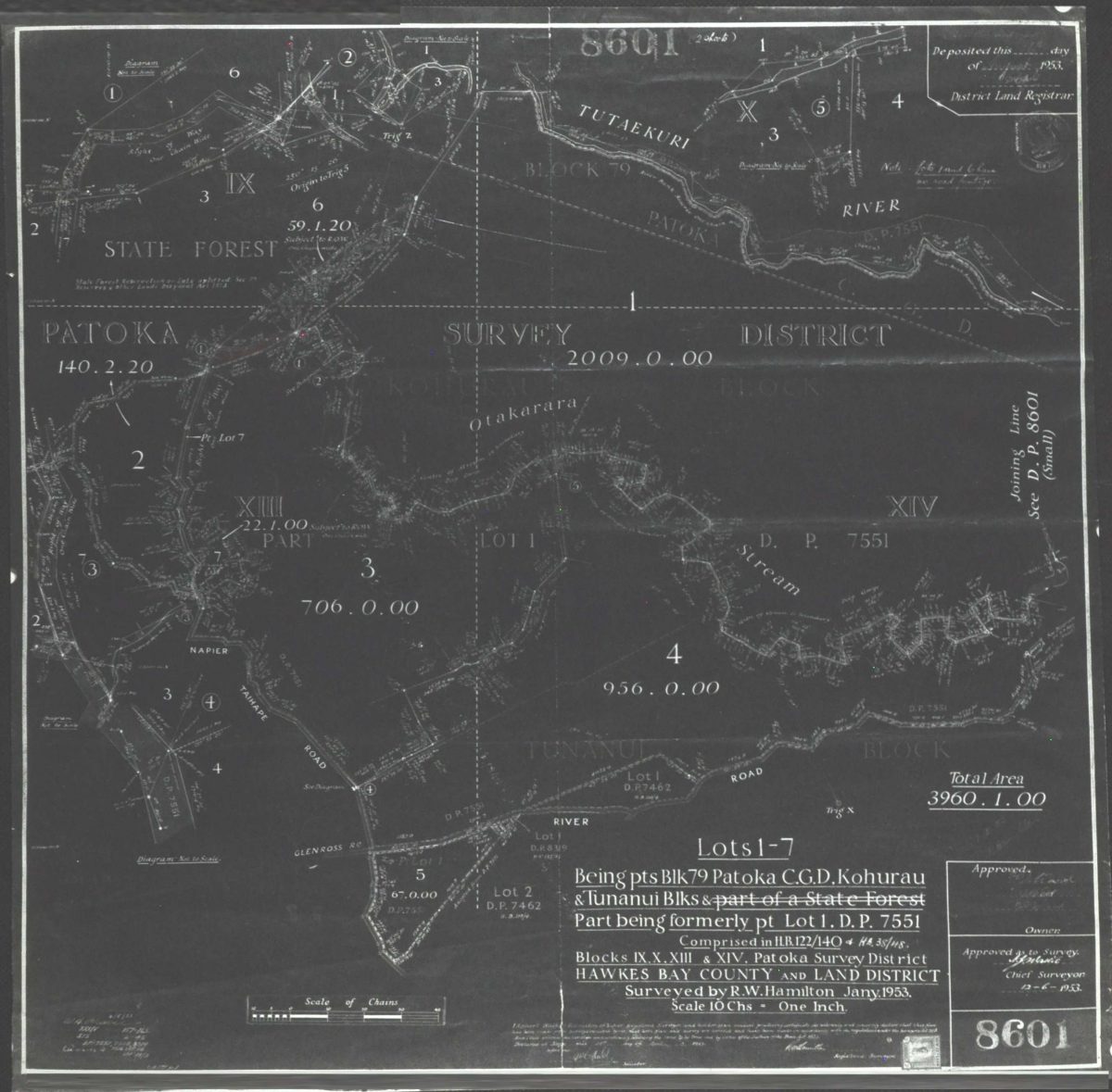
PATOKA SURVEY DISTRICT
Total Area
3960.1.00
Lots 1-7
Being pts Blk 79 Patoka C.G.D. Kohurau & Tunanui [Tuna Nui] Blks & part of a State Forest
Part being formerly pt Lot 1. D.P. 7551
Comprised in H.B. 122/140 & H.B. 38/48.
Blocks IX, X, XIII & XIV, Patoka Survey District
HAWKES BAY COUNTY AND LAND DISTRICT
Surveyed by R.W. Hamilton Jany. 1953.
Scale 10 Chs – One Inch.
Approved as to Survey
Chief Surveyor
12-6-1953.
8601
Subjects
Tags
Format of the original
MapDate published
1953Accession number
1318/1319/43706Supporters and sponsors
We sincerely thank the following businesses and organisations for their support.


Do you know something about this record?
Please note we cannot verify the accuracy of any information posted by the community.