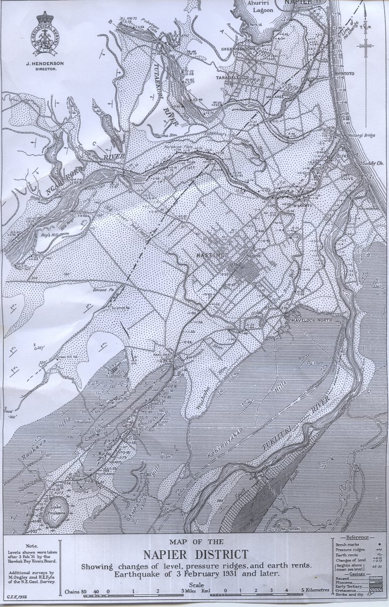
Napier District Geological Map 1933
Original digital file
2017-Anon912-9_NapierGeologicalMap1933.jpg
Non-commercial use

This work is licensed under a Attribution-NonCommercial 3.0 New Zealand (CC BY-NC 3.0 NZ).
Commercial Use
Please contact us for information about using this material commercially.Can you help?
The Hawke's Bay Knowledge Bank relies on donations to make this material available. Please consider making a donation towards preserving our local history.
Visit our donations page for more information.
Description
Transcript –
J. HENDERSON
DIRECTOR
MAP OF THE NAPIER DISTRICT
Showing changes of level, pressure ridges, and earth rents.
Earthquake of 3 February and later.
Note.
Levels shown were taken after 3 Feb ’31 by the Hawke’s Bay Rivers Board.
Additional surveys by M. Ongley and H.E. Fyfe of the N.Z. Geol. Survey.
G.E.H. 1933
Reference
Bench marks
Pressure ridges
Earth rents
Changes of level
Heights above mean sea level
Geology
Recent
Pliocene
Early Tertiary
Cretaceous
Strike and dip


Do you know something about this record?
Please note we cannot verify the accuracy of any information posted by the community.