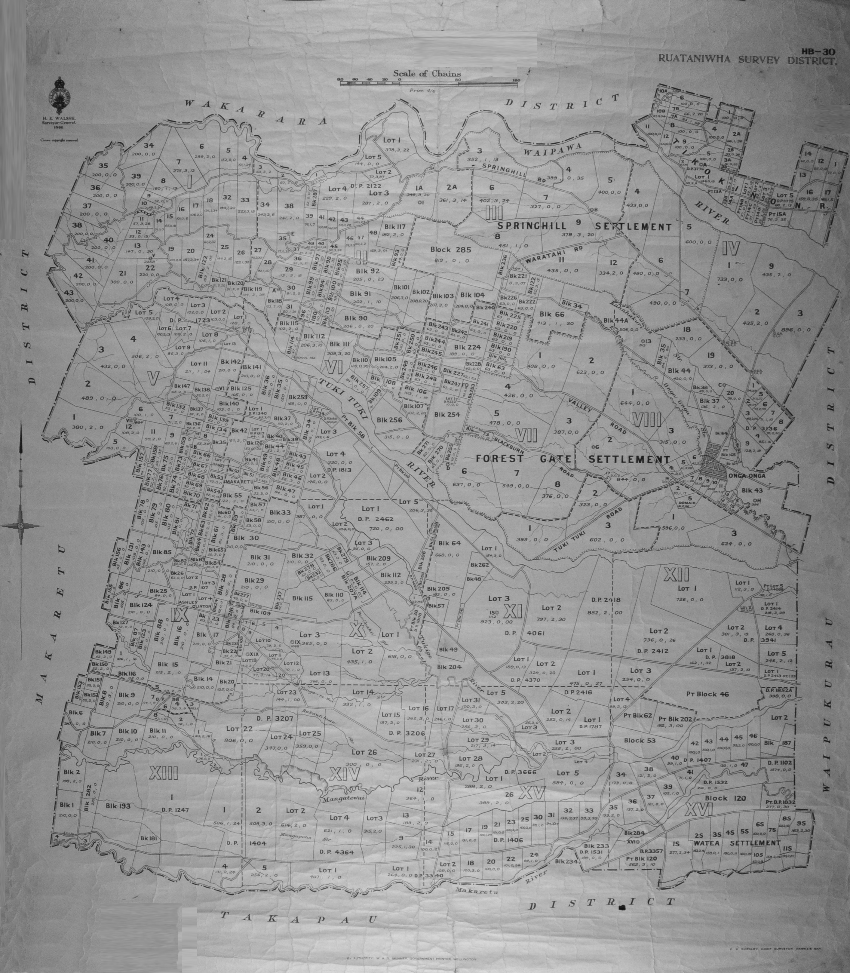
Ruataniwha Survey District Map 1932

Original digital file
berkahnj1371-ruataniwhasurveydistricthb-30.jpeg
Non-commercial use

This work is licensed under a Attribution-NonCommercial 3.0 New Zealand (CC BY-NC 3.0 NZ).
Commercial Use
Please contact us for information about using this material commercially.Can you help?
The Hawke's Bay Knowledge Bank relies on donations to make this material available. Please consider making a donation towards preserving our local history.
Visit our donations page for more information.
Description
RUATANIWHA SURVEY DISTRICT. HB-30
Scale of Chains
Price 4/6
H.E WALSHE
Surveyor-General.
1932
Crown copyright reserved
WAKARARA DISTRICT
SPRINGHILL RD
WAIPAWA RIVER
SPRINGHILL SETTLEMENT
WARATAHI RD
FOREST GATE SETTLEMENT
VALLEY ROAD
BLACKBURN ROAD
TUKI TUKI RIVER
TUKI TUKI ROAD
Tanga-re-wai
Rakautitirau[?]
TIKOKINO N.R.
Kahahakuri Str.
Onga Onga Str.
ONGA ONGA
MAKARETU DISTRICT
Mangatewai River
WAIPUKURAU DISTRICT
WATEA SETTLEMENT
Makaretu River
Mangapoho Str.
TAKAPAU DISTRICT
Subjects
Tags
Format of the original
MapAccession number
1371/1387/37991Supporters and sponsors
We sincerely thank the following businesses and organisations for their support.


Do you know something about this record?
Please note we cannot verify the accuracy of any information posted by the community.