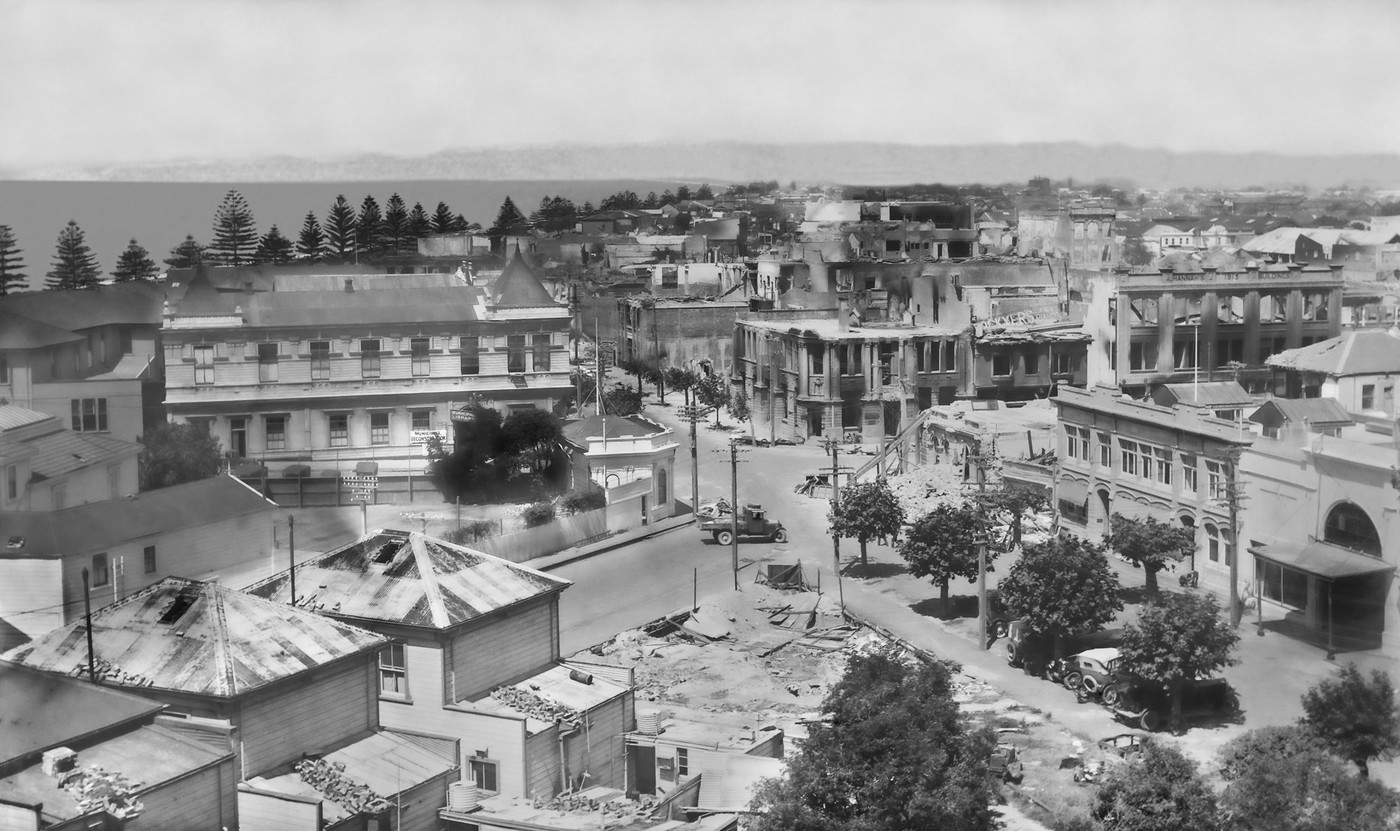
Ruined Napier City Landscape

Original digital file
TownshendL4004_Box44_011_Earthquake.jpg
Non-commercial use

This work is licensed under a Attribution-NonCommercial 3.0 New Zealand (CC BY-NC 3.0 NZ).
Commercial Use
Please contact us for information about using this material commercially.Can you help?
The Hawke's Bay Knowledge Bank relies on donations to make this material available. Please consider making a donation towards preserving our local history.
Visit our donations page for more information.
Description
Taken from Seapoint Road, Bluff Hill
Text on signs –
“MUNICIPAL LIBRARY
MUNICIPAL RECONSTRUCTION [Herschell and Browning Streets intersection]
LOCKYER’S FOR PIANOS
HANNAH’S 1915 BUILDINGS”
Hawke’s Bay County Council building
Note the direction the chimneys have fallen on the three houses in Byron Street, bottom left
Alexander Lavery (1863-1940) took photos of Hawke’s Bay from the early 1900s to 1940
Subjects
Tags
Location
NapierFormat of the original
Glass plate negativeDate published
1931Accession number
612429Supporters and sponsors
We sincerely thank the following businesses and organisations for their support.


Do you know something about this record?
Please note we cannot verify the accuracy of any information posted by the community.