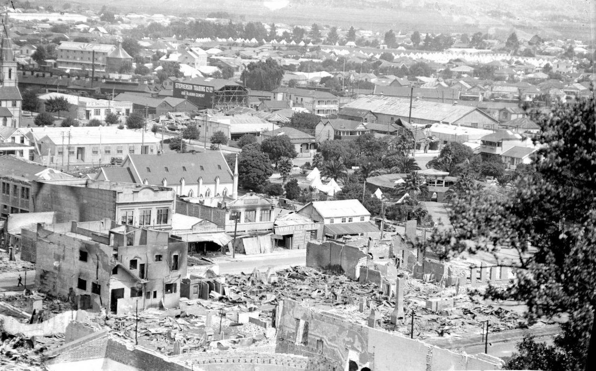
Ruined Napier City Landscape
Original digital file
ThomasS1555_GlassNegs_058a_EarthquakeFromHill-1.jpg
Non-commercial use

This work is licensed under a Attribution-NonCommercial 3.0 New Zealand (CC BY-NC 3.0 NZ).
Commercial Use
Please contact us for information about using this material commercially.Can you help?
The Hawke's Bay Knowledge Bank relies on donations to make this material available. Please consider making a donation towards preserving our local history.
Visit our donations page for more information.
Description
View of Napier from hill after 3 February 1931 earthquake
Buildings in photo – Trinity Methodist Church, Kelly’s and Whitfields Ltd, Emerson Street; Clive Square band Rotunda above.
Tents in Nelson Park at top
St Patrick’s Roman Catholic church spire at left
Signs on buildings –
“STEPHENSON TRADING CO. LTD
USE MILBURN CEMENT
SUNSHINE BREWERY
SPEIGHTS[?] ON TAP.
F.G. SMITH & Co. Ltd.”


Do you know something about this record?
Please note we cannot verify the accuracy of any information posted by the community.