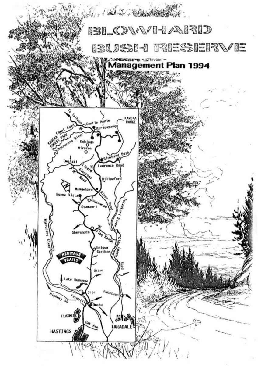
Blowhard Bush Reserve Management Plan 1994

Page 4 of 20
BLOWHARD BUSH RESERVE PROPOSED MANAGEMENT PLAN 1994.
INTRODUCTION
This management plan for Blowhard Bush Reserve has been prepared in accordance with the procedures set out in Section 41. Reserves Act 1971 and the Royal Forest & Bird Protection Society’s “Guidelines for Management Plans for Forest & Bird Reserves”.
The complex nature of Blowhard Bush Reserve with its diverse scenery and ecology, requires the planning of each area as a separate entity but with linking tracks, a general management plan has been prepared.
This document is a Management Plan comprising of a comprehensive statement which provides guidelines for the management of the reserve’s resources, qualities and values. These long term aims, are expressed as objectives which are based on “Protected Private Land” status under the Reserves Act 1977.
Roy J Peacock
Hastings-Havelock North Branch,
Royal Forest & Bird Protection Society of NZ Inc,
1 March 1994
1 RESOURCE INFORMATION.
1.1 Location.
Blowhard Bush Reserve is located at the junction of Lawrence Road and Taihape Road, 53km west of Hastings (See Map 1). It ranges in altitude from 700 to 825m a s 1 and has a total area of 63.1057 hectares.
Map reference NZMS 260 U20 935040.
1.2 Access.
Taihape Road passes the southern side of the reserve but access is from Lawrence Road by way of a track connecting to a carpark on the Department of Conservation estate.
1.3 Legal Description.
Protected Private Land Status, Reserves Act 1977
OKAWA Taihape Road, Lot 1 DP10991 Section 4 Block X Kuripapango S D
1.4 Classification and Zoning.
Unclassified Zoned Rural 4.
1.5 Administration.
Administration of the reserve is the responsibility of the Hastings- Havelock North Branch Committee of the Royal Forest & Bird Protection Society of NZ Inc.
1.6 History.
Once man came on the scene, the “whakatoa” of the Maori, was to burn off a great deal of the lowland forest to grow edible plants or to drive the wildlife into traps for food. Many of these fires ran out of control and were only stopped by the limestone block walls of Blowhard Bush Reserve.
Europeans came on the scene when William Colenso crossed part of the Blowhard in 1851 and reported an eroded landscape of Pteridium fern land . . .

Page 5 of 20
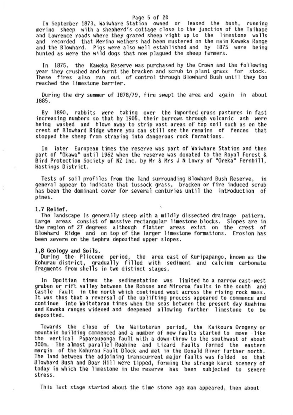
In September 1873, Waiwhare Station owned or leased the bush, running merino sheep with a shepherd’s cottage close to the junction of the Taihape and Lawrence roads where they grazed sheep right up to the limestone walls and recorded that Merino wethers had been mustered on the main Kaweka Range and the Blowhard. Pigs were also well established and by 1875 were being hunted as were the wild dogs that now plagued the sheep farmers.
In 1875, the Kaweka Reserve was purchased by the Crown and the following year they crushed and burnt the bracken and scrub to plant grass for stock. These fires also ran out of control through Blowhard Bush until they too reached the limestone barrier.
During the dry summer of 1878/79, fire swept the area and again in about 1885.
By 1890, rabbits were taking over the imported grass pastures in fast increasing numbers so that by 1905, their burrows through volcanic ash were being washed and blown away to strip vast areas of top soil such as on the crest of Blowhard Ridge where you can still see the remains of fences that stopped the sheep from straying into dangerous rock formations.
In later European times the reserve was part of Waiwhare Station and then part of “Okawa” until 1962 when the reserve was donated to the Royal Forest & Bird Protection Society of NZ Inc. by Mr & Mrs J N Lowry of “Oreka” Fernhill, Hastings District.
Tests of soil profiles from the land surrounding Blowhard Bush Reserve, in general appear to indicate that tussock grass, bracken or fire induced scrub has been the dominant cover for several centuries until the introduction of pines.
1.7 Relief.
The landscape is generally steep with a mildly dissected drainage pattern. Large areas consist of massive rectangular limestone blocks. Slopes are in the region of 27 degrees although flatter areas exist on the crest of Blowhard Ridge and on top of the larger limestone formations. Erosion has been severe on the tephra deposited upper slopes.
1.8 Geology and Soils.
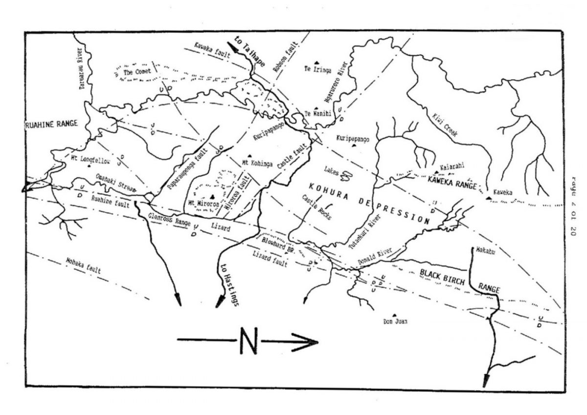
During the Pliocene period, the area east of Kuripapango, known as the Kohurau district, gradually filled with sediment and calcium carbonate fragments from shells in two distinct stages.
In Opoitian times the sedimentation was limited to a narrow east-west graben or rift valley between the Robson and Miroroa faults in the south and Castle fault in the north which continued west across the rising rock mass. It was thus that a reversal of the uplifting process appeared to commence and continue into Waitotaran times when the seas between the present day Ruahine and Kaweka ranges widened and deepened allowing further limestone to be deposited.
Towards the close of the Waitotaran period, the Kaikoura Orogeny or mountain building commenced and a number of new faults started to move like the vertical Paparauponga fault with a down-throw to the southwest of about 300m. The almost parallel Ruahine and Lizard Faults formed the eastern margin of the Kohurau Fault Block and met in the Donald River further north. The land between the adjoining transcurrent major faults was folded so that Blowhard Bush and Boar Hill were tipped, forming the strange karst scenery of today in which the limestone in the reserve has been subjected to severe stress.
This last stage started about the time stone age man appeared, then about

Page 6 of 20
500 000 years ago the Kaweka Ranges rose above the sea, while lagoons filled most depressions that in time became salt free as drainage patterns formed when rivers and streams cut their way deep into the crush zones of the major fault lines.
About 14000 to 10000 years ago volcanic ash reaching this area, formed a reddish brown silt loam of low fertility that formed a base for tree and plant growth. In 186 A.D. a hot Taupo ash shower burnt must of the existing plant cover leaving traces of burnt timber up to a metre below the present surface.
The layer of Taupo Tephra that in places is over 2m thick and has been subjected to severe erosion where up to a metre of tephra has been removed from the results of rabbit browsing and burrows, that allowed wind and rain to penetrate the surface, accompanied by frost creep and heaving, to release surface material to be water transported away.
Soils in the lower forest contain high proportions of humus and tephra and have not been known to completely dry out even during severe droughts.
1.9 Climate.
Mean annual rainfall is approximately 1.5m. The highest rainfall is during winter.
Winds are predominantly from the western quarter, sometimes blowing from the north-west during summer when hot dry winds raise the fire hazard.
1.10 Vegetation.
The vegetation is described as an island of podocarp-hardwood forest that is unusual for this altitude. Above the mature forest lies a band of kanuka forest supporting an emerging canopy of Pittosporum, Pseudopanax, Pseudowintera and Cordyline species.
The crest of Blowhard Ridge is covered with planted manuka and secondary growth, established after planting treated Coriariaceae species seed from nearby fire induced thickets.
The northern end of the reserve consists of a regenerating, fire induced manuka with plants from the mature forest spreading to provide secondary growth.
Being almost surrounded by exotic forest, with plantings of Pinus contorta upwind. Seedlings of both Pinus contorta and radiata may be found in the upper and southern reserve sub-areas, despite constant removal.
1.11 Fauna.
Birds are the most common native fauna with the most abundant species being bellbird, tui, fantail, grey warbler, whitehead, pigeon, cuckoos, tomtit, fernbird, pipit, skylark, morepork, silvereye, robin, rifleman and harrier hawk. Magpies, blackbirds and thrushes have arrived during the past quarter century.
Other native animals are at present under survey.
Introduced animals are having a significant effect on the condition of the vegetation. Opossums have caused major damage in the past which has affected the rate of regeneration. Control measures are being undertaken by poisoning.
Over the past seven years, sika deer have been moving into the reserve in small numbers.

Page 7 of 20
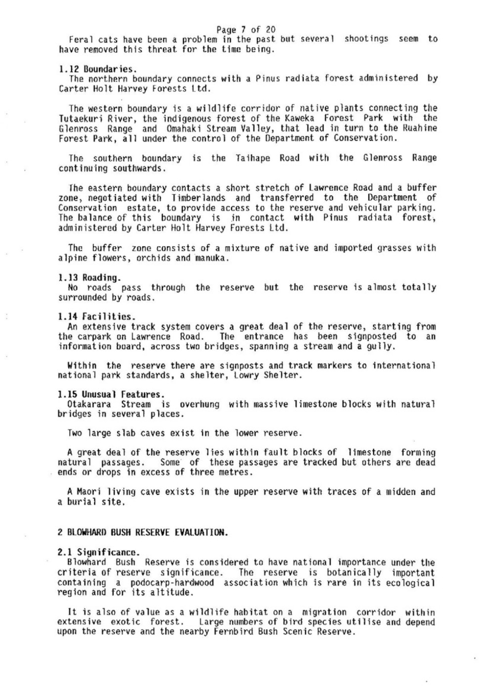
Feral cats have been a problem in the past but several shootings seem to have removed this threat for the time being.
1.12 Boundaries.
The northern boundary connects with a Pinus radiata forest administered by Carter Holt Harvey Forests Ltd.
The western boundary is a wildlife corridor of native plants connecting the Tutaekuri River, the indigenous forest of the Kaweka Forest Park with the Glenross Range and Omahaki Stream Valley, that lead in turn to the Ruahine Forest Park, all under the control of the Department of Conservation.
The southern boundary is the Taihape Road with the Glenross Range continuing southwards.
The eastern boundary contacts a short stretch of Lawrence Road and a buffer zone, negotiated with Timberlands and transferred to the Department of Conservation estate, to provide access to the reserve and vehicular parking. The balance of this boundary is in contact with Pinus radiata forest, administered by Carter Holt Harvey Forests Ltd.
The buffer zone consists of a mixture of native and imported grasses with alpine flowers, orchids and manuka.
1.13 Roading.
No roads pass through the reserve but the reserve is almost totally surrounded by roads.
1.14 Facilities.
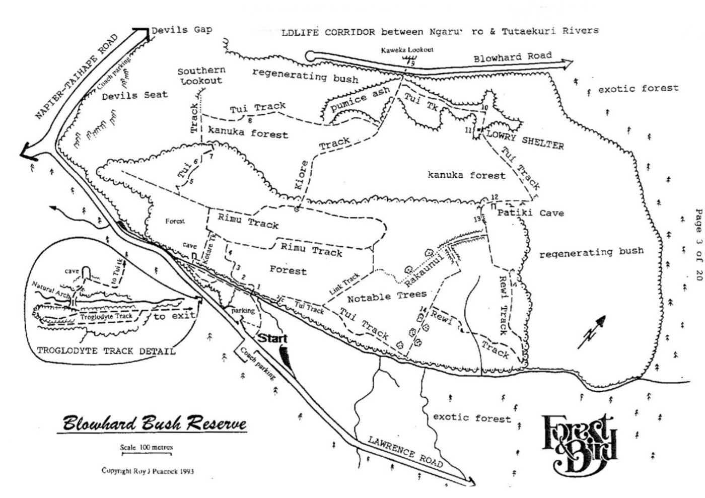
An extensive track system covers a great deal of the reserve, starting from the carpark on Lawrence Road. The entrance has been signposted to an information board, across two bridges, spanning a stream and a gully.
Within the reserve there are signposts and track markers to international national park standards, a shelter, Lowry Shelter.
1.15 Unusual Features.
Otakarara [Otekarara] Stream is overhung with massive limestone blocks with natural bridges in several places.
Two large slab caves exist in the lower reserve.
A great deal of the reserve lies within fault blocks of limestone forming natural passages. Some of these passages are tracked but others are dead ends or drops in excess of three metres.
A Maori living cave exists in the upper reserve with traces of a midden and a burial site.
2 BLOWHARD BUSH RESERVE EVALUATION.
2.1 Significance.
Blowhard Bush Reserve is considered to have national importance under the criteria of reserve significance. The reserve is botanically important containing a podocarp-hardwood association which is rare in its ecological region and for its altitude.
It is also of value as a wildlife habitat on a migration corridor within extensive exotic forest. Large numbers of bird species utilise and depend upon the reserve and the nearby Fernbird Bush Scenic Reserve.

Page 8 of 20
Blowhard Bush Reserve is also considered to have regional importance under the criteria of scenic tourist potential for geological formations, indigenous forest associations and scenic beauty.
Blowhard Bush Reserve is also part of the Heritage Trail Foundation list of attractive sites, along the Inland Patea Heritage Trail.
2.2 Development and Use.
Blowhard Bush Reserve has been developed to enhance passive public use. It is intended that continuing development will complement other conservation educational reserves in Hawke’s Bay.
The track system lies within areas of reasonable grades and has been developed as nature trails with scope for further labelling and information pamphlets.
A limited area of the summit of the reserve has been subject to extensive erosion. An ecological planting programme commenced in the late 1960’s requires completing to restore a final hectare of bare tephra.
Public use of Blowhard Bush Reserve has been increasing as awareness of its recreational value has become known. This will increase in the near future when educational facilities are improved at Kuripapango.
2.3 Adjacent Reserves.
The management planning for Blowhard Bush Reserve must take into account, the influence and requirements of Fernbird Bush Scenic Reserve. At present there is no direct method of public entry into Fernbird Bush S.R. where regeneration of beech forest is proceeding at a rapid pace, forcing fernbirds to move into the shrub land surrounding Blowhard Bush Reserve.
2.4 Management Issues.
The primary issue is to ensure protection and preservation of the existing native vegetation. Secondary issues of exotic flora and fauna control, fire prevention and protection of geological formations are important.
There are also recreational considerations. The possibility of constructing a picnic shelter within the buffer zone and enlarging the carpark. These issues pertain to facilities, access and recreational use.
3 MANAGEMENT OBJECTIVES.
The management objectives provide the basic long term aims for managing Blowhard Bush Reserve.
Primary Objective.
To protect and preserve indigenous vegetation and fauna, ecological associations, scenic qualities and natural features of the reserve.
Secondary Objective.
To ensure the provision of facilities that will aid passive recreational use of the reserve, subject to any restrictions as are deemed necessary to achieve the primary objective.
4 MANAGEMENT POLICIES.
4.1 Administration.
The Hastings-Havelock North Branch Committee of the Royal Forest & Bird Protection Society of NZ Inc. administers and controls Blowhard Bush Reserve

Page 9 of 20
in conjunction with the Hawke’s Bay Conservancy office of the Department of Conservation. It is desirable, due to the regional importance this reserve has, that control remains in Hawke’s Bay with guidance sought from the Society’s National Executive if and when the occasion demands.
Policy.
The day by day administration and control of the reserve shall remain the responsibility of the Hastings-Havelock North Branch Committee of the Royal Forest & Bird Protection Society of NZ Inc.
4.2 Plan Amendment and Review.
Management plans need to be kept up-to-date and in line with current knowledge and changing circumstance. Consequently this plan will require periodic reviews to ensure its continued relevance to the reserve. Such reviews should occur at intervals of no mare than five years.
Policy.
To review the management plan as is deemed necessary or at intervals of no more than five years.
4.3 Vegetation Management.
Protection and preservation of the reserve’s native vegetation is a high priority. Exotic seedlings require removal or suitable control.
Policy.
To prohibit the removal, damage or destruction of indigenous vegetation from or within the reserve, except for the purpose of public safety, track maintenance or approved research studies.
To remove, exterminate or control exotic vegetation from or within the reserve.
To continue to replant erosion areas with genetically correct local vegetation.
To ensure that the natural character and setting of the reserve is maintained.
4.4 Fauna Management.
The native animals, predominantly comprising of bird species, is a feature of this reserve and as such should be given maximum protection. Exotic animals, opossums, deer, hares and wasps have a marked influence on the vegetation of the reserve.
Policy.
To prohibit the removal, damage or destruction of native fauna from or within the reserve.
To control and as far as possible exterminate exotic animals where the reserve’s native vegetation and fauna requires protection.
To require immediate removal of any trespassing domestic stock from within the reserve.
To not permit the entry of any domestic animal (dogs, cats etc) into the reserve.
Proposals.
To continue with an opossum control programme under the direction of the Hawke’s Bay Regional Council and issue opossum trapping permits to approved persons.

Page 10 of 20
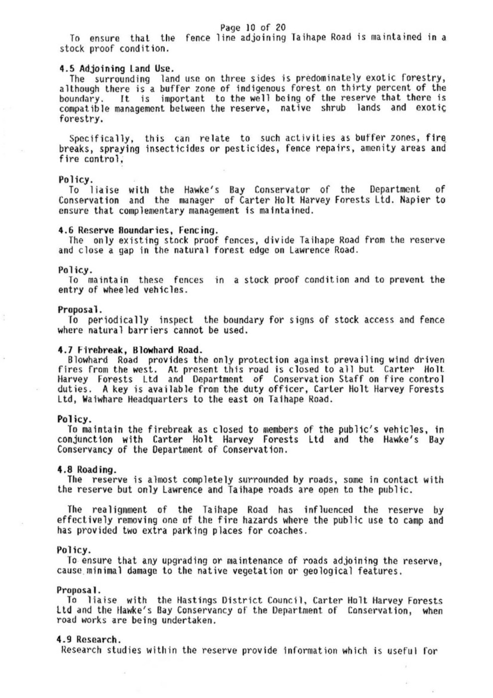
To ensure that the fence line adjoining Taihape Road is maintained in a stock proof condition.
4.5 Adjoining Land Use.
The surrounding land use on three sides is predominately exotic forestry, although there is a buffer zone of indigenous forest on thirty percent of the boundary. It is important to the well being of the reserve that there is compatible management between the reserve, native shrub lands and exotic forestry.
Specifically, this can relate to such activities as buffer zones, fire breaks, spraying insecticides or pesticides, fence repairs, amenity areas and fire control.
Policy.
To liaise with the Hawke’s Bay Conservator of the Department of Conservation and the manager of Carter Holt Harvey Forests Ltd. Napier to ensure that complementary management is maintained.
4.6 Reserve Boundaries, Fencing.
The only existing stock proof fences, divide Taihape Road from the reserve and close a gap in the natural forest edge on Lawrence Road.
Policy.
To maintain these fences in a stock proof condition and to prevent the entry of wheeled vehicles.
Proposal.
To periodically inspect the boundary for signs of stock access and fence where natural barriers cannot be used.
4.7 Firebreak, Blowhard Road.
Blowhard Road provides the only protection against prevailing wind driven fires from the west. At present this road is closed to all but Carter Holt Harvey Forests Ltd and Department of Conservation Staff on fire control duties. A key is available from the duty officer, Carter Holt Harvey Forests Ltd, Waiwhare Headquarters to the east on Taihape Road.
Policy.
To maintain the firebreak as closed to members of the public’s vehicles, in conjunction with Carter Holt Harvey Forests Ltd and the Hawke’s Bay Conservancy of the Department of Conservation.
4.8 Roading.
The reserve is almost completely surrounded by roads, some in contact with the reserve but only Lawrence and Taihape roads are open to the public.
The realignment of the Taihape Road has influenced the reserve by effectively removing one of the fire hazards where the public use to camp and has provided two extra parking places for coaches.
Policy.
To ensure that any upgrading or maintenance of roads adjoining the reserve, cause minimal damage to the native vegetation or geological features.
Proposal.
To liaise with the Hastings District Council, Carter Holt Harvey Forests Ltd and the Hawke’s Bay Conservancy of the Department of Conservation, when road works are being undertaken.
4.9 Research.
Research studies within the reserve provide information which is useful for

Page 11 of 20
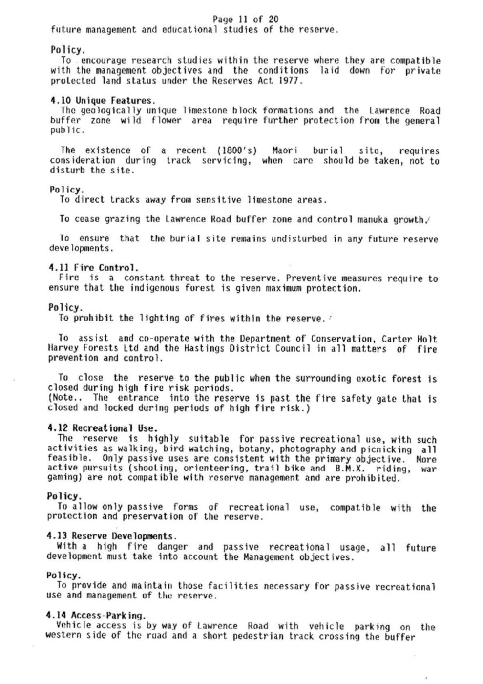
future management and educational studies of the reserve.
Policy.
To encourage research studies within the reserve where they are compatible with the management objectives and the conditions laid down for private protected land status under the Reserves Act. 1977.
4.10 Unique Features.
The geologically unique limestone block formations and the Lawrence Road buffer zone wild flower area require further protection from the general public.
The existence of a recent (1800’s) Maori burial site, requires consideration during track servicing, when care should be taken, not to disturb the site.
Policy.
To direct tracks away from sensitive limestone areas.
To cease grazing the Lawrence Road buffer zone and control manuka growth.
To ensure that the burial site remains undisturbed in any future reserve developments.
4.11 Fire Control.
Fire is a constant threat to the reserve. Preventive measures require to ensure that the indigenous forest is given maximum protection.
Policy.
To prohibit the lighting of fires within the reserve.
To assist and co-operate with the Department of Conservation, Carter Holt Harvey Forests Ltd and the Hastings District Council in all matters of fire prevention and control.
To close the reserve to the public when the surrounding exotic forest is closed during high fire risk periods.
(Note . . . The entrance into the reserve is past the fire safety gate that is closed and locked during periods of high fire risk.)
4.12 Recreational Use.
The reserve is highly suitable for passive recreational use, with such activities as walking, bird watching, botany, photography and picnicking all feasible. Only passive uses are consistent with the primary objective. More active pursuits (shooting, orienteering, trail bike and B.M.X. riding, war gaming) are not compatible with reserve management and are prohibited.
Policy.
To allow only passive forms of recreational use, compatible with the protection and preservation of the reserve.
4.13 Reserve Developments.
With a high fire danger and passive recreational usage, all future development must take into account the Management objectives.
Policy.
To provide and maintain those facilities necessary for passive recreational use and management of the reserve.
4.14 Access-Parking.
Vehicle access is by way of Lawrence Road with vehicle parking on the western side of the road and a short pedestrian track crossing the buffer

Page 12 of 20
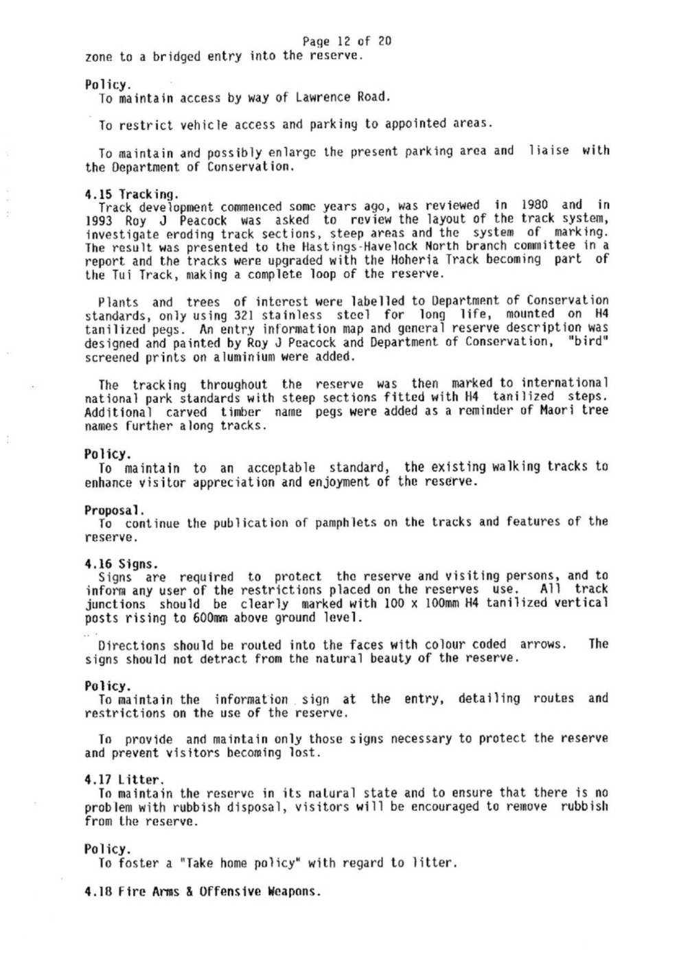
zone to a bridged entry into the reserve.
Policy.
To maintain access by way of Lawrence Road.
To restrict vehicle access and parking to appointed areas.
To maintain and possibly enlarge the present parking area and liaise with the Department of Conservation.
4.15 Tracking.
Track development commenced some years ago, was reviewed in 1980 and in 1993 Roy J Peacock was asked to review the layout of the track system, investigate eroding track sections, steep areas and the system of marking. The result was presented to the Hastings-Havelock North branch committee in a report and the tracks were upgraded with the Hoheria Track becoming part of the Tui Track, making a complete loop of the reserve.
Plants and trees of interest were labelled to Department of Conservation standards, only using 321 stainless steel for long life, mounted on H4 tanilized pegs. An entry information map and general reserve description was designed and painted by Roy J Peacock and Department of Conservation, “bird” screened prints on aluminium were added.
The tracking throughout the reserve was then marked to international national park standards with steep sections fitted with H4 tanilized steps. Additional carved timber name pegs were added as a reminder of Maori tree names further along tracks.
Policy.
To maintain to an acceptable standard, the existing walking tracks to enhance visitor appreciation and enjoyment of the reserve.
Proposal.
To continue the publication of pamphlets on the tracks and features of the reserve.
4.16 Signs.
Signs are required to protect the reserve and visiting persons, and to inform any user of the restrictions placed on the reserves use. All track junctions should be clearly marked with 100 x 100mm H4 tanilized vertical posts rising to 600mm above ground level.
Directions should be routed into the faces with colour coded arrows. The signs should not detract from the natural beauty of the reserve.
Policy.
To maintain the information sign at the entry, detailing routes and restrictions on the use of the reserve.
To provide and maintain only those signs necessary to protect the reserve and prevent visitors becoming lost.
4.17 Litter.
To maintain the reserve in its natural state and to ensure that there is no problem with rubbish disposal, visitors will be encouraged to remove rubbish from the reserve.
Policy.
To foster a “Take home policy” with regard to litter.
4.18 Fire Arms & Offensive Weapons.

Page 13 of 20
With the number of tracks within the reserve, the carrying or use of a firearm or offensive weapon (e.g. sling shot, bow & arrow, crossbow, etc) could endanger visitors or native fauna.
Policy.
To prohibit the carrying and use of any firearm or offensive weapon in the reserve. However the hunting of deer, possums, cats and other noxious animals may be permitted when authorised in writing by the managing branch’s secretary under the direction of the branch committee and the Department of Conservation, when the safety of reserve users must be considered. (e.g. Spotlighting at night.)
4.19 Camping.
Facilities do not exist for camping and it is considered to be an inappropriate use of the reserve. Such activities will only be permitted on the direction of the branch committee.
Policy.
To allow camping only to specific persons or groups for the purpose of study or reserve maintenance. Such permits must be authorised in writing by the managing branch’s secretary under the direction of the branch committee.
4.20 Buildings.
Lowry Shelter is an existing building first erected in 1964, when financed by Hastings-Havelock North branch members.
Repainted and repaired in 1975 and 1986.
A heating and cooking stove was removed for fire safety reasons in 1985.
By 1993 parts of the lodge had been burnt and rats were nesting in the walls. The main structure contained several rotting timbers and the exterior paint was almost non existent.
Relocated and rebuilt close to the crest of the Blowhard ridge by Roy J Peacock with help from the Hastings Periodic Detention Centre in August 1993.
Policy.
To maintain Lowry Shelter to reasonable standards as a picnic shelter and for the protection of reserve users during bad weather.
To erect an open picnic shelter by Lawrence Road to Department of Conservation Standards, sometime in the future.
4.21 Water Source.
The stream that acts as the lower boundary of the reserve requires protection from pollution.
Policy.
To ensure that all care is taken not to pollute the Otakarara Stream.

Page 14 of 20
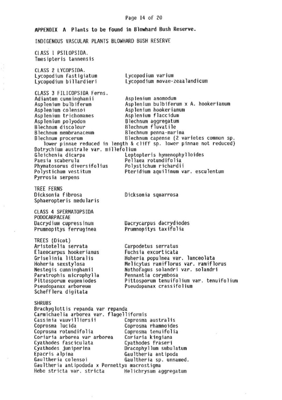
APPENDIX A Plants to be found in Blowhard Bush Reserve.
INDIGENOUS VASCULAR PLANTS BLOWHARD BUSH RESERVE
CLASS 1 PSILOPSIDA.
Tmesipteris tannensis
CLASS 2 LYCOPSIDA.
Lycopodium fastigiatum Lycopodium varium
Lycopodium billardieri Lycopodium novae-zeaalandicum
CLASS 3 FILICOPSIDA Ferns.
Adiantum cunninghamii Asplenium anomodum
Asplenium bulbiferum Asplenium bulbiferum x A. hookerianum
Asplenium colensoi Asplenium hookerianum
Asplenium trichomanes Asplenium flaccidum
Asplenium polyodon Blechnum aggregatum
Blechnum discolour Blechnum fluvatile [fluviatile]
Blechnum membranaceum Blechnum penna-marina
Blechnum procerum Blechnum capense (2 varietes common sp. lower pinnae reduced in length & cliff sp. lower pinnae not reduced)
Botrychium australe var. millefolium
Gleichenia dicarpa Leptopteris hymenophylloides
Paesia scaberula Pellaea rotundifolia
Phymatosorus diversifolius Polystichum richardii
Polystichum vestitum Pteridium aquilinum var. esculentum
Pyrrosia serpens
TREE FERNS
Dicksonia fibrosa Dicksonia squarrosa
Sphaeropteris medularis
CLASS 4 SPERMATOPSIDA
PODOCARPACEAE
Dacrydium cupressinum Dacrycarpus dacrydiodes
Prumnopitys ferruginea Prumnopitys taxifolia
TREES (Dicot)
Aristotelia serrata Carpodetus serratus
Elaeocarpus hookerianus Fuchsia excorticata
Griselinia littoralis Hoheria populnea var. lanceolata
Hoheria sexstylosa Melicytus ramiflorus var. ramiflorus
Nestegis cunninghamii Nothofagus solandri var. solandri
Paratrophis microphylla Pennantia corymbosa
Pittosporum eugeniodes Pittosporum tenuifolium var. tenuifolium
Pseudopanax arboreum Pseudopanax crassifolium
Schefflera digitata
SHRUBS
Brachyglottis repanda var repanda
Carmichaelia arborea var. flagelliformis
Cassinia vauvilliersii Coprosma australis
Coprosma lucida Coprosma rhamnoides
Coprosma rotundifolia Coprosma tenuifolia
Coriaria arborea var arborea Cariaria kingiana
Cyathodes fasciculata Cyathodes fraseri
Cyathodes juniperina Dracophyllum subulatum
Epacris alpina Gaultheria antipoda
Gaultheria colensoi Gaultheria sp. unnamed.
Gaultheria antipododa x Pernettya macrostigma
Hebe stricta var. stricta Helichrysum aggregatum

Page 15 of 20
Karzia [Kunzea] ericoides Leptospermum scoparium
Melicope simplex Neomyrtus pedunculata
Olearia furfuracea Olearia nummularifolia var, nummularifolia
Pimelea prostrata var, prostrata
Pseudowintera colorata Urtica ferox
Dicot LIANES
Clematis foetida Clematis marata
Clematis fostri Clematis hookeriana
Metrosideros colensoi Metrosideros colensoi var pendens
Metrosideros diffusa Muehlenbeckia australis
Parsonia capularis var ochacea Rubus schmidelioides var. schmidelioides.
Monocot TREES
Cordyline australis Cordyline indivisa
ORCHIDS
Corybus macranthus Corybus oblongus
Earina mucronata Microtis unifolia
Prasophyllum colensoi Pterostylis montana
Pterostylis graminea Thelymitra decora
Thelymitra longifolia
RUSHES
Luzula picta
GRASSES
Agropyron scabrum Chionochloa rubra var rubra
Cortaderia fulvida Deyeuxia avenoides
Deyeuxia avenoides var. brachyantha
Festuca novae-zelandiae Hierochloe sp. (like redolens)
Notodanthonia buchananii ? Notodanthonia gracilis
Notodanthonia setifolia Poa ancepts var. ancepts
Poa colensoi Trisetum sp, (like antarticum)
Trisetum sp. (unnamed)
SEDGES
Baumea rubiginosa Baumea tenax
Carex breviculmis Carex coriacea
Carex echinata Carex fosteri
Carpha alpina Eleocharis gracilis
Lepidosperma australe Morelotia affinis
Schoenus pauciflorus (slender form)
Scirpus fluitans Uncinia scabra
Uncinia uncinata
OTHER Monocot. HERBS
Astelia fragrans Astelia sotandri
Astelia nervosa Collospermum microspermum
Libertia sp. Phormium cookianum
Phormium tenax
COMPOSIT HERBS
Celmisia gracilenta var. gracilenta
Celmisia setacea Craspedia viscosa
Craspedia major Craspedia (unamed)
Gnaphalium audax Helichrysum bellodoides
Lagenophora pumila Microseris Scapigera
Raoulia glabra Vittadinia australis
Dicot. HERBS
Acaena anserinifolia Acaena Novae-zealandiae

Page 16 of 20
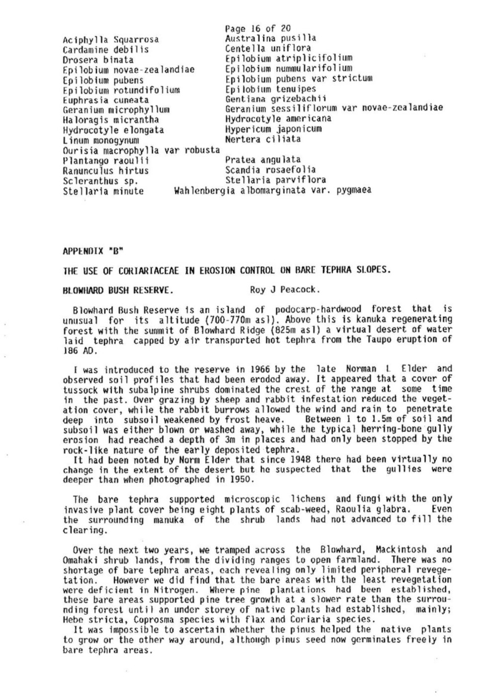
Aciphylla Squarrosa Australina pusilla
Cardamine debilis Centella uniflora
Drosera binata Epilobium atriplicifolium
Epilobium novae-zealandiae Epilobium nummularifolium
Epilobium pubens Epilobium pubens var strictum
Epilobium rotundifolium Epilobium tenuipes
Euphrasia cuneata Gentiana grizebachii
Geranium microphyllum Geranium sessiliflorum var novae-zealandiae
Haloragis micrantha Hydrocotyle americana
Hydrocotyle elongata Hypericum japonicum
Linum monogynum Nertera ciliata
Ourisia macrophylla var robusta
Plantango raoulii Pratea angulata
Ranunculus hirtus Scandia rosaefolia
Scleranthus sp. Stellaria parviflora
Stellaria minute Wahlenbergia albomarginata var. pygmaea
APPENDIX “B”
THE USE OF CORIARIACEAE IN EROSION CONTROL ON BARE TEPHRA SLOPES.
BLOWHARD BUSH RESERVE. Roy J Peacock.
Blowhard Bush Reserve is an island of podocarp-hardwood forest that is unusual for its altitude (700-770m asl). Above this is kanuka regenerating forest with the summit of Blowhard Ridge (825m asl) a virtual desert of water laid tephra capped by air transported hot tephra from the Taupo eruption of 186 AD.
I was introduced to the reserve in 1966 by the late Norman L Elder and observed soil profiles that had been eroded away. It appeared that a cover of tussock with subalpine shrubs dominated the crest of the range at some time in the past. Over grazing by sheep and rabbit infestation reduced the vegetation cover, while the rabbit burrows allowed the wind and rain to penetrate deep into subsoil weakened by frost heave. Between 1 to 1.5m of soil and subsoil was either blown or washed away, while the typical herring-bone gully erosion had reached a depth of 3m in places and had only been stopped by the rock-like nature of the early deposited tephra.
It had been noted by Norm Elder that since 1948 there had been virtually no change in the extent of the desert but he suspected that the gullies were deeper than when photographed in 1950.
The bare tephra supported microscopic lichens and fungi with the only invasive plant cover being eight plants of scab-weed, Raoulia glabra. Even the surrounding manuka of the shrub lands had not advanced to fill the clearing.
Over the next two years, we tramped across the Blowhard, Mackintosh and Omahaki shrub lands, from the dividing ranges to open farmland. There was no shortage of bare tephra areas, each revealing only limited peripheral revegetation. However we did find that the bare areas with the least revegetation were deficient in Nitrogen. Where pine plantations had been established, these bare areas supported pine tree growth at a slower rate than the surrounding forest until an under storey of native plants had established, mainly; Hebe stricta, Coprosma species with flax and Coriaria species.
It was impossible to ascertain whether the pinus helped the native plants to grow or the other way around, although pinus seed now germinates freely in bare tephra areas.

Page 17 of 20
After reading that the first plant to grow after the Tarawera eruption was tutu, Coriaria arborea, I started to search for evidence of local usage of Coriaria species in revegetation programmes but found that because Coriaria arborea is very poisonous and can poison the nectar collected by bees, from which the honey can poison humans, no research appeared to have been done on this plant.
Norman Elder and I tried planting manuka seedlings in 1969 and four year old kanuka trees in 1970 but the wind blew away the soil and the plants to leave shallow crater-like holes that soon leveled out.
In 1971, I tried sowing manuka seeds in cracks with no results visible in 1972. It was in 1972 that I found Coriaria arborea plants growing in an old fireplace by a Justice Department hut and just one plant had spread to cover a square metre by the following year. Finding that Coriaria species was a leguminous plant (ie associated bacteria fix nitrogen from the atmosphere), I collected ripe Coriaria arborea seed and using a MoW technique with a kind of vegetable adhesive, stuck the seeds on the bare areas. What I did not know, was that the adhesive had been treated with a fungicide that broke down the fungi mycelium in the surface tephra, releasing the adhesive and allowing the wind to strip away another layer of tephra.
1973 saw a 25m square tephra plot at the lower edge of the desert, planted with Coriaria arborea seed at three seeds to a 5mm diameter tube hole at 400mm triangular spacing. However the germination or strike rate was under 2%.
The 1974 season saw a more extensive collection of 5kg of Coriaria species fruit that was layered in hot sand in equal batches from 52 to 100 degrees at 6 degree intervals. Then the sand and seed mix was stored in a refrigerator that cycled from 2 to 10 degrees at three hour intervals for six weeks, The seed/sand mix was then mixed with light soil from Coriaria arborea thickets existing in regenerating areas and brushed the mix into shallow cracks in the tephra surface. Spring resulted in a germination rate of 50% with a summer survival rate of 44% for the seed heated to 56 degrees.
For the 1975 season, three kilograms of ripe fruit was heated in sand to 56 degrees, then half was scarified with a 300mm diameter nylon blade, rotating at 2800rpm in a 500mm diameter container for one minute. Both samples were then subjected to the same layering technique in a refrigerator. The treated seed was then brushed into cracks on two 50 x 20m plots by children from Hastings Intermediate School. The unscarified seed had a germination rate of 51%. The scarified seed had a germination of 76% with a strike rate of 70%.
By winter this growth was 200mm high and the previous planting in holes, 400mm high.
The 1976 season used Coriaria species fruit collected by Heretaunga Intermediate School, of which about 20% was unripe, then heat treated, scarified and layered. The result was a 60% strike.
At the time of the seed planting, duff or forest floor litter was collected from the reserve below and poked around the bases of the plants in site 2 that now had reach a metre high. Pseudopanax arboreum seed was mixed with sand and brushed around the bases of Coriaria arborea in site 1. It was also noted that Cortaria kingiana was now spreading out from the bases of a large proportion of the Coriaria arborea.
During 1977 with the help of scouts from the Red Shield and Windsor troops, we gathered eight kilograms of ripe Coriaria species fruit over four days and after repeating the seed treatment, children from Heretaunga Intermediate School poured the seed/sand mix into cracks in the tephra surface over an area 25m by the full width of the desert.

Page 18 of 20
Around the bases of the fast growing Coriaria arborea, small secondary growth plants were starting to appear, mainly hebe, Pseudopanax, manuka, broadleaf, wineberry and Senicio [Senecio].
Once again bags of duff were collected from the regenerating forest floor and packed around the bases of Coriaria arborea plants
The process was repeated each year until 1982 when the long range weather forecast was for drought. The areas already planted were dusted with bone meal at a rate of 100grms/sq.m. during very light rain.
The early plantings were now covered in open secondary growth up to four metres high and were now forming and trapping leaf debris and windblown dust to an uncompressed depth of 75mm.
Good growth was noted until late November when growth slowed and leaves started to he shed.
By January 1983 there had been a 40% leaf fall and conditions were very dry. A standard Moisture Meter reading of 5.2% was the average on ten sites.
Also in 1983 there was a phenomenal flowering period and 3.5 kilos of ripe fruit was harvested from the early Coriaria arborea plantings, which together with further collected seed, was treated and sown in the now much wider cracks in the last upper site.
By the close of February, the soil moisture reading had risen to 7% average and the leaf shed exceeded 50%.
With the onset of the winter rain, growth started again and before the heavy frosts, new growth on the Coriaria arborea had exceeded 400mm, while the other secondary growth plantings produced new leaves and minor growth.
By January 1984, with the drought in its second year on the Heretaunga Plains, the Coriaria species of the first two years was dying out in the shade of secondary growth. In the open tephra area, the soil moisture averaged 5% but where growth exceeded 2m high, the soil moisture ranged from 20% at 2m, to 31% at 4m high. 50% of the tender species planted as leaf litter in 1981 had died but the two Coriaria species not shaded by secondary growth had almost doubled in height, diameter of ground coverage and branch density.
In the spring of 1984 there was a sudden flush of growth, followed by a tremendous burst of flowering as the drought continued, although some rain was arriving as over-spray from the western side of the ranges. Some shrubs only two years old flowered only to die back. The flowering in more mature shrubs was even and prolific with seed maturing well.
With the drought continuing, only a small quantity of Coriaria arborea seed was gathered and treated to replant the top site that had less than a 2% strike rate, This area was also dressed with bone meal but strong winds removed most of this.
It was hard to tell if the seed had germinated or not on the open areas. Checks indicated that germination had taken place but the new growth had promptly died. In the deep gullies, was a different story, germination took place and about 10% of the Coriaria arborea reached 100mm long. The continued duff plantings were the worst yet with an almost complete lack of germination.
The winter of 1985 saw the density of the secondary growth improving with humus now thinly covering most of the floor and saprophytic bacteria, crustacea and apterygota becoming active. However with the prospect of yet another drought year, no further planting was undertaken.

Page 19 of 20
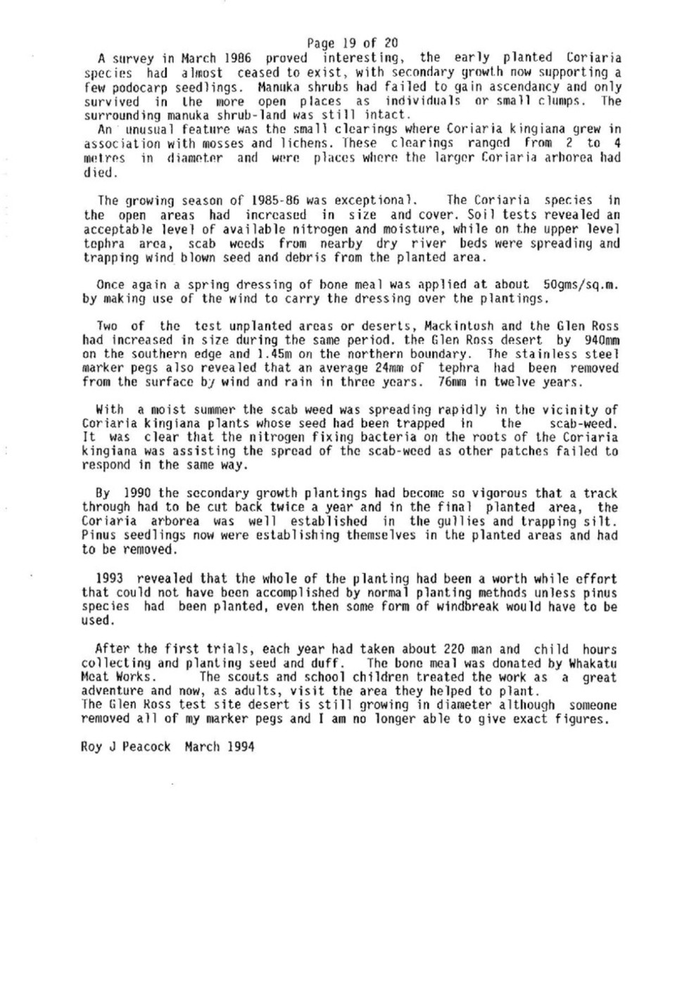
A survey in March 1986 proved interesting, the early planted Coriaria species had almost ceased to exist, with secondary growth now supporting a few podocarp seedlings. Manuka shrubs had failed to gain ascendancy and only survived in the more open places as individuals or small clumps. The surrounding manuka shrub-land was still intact.
An unusual feature was the small clearings where Coriaria kingiana grew in association with mosses and lichens. These clearings ranged from 2 to 4 metres in diameter and were places where the larger Coriaria arhorea had died.
The growing season of 1985-86 was exceptional. The Coriaria species in the open areas had increased in size and cover. Soil tests revealed an acceptable level of available nitrogen and moisture, while on the upper level tephra area, scab weeds from nearby dry river beds were spreading and trapping wind blown seed and debris from the planted area.
Once again a spring dressing of bone meal was applied at about 50gms/sq.m. by making use of the wind to carry the dressing over the plantings.
Two of the test unplanted areas or deserts, Mackintosh and the Glen Ross had increased in size during the same period, the Glen Ross desert by 940mm on the southern edge and 1.45m on the northern boundary. The stainless steel marker pegs also revealed that an average 24mm of tephra had been removed from the surface by wind and rain in three years. 76mm in twelve years.
With a moist summer the scab weed was spreading rapidly in the vicinity of Coriaria kingiana plants whose seed had been trapped in the scab-weed. It was clear that the nitrogen fixing bacteria on the roots of the Coriaria kingiana was assisting the spread of the scab-weed as other patches failed to respond in the same way.
By 1990 the secondary growth plantings had become so vigorous that a track through had to be cut back twice a year and in the final planted area, the Coriaria arborea was well established in the gullies and trapping silt. Pinus seedlings now were establishing themselves in the planted areas and had to be removed.
1993 revealed that the whole of the planting had been a worth while effort that could not have been accomplished by normal planting methods unless pinus species had been planted, even then some form of windbreak would have to be used.
After the first trials, each year had taken about 220 man and child hours collecting and planting seed and duff. The bone meal was donated by Whakatu Meat Works. The scouts and school children treated the work as a great adventure and now, as adults, visit the area they helped to plant.
The Glen Ross test site desert is still growing in diameter although someone removed all of my marker pegs and I am no longer able to give exact figures.
Roy J Peacock March 1994

Page 20 of 20
Appendix.C
The Winds of the Blowhard.s
The Blowhard lies so close to the fortieth parallel that any variation in the weather pattern of the low and high pressure centres can swing the roaring forties up through the gap at Kuripapango during equinoctial periods when the sun crosses the celestial equator. This added to the prevailing westerly wind passing over the Blowhard above a height of 2000m with the land surface further complicating the wind flow through the contorted funnel between the Ruahine and Kaweka Ranges, the winds are twisted, delayed and then, seemingly released as strong gusts that sweep through the Kuripapango gap like squalls.
The highest mean wind speeds are observed during the months of October, November and early December. The lowest wind speeds usually occur between March and August following the retreat south of the anticyclones that effect our general weather so much.
One of the problems associated with this westerly wind besides its strength is that it tends to transport Pinus contorta seeds from the Comet area and from plantings made by the New Zealand Forest Service on the dividing ranges, to Blowhard Ridge where seeds are now able to germinate freely in the protection of regenerating forest. With its speed of growth, Pinus contorta does not have the altitude problems of the native forest and soon tops native growth, restricting available light. This makes the Pinus contorta a problem that has to be tackled each year by parties of Forest & Bird members that search the forest to pull up pinus seedlings by the roots. Even then, an odd Piant [plant] is missed and later requires chainsaw action.
Another plant that has become a serious weed is the Clematis vitalba or “Old mans beard”, that also travels from Taihape on the prevailing wind.
The Clematis vitalba was brought into New Zealand as a vigorous root stock for ornamental varieties of the climbing plant, Clematis.
Neglect by Ted Spooner, an early settler in the Taihape area, allowed the clematis root stock to take over and seed prolifically. Soon the Clematis vitalba was invading clearings and the edges of forest throughout the district then the westerly wind did the rest. It carried the fluffy flying seeds right across into Hawke’s Bay where it became a rampant pest in the waterways. Climbing to smother windbreak trees and invading reserves to a point, where the Hawke’s Bay County Council considered the infestation too great to afford even limited measures of control and therefore never gave the Clematis vitalba a serious pest rating even though a single node of Clematis vitalba stem can root and within a couple of years, produce enough flying seed to infect hundreds of hectares of open or regenerating forest that unless cleared of this pest is doomed by smothering and eventually flattened to the ground by shear weight of vines.
Blowhard Bush has been infected in several places but prompt action has eradicated the Clematis vitalba before it could get a hold.
Unfortunately the Hawke’s Bay Regional Council still continues to ignore this pest and only concerned landowners and Forest & Bird members continue to fight the Clematis vitalba encroaching on our native forests.

Original digital file
BlowhardBushReserve_ManagementPlan1994.pdf
Non-commercial use

This work is licensed under a Attribution-NonCommercial 3.0 New Zealand (CC BY-NC 3.0 NZ).
Commercial Use
Please contact us for information about using this material commercially.Can you help?
The Hawke's Bay Knowledge Bank relies on donations to make this material available. Please consider making a donation towards preserving our local history.
Visit our donations page for more information.
Subjects
Business / Organisation
Royal Forest and Bird Protection Society of New Zealand IncorporatedFormat of the original
Typed documentDate published
1994People
- William Colenso
- Norman L Elder
- Mr and Mrs J N Lowry
- Roy Peacock
- Ted Spooner
Accession number
546776Supporters and sponsors
We sincerely thank the following businesses and organisations for their support.


Do you know something about this record?
Please note we cannot verify the accuracy of any information posted by the community.