Moawhango Four-Wheel Drive Trip 2010

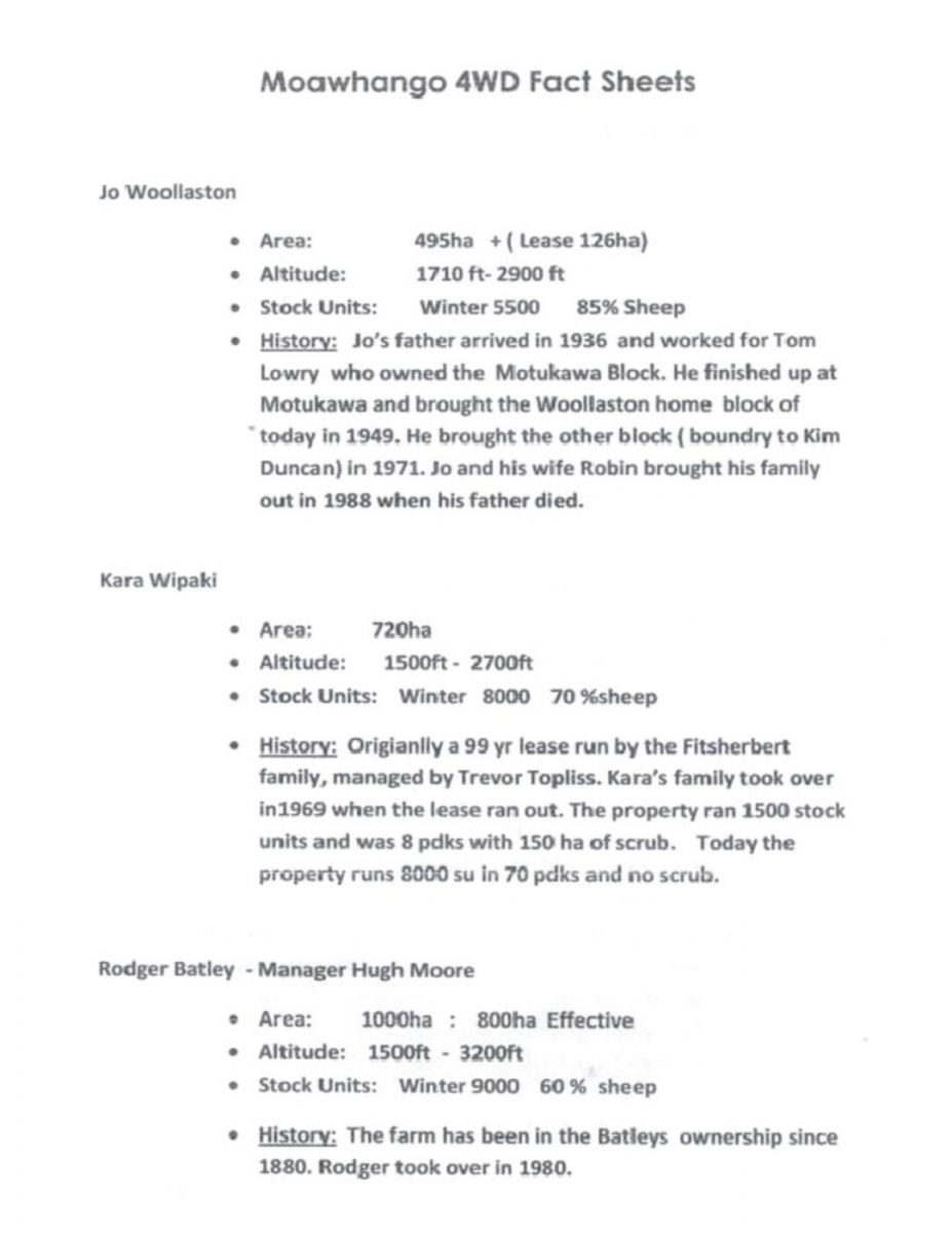
Moawhango 4WD Fact Sheets

Jo Woollaston

Area:   495ha + ( Lease 126ha)
Altitude:   1710 ft- 2900 ft
Stock Units:   Winter 5500 85% Sheep
History:   Jo’s father arrived in 1936 and worked for Tom Lowry who owned the Motukawa Block. He finished up at Motukawa and brought [bought] the Woollaston home block of today in 1949. He brought the other block (boundary to Kim Duncan) in 1971. Jo and his wife Robin brought his family out in 1988 when his father died.

Kara Wipaki

Area:   720ha
Altitude:   1500ft – 2700ft
Stock Units:   Winter 8000 70% sheep
History:   Originally a 99 yr lease run by the Fitsherbert [Fitzherbert] family, managed by Trevor Topliss. Kara’s family took over in 1969 when the lease ran out. The property ran 1500 stock units and was 8 pdks [paddocks] with 150 ha of scrub. Today the property runs 8000 su in 70 pdks and no scrub.

Rodger Batley – Manager Hugh Moore

Area:   1000ha : 800ha Effective Altitude: 1500ft – 3200ft
Stock Units:   Winter 9000 60% sheep
History:   The farm has been in the Batleys ownership since 1880. Rodger took over in 1980.

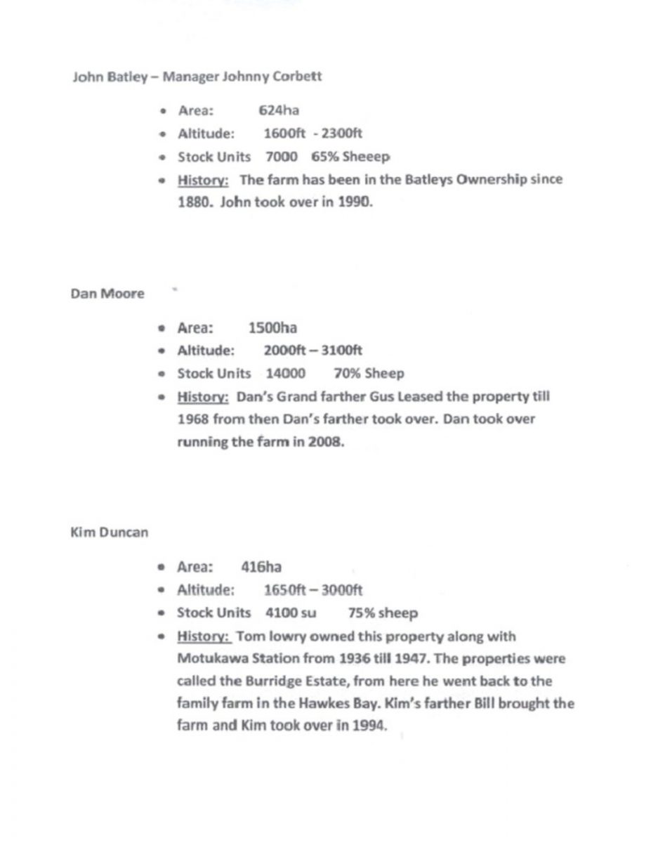
John Batley – Manager Johnny Corbett

Area:   624ha
Altitude:   1600ft – 2300ft
Stock Units   7000 65% Sheep
History:   The farm has been in the Batleys Ownership since 1880. John took over in 1990.

Dan Moore

Area:   1500ha
Altitude:   2000ft – 3100ft
Stock Units   14000 70% Sheep
History:   Dan’s Grand farther [Grandfather] Gus Leased the property till 1968 from then Dan’s father took over. Dan took over running the farm in 2008.

Kim Duncan

Area:   416ha
Altitude:   1650ft – 3000ft
Stock Units   4100 su 75% sheep
History:   Tom Lowry owned this property along with Motukawa Station from 1936 till 1947. The properties were called the Burridge Estate, from here he went back to the family farm in the Hawkes Bay. Kim’s father Bill brought [bought] the farm and Kim took over in 1994.

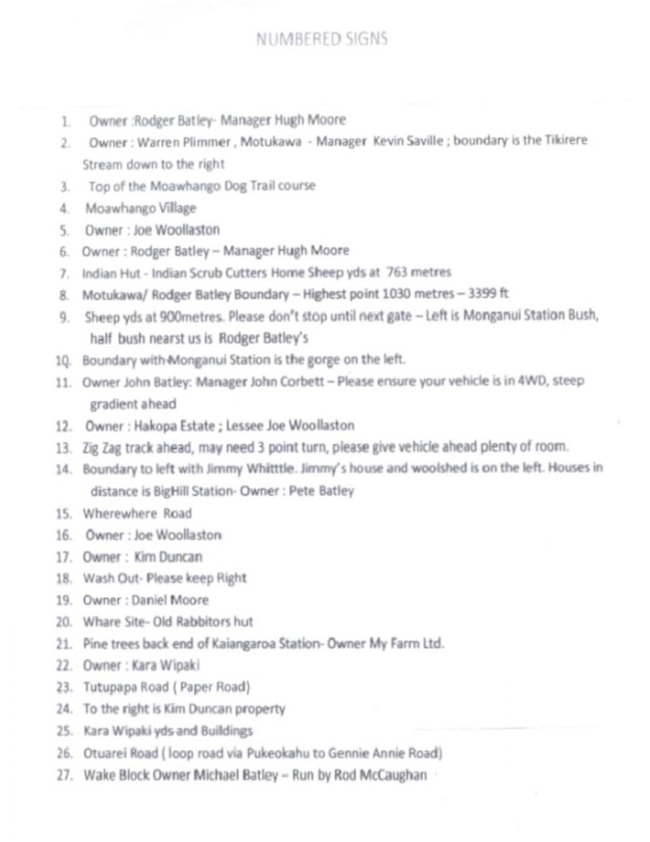
NUMBERED SIGNS

1.   Owner: Rodger Batley – Manager Hugh Moore
2.   Owner: Warren Plimmer, Motukawa – Manager Kevin Saville; boundary is the Tikirere Stream down to the right
3.   Top of the Moawhango Dog Trail [Trial?] course
4.   Moawhango Village
5.   Owner: Joe Woollaston
6.   Owner: Rodger Batley – Manager Hugh Moore
7.   Indian Hut – Indian Scrub Cutters Home Sheep yds at 763 metres
8.   Motukawa/Rodger Batley Boundary – Highest point 1030 metres – 3399 ft
9.   Sheep yds at 900 metres. Please don’t stop until next gate – Left is Monganui Station Bush, half bush nearst [nearest] us is Rodger Batley’s
10.   Boundary with Monganui Station is the gorge on the left.
11.   Owner John Batley: Manager John Corbett – Please ensure your vehicle is in 4WD, steep gradient ahead
12.   Owner: Hakopa Estate; Lessee Joe Woollaston
13.   Zig Zag track ahead, may need 3 point turn, please give vehicle ahead plenty of room.
14.   Boundary to left with Jimmy Whittle. Jimmy’s house and woolshed is on the left. Houses in distance is Big Hill Station – Owner: Pete Batley
15.   Wherewhere Road
16.   Owner: Joe Woollaston
17.   Owner: Kim Duncan
18.   Wash Out – Please keep Right
19.   Owner: Daniel Moore
20.   Whare Site – Old Rabbitors [rabbiters’] hut
21.   Pine trees back end of Kaiangaroa [Kaingaroa] Station – Owner My Farm Ltd.
22.   Owner: Kara Wipaki
23.   Tutupapa Road (Paper Road)
24.   To the right is Kim Duncan property
25.   Kara Wipaki yds and Buildings
26.   Otuarei Road (loop road via Pukeokahu to Gentle Annie Road)
27.   Wake Block Owner Michael Batley – Run by Rod McCaughan

Moawhango School 4WD 2010

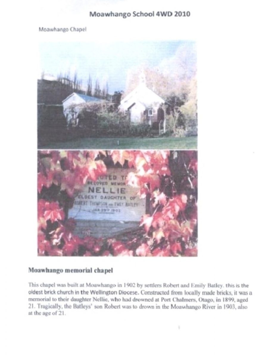
Moawhango Chapel

Moawhango memorial chapel

This chapel was built at Moawhango in 1902 by settlers Robert and Emily Batley, this is the oldest brick church in the Wellington Diocese. Constructed from locally made bricks, it was a memorial to their daughter Nellie, who had drowned at Port Chalmers, Otago, in 1899, aged 21. Tragically, the Batleys’ son Robert was to drown in the Moawhango River in 1903, also at the age of 21.

[Map of four-wheel drive trip route]

[Map of four-wheel drive trip area]

Original digital file

LowryTR888_Moawhango.pdf

Non-commercial use

Attribution-NonCommercial 3.0 New Zealand (CC BY-NC 3.0 NZ)

This work is licensed under a Attribution-NonCommercial 3.0 New Zealand (CC BY-NC 3.0 NZ).


Commercial Use

Please contact us for information about using this material commercially.

Can you help?

The Hawke's Bay Knowledge Bank relies on donations to make this material available. Please consider making a donation towards preserving our local history.

Visit our donations page for more information.

Tags

Format of the original

Typed documents, maps

Date published

2010

People

  • Emily Batley
  • John Batley
  • Michael Batley
  • Nellie Batley
  • Pete Batley
  • Robert Batley Junior
  • Robert Batley Senior
  • Rodger Batley
  • Johnny Corbett
  • Bill Duncan
  • Kim Duncan
  • Tom Lowry
  • Rod McCaughan
  • Dan Moore
  • Gus Moore
  • Hugh Moore
  • Warren Plimmer
  • Kevin Saville
  • Trevor Topliss
  • Kara Wipaki
  • Jo/Joe Woollaston
  • Robin Woollaston

Accession number

888/1544/38368

Do you know something about this record?

Please note we cannot verify the accuracy of any information posted by the community.

Supporters and sponsors

We sincerely thank the following businesses and organisations for their support.