Soils and Some Related Agricultural Aspects of Mid Hawke’s Bay
SOILS & SOME RELATED AGRICULTURAL ASPECTS OF MID HAWKE’S BAY
FOREWORD.
The more recent outlook on soil survey work links soil information with agricultural usage both existing and potential. The manner of approach in this bulletin is consistent with this treatment, and some of the material presented is therefore set out in considerably greater detail than has been the case with previous Soil Survey bulletins. The soil types have been linked with the important soil-forming factors such as climate, topography, parent material, etc., and optimum utilization of the land described.
It is hoped that the bulletin will be of use to the farming community, particularly returned servicemen who are planning their rehabilitation on land in the district.
The long delay in publication is regretted, but wartime and post-war difficulties in the printing trade have prevented earlier action.
E. MARSDEN, Secretary, Department of Scientific and Industrial Research.
CONTENTS
Page
LIST OF TABLES
FOREWORD 9
I. GENERAL DESCRIPTION OF AREA 11
II. SOIL-FORMING FACTORS 15
A. Climate 15
Temperature 15
Rainfall 16
Dry and Wet Periods 22
Humidity 23
Sunshine 23
Wind 24
B. Topography and Lithology 25
1. North-Western Ranges and Plateau 25
2. Western Ranges 26
3. Western Foothills 27
4. Coastal Hill Country 28
5. Eastern Plains and Flat 31
6. Western Plains and Terrace 32
C. Vegetation 33
Areas of High Rainfall and Elevated Area 33
(1) Podocarp Forest 33
(2) Nothofagus Forest 34
(3) Tussock Grassland 34
Areas of Low Rainfall and Lowland Areas 35
(4) Coastal Forest 35
(5) Bracken Fern, Scrub and Native Grassland 35
Peat Swamps 36
(6) Raupo 36
III. SOIL CLASSIFICATION 37
Rendzina Soils 37
Yellow-Grey Loams 37
Yellow-Brown Loams 39
Pumice Podzolic Soils 45
Recent Soils 45
Meadow Soils 45
Organic Soils 45
IV. SOILS AND AGRICULTURE 46
Description of Soil Types 46
Bluff Series (1) 46
Te Mata Series (2) 47
Te Aute Series (3) 48
Te Onepu Series (4) 49
Kidnappers Series (5) 50
Mokamoka Series (6) 52
Silver Series (7) 53
Mangatoro Series (8) 54
Aramoana Series (9) 54
CONTENTS – (Continued).
Page
Tutamoe Series (10) 55
Vernon Series (12) 56
Te Apiti Series (13) 57
Elsthorpe Series (14) 58
Tangoio Series (15) 59
Waipawa Series (16) 61
Raukawa Series (17) 62
Mokapeka Series (19) 63
Waimarama Series (20) 64
Crownthorpe Series (21) 65
Pukehou Series (22) 67
Otane Series (23) 68
Wanstead Series (24) 69
Mangatarata Series (25) 71
Atua Series (26) 72
Maraetotara Series (27) 74
Matapiro Series (28) 76
Okawa Series (29) 81
Waipukurau Series (30) 82
Waikonini Series (31) 83
Poporangi Series (32) 84
Ruahine Series (33) 85
Wakarara Series (34) 87
Olrig Series (35) 87
Makaretu Series (37) 88
Gwavas Series (38) 90
Takapau Series (39) 90
Kopua Series (40) 93
Dannevirke Series (41) 95
Mangatahi Series (42) 96
Matamau Series (43) 98
Kaweka Series (44) 99
Te Pohue Series (45) 100
Titiokura Series (46) 102
Taupo Series (47) 102
Puketitiri Series (48) 104
Kuripapanga [Kuripapango] Series (49) 105
Gisborne Series (50, 51) 105
Tutira Series (52) 107
Waikoau Series (53) 108
Waiwhare Series (55) 108
Tukituki Series (56) 109
Esk Series (57) 110
Argyll Series (58) 111
Twyford Series (59, 61) 113
Hastings Series (60, 63) 115
Pakowhai Series (62) 117
Kaiapo Series (64) 118
Raumati Series (65) 119
Rotoatara Series (67) 119
Poukawa Series (68) 120
CONTENTS – (Continued).
Page
B. Soil Management 121
1. Cultivation 121
2. Consolidation 122
3. Soil-Moisture and Temperature Conditions 123
4. Topdressing 124
Phosphate 124
Lime 125
Potash 126
Nitrogen 126
Organic Fertilisers 126
Results of Field Trials with Fertilisers in Mid Hawke’s Bay 127
C. Soils and Crops 130
Farm Crops 130
Fruit and Market-Garden Crops 131
Intensive Cropping of Saline Soils 132
D. Soils and Pastures 133
Pasture Improvement 143
Subterranean Clover 145
E. Farm Water Supplies 146
Farming Industries 147
Sheep Farming 147
Dairy Industry 148
Pig Industry 149
Apiaries 149
Seed and Grain Production 150
Fruit Growing 151
Market Gardens and Vineyards 153
Forestry 155
V. SOIL EROSION AND CONSERVATION 156
Forms of Soil Erosion 156
Sheet Erosion 156
Gully Erosion 158
Slip and Slump Erosion 162
Tunnel Erosion 165
Wind Erosion 166
River-bank Erosion 166
Soil Erosion and Agriculture 168
Soil Erosion, Flooding and Sedimentation 170
Esk Catchment Area 171
Tutaekuri Catchment Area 172
Ngaruroro Catchment Area 174
Tukituki Catchment Area 174
ACKNOWLEDGMENTS 176
ERRATUM 176
LIST OF TABLES
Table Page
I. Approximate Mean Temperatures 16
II. Rainfall at Mid Hawke’s Bay Stations 18
III. Number of Rain Days 21
IV. Mean Rainfall in Hawke’s Bay 22
V. Humidity at 9 a.m 23
VI. Hours of Bright Sunshine 23
VII. Wind Frequencies, per cent 24
VIII. Fusion Analyses of Clay Fractions 38
IX. Fusion Analyses of Soil Horizons (all fractions) 38
X. Chemical Analyses of Mid Hawke’s Bay Soils 40
XI. Responses on Mid Hawke’s Bay Soils to Fertilisers applied as Pasture Topdressing 128
XII. Crops, Soils and Soil Properties correlated with the Crop Types of Mid Hawke’s Bay 130
XIII. Recent Soils: Effect of Drainage on Crop Adaptation 131
XIV. Pasture Types of Mid Hawke’s Bay: Their Composition, Distribution, and Soils 135
XV. Agricultural Properties of Mid Hawke’s Bay Soils 136
XVI. Number of Sheep in Mid Hawke’s Bay Counties at the 30th April, 1945 147
XVII. Average Production in New Zealand of Pip and Stone Fruits in bushes per tree for the years 1943 to 1946 152
XVIII. Distribution of Erosion on Mid Hawke’s Bay Soils 168
XIX. Percentage Distribution of Slope Classes in Mid Hawke’s Bay (including Heretaunga Plains) 169
XX. Distribution of Slope Classes in the Esk Catchment Area 171
XXI. Distribution of Erosion on the Soils of the Ranges 175

Page 11
I. General Description of Area.
The district of Mid Hawke’s Bay is the middle portion of Hawke’s Bay Land District situated on the south-eastern coast of the North Island. It is a rhomboidal area of approximately 2,000 square miles. The greatest distance from north to south and from east to west is a little over fifty miles. The Pacific Ocean is the eastern boundary, the summit of the Ruahine Range and the upper reaches of the Ngaruroro River the western, an east-west line through Tangoio district the northern and an east-west line through Waipukurau the southern boundary. The district includes the Heretaunga Plains centred on Hastings and the old Ahuriri Lagoon north-west of Napier, a total area of some 85,000 acres which has been described in detail in an earlier bulletin.*
Nearly half of the district is hilly, mountainous, or precipitous land too steep to plough, a quarter is rolling downland and the remainder is flat. Most of the mountainous land lies along the western margin where a portion of the main “backbone” mountain system of North Island passes through the district and has a maximum elevation of 5,589 ft. In the north-west at the foot of the mountains is a considerable area of high country above 2000 ft. Near the south-eastern coast Kahuranaki Mountain and Waimarama Range also rise above this level. East of the main mountains are extensive terraces and flats, the chief of these being Heretaunga Plains near Hastings and Ruataniwha or Takapau Plains situated a few miles west of Waipukurau. In the remaining area the surface is mostly rolling and hilly with steeper slopes predominating near the coast, while the elevation is generally less than 1000 ft. and seldom exceeds 1500 ft.
The district is drained by three main rivers, the Tukituki, Ngaruroro, and Tutaekuri, which flow eastward from the western mountains.
Light “pumice” soils, derived from subaerial volcanic-ash showers occupy the north-western portion of the district, and are mostly of low fertility. Other light soils occur to the west, south of Ngaruroro River, where they are formed from greywacke and argillite, greywacke conglomerates, or pumiceous sandstones and mudstones. They also have low natural fertility except where the native vegetation was forest. The “coastal hill country” in the east is noted for its
* Land Utilization Report of the Heretaunga Plains: N.Z. Dept. Sci. & Ind. Res. Bulletin No. 70, 1939.

Page 12
good natural fertility, and its loamy soils are formed on muddy sandstones, limestones, mudstones, and related rocks. The most fertile soils of the district are those formed on recent river deposits on Heretaunga Plains, on the eastern portion of Ruataniwha Plains, and on smaller flats in the coastal belt.
The climate of Mid Hawke’s Bay is temperate with some continental features. Summer temperatures sometimes exceed 90 deg. F., and the minimum temperature recorded on grass during winter frosts is 14 deg. F. Frosts occur most frequently between March and October but in some coastal districts such as Napier and Bay View there are occasional frosts only, in the months of March and October. However, in all districts late or early frosts are liable to occur and January and February are the only months that can really be regarded as frost-free. The average annual rainfall is under 35 in. per annum in a narrow belt between Napier and Waipukurau, and rises to more than 50 in. near the western mountains, on Waimarama Range, and in the extreme north.
The Borough of Napier (17,243)* is the port and chief town of Hawke’s Bay Land District, and is situated at the northern end of Heretaunga Plains. About 12 miles south of Napier lies the Borough of Hastings (14,623) upon which is centred at least half of Mid Hawke’s Bay. The urban populations of these two boroughs, i.e. the population of the area within approximately three miles of the chief Post Office, are 20,297 and 20,330 respectively. The Borough of Waipukurau (2,095) is situated on the southern boundary of the district, and the Borough of Waipawa (1,169) is four miles north of Waipukurau. Both serve large rural areas.
Taradale (1,765) lies four miles south-west of Napier, and Havelock North (1,458) two miles south-east of Hastings. Both are independent Town Districts, Havelock North being mostly a residential suburb of Hastings. Other important rural townships which are administered as portions of the adjoining County include Otane (526), four miles north of Waipawa, Tikokino (formerly Hampden) (238), eleven miles north-west of Waipawa, and Ongaonga (355), six miles south of Tikokino. Elsthorpe (203) and Waimarama (225) lie nineteen miles south and fourteen miles south-east of Hastings respectively. Clive (656) is mid-way between Napier and Hastings, and Bay View (formerly Petane) (458) is six miles north of Napier.
* Figures in brackets indicate the population at the census of 25th September, 1945.

Page 13
The total population of Mid Hawke’s Bay including Maoris is 56,380 of which 38,353 are concentrated in the boroughs and chief town districts and the remainder, namely 18,027, are predominantly rural.
As the boundaries of the district are determined by Survey Districts they do not correspond with County boundaries. The district includes the major portions of Hawke’s Bay County (14,707) and Waipawa County (3,192), and minor portions of the Patangata County (2,518) and Waipukurau County (1,043). Among the counties of New Zealand Hawke’s Bay County ranks sixth on the basis of population, and second on the basis of capital valuation.
The chief medium of transport is the railway. The Wellington-Gisborne line enters the district south-west of Waipukurau and continues north-north-east to Napier, and then in a northerly direction to Wairoa about 73 miles by rail from Napier. The district is well-provided with all weather roads except in a few sparsely settled areas of steep country in the west, north-west and south-east. The main south road from Napier follows the railway to Waipukurau and continues to Wellington. The Napier-Taihape road is the only outlet across the western mountains, and the Napier-Taupo road and Napier-Wairoa roads provide communication with the north-west (to Rotorua and Auckland) and with the north (to Gisborne and East Coast) respectively. Service car and lorry services are maintained on all these routes.
The Port of Napier is the chief exporting centre for the district although a considerable amount of fruit and other produce is exported through Wellington. Shipping services are also available between Napier and other New Zealand ports. Daily air services are maintained between Napier and Palmerston North.
The district is, on the whole, well reticulated, and the few areas without electricity and with no immediate prospect of reticulation are sparsely settled. Such areas occur in the north and near the western mountains. Heretaunga and Ruataniwha plains are both intensively reticulated. Nearly half the electricity used in Mid Hawke’s Bay is consumed by industries.
Sheep-farming is the principal agricultural industry of the district. Freezing works are established at Whakatu, three miles north-east of Hastings, and Tomoana, near the north-eastern boundary of Hastings. Dairying is on a small scale compared with the sheep industry.

Page 14
An important fruit-growing industry is established on Heretaunga Plains where there are also a considerable number of market-gardens and a few vineyards. Ryegrass and white clover seed are produced in substantial quantities on Heretaunga and Ruataniwha plains, and on other fertile flat areas.
Tobacco leaf is processed at Napier but is not grown locally. Bricks, tiles and pipes are produced from clay deposits at Napier and Havelock North.
The preceding account gives a brief description of the physical, social, and economic features of Mid Hawke’s Bay. In the following pages the soil resources of the district and its physical features are described in detail and the utilisation of the soils is reviewed.
The soil survey was completed in 1939 and with the commencement of the war the compilation of the Bulletin was delayed while general surveys were made of the soils of the whole of the North Island. During the war more knowledge was obtained of New Zealand soil groups, and it was found that some alterations could be made in the classification of groups in Hawke’s Bay. As the maps had already been published these alterations are indicated in the section on soil classification.

Page 15
II. Soil – Forming Factors.
Soil, according to modern technical usage, includes not only the topsoil but also the subsurface soil, subsoil, and deep subsoil above the parent rock. It is the product of several factors the chief being climate, vegetation, parent rock, and the slope of the land surface.
The most important of these factors is climate which determines the general nature of the soil processes over broad geographical areas. Vegetation, parent rock, and slope also play an important part and any one of these factors may actually dominate the soil processes under favourable local conditions. In the low-rainfall areas of Mid Hawke’s Bay, which include most of the eastern half of the district, parent rock and slope both have an important influence on the nature and fertility of the soils, but their influence is very much less important in the western portion of the district where the rainfall is higher.
At the commencement of the survey under review little detailed information was available concerning the geology of the district and its climate, physiography, and native vegetation. The results of investigations made into these soil-forming factors are summarised in this chapter.
A. CLIMATE
The section on climate is adapted from Climatic Notes: New Zealand Districts: E. Kidson, Meteorological Office Note No. 17, 1937. Data, except Figs. 1 and 2, were revised and brought up to date by N. G. Robertson, of the Meteorological Office, Wellington.
TEMPERATURE.
All temperatures quoted in this section are in degrees Fahrenheit. The only data available are from a station representing Napier, the site of which has been changed several times, and a short record from Cornwall Park, Hastings. There were some records of temperature kept in Napier from 1864 to 1866 by the Royal Engineers. In 1868 observations were commenced by the Harbourmaster at a station on The Spit. After a break in 1869 these were resumed in 1870, probably at approximately the same site. At the end of 1880 the Government abandoned all meteorological stations with the exception of those at Auckland, Wellington, and Dunedin. The first row of figures in Table

Page 16
I, therefore, refers to the period from 1868 to 1880. Although The Spit, owing to the nearness of a large expanse of shallow sea, is undoubtedly a warm area, the figures shown in the first row of Table I are somewhat too high.
TABLE. I. – Approximate Mean Temperatures.
Station. Jan. Feb. Mar. Apr. May. Jun. Jul. Aug. Sept. Oct. Nov. Dec. Year. Ft. All. No. Yrs.
The Spit, Napier 67.3 66.2 64.2 59.8 56.1 52.2 50.2 51.0 54.5 58.3 62.4 65.0 59.0 5 11-12
Meeanee 63.8 62.5 61.6 57.7 52.6 48.5 47.2 48.2 51.6 55.3 58.8 62.2 55.8 14 7-8
Greenmeadows 67.0 66.6 63.6 58.5 53.1 49.6 49.2 50.0 53.7 58.0 60.3 63.5 57.8 70 9-11
Nelson Park, Napier 65.5 65.4 62.3 58.6 52.4 48.4 46.8 48.9 51.7 56.4 59.8 63.1 56.6 5 22
Hastings 65.4 65.0 61.6 57.5 50.8 47.0 45.5 48.1 50.7 55.2 59.2 63.1 55.8 45 18
From 1905 to 1922 records were kept at the Marist Fathers’ Theological Seminary, first at Meeanee (1905 to 1912) and then at Greenmeadows (1912 to 1922). The effect of the shallow waters of the Inner Harbour is again shown in the record for Greenmeadows, which gives an annual mean of 57.8 deg. The values in Table I are derived from the means of daily maximum and minimum temperatures. To reduce them to the true mean for the whole day it is estimated that the following corrections should be applied:
Jan. Feb. Mar. Apr. May. Jun. Jul. Aug. Sept. Oct. Nov. Dec. Year.
-1.7 -1.6 -1.5 -1.3 -0.8 -0.3 -0.4 -0.4 -0.9 -1.3 -1.4 -1.6 -1.1
The bulk of the district lies outside of these stations the records of which are described in detail in Bulletin No. 70. Further inland, more severe conditions may be expected.
RAINFALL.
The distribution of annual rainfall is shown in Fig [Figure]. 1. North of Napier the totals are generally above 40 in. They increase as one passes from the coast to the summits of the Maungaharuru and Tangihanga ranges, where they reach over 70 in. and over 100 in. respectively. South of Napier, most of the coast has above 40 in., and there is a small area on the Maraetotara Range where the average rises to over 70 in. West of the coastal ranges, however, there is a large area which receives less than 40 in., and one patch in the valley of the Tukituki River has less than 30 in. Farther westward, as the land rises, there is a second increase, and 80 in. is exceeded on the summits of the Ruahines. These western areas receive an increasing proportion of their rain from the westward.

Page 17
In Table II are given the average monthly and annual falls for a number of stations, together with the position of the station, the number of years’ record, and, if the latter is a long one, the highest and lowest falls recorded. If the record was broken, this is indicated by enclosing the number of years in brackets.
Table III gives the average number of rain days (days on which 0.01 in. or more is recorded) for twenty-six stations with long records. The distribution is shown in Fig. 2. The variation throughout the year has a somewhat similar run to that of rainfall. Wet days are most frequent in winter and least in summer. There are more wet days in spring than in autumn, whereas with regard to the rainfall the reverse is the case. These features can best be followed in the figures given in the last row but one in Table III, which are the means for all the stations listed. The last row gives the mean fall per rain per day. The absolute values of these figures are not important, but the run of them is interesting. The values are highest in January, February, March and May. The relative wetness of these months is thus due more to the heaviness of the rain than to

Page 18
TABLE II. – Rainfall at Mid Hawke’s Bay Stations
Station Years’ Record Lat S Long E RAINFALL
0/ 0/ Jan. Feb. Mar. Apr. May. Jun. Jul. Aug. Sept. Oct. Nov. Dec. Year.
Eskdale 50-51 39 23 176 52 Mean 3.43 3.44 3.17 3.64 4.71 2.46 4.53 3.95 2.97 3.03 2.36 2.83 41.52
Highest 13.14 12.49 22.55 20.74 14.91 13.23 11.24 12.13 10.60 10.15 9.01 7.62 76.92
Lowest 0.17 0.00 0.13 0.19 0.63 0.25 0.42 0.73 0.53 0.24 0.05 0.22 26.20
Riverbank 39 39 27 176 45 Mean 3.46 3.76 4.82 3.35 5.09 3.52 4.81 4.10 2.84 3.09 2.47 2.67 43.98
Highest 12.76 13.41 26.05 23.46 14.84 18.53 14.27 16.14 8.87 8.02 6.33 6.72 82.80
Lowest 0.26 0.00 0.20 0.22 0.63 0.55 0.66 0.90 0.43 0.37 0.05 0.16 28.02
Napier 67 39 29 176 56 Mean 2.94 3.01 2.95 2.88 3.55 2.36 3.92 3.30 2.22 2.12 2.27 2.27 34.79
Highest 11.88 11.93 16.70 14.05 13.52 11.02 10.51 13.00 8.76 9.91 9.91 13.19 57.73
Lowest 017 0.00 0.02 0.17 0.49 0.32 0.23 0.44 0.15 0.09 0.02 0.00 21.47
Waititirau, Napier 29 1/2 39 29 176 56 Mean 2.31 2.17 3.38 2.48 4.05 3.14 3.73 3.39 1.85 2.51 2.05 2.27 33.33
Highest 7.98 4.82 14.24 6.01 13.24 10.45 10.02 7.90 5.79 5.90 6.53 6.05 48.85
Lowest 0.10 0.33 0.00 0.12 0.41 0.30 0.26 0.61 0.38 0.15 0.23 0.05 20.94
Whanawhana [Whana Whana] 39-40 39 31 176 34 Mean 3.82 3.97 3.76 3.02 4.10 3.26 4.57 3.65 2.93 3.35 2.70 3.05 42.18
Highest 12.92 13.21 14.08 15.66 10.80 12.65 12.37 10.47 6.77 7.60 6.19 7.18 75.91
Lowest 0.23 0.00 0.00 0.12 0.75 0.39 0.68 0.96 0.41 0.41 0.12 0.28 28.53
Rakamoana [Rukumoana] 14 1/2 39 33 176 51 (approx) Mean 5.33 4.66 6.92 7.57 6.46 7.13 6.83 6.68 5.60 5.02 3.60 4.38 70.18
Wahine, Sherenden 32-33 39 33 176 35 Mean 3.75 3.71 3.80 2.61 4.12 3.55 3.81 3.74 2.48 2.78 2.26 2.64 39.25
Highest 12.20 13.54 20.65 16.43 12.61 17.74 11.59 12.85 8.44 7.86 5.99 6.20 72.98
Lowest 0.10 0.00 0.20 0.02 0.69 0.20 0.61 0.77 0.24 0.42 0.00 0.28 26.25
Meeanee 18 39 33 176 54 Mean 2.54 2.63 3.41 2.28 4.14 2.56 3.82 2.96 1.77 2.50 2.08 2.19 32.88
Te Hauka [Hauke] Hill 7…39 38 176 31 Mean 3.54 1.34 2.44 2.64 4.17 3.82 4.40 3.52 1.75 3.67 2.03 3.20 37.53

Page 19
TABLE II – Continued.
Station Years’ Record Lat. S Long. E RAINFALL
0/ 0/ Jan. Feb. Mar. Apr. May. Jun. Jul. Aug. Sept. Oct. Nov. Dec. Year.
Hastings 54 39 38 176 51 Mean 2.65 2.67 2.57 2.84 3.42 3.16 3.59 2.96 2.25 2.22 2.02 2.13 32.48
Highest 11.12 7.62 8.03 13.39 9.34 8.69 9.11 6.37 8.28 6.57 5.86 4.74 59.59
Lowest 0.06 0.00 0.17 0.26 0.55 0.46 0.80 0.83 0.47 0.16 0.04 0.18 21.18
Frimley 11 39 38 176 50 Mean 3.12 1.85 2.17 1.71 3.75 2.88 2.95 3.56 1.47 2.99 1.66 1.87 30.98
Te Mata 48-49 39 39 176 39 Mean 2.43 2.35 2.58 2.58 3.58 3.42 3.79 3.19 2.28 2.03 1.90 2.03 32.16
Highest 9.51 7.29 9.06 14.91 10.15 15.20 10.58 8.74 6.94 7.37 6.48 5.56 58.00
Lowest 0.10 0.00 0.02 0.19 0.27 0.34 0.20 0.81 .029 0.07 0.04 0.07 17.96
Maraekakaho 36 39 39 176 39 Mean 2.35 2.30 2.97 2.97 3.82 3.47 3.69 3.29 2.42 3.13 1.99 2.36 34.76
Highest 7.26 8.00 7.65 11.83 9.78 10.58 12.10 9.12 8.79 10.43 8.25 5.45 50.53
Lowest 0.04 0.05 0.16 0.09 0.53 0.18 0.50 0.52 0.25 0.13 0.14 0.05 23.16
Anawai 20-21 39 39 176 53 Mean 5.84 6.35 5.51 6.51 9.39 7.30 9.11 7.47 5.58 3.35 3.81 4.41 74.63
Highest 17.77 25.39 23.30 31.43 25.86 20.63 19.17 13.62 12.86 9.31 9.94 11.33 119.24
Lowest 0.50 0.00 0.36 0.27 1.64 0.74 3.28 1.47 0.50 0.72 0.21 0.13 49.20
Wairunga Havelock North 15 39 39 176 51 (approx) Mean 5.21 5.29 4.86 5.02 9.81 7.18 8.03 6.83 4.96 5.21 2.47 4.10 68.97
Highest 13.31 25.31 17.65 17.21 24.30 18.31 20.20 13.84 10.68 16.34 5.44 14.96 100.14
Lowest 0.95 0.50 0.00 0.24 1.64 1.45 3.11 1.10 0.56 1.01 0.24 0.27 35.47
Poukawa 44 39 45 176 45 Mean 2.25 2.54 2.41 2.42 3.26 3.11 3.52 2.86 1.99 2.28 1.94 2.05 30.63
Highest 7.11 8.41 7.00 11.36 9.72 9.77 10.53 5.56 6.00 8.22 8.03 5.58 49.48
Lowest 0.07 0.00 0.00 0.00 0.66 0.49 0.51 0.83 0.24 0.12 0.03 0.00 18.49
Mokopeka 55 39 47 176 55 Mean 2.94 3.08 3.16 3.28 4.48 4.28 4.93 4.06 2.82 2.48 2.11 2.24 39.86
Highest 9.86 11.12 10.52 19.48 13.98 16.55 13.43 12.92 10.69 8.72 11.09 9.19 75.40
Lowest 0.17 0.00 0.15 0.28 0.39 0.24 0.40 0.51 0.39 0.16 0.12 0.07 21.67
Gwavas 56-57 39 49 176 29 Mean 3.69 3.54 3.39 3.47 4.33 3.89 4.54 3.95 3.35 3.23 2.82 3.10 43.26
Highest 11.54 10.99 11.30 12.34 13.11 11.91 12.23 12.28 7.63 10.81 10.40 14.06 68.21
Lowest 0.14 0.07 0.30 0.34 0.93 0.50 0.79 0.89 0.55 0.33 0.05 0.37 29.49

Page 20
TABLE II – Continued.
Station Years’ Record Lat. S Long. E RAINFALL
0/ 0/ Jan. Feb. Mar. Apr. May. Jun. Jul. Aug. Sept. Oct. Nov. Dec. Year
Pukehou 53 39 50 176 38 Mean 2.78 2.86 2.83 2.99 3.65 3.47 3.75 3.28 2.60 2.60 2.33 2.55 35.69
Highest 8.74 11.50 7.67 11.00 10.24 9.83 10.11 6.28 9.30 11.40 8.71 13.68 60.50
Lowest 0.03 0.00 0.07 0.02 0.64 0.58 0.83 0.82 0.43 0.20 0.00 0.00 22.98
Mangakuri 30 39 50 176 45 Mean 2.22 2.94 3.64 3.73 4.85 4.23 4.96 3.54 3.12 2.61 2.80 2.19 40.83
Highest 6.96 11.57 10.16 9.85 13.79 12.07 15.25 8.81 11.56 8.06 11.83 12.34 –
Lowest 0.20 0.25 0.46 0.57 0.85 0.87 0.70 1.24 1.01 0.21 0.51 0.10 –
Waimarama 56 39 52 176 58 Mean 2.69 3.01 3.10 3.23 4.33 3.93 4.29 3.56 2.69 2.43 2.19 2.20 37.65
Highest 10.86 8.31 10.63 15.53 13.48 11.07 10.64 9.25 8.16 8.24 11.02 6.86 53.72
Lowest 0.00 0.00 0.25 0.28 1.07 0.70 0.82 0.62 0.26 0.38 0.07 0.02 22.07
Blackburn 15 39 54 176 17 Mean 5.04 5.27 3.13 3.83 3.79 3.26 5.11 4.08 3.93 2.56 2.88 3.17 46.05
Highest 13.31 13.98 12.01 14.61 12.02 10.85 12.83 7.54 9.85 8.82 7.41 8.02 74.21
Lowest 0.36 0.05 0.27 0.19 0.74 0.56 1.30 1.26 0.61 0.58 0.06 0.36 32.69
Makaretu 11 39 55 176 16 Mean 3.07 3.23 5.32 2.90 5.37 3.85 4.85 4.85 3.61 4.07 3.61 3.48 48.21
Rangitapu 33 39 56 176 54 Mean 3.56 3.46 3.26 3.64 5.89 5.37 5.52 5.10 3.37 3.20 3.08 3.00 48.45
Highest 11.34 14.75 10.37 15.23 16.57 13.53 11.45 11.71 7.84 10.48 8.64 8.06 75.34
Lowest 0.19 0.31 0.27 0.27 1.76 0.67 1.58 1.18 0.38 0.48 0.36 0.22 32.39
Waipukurau 40 40 00 176 33 Mean 2.68 2.91 2.63 2.27 3.67 2.95 3.68 3.08 2.20 2.38 2.22 2.30 32.97
Highest 8.34 11.13 8.53 7.46 12.07 9.30 9.88 8.03 6.14 10.45 4.70 6.79 45.21
Lowest 0.00 0.00 0.03 0.23 0.55 0.25 0.52 0.71 0.04 0.45 0.04 0.01 20.37
Oruawharo, Takapau 44 40 01 176 21 Mean 2.93 3.21 2.84 2.71 3.66 3.45 4.00 4.00 2.66 2.92 2.39 2.58 33.55
Highest 10.06 11.37 7.81 8.76 9.74 10.48 13.97 15.46 9.24 7.44 4.79 7.02 65.28
Lowest 0.00 0.00 0.07 0.28 0.75 0.50 0.67 1.27 0.60 0.54 0.05 0.19 26.04
Mount Vernon 56 40 01 176 25 Mean 2.65 2.77 2.47 2.65 3.47 3.24 3.58 3.03 2.56 2.32 2.36 2.34 33.44
Highest 8.68 8.10 7.07 8.34 9.05 10.02 8.88 6.72 8.81 7.24 6.97 9.38 52.80
Lowest 0.02 0.00 0.10 0.20 0.49 0.41 0.54 0.80 0.24 0.32 0.01 0.09 21.09

Page 21
TABLE III. – Number of Rain Days.
Station. Jan. Feb. Mar. Apr. May. Jun. Jul. Aug. Sept. Oct. Nov. Dec. Year.
Eskdale 9.1 8.8 9.2 9.7 11.2 11.0 12.6 12.4 11.2 11.1 9.6 9.5 125.4
Riverbank 8.6 8.5 8.7 8.7 10.7 10.5 11.7 11.4 9.6 10.2 9.5 9.1 117.2
Napier 8.1 7.8 7.8 8.1 10.4 11.3 12.4 11.7 10.3 9.1 8.6 7.9 113.5
Hastings 8.8 8.4 8.9 9.7 12.1 12.0 13.3 13.0 11.7 10.9 9.1 8.7 126.6
Whanawhana 10.1 9.4 10.2 9.7 11.8 11.6 13.5 13.7 11.9 11.9 11.6 10.3 135.7
Wahine 8.0 7.7 7.9 8.4 10.1 9.8 11.1 10.9 9.4 9.6 8.7 8.4 110.0
Maraekakaho 9.4 8.1 9.7 10.1 13.0 13.0 14.1 14.8 10.2 12.6 11.1 9.8 135.9
Poukawa 7.5 7.2 7.7 8.7 11.4 11.2 12.2 11.4 10.2 10.0 8.7 8.1 114.3
Te Mata 7.9 6.7 8.2 8.6 12.0 11.3 12.1 12.6 9.0 9.5 8.6 8.5 115.0
Mokopeka 7.9 7.9 8.6 9.0 11.4 11.6 12.9 12.2 10.9 10.4 9.1 8.4 120.3
Gwavas 13.0 11.6 12.6 13.7 16.8 16.8 19.3 17.1 15.4 14.6 13.4 184.1
Pukehou 8.5 8.5 9.4 10.1 13.0 13.4 14.3 13.5 11.8 11.2 11.0 9.4 134.2
Waimarama 8.1 7.7 9.4 9.6 12.3 12.6 14.6 13.3 11.3 9.9 9.8 8.4 127.0
Rangitapu 8.6 8.5 10.7 10.6 13.6 14.4 15.6 14.6 11.6 11.2 11.7 8.9 140.0
Mangakuri 7.5 7.3 9.3 10.6 12.3 12.4 14.6 13.7 12.4 9.6 9.5 8.3 127.5
Waipukurau 7.9 7.8 8.3 9.2 11.8 12.9 14.4 12.4 10.6 10.2 8.8 8.5 122.8
Mount Vernon 9.6 9.5 10.8 11.4 14.2 14.5 16.6 15.1 13.6 12.6 12.0 10.6 150.5
Mean 8.7 8.3 9.3 9.8 12.3 12.4 13.8 13.3 11.3 10.9 10.1 9.2 129.4
Mean fall per rain day .34 .37 .34 .31 .34 .29 .30 .27 .23 .24 .23 .27 .29
increased frequency. In spring, on the other hand, the falls are light as well as infrequent. October is rather better than September or November in this respect.
Fig. 2 – Number of rain days per annum : Hawke’s Bay Land District.

Page 22
Summing up, then, we have in Mid Hawke’s Bay a low and not very reliable rainfall in spring, October having rather more than September or November and December, which are the driest months. Thereafter the mean rainfall increases to a subsidiary maximum in March, but is still less reliable, February and March being sometimes very wet but sometimes very dry. In April the mean rainfall is rather less but the reliability rather greater than in February and March. May has the highest average, the number of cyclones in this month being much greater than in the preceding ones and the individual storms more productive of rain than in the winter. The rain is still unreliable, however. June and July both have heavy rain, that in July averaging little less than that in May, and in these months the rains are most reliable.
The heavy rains mentioned above give rise to rather frequent flooding in Hawke’s Bay.
TABLE IV. – Mean Rainfall in Hawke’s Bay.
(Percentage of normal.)Year 1893 1894 1895 1896 1897 1898 1899 1900 1901 1902 1903
Per cent. 155 114 109 107 128 78 111 124 79 103 34
Year 1904 1905 1906 1907 1908 1909 1910 1911 1912 1913 1914
Per cent. 110 135 85 110 100 111 101 102 97 74 77
Year 1915 1916 1917 1918 1919 1920 1921 1922 1923 1924 1925
Per cent. 74 123 136 106 87 89 67 93 113 117 93
Year 1926 1927 1928 1929 1930 1931 1932 1933 1934 1935 1936
Per cent. 75 112 122 96 87 79 95 91 79 122 111
Year 1937 1938 1939 1940 1941 1942 1943 1944 1945 1946
Per cent. 82 163 69 107 102 81 101 121 72 94
DRY AND WET PERIODS.
In Table IV is given for each year from 1893 to 1946 the percentage which the mean rainfall in Hawke’s Bay was of the normal. This has been determined usually by comparing the average in each year for the stations Tutira, Eskdale, Napier, Maraekakaho, Te Mata, Mokopeka, Gwavas, Pukehou, Waimarama, Mangakuri or Rangitapu, Mount Vernon, Aramoana and Takapau (see Table II for positions), all of which have long records, with the average for all years. In the earlier years Gisborne also was used, and occasional gaps in later years were filled from the records of other stations. In the earlier years stations were few in number, and several of the older ones have been discontinued or moved in recent years. The figures should, however, give a good idea of the conditions prevailing over the province, especially since the beginning of the present century.

Page 23
From June, 1914, to May, 1915, the driest consecutive twelve months on record, the mean rainfall was 40 per cent. of the normal. The year 1938, with 167 per cent. of the normal, was easily the wettest twelve months on record, while the excess for the first seven months amounted to 89 per cent.
It is rather surprising to find that wet periods are, on the whole, rather less outstanding than dry. This may be due to chances being unfavourable for cyclones to occur in suitable positions within short intervals of each other over a long period.
HUMIDITY.
Humidity is rather a difficult quantity to secure a complete account of unless hourly observations are available. Table V gives the mean relative humidity per cent. and the mean vapour pressure in inches at 9 a.m. The relative humidity is low for a New Zealand town at Hastings, and Napier is dry also in the spring and summer. In the midday hours the humidity must be very low on some occasions. The most severe conditions occur in westerly winds, when it may be very hot and dry. There are many manufacturing processes where the rather large range of humidity in Hawke’s Bay would have to be taken into account. The maintenance of proper temperature and humidity conditions in dairy factories, for example, would call for careful design of buildings.
TABLE V. – Humidity at 9 a.m.
– Jan. Feb. Mar. Apr. May. Jun. Jul. Aug. Sept. Oct. Nov. Dec. Year.
NELSON PARK, NAPIER.
Relative H’ty % 63 69 74 77 79 74 82 78 71 68 65 64 72
Vapour Pressure .422 .442 .419 .372 .298 .255 .246 .267 .282 .324 .359 .400 .339
HASTINGS.
Relative H’tly % 63 68 72 75 77 78 77 74 69 65 62 63 70
Vapour Pressure .457 .469 .431 .378 .289 .245 .231 .255 .292 .331 .378 .432 .349
SUNSHINE.
Sunshine records were kept from 1907 to 1922 at Meeanee and Greenmeadows, and from 1924 onwards at Nelson Park. The mean values for each month and the year are given separately for Nelson Park and the other stations combined in Table VI. The figures suggest that there is less cloud on the coast in summer and more in winter than at places a few miles inland, but the differences between the two
TABLE VI. – Hours of Bright Sunshine.
Jan. Feb. Mar. Apr. May. Jun. Jul. Aug. Sept. Oct. Nov. Dec. Year.
Meeanee and Greenmeadows 261.5 206.1 232.1 196.2 158.7 155.5 147.2 188.4 218.6 234.9 247.9 239.2 2486.3
Nelson Park 259.1 208.6 211.5 182.5 156.0 149.7 143.8 177.8 202.0 224.5 238.5 262.5 2416.5

Page 24
stations may be partly fortuitous and partly due to the exposure of the sunshine recorder. The district is a very sunny one. The large amount of sunshine is due principally to its protection by the mountain ranges from westerly winds, but there is also considerable protection from southerlies. The northern side of Hawke Bay is unlikely to have so good a record.
WIND
Without recording anemometers mounted at considerable height in exposed positions it is very difficult to get all account of wind velocity. Occasional westerly gales affect the province, more especially the inland portions. Southerly gales are felt more on the coast. Cyclones sometimes cause gales from an easterly quarter. In so broken a region, however, the frequency of gale winds and their effects must vary very greatly from place to place. Gales are most common, according to the Napier record, in May and the late winter and early spring months.
TABLE VII – Wind Frequencies, Per Cent.
N. N.E. E. S.E. S. S.W. W. N.W. Calms. Gales
NAPIER
Summer 8 20 8 7 8 11 10 10 17 3
Autumn 6 10 3 4 12 17 15 12 21 3
Winter 5 6 2 4 11 22 17 11 21 3
Spring 7 16 5 5 7 12 14 13 21 4
Year 6.5 15.5 4.5 5.0 9.5 15.5 14.0 11.5 20.0 3
HASTINGS
Summer 8 21 8 6 15 17 13 8 4 –
Autumn 5 10 5 4 25 33 8 3 6 –
Winter 3 6 1 3 23 45 14 5 0 –
Spring 10 16 8 4 21 19 14 8 0 –
Year 6.5 13.2 5.5 4.2 21.0 28.5 12.2 6.0 2.5
Table VII gives the percentage of frequency of winds from different directions at 9 a.m. for the four seasons and the year at the Napier and Hastings stations. For summer, December, January and February are taken, and so on. Winds from a westerly quarter are the most frequent, but near the coast in spring and summer there is a considerable proportion of north-easterlies. These are, to a large extent, sea breezes.

Page 25
B. TOPOGRAPHY AND LITHOLOGY.
The region contains several well-defined physiographic units. They are as follows:
1. North-western Ranges and Plateaux.
2. Western Ranges.
3. Western Foothills.
4. Coastal Hill Country.
5. Eastern Plains and Flats.
6. Western Plains and Terraces.
1. NORTH-WESTERN RANGES AND PLATEAUX.
The north-western ranges and plateaux cover approximately 250 square miles or one-eighth of the district.
The Kaweka Range rises from between the 2000 ft. and 3000 ft levels in the north-west to a maximum elevation of 5,652 ft. and trends southwards to Kuripapanga, where it is separated by a series of lower ridges from Ruahine Range, the northern portion of which rises to 4,596 ft. Five miles east of Kaweka Range and parallel with it is Black Birch Range (3,594 ft.). Kohinga Mountain (also known as Bonnie Mary) (3,313 ft.) lies a little over a mile south-east of Kuripapanga and is wrongly shown on the Survey District litho as Cattle Hill. The latter is two miles to the south-east, the two highest points being called the
Fig. 3 – North-western plateaux looking north towards [Black] Birch Range from Napier-Taihape Road, 1½ miles west of Willowford: Foreground – Taupo light sandy loam (47B) on easy slopes, Tutira sandy loam (52) on moderately steep slopes. Left background – the eroded complex of Te Pohue sandy silt (45A). The scrub is mainly manuka.

Page 26
“Cow” and the “Calf” respectively. Blowhard Range (2,747 ft.) trends north and south some six miles east of Kuripapanga.
Separating these ranges and hills are plateau areas of gentle or moderate slopes, most of which are tilted slightly to the east or south-east. Their elevation ranges front approximately 1800 ft. to 3000 ft., and they are dissected by deep gorges. There is a similar elevated plateau between Taruarau and Ngaruroro rivers.
Greywacke and argillite for Kaweka, Black Birch, and Ruahine Ranges. Muddy sandstones capped by limestone forms most of the hill below Kohinga, and hard sandstones with a limestone cap underlie Blowhard Range. Conglomerates of greywacke boulders, or hard sandstones underlie most of the plateaux. At different periods the whole of this physiographic area has been blanketed by volcanic ash-showers of varied origin. The oldest shower is a yellow-brown andesitic ash of sandy loam texture, probably ejected from Mt. Tongariro which lies approximately fifty miles to the west. Subsequent ash-showers consist of pumice and were probably emitted from Lake Taupo, over fifty miles to the north-west. The oldest of these is the Gisborne shower which consists of an earlier shower of sandy loam texture and a later shower of uniformly coarse sand or gravel. The youngest shower is the Taupo pumice which has the texture of sandy silt and contains many coarse pumice fragments.
2. WESTERN RANGES.
The western ranges follow the western boundary of Mid Hawke’s Bay south of the physiographic unit just described, and extend into the district a distance of from four to ten miles. They include Ruahine Range, Wakarara Range, and Big Hill. Ruahine Range, like Kaweka Range further north, is a portion of the “backbone” mountain axis of North Island and the boundary of Hawke’s Bay Land District is surveyed along its crest the highest points of which are Rangi-o-te-atua (5,589 ft.), Te Atua Makuri (5,028 ft. ), and Tupari (5,005 ft.). Wakarara Range (3,307 ft.) and Big Hill (2,442 ft.) trend parallel with Ruahine Range and are separated from it and from each other by a narrow depression varying in width from one-half to three miles. Within this depression the land is dominantly of gentle slope but is dissected by several very deep gorges.
Greywacke and argillite form the western ranges and light soils are developed on them. A few isolated high-level terraces on the ranges are underlaid by muddy sandstones and limestones.

Page 27
Fig. 4 – The western ranges: Ruahine Range in background and Wakarara Range in middle distance. The soils on very steep slopes are Ruahine silt loam (33) and its eroded complexes (33A, 33B), and on steep slopes Wakarara silt loam (34). Manuka scrub covers much of the rolling and flat land – Mangatahi light sandy loam (42D) and Takapau light silt loam (39C) – but has been cleared from Smedley Station in centre.(Courtesy N.Z. Aerial Mapping Ltd.)
3. WESTERN FOOTHILLS.
The western foothills include the belt of rolling and moderately steep land dissected by deep gorges which surrounds Wakarara Range and extends east of Wakarara and Ruahine ranges towards the middle of the district. Pebbly Hill (2,350 ft.) just south of Wakarara Range is one of the highest points, but the general land surface is tilted slightly towards the south-east and lies mostly between the 1800 ft.-level and the 1000 ft-level. Broad terraces border most of the gorges and streams dividing the eastern extensions of the foothills into long, low ridges or isolated hillocks.
Muddy sandstones with a few limestone bands or caps underlie the western foothills close to the ranges, but within a very short distance these beds are buried beneath coarse sandstones, pumiceous sandstones, and thick conglomerates of greywacke stones and boulders. The muddy sandstones and limestone reappear at Ashcott in one small area, and also outcrop in many of the gorges.

Page 28
Fig. 5 – Head of Waipawa River looking west-north-west from Springhill Road: Ruahine Range in extreme background and the southern end of Wakarara Range in right background.
4. COASTAL HILL COUNTRY.
The coastal hill country occupies most of the eastern half of Mid Hawke’s Bay and is divided into two roughly equal areas by Heretaunga Plains. The southern portion lies parallel to the coastline but the northern portion is irregular in shape and extends almost to the ranges in the south and narrows considerably in the north.
The topography of the coastal hill country is most varied. In the northern area the general land surface has a slight tilt east-south-east, and there is a general reduction in elevation from approximately 1000 ft. in the north-west to near sea level at the coast. The southern area is much more complex and consists of a series of ridges or elevated blocks trending north-north-east and separated by broad valleys. The surface of most of the blocks is inclined to the east-south-east but the highest block is near the coast and reaches an elevation exceeding 2000 ft. The complexity of the topography is due to block-faulting. * Most of the coastal hill country lies below
* That the earth-movements have not ceased is indicated by the large number of recent earthquake traces seen during the survey. Some of these were formed during the Napier Earthquake of February 3rd, 1931, and during other earthquakes towards the end of last century.

Page 29
1000 ft. The highest point is on Kahuranaki Mountain (2,117 ft.), ten miles south of Hastings, and Waimarama Range near the southern portion of the coast rises to 2,078 ft. Kohinurakau Range (1,607 ft) south-east of Hastings contains Te Mata Peak (1,310 ft.) Kaokaoroa Range (1,314 ft.) is situated on the east of Lake Poukawa and on the west of this lake is Raukawa Range (1,426 ft.), the eastern face of which is a steep cliff known as The Bluff. Kaiwaka Range (2,078 ft) overlooks Esk River in the north of the district and The Dome (1,528 ft.) is a prominent landmark four miles east of Patoka. Extensive areas of rolling ploughable country, broken in places by steep slopes or deep gorges, are located west of Napier in the Matapiro, Crownthorpe, and Sherenden districts, and also in the neighbourhood of Waipawa and Waipukurau. Smaller rolling areas are situated in other parts of the coastal hill country, but the slopes are mainly steep in the Tangoio district and also west of Otane and east of Tukituki River.
The rocks underlying the coastal hills are as varied as the topography. The oldest rocks are white argillites which occur west of Otane and east of Waipawa and Waipukurau. They rarely contain lime. Claystones of bentonitic type occasionally interbedded with sandstone occur near the coast south of Waimarama and in the neighbourhood of Craggy Range, Elsthorpe, Tamumu and Waipukurau. These rocks are relatively old (early Tertiary). Another relatively old rock is a coarse, hard sandstone, which is pumiceous in places, adjacent to Silver Range and in Maraetotara Valley. Shell limestone of younger Tertiary age (Te Aute Limestone) is distributed throughout the coastal hill country and occurs both in thick massive beds and in thin beds interbedded with muddy sandstones. Typical locations are Raukawa Range, the Maraekakaho Hills, the hills west of Waipukurau, the Kohinurakau, Kaokaoroa, and Waimarama ranges, Kahuranaki Mountain, Flag Range, and Bluff Hill at Napier. The limestone occurs in other localities, but its importance as a soil-former is confined to steep slopes except in a few places between Maraekakaho and Waipukurau, and in one small area near Kahuranaki Mountain. Lime-sinter is found in association with the limestone in many places, particularly near Craggy Range. Lime-bearing muddy sandstones and mudstones are widely distributed in the southern portion of the coastal hill country. Typical localities are Raukawa and Te Aute valleys adjacent to Middle Road, and most of the district east of Tukituki River. Among the younger rocks is a series consisting of muddy sandstones, pumiceous sandstones, pumice beds, and a thick conglomerate of greywacke stones and boulders. They are exposed along the coast between Clifton and Cape Kidnappers,


Page 31
and are of the same age as similar beds in the western foothills. The muddy sandstones are widespread west of Napier in the Matapiro, Crownthorpe, and Sherenden districts, and occur north and west of Bay View, on the lower hills adjoining Heretaunga Plains, and in the low valley between Heretaunga Plains and Waipukurau Borough. The pumice beds are located between Clifton and Tukituki River, adjacent to the Old Ahuriri Lagoon, north of Bay View, and on the northern slopes of Kohinurakau Range.
In comparatively recent times much of the coastal hill country was submerged by the sea which inundated all the lower-lying valleys at least as far west as Tunanui [Tuna Nui], 20 miles west of Napier and southwards beyond Waipukurau. During the submergence a series of beds was deposited including conglomerates of greywacke boulders, pumiceous sandstones, pumiceous clays and muddy sandstones, and pumice beds. When the landmass emerged from the sea, probably in early Pleistocene times, these deposits remained overlapping upon all but the oldest rocks described in the previous paragraph. The series is easily identified in some places, for example near the coast between Cape Kidnappers and Tangoio, between Hakowhai and Rissington, in the Pakipaki-Waipukurau and Elsthorpe valleys, on the northern slopes of Kohinurakau Range, and at Waimarama. In many localities the surface of these young beds is little disturbed. In other places erosion has removed them, and in others again there are small remnants. It is the presence of this series that accounts for the widespread and rather erratic distribution of the soil types belonging to Matapiro, Crownthorpe and Tangoio series, and especially for their occurrence in places where the soils have hitherto been regarded as derived from the underlying limestone or mudstone.
In the north-western portion of the coastal district there are thin deposits of pumice. This area lies in the marginal zone of the volcanic ash-showers already described.
5. EASTERN PLAINS AND FLATS.
The Heretaunga Plains centred on Hastings occupy about 77,500 acres. The former Ahuriri Lagoon extended west and north-west of Napier, and contained approximately 7,500 acres most of which was raised above sea-level during the Napier Earthquake of 3rd February, 1931.
The geology of Heretaunga Plains is described in detail in Bulletin No. 70. The Plains are formed on the site of an old sea-basin that was progressively infilled with sediments from Ngaruroro, Tutaekuri, and Tukituki rivers. These deposits

Page 32
are predominately silts and sandy silts, and there are some areas of clays, sands, and shingle. The sediments are derived from the greywacke and argillite rocks of the ranges and from the sandstones, mudstones and limestones of the foothills. Another source is the volcanic ash showers covering the headwaters of the rivers. Similar sediments form alluvial flats distributed throughout the coastal hill country, for example in the Moteo, Poukawa and Elsthorpe valleys.
6. WESTERN PLAINS AND TERRACES.
The Ruataniwha Plains occupy approximately 64,000 acres in the district west of Waipawa and Waipukurau. The eastern part of the Plains for a depth of five miles has been built up by the Manga-o-nuku, Waipawa, Tukituki, Tukipo, Makaretu, Porangahau (Takapau), and Maharakeke rivers which have deposited silts, and clays and greywacke shingle closely resembling the sediments underlying Heretaunga Plains. The land surface is highest in the north where it reaches 650 ft. and falls below 500 ft. at the point where Tukituki River leaves the plains. On the west of this belt are broad terraces (Pleistocene age), which extend up the rivers and streams, a total distance of between 10 and 18 miles. Near the ranges these terraces are several hundred feet above stream-level and in places their elevation exceeds 1000 ft. but they gradually lose height as they continue eastwards and finally end about 600 ft. above sea-level. The sediments forming the terraces consist of thick deposits of greywacke shingle with a few sandy lenses, overlain by a bed of sandy silts between 18 in. and 33 in. thick. Adjacent to the main terraces and some 200 ft. above them are a few remnants of older terraces.
The eastern portion of the Plains is of Recent origin and its surface history can readily be followed. In the Argyll district numerous old river courses are plotted on the soil map and it is clear that these were formerly occupied by Waipawa River which deposited heavy silts while flowing in these old channels. Similarly Tukituki River has meandered over the Fairfield district and the lower reaches of Kahahakuri Stream actually occupy an old Tukituki course. The incursions of Waipawa River into this old course are indicated on the soil map.

Page 33
C. VEGETATION.
Apart from the bush-edges sketched upon early maps there are few detailed records of the vegetative cover of Mid Hawke’s Bay in the earliest days of European settlement, that is, towards the middle of the last century. Prior to the Europeans the Maoris, and before them another race inhabited the district. The latter races probably destroyed the native vegetation in places, particularly in the coastal hill country. Consequently it is not always easy to reconstruct the distribution of the original native vegetation under which the bulk of the soils were formed.
Climate appears to be the chief factor governing the distribution of native vegetation in the district, and the amount of rainfall is especially important. The soil is another factor, and in particular its fertility, drainage, and texture. The following are the chief types of native vegetation:
AREAS OF HIGH RAINFALL AND ELEVATED AREAS:
(1) Podocarp Forest.
(2) Nothofagus Forest.
(3) Tussock Grassland.
AREAS OF LOW RAINFALL AND LOWLAND AREAS:
(4) Coastal Forest.
(5) Bracken Fern, Scrub and Native Grassland.
PEAT SWAMPS:
(6) Raupo.
AREAS OF HIGH RAINFALL AND ELEVATED AREAS:
(1) Podocarp Forest: Podocarp forest originally covered the western portion of the western foothills and extended on to the lower slopes of Ruahine Range south of a point west of Big Hill. Further north the hills of Whanawhana Station and also parts of Blowhard Range were under this type of forest and it occurred on some of the higher pumice lands north of Kaweka Range and north and north-west of Patoka. In the coastal hill country podocarp forest was limited to the highest portion of Waimarama Range and to small areas of alluvium such as that near Valley Road south-east of Maraekakaho.
Rimu and matai were the dominant constituents of the forest. Some of the variation in the forest was influenced by the underlying soils, rimu preferring heavy soils, totara the light, well-drained soils and matai the moderately well-drained soils. Podocarp forest intensifies leaching of the soils, and leads to the formation of shallow topsoils. The concentration of plant-foods in the topsoil causes the fertility under sown grassland to fall off if not maintained by topdressing. The forest trees impart distinctive colours to the topsoil – dark brown under totara, brown under totara-matai, grey-brown under matai-rimu, and brownish grey under rimu.

Page 34
The eastern boundary of the podocarp forest appears to have been generally limited by the amount of rainfall. It is rare for the forest to occur below a rainfall of 50 in per annum one of the few cases known being at Valley Road, but here conditions are swampy. That the rainfall determines the boundary is indicated by the nature of marginal forest, particularly where narrow tongues of forest are projected eastwards. The tongues of forest end in a totara association, totara being most resistant to the drier climate.
The podocarp forest has been removed almost completely except on inaccessible areas such as Ruahine Range, and on one or two reserves such as Hutchinson’s Reserve near Puketitiri just north of the district and the privately reserved forests at Gwavas near Tikokino, and Waipoapoa on Waimarama Range. It has been replaced by grassland and its original distribution has been mapped by its influence on the soils.
(2) Nothofagus Forest: Mountain beech (Nothofagus cliffortioides) is the chief constituent of the nothofagus forest above about 3,200 ft. and red beech (N. fusca) is the dominant species below this elevation. The forest is situated on Ruahine Range and on Kaweka and Black Birch ranges and adjacent high plateaux on the north-western pumice country. Black beech (N. solandri) is comparatively infrequent and is typically confined to small stands on river terraces. It formerly occurred at Ashley Clinton and near Wakarara Mill, and is still found in small stands on the north-western pumice country. Black Birch Range, however is misleadingly named, as the predominant species is mountain beech although a few trees of black beech are located on its lower slopes. The nothofagus forest produces poorer soils than the podocarp forest, but owing to its limited extent and general inaccessible location its importance in soil-formation is of little interest to agriculture in the district.
(3) Tussock Grassland: Tussock, snow-grass, and mountain flax still cover some of the elevated plateaux and steep mountain slopes in the north-western district. Wakarara Range was formerly covered chiefly by tussock and mountain flax, and it is likely that the present-day cover of stunted scrub, bracken fern, mountain flax and occasional tussocks on most of the north-western pumice country replaces an earlier tussock cover. Much of the tussock cover may have been destroyed in pre-European times. Stands of beech occur in this district in sheltered localities, but neither beech nor podocarp forest is prominent on light, poor soils, under a total annual rainfall of below 50 in.

Page 35
AREAS OF LOW RAINFALL AND LOWLAND AREAS.
(4) Coastal Forest: A few relatively large areas of the coastal hill country were formerly covered with light coastal forest containing ngaio and titoki, and in places totara and other podocarps. The chief occurrence was in the Te Aute and Raukawa valleys but it also occurred in the districts of Tamumu, Elsthorpe, Mangakuri and Waimarama and at the junction of the Ngaruroro and Taruarau rivers near Whanawhana. This type of forest has a notable preference in Mid Hawke’s Bay for the fertile soils derived from calcareous mudstone and limestone. The coastal forest has now been almost entirely destroyed and replaced by grassland.
Fig. 7 – Remnant of coastal forest – ngaio and titoki and a few kahikatea and totara – on the Bluff, west of Te Aute.
(5) Bracken Fern, Scrub, and Native Grassland. The bulk of the coastal hill country and the western foothills east of the podocarp forest appear to have been covered mostly by bracken fern when the first European settlers arrived over a century ago. By the botanist bracken fern is not recognised as a climax association and is considered to represent a stage in the gradual evolution of vegetation to forest. It is therefore likely that the bracken fern replaces an earlier vegetative cover which was in the process of regeneration when settlement took place. It is unlikely that this early cover was

Page 36
podocarp forest which today as already stated is limited by the rainfall. The cover may have been coastal forest which is now confined to more fertile soils with a higher rainfall than 35 in. On Ruataniwha Plains bracken was apparently not the cover for Colenso recorded the presence of native grasses. The “native” grass which has now replaced the bracken fern, is danthonia-dominant. New Zealand rice grass, another native, is prominent in this grassland in the low rainfall areas.
PEAT SWAMPS,
(6) Raupo: Peaty swamps are situated at Lake Poukawa and north-east of Otane, and there are smaller peaty areas at Tangoio, Moteo, Patangata, and other places throughout the district. Raupo formerly grew on the peat. Around the margins of most of the peat swamps there are stumps of kahikatea or totara which are exposed as the peat sinks following drainage. It appears that the forest initially became established on poorly-drained alluvium, but that it was progressively drowned as the water-level of the swamp rose, being replaced by raupo. So far as is known tree-stumps in situ have their roots in the underlying alluvium and not in the peat and the fallen logs were floated into the middle of the swamp where they later became buried. The organic matter in the peat appears to have been derived chiefly from the raupo.

Page 37
III. Soil Classification.
The soils of Mid Hawke’s Bay are classified in seven groups Rendzina, Yellow-Grey Loams, Yellow-Brown Loams, Pumice Podzolic Soils, Recent Soils, Meadow Soils, and Organic Soils. Some of these groups are further subdivided into Stages according to the degree of development of the soil profiles.
RENDZINA SOILS
The Rendzina soils are formed from limestone and owe their morphological features mainly to the parent material. Profiles developed on rolling slopes (Te Onepu clay loam), undisturbed by soil creep, are distinguished from those of other groups by the presence of a sticky brown clay B horizon. The A horizon, dark brown in colour, has a coarse crumb structure despite its heavy texture. On moderately steep and steep slopes the profile is shallow and fragments of limestone occur throughout it.
The silica-sesquioxide ratios of the A and B horizons of soils on rolling topography are similar, lying between 2.5 and 2.6.
YELLOW-GREY LOAMS.
Soils of this group are derived from mudstones, sandstones, and argillites of Tertiary and Cretaceous age with rainfall ranging from 30in. to 50in. The profile of the semi-mature stage on Matapiro soils (28) is:-
A1. 9 in. dark-grey sandy loam, crumb structure,
A2. 6 in. grey sandy loam, crumb structure,
A2-B. 3in. yellowish-grey heavy sandy loam,
B. 6in. greyish-yellow heavy sandy loam, cemented to hard pan,
C. 24in. greyish-yellow sandy loam, compacted on grey-brown, massive muddy sandstone,
This profile with a grey A2 horizon, a shift of clay into the B horizon and cementation of the B horizon might at first sight be classed as a podzol. But morphological characters against this classification are, – the A2 horizon is not structureless and has not got the ash-grey colour normally associated with this horizon, and the A layer is as much as 9 in.
* This section of the bulletin contains technical data concerning the process of soil formation. As the practical findings drawn from this material are incorporated in the other Sections the reader can without loss omit what follows.

Page 38
thick. Again the high percentage base saturation figures do not fit a podzol with a well-developed grey layer – average figures for the soil type are A1 60 per cent., A 2 70 per cent., and B, 75 per cent. The pan is not stained by iron oxide. A thin very strongly cemented layer about one eighth inch thick at the top of the pan is dark grey in colour. Fusion analysis of the horizons (Table IX) indicate that the pan contains a little more iron oxide than the A horizons and the hard layer at the top of the pan somewhat more than the pan itself. The profile needs further study to find out the reason for the development of well defined horizons in a comparatively little leached soil.
TABLE VIII – Fusion Analyses of Clay Fractions.
No. and Classification 1- Rendzina 2-Yellow-Grey Loam.
Depth 0-6in. 9-12in. 15-19in. 0-6in. 12-15in. 18-20in.
(A) (B) (B) (A) (A2) (B)
Si02 52.43 51.86 52.74 56.09 56.30 55.56
Al202 26.99 27.25 27.35 29.17 27.59 28.46
Fe203 11.25 11.76 11.72 8.28 9.41 10.42
Other constituents 9.33 9.12 8.19 6.46 6.70 5.46
Si02/R203 2.60 2.53 2.57 2.76 2.84 2.68
No. and Class. 3-Yellow-Brown Loam 4-Yellow-Brown Loam
Depth 0-3in. 0-6in. 12-18in 18-24in
Si02 44.40 42.35 43.46 41.54
Al203 38.14 37.12 38.38 35.46
Fe203 9.80 12.45 11.76 15.81
Other constituents 7.66 8.08 6.40 7.19
Si02/R203 1.70 1.59 1.61 1.55
TABLE IX. – Fusion Analyses of Soil Horizons (all Fractions)
2 – Yellow-Grey Loam
Depth 0-6in. (A1) 12-25in. (A2) Hard Pan Cemented layer at top of pan
Si02 70.14 72.15 68.99 69.93
Al203 16.22 15.24 15.90 14.97
Fe203 4.71 4.47 5.51 6.49
Other constituents 8.90 8.14 9.60 8.61
No. 1 – Rendzina: From Pukeora Hill, Waipukurau.
No. 2 – Yellow-Grey Loam: Junction of Crownthorpe and Matapiro roads.
No. 3 – Yellow-Brown Loam: Ngaruroro River flats, north bank opposite Maraekakaho.
No. 4 – Yellow-Brown Loam: Foothills of the Ruahine Range, Norsewood S.D. (south of Mid Hawke’s Bay district).

Page 39
In the recent and young stages no horizons can be distinguished beyond the darkening of the topsoil with humus. Both topsoil and subsoil have good crumb structures and in the case of the heavier profiles the structure can be classed as nutty.
Since the maps have been published it has been found that yellow-grey loams have been mapped in areas where the rainfall exceeds 50 in. Such soils are now known to be yellow-brown loams and podzolic soils. They occur in the high country west of Waimarama, in the Ngaruroro Valley west of Kereru, and in the Tangoio district on the north-eastern border and are shown on the maps as Waimarama, Crownthorpe, Atua, Maraetotara, and Matapiro types.
YELLOW-BROWN LOAMS.
The Yellow-Brown Loam soils belong to the Brown Loam group. They derive their characteristics from the parent-material from which they are formed. In Mid Hawke’s Bay the soils are formed on residual greywacke or greywacke sediments mixed with a small percentage of volcanic ash. The rainfall ranges from 35 in to 80 in. and the original vegetation was forest except in the low-rainfall areas where it was bracken fern and scrub.
The topsoil in the recent and immature stages is dark brown and the subsoil yellow-brown. Both topsoil and subsoil are very free. In the semi-mature stage there is a slight shift of clay into the subsoil which in consequence becomes somewhat compacted. Also a slight greying below the topsoil is observed in some profiles, this being due either to high water table or to the onset of the podzol process,
The silica-sesquioxide ratio of Takapau soil (immature stage) is 1.70 and in the profile of Wakarara soil (young stage) is 1.59, 1.16, and 1.55. The low ratio is due to the high content of alumina and the figures are in line with those obtained for brown loams in other parts of New Zealand.
The Yellow-Brown Loams of Mid Hawke’s Bay are unusual in that they are formed from weathered greywacke – in most other districts it is the podzol that develops on this rock. The reason for the difference in soils is being sought.

Page 40
TABLE X. – Chemical Analyses of Mid Hawke’s Bay Soils.
Lab. No. Legend No. Soil Type. Locality. Depth in inches. Soluble in 1 per cent. Citric Acid. (per cent) P2O5 K2O pH. Carbon (per cent.) Nitogen (per cent.) Loss on Ignition (p.c.) Capacity (m.e.) Base Exchange (per cent.) Total Bases (m.e.) Saturation CaO (m.e.) MgO (m.e.)
B160 4 Te Onepu clay loam Te Onepu Rd., 0-6 .012 .027 6.1 – – – 33.1 20.6 62 – –
B161 Maraekakaho S.D. 7-10 – – 6.0 – – – 34.6 26.4 76 – –
B162 18-22 – – 5.3 – – – 38.1 25.3 67 – –
B289 5 Kidnappers silt loam. Waimarama Range, Oero S.D. 0-6 .009 .007 6.5 – – – 25.0 24.3 98 18.5 4.4
B133 9 Aramoana heavy loam. Raukawa, Maraekakaho S.D. 0-6 .010 .036 6.4 – – – 21.7 13.3 61 9.6 4.2
B135 9-12 – – 7.0 – – – 14.1 12.1 85 – –
B136 15-21 – – 7.3 – – – 19.3 12.4 65 – –
B290 10A Tutamoe light silt loam. Silver Range, Oero S.D. 0-5 .010 .013 5.6 – – – 15.2 1.8 12 – –
B291 5-12 – – 5.9 – – – 12.5 0.7 6 – –
B292 18-24 – – 5.8 – – – 15.9 1.5 10 – –
2885A 12 Vernon silt loam. 1½ miles W of Otane, Blk. VII, Waipukurau S.D. 0-6 .007 .017 6.2 – – 11.6 32.9 24.3 74 14.9 –
2885B 6-8 .006 .014 6.7 – – 11.7 22.4 16.2 72 11.3 4.1
2099 13 Te Apiti clay Tukituki-Elsthorpe Rd., Blk. XII, Te Mata S.D.
0-6 .009 .032 5.7 4.6 .33 11.7 37.8 30.6 81 23.4 7.4
2100A 8-12 .007 .019 5.7 1.4 .14 6.5 40.4 32.6 81 27.9 5.6
2100B 13-18 .003 .013 5.5 0.7 .07 5.3 39.1 37.8 97 31.9 4.6

Page 41
2879A 14 Elsthorpe heavy loam. 1½ miles south of Trig D, Blk. I, Kidnappers S.D. 6.5 .008 .026 6.2 3.4 .28 9.2 37.7 29.8 79 22.9 –
2879B 5-7 .006 .020 5.8 – – 6.7 45.8 38.0 83 29.9 –
2879C 7-9 .003 .018 5.8 – – 6.1 41.7 40.5 97 33.2 –
2880A 11-14 .005 .010 5.4 – – 5.7 40.5 38.5 95 32.0 –
B212 15A Tangoio light sandy loam. Roy’s Hill Heretaunga S.D. 0-6 0.13 0.27 6.7 – – – 11.9 9.5 80 – –
B331 16 Waipawa silt loam. Waipukurau S.D. 0-7 .003 0.13 5.9 – – – 15.8 10.6 67 6.2 2.8
B332 7-12 – – 6.2 – – – 9.5 10.4 (100) 6.3 2.9
B333 12-18 – – 6.3 – – – 11.2 13.2 (100) – –
1865 Raukawa silt loam, fertile phase. ¼ m. north of Raukawa, Blk. VIII, Maraekakaho S.D. 0-6 .006 .031 6.5 – – 9.2 25.3 18.7 74 – –
1866A 17A 12-18 .001 .020 6.6 – – 4.4 22.0 20.4 93 – –
1866B 18-22 .002 .017 6.6 – – 3.8 20.1 20.1 100 – –
2881A 19 Mokapeka sandy loam. Lot 1, D.P. 3772, Blk VI, Oero S.D. 0-6 .006 .019 5.5 – .26 9.2 19.3 13.5 70 5.1 –
2881B 6-8 .004 .017 5.5 – – 5.3 15.7 10.7 68 5.7 –
2882A 8-16 .002 .011 5.2 – – 3.7 18.0 12.0 66 3.2 –
2882B 24-30 .004 .006 4.8 – – 4.7 30.7 13.0 42 – –
2117 Crownthorpe sandy loam. ½ m. west of Taradale. Blk VII, Heretaunga S.D. 0-6 .004 .019 6.1 2.7 .21 6.9 14.4 9.8 68 8.0
2118A 21 12-17 – – 6.8 .5 .06 3.9 13.8 12.0 87 6.9 –
2118B 18-23 – – 6.6 .3 .05 4.0 17.7 15.0 85 8.8 –
B203 21E Crownthorpe light silt loam. Matapiro Rd., Matapiro S.D. 0-6 .006 .024 6.5 – – – 18.5 15.8 85 12.0 4.6
B204 9-12 – – 6.9 – – – 11.8 11.0 93 – –
B335 22 Pukehou silt loam. Pukehou Railway Station 0-6 .021 .010 6.1 – – – 29.9 22.8 76 17.4 3.1
B336 6-9 – – 6.0 – – – 22.7 19.3 89 14.7 2.7
B337 9-15 – – 6.3 – – – 17.2 16.8 98 11.6 2.6
B338 15-18 – – 6.4 – – – 15.2 14.0 92 11.0 2.4
(517) 24 Wanstead clay loam Pourerere Rd., Pourerere S.D. 0-6 .005 .015 6.4 5.4 .43 – 37.6 20.6 55 16.3 4.5
(518) 7-11 .003 – 6.2 – – – 37.8 28.9 77 – –
[???] 25A Mangatarata silt loam, shallow phase. Waipukurau S.D. 0.6 .014 .018 6.1 – – – 20.7 13.1 63 9.1 2.8

Page 42
TABLE X. – Continued.
Lab. No. Legend No. Soil Type Locality Depth in inches. Soluble in 1 per cent Citric Acid. (per cent) P2O5 K2O pH Carbon (per cent) Nitrogen (per cent) Loss on Ignition (p.c) Capacity (m.e.) Base Exchange (per cent) Total Bases (m.e.) Saturation. CaO (m.e.) MgO (m.e.)
B155 26 Atua silt loam. Raukawa, Maraekakaho S.D. 0-6 .009 .024 6.1 – – – 25.3 19.5 77 – –
B156 6-8 – – 6.3 – – – 18.1 14.7 81 – –
B157 9-12 .004 – 6.9 – – – 14.0 17.4 (100) – –
2097 27 Maraetotara sandy loam. 3 ¼ m. west of Waimarama Blk. IX, Kidnappers S.D. 0-6 .013 .014 5.9 3.9 .24 9.4 18.5 8.2 44 6.6 –
2098A 10-16 .002 .009 6.4 .9 .08 4.6 8.7 5.3 61 3.1 –
2098B 18-24 trace .005 5.8 .4 .04 3.7 10.2 6.8 67 4.5 –
2098C 24-30 – – 6.0 .3 .04 3.6 10.0 8.0 80 5.0 –
2895 27A Maraetotara light silt loam. Sec. 3A4B3 Blk. IV, Oreo S.D. 0-5 .021 .022 5.8 – – 18.1 25.1 6.1 24 4.1 2.4
2896 6-15 .014 .017 6.1 – – 10.7 17.7 1.8 10 0.9 1.1
B134 28 Matapiro sandy loam. Matapiro Rd., Matapiro S.D. 0-6 .008 .039 6.0 – – – 25.2 16.3 65 11.4 4.5
B142 9-12 – – 6.7 – – – 15.8 13.0 77 – –
B143 13-18 – – 6.2 – – – 12.1 9.2 76 – –
B144 21-24 – – 5.8 – – – 18.7 7.7 41 – –
1507 Matapiro light silt loam. Te Aute, Maraekakaho S.D., 0-6 .005 – 6.1 – – 10.1 19.4 14.9 77 – –
1508A 28E 12-15 .001 – 6.6 – – 5.7 18.0 15.6 87 – –
1508B 18-21 trace – 6.5 – – 6.1 22.1 19.7 89 – –
B362 29 Okawa heavy sandy loam. Poukawa Railway Station, Te Mata S.D. 0-6 .007 .003 5.5 – – – 15.3 6.9 45 – –
B363 6-10 – – 6.2 – – – 10.4 6.2 60
B364 10-15 – – 6.7 – – – 14.4 12.5 87 – –

Page 43
2915 31 Waikonini loamy sand. 1½ m. south of Trig 64, Sec. 8, Blk. XV, Patoka S.D. 0-6 .009 .007 5.4 – – 13.0 26.9 9.5 35 2.5 2.7
2916A 8-18 .002 .002 6.0 – – 5.3 11.4 6.8 60 2.7 2.8
2916B 20-24 trace .001 5.9 – – 6.1 16.0 8.0 50 4.3 –
1543 32 Poporangi sandy loam. Aorangi Rd., Matapiro S.D. 0-6 – – 5.8 – – 9.4 18.7 13.5 72 – –
1544A 10-14 .002 – 6.4 – – 5.5 10.6 8.5 80 – –
1544B 17-21 trace – 6.7 – – 4.1 10.3 9.9 96 – –
B281 33 Ruahine silt loam. Pukenui Trig., Mill Rd., Makaretu S.D. 0-6 .005 .037 6.0 – – – 58.1 12.4 21 10.0 2.4
B282 7-12 .006 – 5.7 – – – 50.9 3.3 6 – –
2597 37 Makaretu silt loam. Blackburn Rd., Ongaonga, Blk. II, Ruataniwha S.D. 0-6 .003 .026 5.7 – – 8.5 14.9 7.6 51 7.2 –
2598A 9-12 .003 .011 5.6 – – 5.2 – – – – –
2598B 14-18 .003 .012 5.2 – – 4.5 – – – – –
B125 39 Takapau silt loam. Takapau Plains, Ruataniwha S.D. 0-6 .018 .033 6.9 – – – 39.9 15.3 38 – –
B126 10-13 – – 6.6 – – – 30.8 9.0 29 – –
B286 43A Matamau heavy silt loam. Wakarara Mill Rd., Wakarara S.D. 0-6 .006 .015 5.5 – – – 31.2 4.2 13 – –
B287 9.14 .004 – 5.9 – – – 28.7 1.7 6 – –
B288 18-24 .003 – 5.5 – – – 24.1 3.3 14 – –
2609 45 Te Pohue sandy silt. D.P. 2846, Blk 14, Kuripapanga. S.D. 0-6 .028 .022 5.9 – .55 16.6 29.6 12.5 42 9.3 2.0
B148 47 Taupo sandy silt. Heay’s Rd, Maungaharuru S.D. 0-4 .012 .021 5.7 – – – 27.2 9.0 33 – –
B149 4-9 – – 5.4 – – – 19.6 5.3 27 – –
B150 11-15 – – 6.2 – – – 8.5 3.5 41 – –
1905 47B Taupo light sandy loam. 16 chs. w.n.w. of Willowford, Blk. XIII, Patoka S.D. 0-6 .018 .011 5.7 – – 20.0 31.7 14.9 47 – –
1906A 11-15 .008 .009 6.2 – – 14.6 42.2 10.2 26 – –
1906B 18-21 .008 .007 6.2 – – 15.1 28.6 5.7 20 – –
(487) 48 Puketitiri sandy silt. Hukanui Rd., Pohui S.D. 0-6 .020 .024 5.4 11.0 .76 – 37.7 13.3 35 10.2 2.3
(488) 8-12 .020 .021 5.3 – – – 36.0 3.6 10 2.8 –
(489) 13-18 .016 – 5.3 – – – 22.3 1.5 7 – –
(490) 18-24 .012 – 5.5 – – – 16.5 1.5 10 – –
1557 50 Gisborne sandy loam. Napier-Taupo Rd, Puketapu S.D. 0-6 – – 5.9 – – 19.6 28.9 14.3 49 – –
1558 9-12 – – 6.0 – – 10.7 14.6 5.4 37 – –

Page 44
TABLE X. – Continued.
Lab. No. Legend No. Soil Type. Locality. Depth in Inches. Soluble in 1 per cent Citric Acid. (per cent.) P2O5 K2O pH Carbon (per cent.) Nitrogen (per cent.) Loss on Ignition. (p.c.) Capacity (m.e.) Base Exchange (per cent.) Total Bases (m.e.) Saturation. CaO (m.e.) MgO (m.e.)
1511 51A Gisborne fine sandy loam, easy rolling phase. ½ m. south of Patoka, Patoka S.D. 0-3 .010 .019 6.0 – – 14.7 21.8 9.7 44 – –
1512 10-12 .011 .009 6.4 – – 12.3 17.0 6.2 37 – –
2673 55 Waiwhare sandy loam. 3 ¼ m. north-west of Rissington School. Sec. 1. Blk. XII. Puketapu S.D. 0-6 .009 .039 5.7 – – 10.1 15.8 6.4 40 4.1 2.3
2674A 7-15 .004 .021 5.6 – – 4.8 10.4 4.6 44 2.3 –
2674B 17-24 .002 .007 4.7 – – 3.8 25.2 6.1 24 4.3 –
2899 61 Twyford heavy silt loam. Sec. 38, Blk. VII, Oero S.D. 0-6 .025 .014 7.9 – – 7.7 22.3 37.0 (100) 33.8 2.5
2913 64 Kaiapo silt loam. Waipawa-Tikokino Rd., Sec. 17, Blk. I, Waipukurau S.D. 0-6 .007 .033 6.9 – – 14.0 27.4 20.3 74 14.9 3.7
2914A 6-10 .004 .007 7.2 – – 3.2 12.1 9.2 76 6.5 2.5
2914B 10-15 – .002 7.3 – – 3.7 12.1 10.3 85 5.9 2.6
B274 65 Raumati heavy silt loam. Ruataniwha S.D. 0-6 .005 .017 6.6 – – – 47.0 9.0 20 6.7 2.8
B274A 9-15 .004 – 6.7 – – – 13.3 5.9 45 – –
B275 18-24 .001 – 6.1 – – – 18.9 10.0 53 9.2 –
2909 68 Poukawa peaty loam. 1-3 mile east of Trig U, Blk. 10, Oero S.D. 0-6 .030 .037 4.4 – – 56.1 78.8 27.1 34 22.4 3.1
1811 68 Poukawa peaty loam. 0-6 – – 8.1 – – 43.4 – – – – –

Page 45
PUMICE PODZOLIC SOILS.
The Pumice Podzolic soils are derived from Taupo and Gisborne subaerial volcanic ash deposits of rhyolitic composition. The rainfall ranges from 50 in. to 60 in. The original vegetation was tussock, fern and scrub with forest on the western and northern margins.
Soils derived from Taupo pumice, all of which are in the immature stage, have a brownish-black topsoil and a greyish-yellow subsoil. Under higher rainfall in other districts, e.g. Mamaku near Rotorua, and Kopaki near Te Kuiti, they exhibit a thin grey A2 horizon.
Soils derived from Gisborne pumice have a light-brown subsoil and are somewhat doubtfully included in the podzolic soils; soils of similar origin in the Gisborne district show the morphological features of Yellow-Brown Loams.
RECENT SOILS
The Recent soils are derived from alluvial beds deposited by rivers within historic times. Many of the soils where not protected by stop banks are added to during present day floods.
MEADOW SOILS.
The Meadow soils have a grey subsoil owing to high water-table conditions. The Kaiapo silt loam is a recent meadow soil, whereas the Raumati silt loam lies on terraces many feet above flood-level.
ORGANIC SOILS.
The peats and peaty loams are similar to other organic soils in New Zealand. There is, however, the unusual feature that the peaty loam in places contains fresh-water shells which on decomposing give to the soil a neutral reaction.

Page 46
IV. Soils and Agriculture.
A. DESCRIPTION OF SOIL TYPES.
BLUFF SERIES (1).*
Bluff Series contains one soil type, Bluff loam.
Bluff loam (1) is a shallow soil of high natural fertility. Derived from limestone, it occurs on steep and very steep slopes. Its surface is mostly smooth, but is broken in places by slips and bare rock faces. The total area of Bluff loam is 2,844 acres, and it is typically developed on the ‘’Bluff, ” a steep cliff west of the main highway at Te Aute. Other areas occur west of the Bluff, north of Waipukurau, and in the Mangakuri-Te Apiti district. A profile is –
6 in. dark-reddish brown, crumbly loam with small particles of limestone,
3 in. dull-white, soft, crumbly limestone, on hard, jointed limestone.
The limestone is in some localities covered by a thin bed of sandstone on which soils of Tangoio Series (15) are formed.
Fig. 8 – Bluff loam (1) on steep slopes with remnant of coastal forest in background, and Matapiro light silt loam (28E) on easier slopes in middle distance and foreground: The Bluff west of Te Aute looking north-west from Te Onepu Road.
* Numbers in brackets refer to the numbers of the soil types on the soil maps accompanying this report.

Page 47
Most of Bluff loan is excellently drained due to the presence of joints in the limestone, but in places the rock is massive and infiltrated waters flow downhill upon it, coming to the surface lower down the slope in the form of seepages. There are a number of springs on areas of Bluff loam, and streams are usually not far distant.
Fig. 9 – Bluff loam (1) profile. The white bed below the middle of the soil auger is limestone – the Bluff, 1½ miles west of Te Aute.
The soil contains adequate lime and is neutral in reaction. There is considerable variation in the supply of phosphate and potash, phosphate being generally low and potash low in places.
TE MATA SERIES (2)
Te Mata Series contains one soil type, Te Mata sandy loam.
Te Mata sandy loam (2) is a lighter soil than Bluff loam (1) and dries out more rapidly. It is also a little less fertile. The surface is broken by characteristic steep cliffs and rock faces from which blocks of limestone shed down upon lower slopes. The soil, covering 6,109 acres, is typically developed on the slopes of Te Mata Peak about five miles south-east of

Page 48
Hastings. Other small areas occur throughout the coastal hill country south of Napier. A profile is –
4-6 in. dark-grey sandy loam with small particles of limestone,
3-6 in. light-yellow heavy sandy loam with limestone particles,
3 in. light-yellow heavy sandy loam, mainly weathered limestone, slightly compact, on dull-white, shelly limestone, very hard and massive.
Near Greenmeadows the profile is very sandy.
Although the underlying rock is massive the soil is well drained as infiltrated waters can escape downhill along the porous sandy subsoil. Water supply is not good as permanent streams are widely spaced and springs are few. Gullies develop rapidly wherever water concentrates during heavy rains. The soil is similar to Bluff loam (1) in plant-food content.
Fig. 10 – Te Mata sandy loam (2) on steep slopes below Te Mata Peak – looking south-west from Waimarama Road, 1½ miles north of Tukituki Bridge.
The outcropping rock is limestone.
TE AUTE SERIES (3)
One soil type is contained in Te Aute Series. This is Te Aute sandy loam.
Te Aute sandy loam (3) has high natural fertility, being formed on soft, shelly limestone. It occurs on moderately steep slopes. The underlying rock is usually within 30 in. of the surface which is fairly smooth. The soil covers 3,650 acres mostly in small areas the largest of which are situated

Page 49
above the Bluff at Te Aute, and north of Waipukurau. A profile is –
6 in. dark-brown sandy loam,
2 in. dark-grey sandy loam,
4 in. reddish-yellow heavy sandy loam, compact and crumbly,
4 in. reddish-yellow sandy loam with particles of limestone, slightly compact,
6 in. dull-white, crumbly limestone, on massive, shelly limestone.
The limestone is partly covered in some localities by a thin bed of sandstone on which soils of Crownthorpe Series (21) are formed.
The drainage of Te Aute sandy loam is good as infiltrated waters escape downhill along the sandy sub-surface horizons, or by way of widely spaced cracks in the underlying limestone. A few springs occur and permanent streams are generally located nearby.
The soil is neutral to slightly acid and is well supplied with lime. The amount of available potash is generally high; it varies a good deal from place to place. Phosphate is low.
TE ONEPU SERIES (4)
The Te Onepu Series contains one soil type. Te Onepu clay loam.
Te Onepu clay loam (4) is a heavy soil with a dense clay subsoil. Formed on limestone or on very calcareous muddy sandstone it has high natural fertility. Its surface is mostly smooth and slopes gently, but in places is broken by deep gullies. A total area of 4,229 acres of this soil has been mapped, mostly on the plateau south of Maraekakaho, and near Te Onepu Road above the Bluff at Te Aute. A profile –
6 in. dark-brown clay loam,
3-4 in. light-reddish-brown clay loam, sticky and compact,
3-6 in. dark-reddish-brown heavy clay, sticky and very compact, on dark-reddish-brown clay containing particles of limestone, crumbly and fairly compact.
In places the profile is shallow, and the underlying limestone rock lies within 18 in. of the surface. West of Kahuranaki Mountain and near Pukeora Sanatorium the soil contains less clay and resembles Te Aute sandy loam (3) in profile. The limestone is partly covered in most localities by muddy sandstone or mudstone beds on which are developed the Te Onepu, Matapiro (28) or Atua (26) soils.

Page 50
The internal drainage of Te Onepu clay loam is slow and the soil poaches in wet weather. Permanent streams are widely spaced and, in most places, are situated in deep gullies. The number of springs is small and artificial ponds are used to improve water-supply
Te Onepu clay loam is slightly acid and contains adequate lime. The supply of potash varies from medium to high, and phosphate is low.
KIDNAPPERS SERIES (5, 5 A-C)
Kidnapper’s Series contains shallow, fairly heavy soils of high natural fertility, derived from mudstone. The soils dry out moderately rapidly, particularly in the lower rainfall districts. They lie on very steep slopes and are scarred by slips. Soils of this series are among those called “good papa country, and they are found throughout most of the coastal hill country, and also in smaller areas near the main ranges.
Fig.11 – Kidnappers silt loam (5) looking south from Waimarama Road, ¾ mile south of Tukituki Bridge. The slipping is a feature of this fertile mudstone soil.
Drainage of the soils is impeded by the underlying rock, but a short, dry period is sufficient to enable drainage waters to escape downhill, or into cracks in the mudstone. The few springs that occur are usually temporary, and in most places

Page 51
there are closely spaced permanent streams. Slipping is a serious feature of Kidnappers soils, from 20 to 60 per cent of the surface having been affected. However the subsoil exposed by slipping is fertile and natural re-grassing is rapid.
The soils are neutral or slightly acid and well-supplied with lime. The analyses show that both potash and phosphate are low, but the potash content may be higher in places.
Kidnappers silt loam (5) covers 31,514 acres and is the most extensive soil on very steep slopes west of the main ranges. Large areas are situated on the lower slopes of Waimarama Range, and smaller areas occur south-west of Cape Kidnappers, and also north-east of Rissington. Other small areas are located in most parts of the coastal hill country and also close to the ranges. A profile is –
5 in. greyish-yellow, crumbly silt loam,
5-14 in. greyish-yellow, crumbly silt loam containing particles of mudstone on blue-grey, shattered mudstone.
The soil is very shallow where recent slipping has occurred. Where more than 60 per cent of the surface has been recently slipped the soil is classed with the shallow phase (5A).
The shallow phase of Kidnappers silt loam (5A) is distinguished by very severe slip erosion. In places, after heavy rains little soil and no vegetative cover remain on over 60 per cent of its area. The soil covers 6,678 acres, mostly on the sides of steep-walled gorges or gullies where slipping is accelerated by stream-undercutting. A profile is –
0-4 in. greyish-yellow, crumbly silty clay with particles of mudstone,
2 in. blue-grey, crumbly weathered mudstone, on blue-grey, shattered mudstone.
Deeper profiles of Kidnappers silt loam occur on unslipped areas. In most places the slipped scars re-grass quickly.
The fertile phase of Kidnappers silt loam (5B) owes its slightly higher fertility to the presence of thin beds of limestone in the parent mudstone rock and also to higher lime-content of the mudstone. Lime-bearing waters and particles of limestone shed down over the slopes below the numerous outcrops. Springs occur in many places above or below the limestone beds. The fertile phase covers 8,509 acres in the same localities as the silt loam soil.
Kidnappers heavy sandy loam (5C) is lighter than the silt loam type and is slightly less fertile. The sandy texture, which causes the soil to dry out fairly rapidly, is due to the presence of sandstone interbedded with the parent mudstones.

Page 52
The soil covers 6,446 acres, chiefly in the Mangakuri district, north-west of Napier, and adjacent to the main ranges. A profile is –
4 in. dark-greyish-yellow heavy sandy loam,
2 in. light-greyish-yellow sandy clay loam,
12 in. light-greyish-yellow clay, (slightly sandy), on light-yellow, massive mudstone or sandstone,
In the Mangakuri district profiles on easier slopes are heavy, being transitional to Te Apiti clay (13).
MOKAMOKA SERIES (6, 6A-B)
The soils of Mokamoka Series are fairly light and shallow and they dry out rapidly. They have medium to low natural fertility, being formed on sandstone containing little lime except where it is the parent material of the complex (6B). The soils lie on very steep or precipitous slopes on the sides of gorges or cliffs, and in many places the surface is slipped, exposing bare sandstone faces on 20 to 50 per cent of the area. They are found in the north-west of the district west of the main ranges, and also near Kahuranaki Mountain and Waimarama Range. The Mokamoka district, where the soils are typically developed, is situated near Waikare, north of Mid Hawke’s Bay.
The Mokamoka soils are well-drained as the sandy subsoils allow drainage-waters to move rapidly downhill above the parent rock. There are few springs but permanent streams are situated nearby in most localities. The sandstone exposed by erosion is not fertile and a long period elapses before it becomes re-grassed. For this reason the control of slips and gullies is particularly important.
The soils have not been analysed, but their plant food content is probably similar to that of the Tutamoe Series (10).
Mokamoka sandy loam (6) covers 1,113 acres, chiefly in the north-west of the district. A profile is –
6 in. greyish-yellow sandy loam,
12 in. light-greyish-yellow loamy sand, on light-brownish-yellow, massive sandstone.
In the north-western areas particles of pumice are found in the topsoil.
The stony phase of Mokamoka sandy loam (6A) has fairly low fertility and dries out rapidly. Beds of stony greywacke conglomerate, interbedded with the parent sandstone, outcrop on about 5 per cent of its area. The stony phase covers 4,470 acres mostly situated in the district fifteen miles north-west of Napier. The profile is lighter than that of the sandy loam

Page 53
soil, and in places is stony. A few areas of the stony phase, occurring in the north-western volcanic ash-shower district, have a thin superficial layer of pumice.
The Mokamoka complex (6B) is fairly fertile and dries out more slowly than the sandy loam soil. Limestone beds, interbedded with the parent sandstone, outcrop on about 5 per cent of its area. Fragments of limestone and lime-bearing waters shed down on the slopes below these outcrops, and increase the soil fertility. The complex covers 6,915 acres chiefly in the upper reaches of Tutaekuri and Maraetotara rivers.
The soil profiles of the complex vary. The chief profile is that of Mokamoka sandy loam, but in many places particles of limestone occur in the topsoil, and in north-western areas the soil is covered by a thin layer of sub-aerial pumice.
SILVER SERIES (7, 7A)
The Silver Series contains one soil type, Silver sandy loan, and its stony phase.
Silver sandy loam (7) is a light soil of fairly low natural fertility. It resembles Mokamoka sandy loam in many respects, the chief difference being the very hard and massive nature of the underlying calcareous sandstone which strongly resists root penetration. Reversion to scrub is common, in open pastures on this soil. Sandstone faces exposed by shallow slips cover very slowly with grass. The soil, occupying 1,839 acres is situated mostly on the very steep slopes of Silver Range west and north-west of Elsthorpe, and to a less extent on the Elsthorpe-Mangakuri Road. A profile is –
6 in. dark-brownish-yellow sandy loam,
2-4 in. light-brownish-yellow loamy sand, free, on dark-greyish-yellow, calcareous sandstone, massive and strongly cemented.
Silver sandy loam is poorly watered, streams being widely spaced and springs uncommon.
The stony phase of Silver sandy loam (7A) is very severely eroded, rugged outcrops of sandstone or Stony greywacke conglomerate occupying over 60 per cent of its area. The soil is light and shallow and has low natural fertility. It dries out very rapidly and is mostly situated on high, precipitous sea-cliffs. Consequently it is generally unsuited to grazing. The stony phase covers 1,240 acres, mainly on the

Page 54
coast between Clifton and Cape Kidnappers, and a few miles south of Waimarama. A profile is –
4 in. dark-brownish-yellow sandy loam, on dark-greyish-yellow, stony greywacke conglomerate or sandstone.
In places, on less precipitous slopes, the soil grades into soils of the Mokamoka Series (6). South of Waimarama the stony phase is associated with soils of Te Apiti Series (13) which are very heavy, and large-scale slumping is taking place.
MANGATORO SERIES (8)
The Mangatoro Series contains one soil type, Mangatoro silt loam.
Mangatoro silt loam (8) is a shallow, gravelly soil of light consistency and of medium to low natural fertility. It occurs on very steep slopes and dries out badly. The parent rock is hard, shattered, white argillite which is locally known as “shale” and is exposed in many places by slipping or sheet erosion. The soil is developed on Mangatoro Range in southern Hawke’s Bay, and to a less extent west of Otane and south of Tamumu. Its total area is 922 acres. A profile is –
2 in. light-yellowish-grey silt loam with many small fragments of white argillite,
36 in. whitish-grey, weathered argillite, on white argillite, shattered and unweathered.
Fragments of white argillite shed down from rock outcrops on to lower slopes. The roots of pasture grasses are almost confined to the shallow topsoil.
The drainage of Mangatoro silt loam is excellent. Water supply is rather poor as streams are widely spaced and springs uncommon. Heavy stocking accelerates sheet erosion which leads to the development of small shingle slides. Gullies are also formed easily.
The soil has not been analysed but its plant-food content is probably similar to that of Vernon silt loam (12).
ARAMOANA SERIES (9, 9A)
The Aramoana Series contains one soil type, the Aramoana heavy loam and two phases, of which one, the fertile phase, occurs in Mid Hawke’s Bay.
Aramoana heavy loam (9), confined to steep slopes, is a fairly heavy soil of high natural fertility formed on calcareous mudstone. It has an uneven surface due to slipping, but the number of fresh scars is small because the slips re-grass in a very short time. The soil, sometimes described as “good papa

Page 55
country,” covers 8,561 acres, mostly in the southern part of the coastal hill country east of Tukituki River. It is typically developed at Aramoana, near Pourerere, in southern Hawke’s Bay. A profile is –
4-5 in. light-greyish-yellow, crumbly heavy loam
1-2 in. light-greyish-yellow, crumbly silty clay loam,
6 in. greyish-yellow, crumbly silty clay loam, fairly compact,
12-24 in. light-yellow silty clay loam containing particles of mudstone, on blue-grey shattered weathered mudstone.
Where recent slipping has taken place fragments of mudstone occur throughout the profile.
The internal drainage of Aramoana heavy loam is rather slow and the soil poaches in wet weather and dries out fairly slowly. In most places the soil is well-watered, there being numerous permanent streams and springs. The high natural fertility of the soil encourages over-grazing which opens up the naturally dense pasture swards, especially when the soil is very wet or dry, and this is followed by increased slip and sheet erosion.
Aramoana heavy loam is neutral to slightly acid and contains a good supply of lime. The potash content is medium to high and phosphate is low.
The fertile phase of Aramoana heavy loam (9A) is formed on very calcerous mudstone, or on mudstone containing beds of limestone of variable thickness. It is one of the most fertile soils on steep slopes in the district and is locally known as “good mudstone country.” In places the limestone forms outcrops, and lime-bearing waters with fragments of limestone shed down over the slopes below these outcrops raising the soil fertility. The soil covers 2,826 acres, chiefly in the Raukawa, Tuki tuki and Elsthorpe valleys.
The soil profile of the fertile phase is similar to Aramoana heavy loam with the exception that particles of limestone occur in it.
TUTAMOE SERIES (10A)
The Tutamoe Series contains two types and one phase. Of these only one type, the Tutamoe light silt loam, occurs in the district.
Tutamoe light silt loam (10A) is a light soil of fairly low natural fertility formed on hard, calcareous sandstone similar to the sandstone underlying Silver sandy loam (7). It dries rapidly. It occurs on steep slopes with a fairly smooth surface, the number of slips being small. In places scrub invades the open pastures. The Tutamoe soil covers 5,300

Page 56
acres, mostly in the south-east of the district beyond the Tukituki River, the largest areas being situated near Silver Range north and west of Elsthorpe, and near the Elsthorpe-Mangakuri Road. It is also found in the Tutamoe district north of Gisborne from which it takes its name. A profile is –
5 in. light-yellowish-grey light silt loam,
2 in. light-yellowish-grey light sandy loam,
12 in. light-yellow-grey light sandy loam, slightly compact,
6 in. greyish-yellow loamy sand, slightly compact, on greyish-yellow, calcareous sandstone, hard and massive.
The soil resembles Silver sandy loam in most of its properties, the chief differences being that there is less slipping and the slopes are less steep.
Tutamoe light silt loam is slightly acid and has a medium supply of lime and potash. Phosphate is low.
VERNON SERIES (12)
The Vernon Series contains one soil type. Vernon silt loam.
Fig. 12 – Vernon silt loam (12) on steep slopes and Waipawa silt loam (16) on moderately steep slopes in background. The shallow phase of Otane silt loam (23A) occurs on flats in the middle distance and Pukehou heavy silt loam (22) in foreground. Otane Hills looking south-west from the main south road at Otane.

Page 57
Vernon silt loam (12) is a light, shallow, gravelly soil with fairly good natural fertility. It lies on steep slopes and is formed on hard, shattered, white argillite, locally called “shale.” Its surface is slightly uneven due to terracettes or to sheet erosion caused by stock. The soil occurs in two main areas, totalling 3,341 acres, situated west of Otane and east of Waipukurau. Mount Vernon is about one mile north of Waipukurau. A profile is –
6 in. grey silt loam containing fragments of argillite,
2 in. light-brown silt loam containing fragments of argillite and stony in places, on white argillite, hard and shattered.
The soil resembles Mangatoro silt loam (8) in most of its properties, the chief differences being that there is less slipping and the slopes are less steep.
Vernon silt loam is slightly acid and is low in phosphate. Analyses of samples from the area west of Otane indicate a plentiful supply of lime and a medium supply of potash; it is likely that the lime content is lower east of Waipukurau.
TE APITI SERIES (13, 13A)
The Te Apiti Series contains one soil type, the Te Apiti clay and its complex.
Te Apiti clay (13), which is confined to moderately steep slopes, is a heavy soil with slow drainage and good natural fertility. It is formed on mudstone or claystone, and is very unstable, the surface being deeply scarred by low-angle slips. The soil covers 3,590 acres in the southern half of the coastal hill country, being most extensive south of Waimarama and north of Elsthorpe. Te Apiti is situated eight miles south of Waimarama. The natural fertility is a little higher than average in the Waimarama district, where the native vegitation [vegetation] was coastal forest. A profile is –
5 in. yellowish-grey clay,
3 in. light-yellowish-grey clay with slight orange flecking,
9 in. light-yellowish-grey very heavy clay, sticky and compact, on light-yellowish-grey heavy clay, sticky and slightly compact.
Drainage within the soil is impeded by the clay texture and is very slow. The soil poaches readily and dries out slowly. The water-supply is fairly good, permanent streams being located near most areas of the soil. A small number of springs occur. Where pasture swards are open the soil cracks badly in dry weather and this is likely to be one of the factors encouraging slipping. The clays exposed by slipping re-grass fairly rapidly.

Page 58
Te Apiti clay is moderately to slightly acid and is well supplied with lime. The potash content is medium to high and phosphate is low.
The Te Apiti complex (13A) is distinguished from the clay soil by its lower natural fertility. Where the pasture is open it is invaded by scrub, Strathmore weed (Pimelia prostrata) and patotara (Leucopogon fraseri). Nevertheless the natural fertility is classed as medium rather than low. The soils of the complex are formed on mudstones and claystones which are generally interbedded with bentonitic clays, greensands, or pumiceous sandstones with green glauconitic veins. These rocks are also associated with white argillites. The complex covers 4,124 acres near the coast south of Waimarama. The most common profile is –
4-5 in. dark-grey clay loam,
4 in. light-yellow, sticky clay, on light-greyish-yellow heavy clay, sticky and compact.
Owing to differences in parent material the profile varies a good deal – some profiles have a very heavy clay topsoil whereas in others there are stones throughout the profile. In some areas of the complex gullies have reached large dimensions and slumping occurs on a considerable scale on very low-angle slopes.
The disappointing natural fertility of the complex is difficult to explain as analyses indicate that the plant-food content is similar to that of Te Apiti clay.
ELSTHORPE SERIES (14, 14A)
Elsthorpe Series contains heavy soils resembling Te Apiti clay (13) but lacking its very heavy texture. The soils, which lie on moderately steep slopes, have good natural fertility. They are formed on bluish-green or white mudstones and claystones. Their surface is largely broken by slips, but a few smooth faces remain. They are situated in the south-eastern portion of the district chiefly in the Tukituki Valley and near Elsthorpe.
Drainage is slow, being impeded by the heavy subsoils, and poaching occurs under wet conditions. Slips on the Elsthorpe soils are deep and fluid, but less so than those on the Te Apiti clay.
The soils have medium to slight acidity and are well supplied with lime. The potash content is medium and phosphate is low.

Page 59
Elsthorpe heavy loam (14) is a heavy soil covering 1,074 acres in the Elsthorpe and Tukituki valleys. A profile is –
5 in. dark-grey heavy loam,
2-3 in. light-greyish-yellow clay s
2 in. light-greyish-yellow clay, slightly compact,
5 in. light-greyish-yellow clay, moderately compact, on light-yellow clay slightly contact.
Elsthorpe silt loam (14A) is fairly heavy and has high natural fertility. It is similar to Raukawa silt loan (17), from which it is distinguished by its heavier texture and by the presence of a horizon of sticky clay in the deep subsoil. The soil covers 2,671 acres, mostly in the Tamumu district. A profile is –
6 in. dark-brown silt loam,
3 in. light-greyish-yellow silty clay loam,
9 in. light-yellow silty clay loam with greyish mottling, slightly compact,
12 in. light-greyish-yellow silty clay with pale yellow mottling, slightly compact, on light-yellowish-grey sticky clay.
The drainage of the soil is rather slow.
TANGOIO SERIES (15, 15A-E)
Soils of the Tangoio Series, located on steep slopes, are fairly heavy and have good natural fertility. They are formed on muddy sandstones, stony greywacke conglomerates, and mudstones with interbedded limestones. Half of the total area of the soils of this series is smooth and the remainder is broken by slips and gullies of which about 20 per cent are of recent origin. A feature of the Tangoio soils is their close association with those of the Crownthorpe Series (21); in many places due to their small area it has been impossible to show the latter separately on the map. The soils occur extensively in the north-east of the district near Tangoio and also in the east near Cape Kidnappers, and smaller areas occur throughout the coastal hill country except in the south-east.
The surface drainage of Tangoio soils is good except in the depressions created by slipping or earth-movement. On most of the soils internal drainage is fairly good, drainage waters escaping downhill along the sandy subsurface horizon. The rocks and deeper soil materials exposed by erosion are poor media for plant growth, and grasses re-establish slowly.
Most of the Tangoio soils are slightly acid and well supplied with lime and potash but phosphate is low.

Page 60
Tangoio sandy loam (15) is formed on muddy sandstones and covers 16,218 acres, chiefly in the Tangoio and Sherenden districts. A profile is –
5 in. brownish-grey sandy loam,
3 in. dark-greyish-yellow heavy sandy loam,
3 in. dark-greyish-yellow heavy sandy loam, slightly compact,
18 in. brownish-yellow sandy clay loam, slightly compact, on brownish-yellow heavy sandy loam.
Tangoio light sandy loam (15A) is a moderately well-drained soil and is a little less fertile than the sandy loam type. The total area mapped is 2,655 acres, mostly in the Tangoio district. A profile is –
6 in. brownish-grey light sandy loam,
2 in. greyish-yellow light sandy loam,
10 in. greyish-yellow sandy loam, slightly compact, on greyish-yellow sandy loam.
North of Tutaekuri River the profile in places consists of pumice gravelly sands.
Tangoio stony sandy loam (15B) is similar to the light sandy loam (15A) soil but, being stony, dries out a little more rapidly. It is formed on stony greywacke conglomerates interbedded with sandstones, and the conglomerates outcrop on approximately 10 per cent of its area. The rock outcrops contain a little lime in places, and stones from them shed down upon lower slopes. The soil covers 6,442 acres, mostly near Cape Kidnappers and in the district north of Sherenden
The Tangoio complex (15C) and its fertile phase (15D) are formed on muddy sandstones containing beds of limestone. The limestone outcrops in places, and these outcrops occupy a considerable proportion of the area of the fertile phase. Fragments of limestone and lime-bearing waters from the rock outcrops shed down over lower slopes and raise the soil fertility. The complex, a little more fertile than the sandy loam soil, covers 5,858 acres, mainly in the district west of Napier. The fertile phase which has high natural fertility has been mapped on 5,509 acres, chiefly south and south-west of Hastings,
The soil profiles are similar to Tangoio sandy loam, the chief differences being the presence of limestone particles and of browner colours, both of which are more evident in the fertile phase. Both profiles in places grade through a transitional zone into Bluff loam (1) and Te Mata sandy loam (2).
Drainage of the soils is locally affected by springs emerging from above or below the limestone bands. Pastures remain green for a longer period than on Tangoio sandy loam.

Page 61
Tangoio light silt loam (15E) has a heavier texture and higher natural fertility than the sandy loam soil, and is transitional between the Tangoio Series and Aramoana heavy loam (9). It is formed on sandy mudstone, or on muddy sandstones containing thin beds of limestone which outcrop in places. The surface is uneven due to slipping, a few of the slips being very recent. The soil, covering 1,358 acres, is mainly in small areas near Argyll, east of Lake Poukawa, and north of Hakowai. A profile is –
4 in. grey-brown light silt loam,
2-3in. dark-yellowish-grey silty clay loam,
12 in. greyish-yellow silty clay, slightly compact, on greyish-yellow silty clay loam.
The heavy texture impedes drainage which is fairly slow.
WAIPAWA SERIES (16, 16A)
The Waipawa Series consists of one type, Waipawa silt loam, and its shallow phase.
Waipawa silt loam (16), a fairly shallow, light soil, confined to moderately steep slopes, is inclined to dry out rapidly. It is very susceptible to sheet erosion. The soil which has moderate natural fertility is formed on the white argillites locally known as “shale.” It’s surface is mostly smooth, the uneven parts being due chiefly to stock movement. The soil overs 5,441 acres west of Otane and east and south-east of Waipukurau. The natural fertility of the soils near Otane is higher than those near Waipukurau where scrub invades the open pastures. A profile is –
6 in. light-grey silt loam,
3 in. light-greyish-white silt loam,
3 in. grey silt loam, slightly compact,
6 in. greyish-yellow gravelly silt loam, containing fragments of white argillite, slightly compact, on white argillite, shattered and little weathered.
In places the profile is shallow and is transitional to the shallow phase. Some roots follow cracks in the underlying rock for a distance of several feet but this is unusual and pasture roots tend to be confined to the topsoil and subsurface soil.
The drainage of the soil is rapid and drainage waters escape readily into the underlying shattered rock. Springs are not common, and most permanent streams are widely spaced and not easily accessible. Despite the steep angle of slope farmers have managed to plough a considerable proportion of the soil, but it has been noticed that sheet erosion has removed the topsoil on several fields. Erosion takes place before a complete vegetative cover is re-established, the soil being readily eroded.

Page 62
Waipawa silt loam is slightly acid and well-supplied with lime. The potash content is medium and phosphate is low.
The shallow phase of Waipawa silt loam (16A) is a very shallow soil, the underlying rock being within 8 inches of the surface. Consequently it dries out severely. The soil covers 523 acres only, mostly north-west of Waipawa. A profile is –
6 in. dark-grey stony silt loam, containing argillite fragments,
2-3 in. grey argillite, shattered and weathered, on white argillite, shattered and little weathered.
In places where the profile is deeper it grades into the main type. Cultivation of the shallow phase brings stones to the surface and, moreover, is a bad practice as sheet erosion of the topsoil occurs.
RAUKAWA SERIES (17, 17A-B)
The fertile Raukawa soils, confined to moderately steep slopes, are heavy in texture, being formed on mudstones, fine-grained muddy sandstones or banded rocks consisting of alternating beds of mudstone and sandstone. In places they are eroded by slips. The soils are located in the southern portion of the coastal hill country, being fairly extensive in the Raukawa, Tukituki, and Elsthorpe valleys and near the coast south of Cape Kidnappers and north-west of Mangakuri.
In the higher rainfall districts near Waimarama Range, south of Elsthorpe, and south of Raukawa the soils are light yellow in colour and in these areas there is less lime in the topsoil due to greater leaching, but otherwise the soils are not very different from those in lower rainfall districts.
The Raukawa soils have slow drainage and dry out slowly. In most places the soils are well-watered, there being numerous permanent streams and springs. The high natural fertility of the Raukawa soils tends to encourage over-grazing as noted under Aramoana Series (9). The subsoil exposed by erosion is fertile and in most places re-grasses rapidly.
The Raukawa soils are slightly or moderately acid and well-supplied with lime. The potash content varies from medium to high and phosphate is low.
Raukawa silt loam (17) covers 252 acres only, principally near the Tukituki River south of Hastings. A profile is –
6 in. dark-grey silt loam,
3 in. light-yellowish-grey crumbly silt loam,
3 in. light-yellow silty clay loam, slightly compact,
9 in. light-yellow silty clay, slightly compact, on light-yellow silty clay loam,
The potash content of the silt loam soil varies and is low in places.

Page 63
The fertile phase of Raukawa silt loam (17A) which has very high natural fertility is formed on lime-bearing mudstones or marls with thin beds of limestone outcropping at the surface in places. It is sometimes mistakenly called a ‘limestone” soil, but is more generally and correctly known as ”good mudstone country.” The phase covering 9,328 acres is typically developed in the Raukawa Valley. It also occurs near Mangakuri and Tukituki rivers south of Hastings.
The profile of the fertile phase is similar to that of the type, but is grey in colour and contains particles of limestone many places, these being located usually in the topsoil; the lime content of the soil is therefore very high.
The surface of the fertile phase is more stable than that of the silt loam soil, a feature that encourages ploughing. Pastures remain green well into the dry season.
Raukawa light silt loam (17B) is a little lighter than the silt loam soil and is slightly less fertile. It is formed on sandy mudstone under rainfall exceeding 35 in. per annum except near Cape Kidnappers. Under the higher rainfall the lime content of the topsoil has been reduced and is a little lower than in other Raukawa soils. The soil covers 11,031 acres as of Tukituki River, chiefly in the neighbourhood of Elsthorpe, Atua, and Waimarama Range. A profile is –
4 in. light-greyish-yellow light silt loam,
2-3 in. light-greyish-yellow heavy silt loam,
3 in. light-grey-yellow silty clay with slight orange flecking, slightly compact,
9 in. light-grey-yellow silty clay with slight orange flecking, slightly compact and, containing particles of mudstone,
16 in. light-grey-yellow mudstone weathered on grey, shattered mudstone little weathered.
Near Cape Kidnappers the profile is greyer in colour, and the parent mudstone is partly covered by muddy sandstones on which soils of Crownthorpe Series (21) are developed. Where the rainfall is similar, pastures dry off more rapidly on the light silt loam than on the silt loam soil and the light silt loam is also more susceptible to sheet erosion.
The soil has a medium supply of lime and potash, but phosphate is low.
MOKAPEKA SERIES (19)
The Mokapeka Series contains two soil types, only one of which occurs in Mid Hawke’s Bay. This is the Mokapeka sandy loam.
Mokapeka sandy loam (19) is a fairly light soil with medium to low natural fertility. It is formed on moderately steep slopes on hard calcareous sandstone which is present as a pan

Page 64
just below the subsoil. The lower fertility distinguishes this soil from the more fertile soils associated with it on similar slopes. The surface is mostly smooth, but in places up to 15 per cent is broken by slips which have exposed bare sandstone outcrops or have left shallow soils now with a thin grass cover. The soil occupies 7,279 acres east of Tukituki River, chiefly near Silver Range and adjacent to Maraetotara Road where Mokapeka Station is situated. A profile is –
6 in. dark-grey sandy loam,
3 in. light-greyish-yellow light sandy loam,
10 in. light-yellow light sandy loam with slight orange flecking, slightly compact,
0-12 in. light-greyish-yellow sand, compact, on light-greyish-yellow, massive sandstone.
Fragments of sandstone usually occur in all horizons below the topsoil. The yellow colour of the profile increases with the rainfall. There is little root penetration into the deep subsoil.
The soil is well-drained, drainage waters escaping downhill above the parent rock. It is rather poorly watered, springs being uncommon and permanent streams widely spaced or situated in deep gorges with difficult access. Although the angle of slope is fairly steep the smooth surface of the soil has encouraged ploughing. The rock and other materials exposed by erosion are infertile and are difficult to re-cover with vegetation.
Mokapeka sandy loam is moderately acid and has a medium supply of lime. The potash content is medium and phosphate is low to very low.
WAIMARAMA SERIES (20)
The Waimarama Series consists of a single soil type, the Waimarama sandy loam.
Waimarama sandy loam (20) is a fairly heavy, fertile soil formed on calcareous sandstone containing interbedded limestone. It is confined to moderately steep slopes and its surface is broken by slips or limestone outcrops. Lime-bearing waters and fragments of limestone from these outcrops shed down over lower slopes and increase the soil fertility. The soil occurs under rainfall exceeding 40 in. per annum in most places, and the profile has a yellow colour. Covering 10,225 acres it is typically developed on the slopes of Waimarama Range where it is known as the ” Waimarama limestone country.” Other areas occur east of Tukituki River on the summit of Kahuranaki Mountain, west of Mangakuri, and near Atua. The predominant native vegetation was light forest but on the summit of Waimarama Range where the annual rainfall exceeds 60 in there were stands of rimu and matai

Page 65
under which the soil profile has developed some features similar to those of Yellow-Brown Loam soils. A profile is –
6 in. dark-brownish-yellow sandy loam,
3 in. light-yellow light sandy loam,
3 in. brownish-yellow sandy lam, moderately compact,
6 in. light-yellow sandy loam, moderately compact, on light-yellow sandy loam.
In places the texture of the deep subsoil varies considerably, ranging between sands and silty clay loam.
Waimarama sandy loam has fairly rapid drainage as the subsoil is sufficiently permeable to allow drainage-waters to escape along it down-hill. Pastures dry off more slowly than on the lower-rainfall soils. A number of springs occur on areas of the soil whereas permanent streams are mostly widely spaced. As the subsoil exposed by erosion does not re-grass readily control of erosion in the early stages is important.
The Waimarama soil is slightly acid and has a medium supply of lime except in the deep subsoil where the lime content is high. Both phosphate and potash are low.
CROWNTHORPE SERIES (21, 21 A-E)
Soils of Crownthorpe Series are fairly fertile and occur on moderately steep slopes. They have compact subsoils cemented in places to hardpan. They are formed on pumiceous muddy sandstones which in some localities contain beds of limestone, stony greywacke conglomerate or pumice sands. About 5 per cent of the area of the soils is slipped. The soils are found throughout the coastal hill country except in the south-east, being the most extensive soils on moderately steep slopes in this part of the district.
Near the western ranges and on the Waimarama Range the Crownthorpe soils have light-yellow subsoils, due to higher rainfall. In some areas near Waimarama Range and near the western margin of the coastal hill country the subsoils are more yellow than average.
Most of the Crownthorpe soils have fairly rapid drainage as drainage waters are able to percolate downhill along the sandy subsurface horizon above the compact subsoil. Under prolonged rainfall, however, the drainage waters re-appear at the surface on lower slopes in the form of seepages. Water supply in most localities is rather poor as there are few springs and streams are widely spaced. The subsurface materials exposed by erosion are infertile and re-grass slowly.
The Crownthorpe soils are slightly acid and well-supplied with lime. The supply of potash is medium and phosphate is low. In places pastures on the Crownthorpe soils are susceptible to attack by grass grub.

Page 66
Crownthorpe sandy loam (21) occupying 25,528 acres is typically developed in the Crownthorpe district fifteen miles west of Napier. A profile is –
6 in. dark-grey-brown sandy loam,
2-3 in. light-yellowish-grey sandy loam,
3 in. dark-yellowish-grey heavy sandy loam, slightly compact,
6 in. yellowish-grey sandy clay loam, compact, on light-greyish-yellow heavy sandy loam, slightly compact.
In places the subsoil is cemented in summer to form a hardpan but it softens again in winter.
Crownthorpe light sandy loam (21A) is a fairly light soil which dries out rapidly. It is only moderately fertile, and in places scrub invades the open pastures. The soil which is formed on coarse pumiceous sandstone has a smooth surface in most localities. It covers 9,020 acres mostly north of Tangoio and east of Hastings. A profile is –
6 in. dark-brownish-grey light sandy loam,
6 in. light-yellowish-grey light sandy loam,
6 in. light-yellowish-grey heavy sandy loam, slightly compact, on light-greyish-yellow sandy loam.
Near the coast north of Taradale, profiles of pumice sands are scattered throughout this type.
In many respects Crownthorpe light sandy loam resembles the sandy loan soil. The chief differences are its lighter texture and better drainage, and the earlier spring pasture growth and more rapid drying-off of pastures. The soil contains a medium to good supply of lime. In places pastures are very susceptible to grass grub attack.
Crownthorpe stony sandy loam (21B) is formed on pumiceous sandstones containing beds of stony greywacke conglomerate which in places outcrop at the surface. It is very similar to the light sandy loam soil (21A) in most of its properties the chief difference being the stony profile which causes it to dry out more rapidly. The soil covers 6,857 acres in the neighbourhood of Tunanui, Sherenden, Rissington, Hakowai, Puketapu, and Cape Kidnappers.
The Crownthorpe complex (21C) and its fertile phase (21D) are both formed on calcareous muddy sandstones containing beds of limestone which outcrop in places. On many areas of the fertile phase these outcrops occupy nearly half the surface and lime-bearing waters and particles of limestone shed down on the slopes below then increasing the natural fertility of the soils. The complex, 21,159 acres in extent, is distributed throughout the coastal hill country except in the south-east. The fertile phase has high natural fertility and covers 14,726

Page 67
acres, chiefly on the slopes of the Kohinurakau (Te Mata) and Kaokaoroa (Te Mahunga) ranges. In most places the profiles are a little heavier than the sandy loam soil and are also browner in colour and contain particles of limestone, the differences being more pronounced in the fertile phase. A small number of springs issue from above or below the limestone bands.
Crownthorpe light silt loam (21E) is both heavier and more fertile than the sandy loam (21). It is formed on sandy mudstones or on muddy sandstones containing thin beds of limestone which appear at the surface in places. The soil is transitional between the Crownthorpe Series and Raukawa silt loam (17). In some localities the surface is broken by [slips?]. The soil covers 7,734 acres mainly south-west of Hastings where it forms part of the “Te Aute country.” It also occurs near Pukeora Sanatorium. A profile is –
7 in. dark-brownish-grey light silt loam,
2-3 in. light-yellowish-grey light silt loam,
2 in. light-brownish-grey sandy clay, slightly compact,
6 in. light-brownish-grey silty clay, moderately compact, on light-greyish-yellow silty clay loam, slightly compact.
Some profiles are a little lighter in texture than the one described.
Drainage is impeded by the heavy texture. A few springs are associated with the soil.
Crownthorpe light silt loam is slightly acid to neutral in […]action.
PUKEHOU SERIES (22)
The Pukehou Series contains one type, the Pukehou heavy silt loam.
Pukehou heavy silt loam (22) is a fairly heavy soil of high natural fertility occurring on low, gently sloping terraces. It is not strongly leached, although the subsoil is heavy and contains an accumulation of clay washed downwards by percolating waters, a feature which distinguishes this type from the Recent soils. The soil is formed on river-deposited sediments derived from muddy sandstones, mudstones, limestones, and in places, white argillites. It covers 1,052 acres in the neighbourhood of Pukehou and Otane. A profile is –
6 in. dark-yellow-brown heavy silt loam,
2 in. light-yellowish-grey heavy silt loam,
2 in. light-yellowish-grey silty clay loam, slightly compact,
4 in. dark-yellowish-grey silty clay, moderately compact, on light-brownish-yellow silty clay, slightly compact.

Page 68
On its lower slopes the soil grades into the Hastings Series (60), and on its higher slopes into Okawa heavy loam (29) which is more leached. Where the parent material contains a high proportion of white argillite there is a transition to the Otane Series (23A).
The surface drainage of the Pukehou soil is rapid and the internal drainage is slow due to the dense subsoil. Poaching occurs in wet weather. In most places the soil is well-watered by permanent streams and artesian water is available in some localities. Streams and drains on Pukehou heavy silt loam have widened and deepened considerably in places with the formation of gullies.
The soil is but slightly acid and is well-supplied with lime. The content of potash is low and phosphate is medium.
OTANE SERIES (23A)
The Otane Series consists of one type, the Otane silt loam, and two phases, the deep phase and the heavy phase. Of these only the deep phase occurs in Mid Hawke’s Bay.
The deep phase of Otane silt loam (23A) is a light soil with good natural fertility. It occurs on low, gently sloping terraces and is formed on river-deposited sediments derived chiefly from white argillites, and partly from muddy sandstones, mudstones and limestones. The soil has a smooth silt face and belongs to the group locally known as “shale” soils. It covers 2,174 acres, chiefly in the neighbourhood of Otane, and near Mangatarata Stream, three miles east of Waipukurau. A profile is –
6 in. grey silt, loam,
3 in. light-grey silt loam,
4 in. light-yellowish-grey silt loam, slightly compact
5 in. light-yellowish-grey stony silt loam, moderately compact,
12 in. light-yellowish-grey stony silt loam, slightly compact, on stony gravels of white argillite, little weathered.
Stones of white argillite occur in the upper parts of the profile in places. Profiles are more yellow in the Mangatarata district where the annual rainfall is higher than average. Near Otane some areas of the soil are more fertile than usual and appear to have been submerged beneath lake level in the not long distant past. The soil is well-watered by permanent streams and in places artesian water is available. Serious gully erosion has occurred along several drains and creeks.
The Otane soil is slightly acid, well-supplied with lime, all low in phosphate. The potash content is medium.

Page 69
WANSTEAD SERIES (24, 24A, 24C)
The Wanstead Series contains heavy soils with slow drainage and good natural fertility. The surface is typically rounded and mostly smooth, but about 15 per cent of its area is broken by old slips or slumps of very low angle. The Series contains the heaviest soils on rolling slopes in the district and is closely related to the Te Apiti Series (13) on moderately steep slopes, there being similarity in distribution, parent material and instability of the soil. Wanstead, where the soils are well-developed, is situated about twelve miles south of Waipukurau.
The drainage of the Wanstead soils is very slow due to the dense subsoils and poaching occurs readily. The spring growth of pastures is relatively late and pastures dry off slowly. A small number of springs are associated with the soils but permanent streams are not always situated near them. In places ponds have been constructed to improve water-supply, the subsoils forming a good foundation for the containing dams.
The soils are slightly to moderately acid and are well-supplied with lime. The potash content varies from medium to high, and phosphate is low.
Wanstead clay loam (24) is formed on mudstones or claystones. A typical feature is the low-angle slips which scar its surface. It covers 3,589 acres east of Tukituki River, mostly south of Waimarama and north of Elsthorpe. A profile is –
6 in. dark-grey clay loam,
4 in. dark-greyish-yellow silty clay,
2 in. light-greyish-yellow clay, sticky and slightly compact,
5 in. light-grey-yellow heavy clay, sticky and very compact, on dark-greyish-yellow clay, sticky and compact.
In a few places particles of mudstone or sandstone occur in the profile. The parent rock in many localities lies within 3 ft. of the surface. Very few roots penetrate the deep subsoil.
Natural fertility is higher than average south of Waimarama where the native vegetation was light forest.
The underlying rock is friable and white in some places and contains up to 50 per cent lime, so that it has possibilities as a lime fertiliser on light soils.
The Wanstead complex (24A) has moderately low natural fertility and where pasture cover is open reverts to scrub, a feature distinguishing it from the clay loam soil. The complex covers 2,575 acres, mainly in the Mangakuri district and south of Waimarama. The soil profile varies due to the diversity of parent materials which include mudstones and claystones Interbedded with bentonitic clays, greensands or pumiceous

Page 70
sandstones with green, glauconitic veins. Associated with the parent rock in places are white argillites. A profile over mudstone is –
6 in. grey clay,
4 in. light-greyish-yellow clay,
2 in. light-greyish-yellow clay, compact and sticky,
6 in. whitish-yellow very heavy clay, very compact and sticky, on dark-greyish-yellow clay, compact and sticky.
In many places fragments of mudstone, shale, argillite, or sandstone occur throughout the profile, giving it a lighter texture. Near Mangakuri sandy profiles are found on a few hill tops. The topsoil is very heavy in some localities,
Fig. 13 – Wanstead clay loam (24) profile. The B horizon has a well-developed nutty structure. Roadside cutting, main road south, two miles north of Waipukurau – a small area not indicated on the soil map.
Large-scale slumping is a feature of the complex, and areas ranging from an acre to several hundred acres in extent have slumped forward in a sticky, fluid mass spreading out in a wide, shallow apron over low-lying gentle slopes. The angle of slumping is very low.
The chemical analyses of the Wanstead complex are not greatly different from those of the clay loam soil, and do not clearly indicate the origin of the disappointing natural fertility.

Page 71
Wanstead heavy loam (24C) although lighter in texture than other Wanstead soils is nevertheless a heavy soil. About nine-tenths of its surface is smooth, the remainder being broken by old slips. The soil is a little more stable than other types of this series, and the rounded hillocks are a little steeper. Formed on bluish-green or white mudstones and claystones it covers 6,517 acres, mainly in the Elsthorpe and Tukituki valleys. A profile is –
6 in. grey heavy loam,
4 in. light-yellowish-grey silty clay loam,
3 in. light-yellow-grey clay fairly compact,
6 in. light-yellow-grey clay, sticky and compact, on light-greyish-yellow clay, sticky and compact.
Fig 14 – Wanstead heavy loam (24C) on rounded hills in background, Tukituki stony gravels (56G.S.) in foreground – Tukituki Valley below Te Mata Peak looking north-west from Waimarama, ½ mile south of Tukituki Bridge.
Drainage is better than on other Wanstead soils although it is slow and the soil poaches badly.
MANGATARATA SERIES (25A)
The Mangatarata Series contains one type, the Mangatarata silt loam, and its shallow phase. The main type does not occur in Mid Hawke’s Bay.

Page 72
The shallow phase of Mangatarata silt loam (25A) is a light, stony soil of fairly good natural fertility and it dries out badly. It is formed on white argillite and is one of the group of soils locally called “shale” soils. Its surface is mostly smooth but in places is broken by stony outcrops exposed by erosion. It is fairly extensive near Mangatarata Stream east of Waipukurau, and also east of Otane occupying a total area of 3,737 acres. A profile is
6 in. grey silt loam,
4 in. whitish-grey light silt loam,
6 in. light-yellowish-grey light silt loam with fragments of white argillite, on greyish-yellow stony silt loam or stony gravels,
Many profiles occur in which the argillite rock lies within 8 in. of the surface.
The soil is well-drained, drainage waters escaping into the underlying shattered rocks. The water-supply is generally poor, there being few springs while permanent streams are widely spaced. Most of the soil can be ploughed although stones are brought to the surface. The cultivated soil erodes easily while unprotected by vegetation.
The Mangatarata soil is moderately acid and well-supplied with lime. The supply of potash is medium to high, and phosphate is low.
ATUA SERIES (26, 26A-B)
Soils of Atua Series are fairly heavy and have high natural fertility. They are formed on rolling or gently rolling slopes and are closely related to the Raukawa soils (17) on moderately steep slopes, having similar parent rocks and distribution. Their surface is mostly smooth, about one-tenth being broken by old slips. The Atua soils are commonly described as “good papa country.”
Some areas of the Atua soils occur under rainfall exceeding 35 in per annum and, due to greater leaching, contain less lime than areas under lower rainfall.
The internal drainage of the soils is slow, being impeded by the dense subsoil, and poaching occurs readily. Numerous springs are associated with the soils in most places, and permanent streams are closely spaced. Ponds have been constructed to augment water supply, the heavy subsoils providing a good foundation for the containing dams. The high natural fertility of the soils encourages over-grazing which has the effect of opening up the dense pasture swards and increasing erosion In most places the rocks exposed by erosion are fertile and re-grass rapidly.

Page 73
The Atua soils are mostly slightly to moderately acid well-supplied with lime. The potash content is medium high and phosphate is low.
Atua silt loam (26) is a highly fertile soil typically developed in Raukawa Valley where it is called ”good mudstone country,” and is partly responsible for the high reputation of the “Raukawa country.” Other areas occur south-west of Kahuranaki Mountain. The total area is 1,810 acres. The soil is formed on calcareous mudstone with interbedded limestone. A profile is –
6 in. light-yellowish-grey silt loam,
4 in. light-yellow-grey, crumbly silt loam,
2 in. light-yellow-grey silty clay with thin, grey-brown veins of humus, moderately compact,
6 in. light-greyish-yellow clay, very compact, on light-greyish-yellow silty clay, slightly compact.
South of Raukawa where there was a light forest cover, Atua loam is transitional to the brown topsoil phase (26 A). The soil is slightly acid.
Fig. 15 – Atua silt loam (26) profile, near school, Raukawa Valley. Developed on mudstone it has not formed distinct soil horizons. All horizons have a crumb to nutty structure.
The brown topsoil phase of Atua silt loam (26A) which is very similar to the silt loam soil was formed under fairly heavy forest of rimu and matai. The initial natural fertility

Page 74
is very high but declines if not maintained by artificial fertilisers. A total of 760 acres of the soil has been mapped, chiefly east of Patangata. The colour of the topsoil is grey-brown and the subsoil is light greyish yellow, the yellow colour being due to the original forest cover and to the higher rainfall associated with the soil.
Atua light silt loam (26B) has high natural fertility, but being formed on sandy mudstone, is lighter in texture than Atua silt loam. Like the brown topsoil phase it occurs under a higher rainfall than most areas of Atua silt loam and the colour of the subsoil is greyish yellow. The light silt loam covers 6,433 acres east of Tukituki River, chiefly in the districts of Elsthorpe, Atua and Waimarama Range. A profile is –
6 in. dark-grey light silt loam,
5 in. light-greyish-yellow heavy sandy loam,
2 in. light-greyish-yellow sandy clay loam containing particles of mudstone, slightly compact,
5 in. light-greyish-yellow clay containing particles of mudstone, moderately compact on greyish-yellow silty clay with mudstone fragments, slightly compact.
In places where the parent rock is unusually hard, fragments of mudstone are found throughout the profile. The parent rock of this soil is partly covered by less consolidated sandy mudstones in some localities, notably near Ocean Beach Road and near the Elsthorpe Road, and on these younger beds soils of Matapiro Series (28) are developed. Atua light silt loam is transitional between the Atua Series and Matapiro light silt loam (28E).
The soil is slightly to moderately acid and has a medium supply of lime. Phosphate is low, and the potash content varies from low to medium.
MARAETOTARA SERIES (27, 27 A-B)
The Maraetotara soils which occur on rolling slopes are formed on sandstones which contain limestone beds in some places. Their surface is mostly smooth, but about 15 per cent is broken by slips, limestone outcrops, or sink-holes. The natural fertility below limestone outcrops is higher than average. The soils have well-distributed rainfall being located in the southern portion of the coastal hill country near Silver Range and Waimarama Range, and in the Maraetotara Valley.
The drainage of the Maraetotara soils is moderately rapid despite the compact subsoils, because drainage waters escape downhill along the sandy subsurface horizons. Pastures dry off fairly rapidly, although this is frequently delayed by late rains. A few springs are situated near limestone beds but

Page 75
the water supply is poor in most places as permanent streams are widely spaced. Ponds have been constructed in some districts to improve water supply. The rocks exposed by erosion are difficult to re-grass.
Maraetotara sandy loam (27) which has good natural fertility is formed on calcareous sandstone containing beds of limestone. It occupies 7,978 acres mostly on the plateau top of Waimarama Range where it is the chief soil of the so-called “Waimarama limestone country” but it is not a true limestone soil. A profile is –
6 in. dark-brown sandy loam,
6 in. reddish-yellow light sandy loam,
2 in. light-yellow sandy loam, slightly compact,
6 in. light-yellow heavy sandy loam with slight orange mottling, moderately compact, on light-yellow sandy loam, slightly compact,
Particles of limestone are occasionally found in the topsoil or deep subsoil, and in some localities the underlying sandstone is within 3 ft. of the surface. The texture of the profile varies considerably in places. On some very gentle slopes the light silt loam soil (27 A) occurs in areas too small to separate on the map. Owing to the good natural fertility and high rainfall pastures are naturally dense. Where over-grazing has caused opening of the pasture the soil has eroded.
Maraetotara sandy loam is moderately acid and contains a medium supply of lime and potash. Phosphate is low. In the subsoil the lime content is high.
Maraetotara light silt loam (27A) has medium to low natural fertility and is distinguished by its light, fluffy consistency. It is found under a rainfall exceeding 60 in. per annum which has caused the leaching of plant foods to an unusual degree. In places the soil is transitional to Matamau heavy silt loam (43A) which belongs to the Yellow-Brown Loam group. It covers 3,374 acres on gently rolling slopes, at the head of Maraetotara Valley, on Waimarama Range, and near Atua. The parent rock is fine sandy mudstone or mudstone and the profile is more silty and more yellow in colour than the sandy loam soil. At Maraetotara there are small areas where the profile consists of sands. The light consistency of the soil is due to the soil processes rather than to the texture. The cultivated soil is susceptible to blowing. Sink-holes occur in many places.
The soil is moderately acid and is low in lime. The supply of potash and phosphate is medium. The cobalt content is rather low and it is possible that stock might derive some benefit from cobalt.

Page 76
Maraetotara light sandy loam (27B) is a fairly light soil of medium to low natural fertility. Pastures on it revert to scrub in most districts. It is formed on hard sandstone, in places calcareous, and this rock forms a hardpan within two or three feet of the surface. The related type on moderately steep slopes is Mokapeka sandy loam (19). The light sandy loan covers 5,062 acres chiefly near Silver Range and adjacent to Maraetotara Road. A profile is –
6 in. greyish-brown light sandy loam,
6 in. light-yellowish-grey light sandy loam,
2 in. light-yellowish-grey heavy sandy loam with orange mottling, slightly compact,
8 in. light-yellowish-grey sandy clay loam, compact, in places cemented to form hardpan in summer, on light-yellow sands or sandstone, massive and weathered.
Some profiles contain a higher proportion of sand.
In lower-rainfall areas near Tukituki River pastures dry off rapidly in summer, but elsewhere the drying-off is delayed by late rains.
The light sandy loam is moderately acid and is low in phosphate. It contains a medium supply of potash and lime.
MATAPIRO SERIES (28, 28A-F)
The soils of Matapiro Series have sandy top-soils and heavier subsoils which are cemented and form hardpan in most of the types. They include the most extensive ploughable soils in the district, and are distributed throughout the coastal hill country except in the south-east. The surface of the soils is gently rolling or rolling and is mostly smooth, less than 5 percent being eroded by slipping. The natural fertility is good but varies with the lime content of underlying parent rocks which are typically pumiceous muddy sandstones containing beds of limestone and greywacke conglomerates of variable thickness. The muddy sandstones, in some localities, are replaced by sandstones, pumice sands, or sandy mudstones.
Near the western mountains and on Waimarama Range the subsoils are light-yellow due to higher rainfall. Drainage of Matapiro soils is impeded by the density of the subsoils, and is slow on most of the soils. During wet weather seepages occur on lower slopes. The soils are rather poorly watered. Most of the streams are widely spaced, and springs are few in number except on the heavier types. Numerous ponds have been constructed in order to improve water supply.

Page 77
The Matapiro soils are moderately acid and have a medium to good supply of lime. The potash content is usually medium but in places is high. Phosphate is low. In some districts pastures on the sandier soils are attacked by grass grub.
Fig 16 – Matapiro sandy loam (28) profile, Crownthorpe Road, ¼ mile west of Matapiro Road turnoff. A grey layer is developed below the topsoil, and the subsoil is cemented to form hardpan.
Matapiro sandy loam (28) covers 56,529 acres, chiefly in the Matapiro and Crownthorpe districts west and north of Napier. A profile is –
8 in. dark-grey sandy loam,
6 in. grey sandy loam,
3 in. yellowish-grey heavy sandy loam, slightly compact,
6 in. greyish-yellow heavy sandy loam, cemented to hardpan,
24 in. greyish-yellow sandy loam, slightly compact, cemented on structural surfaces, on grey-brown, massive muddy sandstone.
The hardpan is rock-like during the dry summer months, but softens in winter. In the north-west the soil has a thin cover of pumice ash which becomes progressively thicker in a north-westerly direction. Where this pumice exceeds 6 in. in thickness the soil grades into Waiwhare sandy loam (55). Near Taradale the subaerial pumice was very thin and has been largely removed from the hill-slopes and re-deposited on valley-floors.

Page 78
Matapiro light sandy loam (28A) covers 26,811 acres, mainly near the former coast-line west and north of Napier. The soil drains rapidly and dries out badly. In places scrub invades the open pastures. The underlying coarse pumiceous sands or sandstones are lime-bearing in some localities. A profile is –
6 in. dark-brown light sandy loam,
6 in. yellowish-grey light sandy loam, free,
2 in. yellowish-grey sandy loam, slightly compact,
6 in. greyish-yellow sandy loam, cemented to hardpan, on greyish-yellow heavy sandy loam, slightly compact, partly cemented on structural surfaces,
Where the profile contains pumice gravelly sands near the coast the pan is absent.
In a few places the soil has a medium supply of lime only.
17 – Matapiro light silt loam (28E) profile, main south road, 3 miles south of Pakipaki. Note grey layer below dark A1 horizon.
Matapiro stony sandy loam (28B) resembles the light sandy loam soil and the chief effect of the presence of stones is to intensify the rapid drainage and the rate at which pastures dry off. The soil occupies 5,618 acres the largest areas being situated in the Rissington district, ten miles north-west of Napier. The underlying stony greywacke conglomerates outcrop on many slopes but only small areas of the soil are unploughable.

Page 79
The Matapiro complex (28C) and its fertile phase (28D) are formed on lime-bearing muddy sandstones interbedded in most places with limestone. The fertile phase which has high natural fertility usually has thick outcrops of limestone. Smaller limestone outcrops occur on the complex which is more fertile than the sandy loam soil. The complex covers 6,699 acres mostly south of Puketapu, north-west of Okawa, near Pukeora Sanatorium. The largest areas of the fertile phase which is 6,933 acres in area are situated on the plateau between Maraekakaho and Pukeora Sanatorium, adjacent to Middle Road south of Hastings, and in the neighbourhood of Lake Poukawa,
The soil profiles are browner than Matapiro sandy loam, and frequently contain particles of limestone in the topsoil and deep subsoil, especially the fertile phase which has a clay subsoil in some localities. The hardpan where present is less strongly developed than in the sandy loam soil. Numerous springs arise above or below the limestone bands.
The soils are well-supplied with lime.
Fig. 18 – Matapiro light silt loam (28E), 2½ miles south of Pakipaki. The Matapiro soil is on rolling land part of which is being cropped. On the swamp in the foreground the soil is Poukawa peaty loam (68).
Matapiro light silt loam (28E) is more fertile than the Sandy loam soil and is heavier. It is transitional between the Matapiro Series and Atua silt loam (26), and is formed on sandy mudstones. The soil covers 19,074 acres of which the

Page 80
“Te Aute country’’ is typical. Other areas occur south of Te Aute, near Tukituki River, and near Big Hill.
A profile is –
6 in. dark-grey light silt loam,
4 in. light-yellowish-grey silt loam,
2 in. yellowish-grey sandy clay loam, slightly compact,
6 in. yellowish-grey sandy clay loam, moderately compact, in places cemented to hardpan, on greyish-yellow sandy clay loam, slightly compact.
The drainage of the soil is moderately slow allowing poaching to take place in wet weather. There are numerous springs as on the Matapiro complex.
Matapiro light silt loam is well-supplied with lime.
Fig. 19 – Matapiro silt loam (28F) showing rounded topography, 2 miles north of Waipukurau.
Matapiro silt loam (28F) is a heavy soil with a very dense clay subsoil. It is transitional between the Matapiro Series and Wanstead clay loam (24) being formed on pumiceous, sandy or stony clays, the stones consisting of white argillite. The soil covers 4,010 acres, mostly east of Waipawa and north of Waipukurau.
A profile is –
6 in. light-grey silt loam,
6 in. very-light-grey heavy silt loam,
2 in. light-brownish-grey clay, moderately compact,
6 in. yellowish-grey heavy clay, very compact, on light-yellow silty clay, moderately compact.

Page 81
Although there is a little cementation on structural surfaces in the subsoil the pan is a claypan rather than a hardpan. Some profiles contain white argillite stones and are transitional to the shallow phase of Mangatarata silt loam (25A), which is found on a number of hill-tops in areas too small to show separately on the soil map.
The internal drainage of Matapiro silt loam is very slow. In dry weather the soil cracks badly except where the pasture sward is dense.
The potash content of Matapiro silt loam varies from low to medium.
OKAWA SERIES (29, 29A)
The Okawa series contains heavy soils of good natural fertility, lying on flat or gently sloping terraces mostly between 10 and 40 ft. above stream-level. The subsoils are claypans or hardpans, a feature which distinguishes Okawa soils from the less leached Pukehou soils (22), which are formed on similar river-deposited sediments. The soils are widely distributed in the coastal hill country in small areas.
The pan resists root penetration strongly and many farm shelter trees are forced to adopt a shallow-rooting system above the pan with the result that they are easily uprooted by strong winds.
The surface drainage of Okawa soils is rapid except on level areas where there is some flooding by surface waters and artificial drainage is required. Internal drainage is slow, and drainage waters are perched on top of the pan. Poaching occurs readily. Very little mole-drainage has been carried out and experiments are necessary to determine whether it is satisfactory. It is likely that the subsurface soil is a little too sandy for this type of drainage and that moles would erode easily. The greater part of the area covered by these soils is well-watered by streams but a part of the area is poorly watered. In many places gullies are encroaching on the ploughable land and require controlling.
Analyses show that the Okawa soils are moderately acid and have a medium supply of lime in the topsoil. The lime content of the subsoil is high. Potash varies from low to medium and phosphate is low.
Okawa heavy sandy loam (29) covers 11,532 acres. The largest areas are in the districts of Waipukurau, Waipawa, Lake Poukawa, and Okawa which is twelve miles south of

Page 82
west of Napier. A profile is –
6 in. grey heavy sandy loam,
6 in. light-grey heavy sandy loam,
2 in. light-greyish-yellow clay loam containing thin lenses or veins of humus, slightly compact,
6 in. light-greyish-yellow clay, cemented to a hardpan in summer, on dark-greyish-yellow clay loam, cemented on structural surfaces only, slightly compact.
In places small concretions of oxides of iron and manganese are found in the subsurface soil and upper subsoil. The humus veins in the upper subsoil are due partly to the decomposition of roots which spread out above the pan, and partly to the accumulation of humus washed down from the topsoil.
Okawa heavy loam (29A) is heavier than the previous type because the parent material contains a higher proportion of sediments derived from mudstone rocks. Generally the claypan does not cement to hardpan in summer. The soil occurs under a rainfall exceeding 35in. per annum. It covers 2,095 acres, chiefly in the neighbourhood of Elsthorpe, Tamumu, and Ocean Beach Road. A profile is –
6 in. dark-grey heavy loam,
6 in. ash-grey heavy sandy loam,
2 in. ash-grey clay with slight orange flecking, moderately compact,
8 in. light-greyish-yellow heavy clay with slight orange mottling forming a claypan, very compact, on light-greyish-yellow clay moderately compact,
In places shall concretions of iron and manganese oxides are found in the subsurface soil and in the upper portion of the subsoil.
Some areas of the heavy loam soil have not been drained and are swampy. It is likely that the heavier phases of the soil may be suited to mole-draining and experiments in this direction are required.
WAIPUKURAU SERIES (30)
The Waipukurau Series contains a single soil type, the Waipukurau sandy loam.
Waipukurau sandy loam (30) has good natural fertility. It is distinguished from the Okawa soil (29) by lighter texture and by the presence of a hardpan in the subsoil. The parent material is mainly river-deposited sediments derived from greywackes and argillites, sandstones, limestones, and some mudstones. The Waipukurau soil which is the most extensive of the terrace soils in the coastal hill country covers 15,039

Page 83
acres, chiefly in the districts of Waipukurau, Waipawa, Lake Poukawa, Havelock North, Matapiro, and Rissington. A profile is –
6 in. dark-grey sandy loam,
6 in. light-brownish-grey sandy loam,
2 in. light-greyish-yellow heavy sandy loam with lenses or veins of humus, slightly compact,
8 in. light-greyish-yellow sandy clay loam with some orange flecking, cemented to hardpan when dry, on dark-greyish-yellow heavy sandy loam, cemented on structural surfaces, slightly compact.
The profile appears to be the most mature of the yellow-grey loam soils; the hardpan is usually well developed, and does not soften completely in winter. The hardpan is not always continuous particularly where the subsoil is stony. The profile grades into Okawa heavy sandy loam (29) as its clay content increases. In places stony gravels lie near the surface.
The drainage of the soil is slow, although there is some lateral movement of drainage-waters through the sandy subsurface soil. Poaching occurs in wet weather the water-table remaining perched above the pan for long periods causing roots in the subsurface soil, to drown. The soil is probably too sandy for mole-drainage, but experiments need to be tried with the mole in the upper subsoil. Some areas of the soil are remote from permanent streams but others are well-watered. Artesian water is generally not available. In places gullies are encroaching on the soil and need control. Small areas of the Waipukurau soil, for example near Atua, with rainfall exceeding 40 in. per annum have light-yellow subsoils.
The Waipukurau soil is moderately acid and has a medium supply of lime. Potash varies from low to medium and phosphate is low.
WAIKONINI SERIES (31)
The Waikonini Series contains one soil type the Waikonini loamy sand.
Waikonini loamy sand (31) occurs on gently rolling slopes under rainfall exceeding 35 in. per annum. It is light in texture and has fairly good natural fertility. It is distinguished from soils of the Waipukurau (30) and Poporangi (32) series by the presence of pumice in the upper part the profile. The parent material consists of an old soil similar to Poporangi sandy loam covered by a thin deposit of sub-aerial pumice and by pumice washed off nearby hill slopes. The soil covers 1,284 acres near the north-western

Page 84
pumice country between Whanawhana and Waihau Settlement. Waikonini Station, the type locality, is situated six miles north of Whanawhana. A profile is –
6 in. dark-grey-black pumiceous loamy sand,
6 in. dark-greyish-yellow pumiceous light sandy loam,
6 in. ash-grey pumiceous light sandy loam, with small concretions of iron and manganese oxides,
8 in. whitish-yellow sandy clay loam with yellow mottling cemented to a hardpan when dry, on whitish-yellow heavy sandy clay, compact.
The profile below the topsoil has some similarity to Poporangi sandy loam and grades into this type at a distance of approximately four miles from the margin of the north-western pumice country. Drainage of the surface horizons of Waikonini loamy sand is rapid. Subsoil drainage is slow on gentle slopes being impeded by the compact pan. Permanent streams are widely spaced and ponds have been constructed to improve water supply.
The soil is moderately acid and has a medium supply of lime. Phosphate and potash are low.
POPORANGI SERIES (32)
The Poporangi Series is confined to one soil type, the Poporangi sandy loam.
Poporangi sandy loam (32) is a fairly light soil and has a fairly good natural fertility. The chief feature distinguishing it from Waipukurau sandy loam (30) is the presence of an ash-grey subsurface horizon which is due no doubt to the original swampy conditions. The soil has a clay pan or hardpan. It is formed on flat or gently sloping terraces which in places are several hundred feet above stream-level. The parent rocks are similar to those of the Waipukurau soil. The soil covers 10,750 acres chiefly on the western foothills and plains and to a small extent on the northern part of the coastal hill country. Poporangi Station, where it is well developed, is located near Kereru. A profile is –
8 in. grey-black sandy loam,
6 in. whitish-grey or ash-grey light sandy loam containing concretions of iron and manganese oxides,
2 in. dark-greyish-yellow sandy clay containing concretions of iron and manganese oxides and lenses or veins of humus, moderately compact,
10 in. dark-greyish-yellow sandy clay, very compact cemented to hardpan when dry, on light-greyish-yellow heavy sandy loam, moderately compact.
In places the hardpan remains cemented throughout the year, and like the hardpan of Waipukurau sandy loam resists root

Page 85
penetration. In some localities stony gravels are present in the subsoil, and as their proportion increases the profile grades into Takapau sandy loam (39A). On the Ruataniwha Plains the profile grades into the Hastings soils (60) and near the north-western pumice country into Waikonini loamy sand (31).
Many areas of the Poporangi soils are artificially drained, drainage of the original swamps being necessary before pasture establishment. The natural drainage of the soil is very slow except in small areas underlaid by stony gravels. The water-table perched upon the pan lies close to the surface in wet weather when poaching is severe.
Near the Ngaruroro River and in other places where the rainfall is lower than average the lime-content of the soil is high, but elsewhere the soil has a medium supply of lime. It is moderately acid, low in phosphate, and has a medium supply of potash.
RUAHINE SERIES (33, 33A-C)
The soils of the western ranges south of Ngaruroro River are grouped in the Ruahine Series. They are light and shallow and are formed on greywackes and argillites, the characteristic rocks of the main ranges. The soils were developed under heavy forest or under tussock and scrub and are associated with high rainfall. The natural fertility varies according to the native cover; the topography is mostly very steep. In places the soils have been severely eroded and erosion is their major problem.
The Ruahine soils are well-drained. Permanent streams, though closely spaced, are not easily accessible. The elevation of the soils ranges from 1000 ft. to over 5000 ft. above sea-level, and a few of the lower slopes only, have been grassed. Heavy falls of snow are almost confined to winter and spring, but light falls occur in any month of the year, particularly at high altitudes. A few small areas of the Ruahine soils can be farmed successfully, but the bulk of them are too erosive and should not be farmed. This problem is discussed in the chapter on soil conservation.
Ruahine silt loam (33) is developed under heavy forest. It covers 53,464 acres and is the most extensive of the Ruahine soils. Where the eroded area exceeds about 10 per cent of the total area the soil is mapped as an eroded complex. The

Page 86
natural fertility is medium to high, but soon deteriorates under pasture. A profile is –
6 in. light-brownish-yellow silt loam containing stones,
6 in. light-greyish-yellow, stony heavy silt loam,
12 in. light-yellow, stony heavy silt loam, on light-yellow shattered greywacke and argillite, slightly weathered.
The wet soil is generally coloured reddish-yellow. In places the underlying rock lies within 12 in. of the surface. In a few localities where the forest cover gives place to scrub the profile grades into the light silt loam soil (33C). Only a small area of the soil is under grass.
Ruahine silt loam is moderately acid and is well supplied with potash. Phosphate is low. The topsoil has a medium supply of lime, but the subsoil is low in lime.
The moderately eroded complex of Ruahine silt loam (33A) and the severely eroded complex (33B) cover 23,708 acres and 16,484 acres respectively. They are distinguished from the silt loam soil by greater degree of erosion. Between 10 and 30 per cent of the total area of the moderately eroded complex and over 30 per cent of the severely eroded complex are eroded badly. Soil loss takes place by sheet erosion, shingle slides, slips, and gullies. The severely eroded soil occurs chiefly on the crest of Ruahine Range where the erosion existed prior to European settlement but lower down the slopes it is due to disturbance of the natural vegetation The soil also occurs on the crest of Wakarara Range where the erosion is spectacular and is said to have been accelerated about the turn of the century following heavy stocking. The moderately eroded complex is found on lower slopes of both ranges.
The non-eroded parts of the soils are mostly Ruahine silt loam, but on Wakarara Range and in the Big Hill district they are Ruahine light silt loam, the natural cover in the latter localities being tussock and scrub.
Ruahine light silt loam (33C) has medium to low natural fertility. The native cover was tussock, mountain flax, scrub, and fern in place of heavy forest which covered the main type, and the different properties of the soil are due to the change in vegetation. The topsoil is grey-black in colour, and the subsoil is light brown. The parent material contains a high proportion of argillite interbedded with greywacke The soil occupies 8,200 acres on Wakarara Range, Big Hill, and the lower slopes of Ruahine Range near Big Hill. Because of its light texture the soil is easily eroded following burning or over-grazing.

Page 87
Ruahine light silt loam has not been analysed, but its plant-food content is likely to be similar to that of the silt loam soil.
WAKARARA SERIES (34, 34A )
The Wakarara Series contains one soil type, the Wakarara silt loam. A similar soil on moderately steep slopes is placed in this series for convenience and is called the moderately steep phase.
Wakarara silt loam (34) is similar to Ruahine light silt loam (33C) but the surface slope is not as steep. The soil is more stable for this reason, although severe erosion does occur in places where the vegetative cover has been weakened. It covers 2,238 acres, mainly on the lower slopes of Wakarara Range. Small areas further south on Ruahine Range where the native cover was formerly heavy forest are included in this type as their size did not justify mapping them separately.
The moderately steep phase of Wakarara silt loam (34A) covers 1,258 acres only and is distributed in the same districts and under the same type of native vegetation as Wakarara silt loam. It is formed on greywackes and argillites. A profile is –
6 in. dark-greyish-yellow silt loam,
4 in. dark-greyish-yellow heavy silt loam,
12 in. light-greyish-yellow silty clay, slightly compact, on light-yellow stony silty clay.
The parent rock lies within 4 ft. of the surface and in places forms outcrops. In most localities it is partly covered with muddy sandstones on which Matamau silt loam (43) or Makaretu silt loam (37) is formed.
The moderately steep phase is well-drained. Stony or broken areas reduce the proportion that can be ploughed to less than 20 per cent of the total area.
The soil has not been analysed but its plant-food content is considered to be similar to that of Ruahine silt loam (33):
OLRIG SERIES (35)
The Olrig Series consists of a single soil type, the Olrig sandy loam.
Olrig sandy loam (35) which is confined to steep or very steep slopes is a light, stony soil of shallow depth and low natural fertility. Its surface is usually scarred by shallow slips or broken by large-scale slumps covering areas of several acres. The soil is mostly situated on the sides of

Page 88
deep valleys or gorges, hence its presence on the map usually indicates areas preventing or hindering access. The soil is formed on pumiceous sandstones, muddy sandstones, and thick beds of stony greywacke conglomerates. Altogether 16,599 acres of the soil have been mapped, chiefly in the Western half of the district south of Ngaruroro River, and it is typically developed on Olrig Station on the Kereru Road. A profile is –
6 in. grey-black sandy loam, stony in places,
6 in. light-yellowish-grey stony gravels, loose, on light-brown greywacke conglomerates.
The Olrig soil is well-drained. There are a few springs, and permanent streams are usually situated at the foot of the slopes on which it occurs. The soil cracks deeply in dry weather, a feature which probably accounts for much of the shallow slipping. The rocks exposed by erosion do not revegetate easily. Many areas of the soil should not be farmed; afforestation may be more suitable.
The soil is moderately acid, and is low in both potash and phosphate. Analyses of the lime content are not available but the supply of lime is probably medium.
MAKARETU SERIES (37, 37A-B)
The Makaretu soils which are confined to moderately steep slopes are formed under heavy forest and high rainfall. The related soils under low rainfall are the Crownthorpe soils (21). The natural fertility of these light and friable soils is initially high but falls off if not maintained by fertilisers. On many hill-sides one-third of the area is scarred by old slips, but fresh scars are uncommon. The underlying rocks include pumiceous sandstones and muddy sandstones with interbedded stony greywacke conglomerates. The soils are situated in the south-west of the district on the foothills adjacent to Ruahine Range and the southern portion of Wakarara Range.
The drainage of Makaretu soils is fairly rapid except in small patches underlaid by heavy subsoils or near small temporary springs, a common feature of this type. Permanent streams are generally situated near these soils.
The Makaretu soils are moderately acid and are low in phosphate. The topsoil contains a medium supply of lime and potash, but lime is low in the subsoil.

Page 89
Makaretu silt loam (37) covering 5,450 acres is typically developed in the Makaretu district and near the main ranges west of Ongaonga. A profile is –
7 in. greyish-yellow silt loam,
4 in. light-greyish-yellow heavy silt loam,
4 in. light-greyish-yellow heavy silt loam, slightly compact,
6 in. dark-greyish-yellow heavy silt loam, moderately compact, on light-yellow silt loam, slightly compact.
The profile is unusually variable in texture. Orange-coloured particles of weathered greywacke occur in all horizons in places, and in some areas the deep subsoil is stony.
Makaretu stony silt loam (37A) is a shallow, stony soil which dries out more rapidly and is less slipped than other Makaretu soils. It is formed chiefly on stony greywacke conglomerates. The soil has been mapped over 4,594 acres, most of which lies near the southern end of Wakarara Range. A profile is –
6 in. light-greyish-yellow stony silt loam,
6 in. light-yellow stony silt loam, on light-yellow, weathered stony gravels or greywacke conglomerate,
Spring pasture growth is earlier on this soil than on most high-rainfall soils, and pastures are inclined to dry off in summer, especially where the soil is very stony. In places pastures are infested by grass grub.
Makaretu heavy silt loam (37B) is formed on pumiceous muddy sandstones and mudstones. The topsoil has the light consistency of yellow-brown loam soils. The native forest contained rimu, matai and in places black beech and treefern, the stumps of which are still numerous in some localities. Nearly half the surface has been subjected to slipping, but the proportion of fresh scars generally does not exceed 3 per cent. The soil covers 5000 acres near the foot of Ruahine Range south of Wakarara Range. A profile is –
5 in. dark-greyish-yellow heavy silt loam,
4 in. light-greyish-yellow heavy silt loam,
3 in. light-greyish-yellow heavy silt loam with a little orange mottling, slightly compact,
8 in. light-yellow silty clay loam with orange mottling, moderately compact, on light-yellow silty clay, slightly compact.
South-west of Wakarara Range a few soft, powdery concretions of black manganese oxides occur in the profile. They are irregular in shape with a maximum diameter of half an inch, but usually less than quarter of an inch. These concretions are unusual in the soils of Mid Hawke’s Bay.

Page 90
The drainage of the heavy silt loam soil is fairly rapid being but little slower than the silt loam soil. Where the soil has developed under beech, as in the district south-west of Wakarara Range, it is more strongly leached and the lime supply of the topsoil is lower than average.
GWAVAS SERIES (38)
The Gwavas Series contains one soil type, Gwavas sandy loam.
Gwavas sandy loam (38) is a shallow, light soil of stony texture and low natural fertility. Resting on moderately steep slopes it is formed from stony greywacke conglomerates interbedded with pumiceous sandstones and muddy sandstones. The soil covers 31,471 acres in the western foothills south of Ngaruroro River, and there are typical areas near Gwavas Station about three miles north of Tikokino. A profile is –
6 in. grey sandy loam containing stones,
3 in. grey-brown stony sandy loam, on light-brown stony gravels or weathered conglomerate.
In places the stony subsoil is 2 ft. below the surface.
The drainage of Gwavas sandy loan is rapid. Pasture growth in spring is early and pastures dry off rapidly in dry weather. Most areas of the soil are poorly watered and permanent streams are generally situated in deep valleys difficult of access. Sheet erosion is active in many places and the weathered rock exposed by erosion re-grasses very slowly.
The Gwavas soil is moderately acid and usually contains a medium supply of lime. Potash and phosphate are low.
TAKAPAU SERIES (39, 39A-C)
The Takapau soils are light and fluffy and dry out severely owing to the presence of stony-gravel subsoils. Their natural fertility is low but pastures on them respond well to phosphate topdressing. The soils are situated on flat or gently sloping terraces between 10 ft. and 100 ft. above stream level and in places even more elevated. The terraces are located chiefly on Ruataniwha Plains but also occur adjacent to the middle reaches of the Ngaruroro, Tutaekuri, and Esk rivers and to minor streams on the western foothills. The soils are formed on alluvial silts underlaid by stony greywacke gravels, and derived from greywacke and argillite, pumiceous sandstones, and muddy sandstones. Because of their brown colour and light consistency the soils are sometimes referred to as ‘”volcanic” but this is not quite correct, for as stated above, there is a good deal of parent material other than volcanic ash in them.

Page 91
The drainage of Takapau soils is rapid, but in places surface water’s lie about after rain for short periods, perhaps because of puddling and sealing of the soil on open pastures. Adjacent to hill-slopes where the drainage is poor the soils are classified as Poporangi sandy loam (32) but are generally too small in area to separate on the map. There are few springs and permanent streams although closely spaced are generally deeply entrenched. On Ruataniwha Plains water races have been constructed to improve water supply and in several districts well water is available. Artesian supplies are rare. Fields that have been eroded by blowing while under cultivation have very low natural fertility and require lime and superphosphate topdressing to improve them. Gullies are encroaching on the soils in places and require control. It is a bad practice to concentrate drainage waters without provision against gully formation, especially where the terraces are elevated.
Takapau soils are moderately acid and have a medium supply of lime. The potash content varies from medium to high and phosphate is low.
Fig. 20 – Takapau silt loam (39) profile. Tikokino-Maraekakaho Road, 5 miles north of Tikokino. A and B horizons extend to about 20 in. below the surface – to the lighter coloured layer at base of the photograph.

Page 92
Takapau silt loam (39) is the most extensive terrace soil on the western plains and foothills. It covers 37,511 acres chiefly on Ruataniwha Plains and near Whanawhana. The soil is also well developed near Takapau just south of Mid Hawke’s Bay. A profile is –
6 in. dark-blackish-brown silt loam,
6 in. dark-greyish-yellow silt loam,
6 in. light-brownish-orange silt loam, slightly compact,
6 in. light-brownish-yellow heavy silt loam, moderately compact,
9 in. light-brownish-yellow silt loam, slightly compact, on light-brown stony gravels,
In the Maraekakaho district and north of Ngaruroro River profiles are sandy. In the north-west a thin deposit of sub-aerial pumice occurs in the topsoil. The thick stony-gravel subsoil varies in depth from 18in. to 33in. but the depth is fairly uniform in each locality.
Takapau sandy loam (39A) drains less rapidly than [the] the silt loam soil and dries out a little more slowly. It is transitional between the Takapau soils and Poporangi sandy loam (32). The soil occupies 19,959 acres, mainly in the Maraekakaho district, but it also occurs on Ruataniwha Plains. A profile is –
6 in. brownish-grey sandy loam,
6 in. light-greyish-yellow sandy loam,
6 in. light-greyish-yellow sandy loam, heavier and slightly compact,
6 in. greyish-yellow light silt loam, moderately compact,
6 in. light-yellow sandy loam, slightly compact, on light-brown stony gravels,
In places the profile shows considerable local variation due to the fact that the subsoil is partly cemented to hardpan and drainage is impeded, but most of the soil is well-drained as the pan is not continuous. Included with the sandy loam soil on the map are small areas of Poporangi sandy loam (32) which are too small to show separately. The soil is susceptible to wind erosion, but to a less degree than the silt loam soil.
Takapau stony sandy loam (39B) is a very shallow soil and this feature distinguishes it from other Takapau soils. It is very light and excessively drained. The soil covers 4,935 acres, the largest area being situated about two miles northeast of Ongaonga. A profile is –
6 in. blackish-brown stony sandy loam,
2 in. greyish-yellow stony loamy sand, on light-brown, loose stony gravels.
In places the stony-gravel subsoil is 12in. below the surface and in others the topsoil is silty.

Page 93
Although the soil is stony there are few areas that cannot be ploughed. While under cultivation the soil is susceptible to wind erosion.
Takapau light silt loam (39C) is deeper than other Takapau soils, the stony-gravel subsoil being situated at depths greater than 3ft. It also occurs under higher rainfall and is more leached, a feature indicated by the low supply of plant foods and by the accumulation of clay in the subsoil. The topsoil, which is light and fluffy, has very low natural fertility. The soil covers 3,973 acres near the foot of Wakarara Range. A profile is –
6 in. light-greyish-brown light silt loam,
6 in. dark-brownish-yellow sit loam,
6 in. dark-brownish-yellow heavy silt loam, slightly compact.
6 in. light-brownish-yellow heavy silt loam, moderately compact, on light-greyish-yellow heavy silt loam, slightly compact.
The northern areas contain a deposit of sub-aerial pumice in the topsoil but it is less than 3in. thick.
The lime content of the sub-soil is low. The supply of phosphate and potash in the topsoil is also low.
KOPUA SERIES (40, 40A)
The light Kopua soils are formed under heavy forest and high rainfall. They have high natural fertility when first laid down in pastures but if they are not topdressed with
Fig 21 – Kopua silt loam (40), north side of Waipawa River, 6 miles west of Tikokino. Originally in podocarp forest.

Page 94
artificial fertilisers the fertility is gradually depleted. After 15 to 20 years the pastures have deteriorated badly and stock become unthrifty. This deterioration does not occur where pastures are topdressed with lime and superphosphate. The Kopua soils are located near the western ranges south of Wakarara Range. Kopua, the type locality, is situated south of Mid Hawke’s Bay.
The Kopua soils are well-drained. They are less susceptible to blowing than the Takapau soils, but nevertheless wind has removed the topsoil and exposed infertile subsoils on several cultivated fields which are aptly described as “starvation paddocks.” In one such area pastures were improved considerably by the application of lime and superphosphate.
Fig. 22 – Kopua silt loam (40), upper reaches of Waipawa River, 6½ miles west of Tikokino. The Kopua soil is on the terraces originally in podocarp forest. Makaretu stony silt loam (37A) lies on the rolling hills behind the terraces, and Raumati heavy silt loam (65) carrying rushes in the foreground.
The Kopua topsoils are slightly to moderately acid and have a medium supply of lime and potash. Their cobalt content appears satisfactory. Phosphate is low. The supply of lime and other plant foods in the subsoils is low. The rapid depletion of natural fertility is probably due to the concentration of the plant-food reserve in the topsoils.

Page 95
Kopua silt loam (40) covers 11,117 acres near the main ranges in the south-west of the district and is well-developed west of Tikokino. A profile is –
6 in. dark-greyish-yellow silt loam,
6 in. light-greyish-yellow silt loam,
6 in. light-yellow heavy silt loam, slightly compact,
6 in. greyish-yellow heavy silt loam, moderately compact,
9 in. greyish-yellow heavy silt loam, less compact on light-brown stony gravels.
The colour of the wet subsoil is usually yellow-brown. Included in areas of Kopua silt loam on the map are small areas of Raumati Series (65), Poporangi sandy loam (32) and Kopua light silt loam.
Kopua light silt loam (40A) has a more compact subsoil than the silt loam soil. The subsoil is more grey and is mottled with orange and grey colours. The soil occupies 253 acres mostly south of Ashley Clinton.
DANNEVIRKE SERIES (41, 41A)
The Dannevirke soils resemble the Kopua soils (40) except that they are deeper, the stony-gravel horizon being situated at a depth of 6ft. to 20 ft. They have high initial natural fertility and, as with the Kopua soils, this is inclined to deteriorate if not maintained by artificial fertilisers. The terraces on which the soils are formed are between 20ft. and 50 ft. above the terraces of the Kopua soils, and are situated near the western ranges south of Wakarara Range.
The drainage of the Dannevirke soils is rapid.
Dannevirke soils have a similar plant-food content to the Kopua soils.
Dannevirke silt loam (41) covers 3,593 acres near the western ranges south of Wakarara Range. It is well developed near Dannevirke, south of Mid Hawke’s Bay. A profile is –
6 in. light-brownish-yellow silt loam,
6 in. greyish-yellow heavy silt loam,
6 in. dark-greyish-yellow heavy silt loam, slightly compact,
12 in. light-orange heavy silt loam, moderately compact, on light-reddish-yellow heavy silt loam, slightly compact.
The areas of Dannevirke silt loam shown on the map include a number of small, poorly-drained areas of Raumati silt loam (65).
Dannevirke heavy silt loam (41A) lies on easy rolling slopes. The soil is transitional between the Dannevirke Series and Matamau heavy silt loam (43A). A few small areas of the soil are situated at the foot of Ruahine Range in the south-west of the district near Ashley Clinton and Makaretu. The total area is 2,242 acres. In places the profile is stony.

Page 96
MANGATAHI SERIES (42, 42A-D)
The light soils of Mangatahi Series have fairly low natural fertility but respond well to phosphate topdressing. They were formed on rolling to gently rolling slopes under tussock, native grasses, scrub, and bracken fern. Their parent rocks are pumiceous sandstones and muddy sandstones with thick beds of stony greywacke conglomerates. Except for a small area near Whanawhana the soils are confined to the western foothills south of Ngaruroro River where they cover large areas.
The soils are almost everywhere ploughable and although stones are turned up by the plough they do not seriously interfere with cultivation. Gullies are formed where water is allowed to concentrate. The subsoils exposed by erosion are not fertile and regrass slowly.
The Mangatahi soils are moderately acid. They have a medium supply of lime and phosphate is low. In most of the soils potash is high.
In places pastures on the Mangatahi soils are attacked by grass-grub.
Mangatahi stony sandy loam (42) is shallow and stony and dries out rapidly. It is formed on stony greywacke conglomerates and has low natural fertility. The soil covers 19,328 acres on the western foothills, particularly west and south-west of Maraekakaho. A profile is –
4 in. dark-grey stony sandy loam,
8 in. dark-brownish-grey stony sandy loam, on light-brown weathered stony gravels.
The depth of the stony-gravel subsoil varies considerably over small areas. In depressions drainage is slow and the profile is transitional to Poporangi sandy loam (32).
The Mangatahi complex (42A) is a complex of Mangatahi stony sandy loam and Poporangi sandy loam (32) in approximately equal proportions, the former lying on the higher ground and the latter in depressions. It covers 10,199 acres in the same districts as the stony sandy loam soil.
For most farming purposes the complex may be regarded as moderately acid with a medium supply of lime and potash. Phosphate is low.
Mangatahi sandy loam (42B) has fairly low natural fertility. It is deeper and more fertile than the stony sandy loam soil. It covers 12,340 acres and is found in most parts of the western foothills especially in a narrow belt south of

Page 97
Mangatahi. It also occurs near Whanawhana. A profile is –
8 in. brownish-grey sandy loam,
8 in. greyish-yellow sandy loam,
3 in. light-greyish-yellow sandy loam, slightly compact,
8 in. light-greyish-yellow heavy sandy loam, moderately compact cemented to hardpan in places when dry, on light-greyish-yellow sandy loam, slightly compact.
The soil has fairly rapid drainage as drainage waters escape downhill through the sandy horizon above the pan.
Mangatahi sandy loam has a lower supply of potash than other soils of the Series.
Mangatahi heavy sandy loam (42C) is distinguished from other Mangatahi soils by its heavier texture, slow drainage, and low natural fertility. In places scrub invades the open pastures. The soil covers 599 acres only, a few miles west-south-west of Ongaonga, but is more extensive outside the district. A profile is –
6 in. brownish-grey heavy sandy loam,
6 in. greyish-yellow sandy loam,
3 in. dark-greyish-yellow sandy clay, slightly compact,
8 in. light-greyish-yellow sandy clay, very compact, on light-greyish-yellow sandy clay loam, moderately compact.
The drainage of the soil is impeded by the heavy subsoil, and the soil poaches readily. Most pasture roots are confined to the topsoil.
Samples of the soil from Mid Hawke’s Bay have not been analysed, but analyses of samples from southern Hawke’s Bay indicate that it is strongly acid. Otherwise the plant-food content does not differ from the Mangatahi soils already described.
Mangatahi fine sandy loam (42D) which has low natural fertility is light and fluffy and the stony-gravel subsoil lies at a depth of several feet. The profile resembles that of Takapau light silt loam (39C). The parent rock is pumiceous sandstone containing a high proportion of pumice. The soil covers 13,092 acres at the foot of Whakarara [Wakarara] Range, being well-developed north of Smedley Station. A profile is –
6 in. blackish-brown fine sandy loam,
6 in. dark-brownish-yellow light silt loam,
3 in. light-yellow light silt loam, slightly compact,
6 in. dark-greyish-yellow heavy silt loam, moderately compact, on light-greyish-yellow light silt loam, free.
Particles of pumice occur throughout the profile in many places, and in the northern areas there is a thin coating of subaerial pumice. The cultivated soil is very susceptible to blowing.

Page 98
The subsoil is more acid than other Mangatahi soils and is low in lime. This is due to the greater leaching under high rainfall. Pastures on this soil respond well to superphosphate, Considerable areas are still undeveloped, owing perhaps to lack of access and to the infertile appearance of the undeveloped soil. A large area of the soil near Wakarara Range north of Tikokino has recently been acquired for afforestation.
MATAMAU SERIES (43, 43A-B)
Soils of the Matamau Series lie on rolling to gently rolling slopes. They are fairly light and, as with the related Makaretu soils (37), their natural fertility is initially high but deteriorates under pasture if not maintained by fertilisers. In places deep gorges dissect areas of the soils and, adjacent to these, large slumps have removed several acres of the soils at a time. The heavy forest and high rainfall under which the soils were formed have produced the differences in profile and fertility from the Matapiro Series (28) and the Mangatahi Series (42) which are both formed on similar parent rocks and have similar slope. The soils are situated in the south-west of the district on the western foothills. Matamau from which the Series takes its name, is about twenty miles south-west of Waipukurau, in southern Hawke’s Bay.
The Matamau soils have fairly rapid drainage except in small patches which are underlaid by heavy subsoils. Temporary springs are numerous, and permanent streams are closely spaced.
The soils are almost everywhere ploughable, and although stones are turned up by the plough they do not give undue trouble.
Matamau soils are moderately acid and are low in phosphate. The supply of lime and potash is medium in the topsoil and is lower in the subsurface soil and subsoil. The low reserve of plant foods in the subsoil is the reason why the fertility falls when the soils are farmed.
Matamau silt loam (43) covers 18,909 acres near the southern part of Wakarara Range and further south near Ruahine Range. A profile is –
8 in. light-brownish-yellow silt loam,
6 in. dark-greyish-yellow light silt loam,
3 in. dark-greyish-yellow loam with some light-orange mottling, slightly compact,
12 in. light-yellow light clay loam, moderately compact, on light-yellow light silt loam, free.
In many places the soil rests on light-brown stony gravels at a depth of about 30 in. The profiles are heaviest at the foot of the main ranges.

Page 99
Matamau heavy silt loam (43A) occupies 8,416 acres near the foot of Wakarara Range and Ruahine Range. A profile is –
6 in. dark-greyish-yellow heavy silt loam,
9 in. light-greyish-yellow silty clay loam,
3 in. dark-greyish-yellow silty clay loam, slightly compact,
12 in. light-greyish-yellow silty clay with slight orange mottling, moderately compact, on light-yellow silty clay, slightly compact.
The drainage of the soil is little slower than that of the silt loam type in most places, but a few small areas remain very wet throughout the winter. There are more springs and slips than on the main type.
On the south-west of Wakarara Range, where the soil was originally covered by beech the natural fertility is lower than average. In this district the soil contains some of the soft manganese concretions described in connection with Makaretu heavy silt loam (37B).
Matamau stony silt loam (43B) is a shallow well-drained soil with a stony-gravel subsoil at a depth ranging between 12in, and 24 in. It dries out much more rapidly than the silt loam soil. It covers 2,655 acres mostly near Tikokino on the western foothills south of Wakarara Range. A profile is –
6 in. dark-greyish-yellow stony silt loam,
6 in. light-yellow stony silt loam,
6 in. light-greyish-yellow stony sandy loam,
9 in. light-greyish-yellow stony loam, slightly compact, on light-yellow stony gravels, slightly cemented.
The profile is heavier in places, and grades into the silt loam soil.
KAWEKA SERIES (44, 44A-B)
The Kaweka Series takes in the light, well-drained pumice soils on the very steep slopes of the north-western ranges. The soils have low natural fertility. Their elevation ranges from 2,500 ft. to more than 5,000 ft. above sea-level. The native cover was tussock, scrub and fern except in a few areas where forest was established. The north-western ranges are formed of shattered greywacke and argillites, on which lie subaerial volcanic-ash deposits, the basal shower being Tongariro ash, the next Gisborne pumice, and the uppermost shower Taupo pumice.
Pasture grasses have been established on small areas only, of the Kaweka soils. Farming is extensive, the sheep grazing on the “native” cover. The Kaweka soils are comparable with the Ruahine soils, the chief differences being lower natural fertility and greater degree of erosion due to the presence of the pumice cover.

Page 100
The soils are moderately acid and low in phosphate. Their content of potash and lime is medium.
The Kaweka soils are unsuitable for farming.
Kaweka sandy silt (44) is mostly developed under forest which, because of lack of access, has not been removed. A few small areas are formed under tussock and scrub. In general less than 10 per cent of the soil is eroded. The soil, 12,305 acres in extent, is located chiefly on the northern part of the Ruahine Range and in the neighbourhood of Kaweka Range. A profile is –
6 in. dark-reddish-brown coarse sandy silt (Taupo pumice),
6 in. light-reddish-brown coarse sand (Taupo pumice),
9 in. dark-reddish-brown gravelly sand (Gisborne pumice),
6 in. dark-greyish-yellow loamy coarse sand (Tongariro ash), on light-yellow, shattered greywacke and argillite.
The profile is very shallow in some localities. A good deal of soil creep has taken place with the result that the pumice deposits are somewhat mixed and greywacke fragments appear throughout the profile.
The moderately eroded complex of Kaweka sandy silt (44A) and the severely eroded complex (44B) are distinguished chiefly by the degree of erosion. The native cover was mainly tussock, stunted scrub and bracken fern. The moderately eroded complex, covering 72,485 acres is the chief soil on the northern part of Ruahine Range and on Kaweka Range. The soil is eroded over about 10 to 30 per cent of its area. The severely eroded complex occupies 6,703 acres mostly on the crests of Kaweka and Birch ranges and Cattle Hill, more than 30 per cent of the soil being eroded.
On the non-eroded areas the soil profile varies considerably and in places is different from the type (44). The topsoil is darker in colour, has little structure and is finer in texture, while the thickness of both the Taupo and Gisborne showers is less, the Tongariro ash being present at a depth of 2 ft.
TE POHUE SERIES (45, 45A-B)
The Te Pohue soils are formed from the Taupo pumice shower on moderately steep slopes under a rainfall exceeding 40 in. per annum. They are light, well-drained and easily eroded. Their natural fertility is low but they respond well to superphosphate. Most of the surface is smooth but about 10 per cent is rendered uneven by slips and gullies. The native vegetation was tussock, stunted scrub or bracken fern. The Te Pohue soils are distributed in small areas in the north-western pumice country. The old soils buried beneath the volcanic-ash deposits resemble the Crownthorpe Series (21).

Page 101
The soils are not well-watered as permanent streams are widely spaced and the number of springs is small. They are situated between 1000ft. and 2500ft. above sea-level. Pastures dry off in summer more slowly than would be expected on such light soils and this may be due partly to the high organic matter content of the soils, and partly to the vesicular nature of the pumice particles which may be able to hold moisture. Early frosts in autumn rapidly stop pasture growth.
The Te Pohue soils are moderately acid, and phosphate ranges from low to medium. The supply of potash and lime is medium. In places the soils are low in cobalt and pastures are ”brush-sick “.
Te Pohue sandy silt (45) covers 9,033 acres, the largest areas being situated near Kuripapanga [Kuripapango]. A profile is –
6 in. brownish-black sandy silt (Taupo pumice),
4 in. light-greyish-brown coarse sandy silt (Taupo pumice),
6 in. light-yellow, loose loamy gravelly sand (Gisborne pumice),
9 in. dark-brownish-yellow sandy loam (Tongariro andesitic ash),
15 in. light-reddish-yellow sandy loam, slightly compact (old buried soil), on dark-greyish-yellow, massive sandstone, little weathered.
In places the pumice showers are thinner than described and the Tongariro shower is absent.
The eroded complex of Te Pohue sandy silt (45A) covers 7,069 acres, chiefly near the Napier-Taihape Road in the north-western pumice country. It is unsuitable for farming. Bare rock and subsoil are exposed over 10 to 30 per cent of its area.
Te Pohue light sandy loam (45B) is slightly more fertile than the main type although its natural fertility is low. It occurs near the south-eastern margin of the north-western pumice country where the thickness of the Taupo shower is less than 6in. although underlying volcanic-ash beds are much thicker. The soil occupies 3,282 acres in the headwaters of Tutaekuri River and near Taruarau River. A profile is –
4 in. dark-brownish-black light sandy loam (Taupo pumice),
9 in. light-brownish-orange light sandy loam (Gisborne pumice),
6 in. light-reddish-brown sandy loam, slightly compact (Tongariro ash),
15 in. light-reddish-yellow sandy loam (old buried soil), on dark-greyish-yellow massive sandstone, little weathered.
The Taupo shower thickens towards the north-west and the soil passes gradually into the main type. There is little agricultural difference between the two soils apart from the higher natural fertility of the light sandy loam soil which enables it to hold pastures more easily.

Page 102
TITIOKURA SERIES (46)
The Titiokura Series contains one soil type, the Titiokura sandy silt.
Titiokura sandy silt (46) a light, well-drained soil formed on Taupo pumice, was developed under heavy forest. The soil has high initial natural fertility which deteriorates under pasture if not maintained by fertilisers. It occurs on moderately steep slopes on which limestone outcrops in places. The soil covers 3,182 acres, chiefly north and west of Patoka and on The Blowhard. It is situated above the 1000 ft. contour and in places occurs at an elevation of 2000 ft. to 3000 ft. A profile is –
6 in. dark-greyish-yellow sandy silt (Taupo pumice),
6 in. greyish-yellow sandy silt (Taupo silt),
6 in. light-yellow, loose, coarse sand (Gisborne pumice),
12 in. light-reddish-yellow sandy loam (buried old soil), on dark-greyish-yellow sandstone, massive and little weathered.
The volcanic-ash horizons vary in thickness and in most places are deeper and coarser in texture than the corresponding horizons of Te Pohue sandy silt (45) due to being situated closer to vents from which the ash was erupted. In some localities the Tongariro ash-shower lies at a depth of about 18 in.
In most of its properties the soil resembles the Te Pohue sandy silt, the chief difference being its fairly high natural fertility.
Titiokura sandy silt is moderately acid. It is low in lime, especially in the subsoil. The supply of both potash and phosphate is medium.
In places the soil is deficient in cobalt and bush-sickness occurs.
TAUPO SERIES (47)
The Taupo soils are light and well-drained and are formed on rhyolite pumice erupted from the Taupo district. Their smooth, rolling or gently rolling topography is characteristic, minor irregularities of surface slope having been extinguished by the sub-aerial volcanic ash. The natural fertility of the Taupo soils is low and in most places they are “bush-sick.” The correlation of bush-sickness with soil type and mineral deficiency and later cobalt-deficiency, was first demonstrated on similar soils in the central North Island. The soils were formed under tussock, stunted scrub, and bracken fern, with an annual rainfall of 45 to 60 in. They are located in the north-western volcanic ash-shower district where elevations exceed 1000 ft. and locally rise above 3000 ft. The old soils buried beneath the volcanic ash resembles the Matapiro soils (28). Both the Gisborne rhyolite pumice and Tongariro andesitic ash underlie the Taupo pumice in most localities.

Page 103
The excellent drainage of the Taupo soils is due to their coarse texture. The pastures dry off more slowly than would be expected on such light-textured soils and in this respect the soils resemble Te Pohue sandy silt (45). Early autumn frosts rapidly check pasture growth. The water supply on Taupo soils is rather poor, streams being widely spaced or situated in deep gorges and springs being infrequent. Consolidation improves the soil and is essential before really good pastures can be maintained. Grasses establish slowly on the rock and other materials exposed by erosion.
The soils are moderately acid and their supply of phosphate and potash ranges from low to medium. The lime content of the topsoil is low to medium; in the subsoil it is usually low.
Taupo sandy silt (47), covering 10,226 acres, is most extensive west of Patoka, near the Napier-Taihape Road, and near Taruarau River. A profile is –
6 in. brownish-black sandy silt (Taupo pumice),
9 in. light-greyish-yellow gravelly sand (Taupo pumice),
8 in. light-brownish-yellow loamy coarse sand (Gisborne pumice),
18 in. light-reddish-yellow sandy loam, slightly compact (Tongariro ash),
9 in. light-reddish-yellow sandy loam (buried old soil), on dark-brownish-yellow massive sandstone, weathered.
The thickness of the Taupo pumice shower is least at the south-eastern margin of the ash-showers but does not fall below 8 in. in this type. The underlying ash-showers vary in thickness and in places are absent due to erosion prior to the Taupo pumice eruption. Less than 10 per cent of the total area of the soil is eroded.
The eroded complex of Taupo sandy silt (47A) covers 12,510 acres, chiefly near the Napier-Taihape Road east of Kuripapanga. Soil erosion has exposed bare rock and subsoil over 10 to 30 per cent of the total area of the complex.
Taupo light sandy loam (47B) occurs near the south-eastern margin of the north-western ash-shower district where the depth of the Taupo shower is under 6in. but underlying ash-showers are much thicker. It covers 10,374 acres, mostly north-west of Patoka, near Waiwhare on the Napier-Taihape Road, and near Taruarau River. The soil is transitional between the Taupo Series and the Gisborne Series (50, 51). A profile is –
6 in. brownish-black light sandy loam (Taupo pumice),
6 in. light-reddish-brown loamy coarse sand (Gisborne pumice),
6 in. dark-brownish-yellow coarse sandy loam (Gisborne pumice),
18 in. light-reddish-yellow sandy loam, slightly compact (Tongariro ash),
15 in. light-reddish-yellow sandy loam (buried old soil), on dark-greyish-yellow, massive sandstone, little weathered.

Page 104
In a north-westerly direction there is a gradual transition between the profile described and Taupo sandy silt.
Fig. 23 – Taupo light sandy loam (47B) profile, 1½ miles west of Willowford, Napier-Taupo Road. Top 6 in. of soil is derived from Taupo pumice, the underlying 12 in. from Gisborne pumice and the next 12 in. layer from Tongariro ash. Beneath the 3 ft. auger is the old, buried soil derived from hard sandstone exposed at the base of the photograph.
For agricultural purposes there is little difference between the light sandy loam and the main type except that it holds pastures more easily, and is less erosive. Blowing of the cultivated soil has been severe in places, a notable example being the “blown paddock” at Waiwhare.
In most localities the soil is less “bush-sick” than Taupo sandy silt.
PUKETITIRI SERIES (48)
The Puketitiri Series contains one soil type, the Puketitiri sandy silt.
Puketitiri sandy silt (48), situated on rolling to gently rolling slopes, is formed on Taupo pumice under heavy forest which has imparted distinctive characters to the profile separating it from Taupo sandy silt (47). The natural fertility of the soil is initially high but deteriorates under pasture if not maintained by fertilisers. The soil covers 7,215 acres, chiefly north and west of Patoka and on The Blowhard where the rainfall is high. The soil is also well developed at Puketitiri,

Page 105
about six miles north of Patoka. Most of the soil occurs at high elevations exceeding 1500 ft. and in places 3000 ft. A profile is –
6 in. dark-greyish-brown sandy silt (Taupo pumice),
12 in. dark-greyish-yellow, loose loamy coarse sand (Taupo pumice),
12 in. whitish-yellow coarse sandy loam (Gisborne pumice),
8 in. light-reddish-yellow sandy loam, slightly compact (Tongariro ash),
9 in. light-reddish-yellow sandy loam (buried old soil), on dark-greyish-yellow, massive sandstone.
The Puketitiri soil resembles Taupo sandy silt in most of its properties the chief difference being its higher natural fertility.
The soil is moderately acid and has a medium supply of phosphate and potash. The lime content is low, particularly in the subsoil. The deterioration of untopdressed pastures is due to the concentration of plant nutrients in the topsoil.
The Puketitiri soil is low in cobalt and bush-sickness is prevalent in some localities.
KURIPAPANGA SERIES (49)
The Kuripapanga Series consists of a single type, the Kuripapanga sandy silt.
Kuripapanga sandy silt (49) is a light, well-drained soil formed on river-deposited pumice and situated on smooth, flat or gently sloping terraces between 20ft. and 100ft. above river-level. Rains immediately following the Taupo eruption carried Taupo pumice into the valley bottoms building these deposits. The soil is widespread outside the district; the only area within Mid Hawke’s Bay is 150 acres near Kuripapanga. The native vegetation was tussock, stunted scrub or bracken fern. A profile is –
6 in. brownish-black sandy silt,
6 in. light-yellow light sandy loam, on ash-grey or white, loose gravelly sands.
The agricultural properties of the soil are similar to Taupo sandy silt (47). On the soil maps Kuripapanga sandy silt is labelled “sandy loan” in error.
GISBORNE SERIES (50, 51, 51A)
Soils of the Gisborne Series are light and well-drained and occur on rolling or gently rolling slopes. They are formed on pumice of the Gisborne ash-shower, and have low natural fertility although they are more fertile than the Taupo soils (47). The surface of the soils is smooth, minor irregularities

Page 106
having been obliterated by the sub-aerial volcanic ash. In most places, however, areas of the soils are separated by deep gorges. The soils are formed under a rainfall of 45 to 60 in. per annum. The native vegetation was tussock, stunted scrub, and bracken fern. The Gisborne soils are distributed in a narrow belt trending north-east from Glenross Station to beyond Patoka. Old soils buried beneath the volcanic ash resemble the Matapiro soils (28) and Waipukurau soils (30).
The agricultural properties of the soils are comparable with Taupo sandy silt (47) the chief differences arising out of their higher natural fertility and slightly heavier texture. Thus they hold pastures more easily and when cultivated are less susceptible to blowing. Precautions against soil erosion are, however, essential, for in places the top-soil has been removed by wind.
The Gisborne soils are moderately acid, and contain a medium supply of lime. The supply of lime decreases with depth and is low in the subsoil. Both the potash and phosphate contents vary, ranging from low to medium. The cobalt supply is not good and in some localities bush-sickness occurs.
Gisborne sandy loam (50) is coarser in texture than other Gisborne soils. It covers 6,976 acres in the northern part of the district west of Esk River. A profile is –
6 in. brownish-black sandy loam (Gisborne pumice),
6 in. dark-reddish-brown coarse sandy loam (Gisborne pumice),
6 in. yellowish-brown gravelly loamy sand (Gisborne pumice),
12 in. light-brown sandy loam, slightly compact (Tongariro andesitic ash),
12 in. light-reddish-yellow sandy loam (buried old soil), on dark-brown, massive sandstone, little weathered.
In most localities there is a covering of an inch or so of Taupo pumice. In places the Tongariro andesitic ash horizon is absent.
Gisborne fine sandy loam (51) is slightly more fertile than the previous type. It occupies 17,878 acres in a belt trending north-east from Glenross Station to beyond Patoka. The fine texture is due to the fact that fine materials were deposited at a distance from the vents which ejected the pumice. The gravelly subsoil of Gisborne sandy loam is absent in this type. A profile is –
6 in. blackish-brown fine sandy loam (Gisborne pumice),
10 in. dark-brownish-red coarse sandy loam (Gisborne pumice),
10 in. light-brown sandy loam slightly compact (Tongariro andesitic ash),
15 in. light-greyish-yellow sandy loam (buried old soil), on dark-greyish-yellow, massive sandstone.
In places the Tongariro andesitic ash is absent.

Page 107
The easy rolling phase of Gisborne fine sandy loam (51A) is confined to gentle slopes and is separated from the fine sandy loam soil because it is more easily tilled. It covers 8,587 acres north and west of Patoka.
Considerable areas were brought under a good sward of grass during the war but much of the soil is still undeveloped. The soil has excellent physical properties and there seems no reason why, with fertilisers, it should not be developed.
TUTIRA SERIES (52)
The Tutira Series contains one soil type, the Tutira sandy loam.
Tutira sandy loam (52), situated on moderately steep slopes, is a light, well-drained soil formed on Gisborne pumice. The total depth of volcanic ash in the profile is 9in. to 18in., a feature which distinguishes it from the Waikoau soil (53). The soil has fairly low natural fertility, but is more fertile than the Te Pohue soil because deep-rooted plants are able to obtain food from the underlying old soil. In places 20 per cent of the total area is broken by slips or gullies. The soil was developed under fairly high rainfall, with a native cover of tussock, scrub, and bracken fern. It covers 7,730 acres in the same districts as Gisborne fine sandy loam (51). The largest areas are situated in the north near Esk River and in the north-west adjacent to Tutaekuri River. Typical areas also occur near Tutira about 18 miles north of Napier. A profile is –
6 in. brownish-black sandy loam (Gisborne pumice),
3 in. dark-greyish-yellow sandy loam (Gisborne pumice),
9 in. light-brown sandy loam, slightly compact (Tongariro andestic ash),
12 in. light-greyish-yellow sandy loam (buried old soil), on dark-greyish-yellow, massive sandstone, little weathered.
The north-western areas of the soil are covered by a thin layer of subaerial Taupo pumice and where the depth exceeds 4in., the profile grades into Te Pohue light Sandy loam (45B). In places the Tongariro andesitic ash is absent.
The agricultural properties of the soil are similar to those of Waikoau sandy loam, but the higher natural fertility enables pastures to be established and maintained more easily.
The Tutira soil is moderately acid and the topsoil contains a medium supply of lime, whereas in the subsoil lime is low. The supply of potash and phosphate ranges from low to medium. Although the topsoil does not contain a good supply of cobalt bush-sickness is practically absent. This is probably due to the fact that the roots of some plants reach the underlying old soils which contain adequate cobalt.

Page 108
WAIKOAU SERIES (53)
The Waikoau Series contains one soil type, the Waikoau sandy loam.
Waikoau sandy loam (53) is a light, well-drained soil formed on Gisborne pumice lying on moderately steep slopes. It differs from Tutira sandy loam (52) in having a greater depth of volcanic ash in the profile. The Waikoau soil has low natural fertility and its surface is broken in places by slips and gullies. It covers 3,957 acres on the north-western margin of the Gisborne soils, the largest areas being located in the upper reaches of the Tutaekuri and Mangaone rivers. A profile is –
6 in. brownish-black sandy loam (Gisborne pumice),
6 in. dark-reddish-brown coarse sandy loam (Gisborne pumice),
6 in. brownish-yellow sandy loam (Gisborne pumice),
6 in. light-brown sandy loam, slightly compact (Tongariro andesitic ash),
15 in. light-greyish-yellow sandy loam, (buried old soil), on dark-greyish-yellow, massive sandstone, little weathered.
The profile is not uniform, and in places the Tongariro andesitic ash is absent. Where the total depth of ash is under 18 in. the profile grades into Tutira sandy loam (52). In northwestern areas there is a thin cover of Taupo pumice and when the thickness of this cover exceeds 4 in., the soil grades into the Te Pohue light sandy loam.
The properties of the soil are similar to those of the Te Pohue soil (45B) but the higher natural fertility enables the soil to hold pastures with less difficulty. It is also less susceptible to blowing, but control measures are still necessary.
The Waikoau soil has not been analysed. Its plant-food content is probably similar to that of the Gisborne soils. The soil is low in cobalt and in places bush-sickness has been experienced.
WAIWHARE SERIES (55, 55A)
The Waiwhare soils have fair natural fertility and are confined to rolling and easy rolling slopes. The topsoil and in places the subsurface soil is formed on pumice mainly of the Gisborne shower, and the subsoil is a buried, old soil similar to Matapiro sandy loam (28). The thin coating of pumice has reduced the natural fertility below that of the Matapiro soil, and the chief effect of this is that scrub rapidly invades the open pastures if the fertility is not maintained by fertilisers. The old soil, however, lies within reach of deep-rooted plants. The soils were formed under a rainfall

Page 109
of between 35 in. and 50 in. per annum, and under a native cover of tall bracken fern, and possibly tussock. They are distributed in a broad belt extending north-east from Whanawhana and Waiwhare Station to Esk River.
The Waiwhare soils are moderately acid and contain a medium supply of lime. Their phosphate content is low, and the supply of potash ranges from medium to high. The cobalt supply of Waiwhare soils is good and bush-sickness has not been recorded on them.
Waiwhare sandy loam (55) covers 22,161 acres near the north-western margin of the coastal hill country, the largest areas being located near Waiwhare on the Napier-Taihape road, and on the Otamauri, Waihau, and Glengarry settlements. The depth of subaerial pumice in the upper part of the profile ranges from 5 in. to 10 in., and decreases towards the south-east. A profile is –
6 in. blackish-brown sandy loam (Gisborne pumice),
4 in. dark-brownish-yellow sandy loam (Gisborne pumice),
6 in. dark-greyish-yellow sandy loam (buried old soil),
8 in. light-greyish-yellow sandy loam,
6 in. light-greyish-yellow sandy clay loam, compact, on light-greyish-yellow sandy clay loam, slightly compact.
In places Taupo pumice is present in the topsoil. The profile grades into Matapiro sandy loam (28) where the pumice horizon is less than 5 in. thick.
The cultivated soil is similar to Matapiro sandy loam but is slightly susceptible to blowing due to its lighter texture. On several fields the topsoil, while under cultivation, has been lost by erosion. Good pastures have been established on many areas in recent years, but their maintenance is dependent upon regular phosphate topdressing which prevents reversion to scrub,
Waiwhare light sandy loam (55A) has fairly low natural fertility being formed where the depth of Gisborne pumice exceeds 10 in. In places the pumice is underlaid by a horizon of Tongariro andesitic ash but the total depth of the volcanic ash showers is less than 30 in. The soil occupies 8,512 acres in the same districts as the sandy loam soil which it resembles except for its lower fertility.
TUKITUKI SERIES (56 G.S., 56 St.G.)
Soils of Tukituki Series are derived from stony river-bed deposits and are subject to flooding. They occur adjacent to the courses of all the major rivers including the Tukituki, Ngaruroro, and Tutaekuri. They are also found three miles east of Waipawa, in an old Tukituki course now closed off by artificial stop-banks. Most of the stones in the parent

Page 110
material are greywacke and the finer sediments are derived partly from greywacke and partly from muddy sandstones and similar rocks. Rather similar soils in Argyll Series (58) are classed separately because they are less fertile and are not subject to flooding.
Stony texture severely limits the agricultural value of the soils. Nevertheless they carry a fairly good cover of pasture grasses in places, particularly where there are fine sediments in the parent material. The pasture has grazing value in the spring when growth is earlier than on neighbouring soils. As is to be expected the pasture dries off rapidly in late spring and early summer.
The Tukituki soils are moderately acid and contain a medium supply of lime, potash, and phosphate. Phosphate is high in small areas where the texture is sandy.
Attempts made to afforest the soils have been only partially successful. In places the soils are too droughty for trees to be readily established, and even after establishment they are likely to be killed in a year of drought.
Tukituki gravelly sands (56 G.S.), covering 5,087 acres, is distinguished by an upper horizon of gravelly sands, usually about 6 in. thick, overlying a stony-gravel subsoil. The pasture is mostly poor but in some districts contains some rye and clover. A few small areas can be cultivated but generally stones prevent ploughing.
Tukituki stony gravels (56 St.G.) has little vegetative cover of grazing value. The soil occupies 6,146 acres and is not suitable for farming.
ESK SERIES (57)
The Esk Series contains one soil type, the Esk sand.
Esk sand (57) is a light ploughable soil of good natural fertility. It is located on low river flats subject to flooding in most places. The soil profile consists of loose grey or grey-brown sand with a weakly developed thin topsoil. The sand like other recent deposits is derived from sandstones, mudstones, greywackes, and pumice. Thin beds of loam occur in places, providing a little moisture in an otherwise dry profile. Loamy soils are buried 3 ft. and more beneath the sand in places as in Esk Valley. The Esk soil covers 6,992 acres adjacent to most rivers, and as in Esk Valley appears to be increasing in area due to greater frequency of flooding. The bulk of the Esk Valley sand was deposited during the floods of April 1938.

Page 111
It is unwise to regard any of the soil as entirely free from flooding unless it has been protected by substantial river works. During floods fresh sediments are added and this accounts for the absence of a well-defined grey-brown humus topsoil. Where flooding has not occurred for a long period the topsoil is more developed and in places has a certain amount of structure similar to that of Argyll sand (58 S.) which lies beyond the reach of floods.
The soil occurs mainly under low rainfall. Pastures grow rapidly in spring and dry off very rapidly in summer. Most areas of the soil are well-watered by permanent streams and in places artesian water is obtainable. Suitably situated areas like the Esk Valley might be irrigated with advantage. The structure of the soil is weak, and blowing occurs on cultivated and recently deposited soils.
The soil is neutral and is well-supplied with lime. The supply of potash and phosphate ranges from low to medium.
As the soil is droughty it is not suited to shallow-rooted crops.
ARGYLL SERIES (58 S., 58 St.G., 58A)
The Argyll soils are shallow soils of stony or sandy texture. They have medium to low natural fertility and are situated on river flats or terraces above the reach of floods, a feature which separates them from the more fertile Tukituki (56) and Esk (57) series. The soils mostly occur under low rainfall which accentuates their droughty character. They are distributed chiefly on Ruataniwha Plains south of Ongaonga and Tikokino. Argyll Settlement from which the Series takes its name, is south-east of the latter township.
The soils being older than most recent soils have been able to develop a well-defined humus topsoil like the hill-soils. The Argyll soils are well drained. Pastures come away early in spring and dry off badly in summer. The soils are well-watered by permanent streams in most places.
The Argyll soils are moderately acid and contain a medium supply of lime and potash. The phosphate supply is low.
As the soils are droughty they are not adapted to shallow-rooted crops.
Argyll sand (58 S.) occurs in one area at Waimarama, totalling 64 acres. However, there are many areas associated with other Argyll soils and with the Ruataniwha soils (60), but they are too small to map separately. The soil has fairly good natural fertility but is less fertile than Esk sand (57). A profile is –
6 in. brownish-black sand, on dark-greyish-yellow, loose sand.

Page 112
Argyll stony gravels (58 St.G.) is similar to Tukituki stony gravels (56 St.G.) but is less fertile. It occupies 7,567 acres, mostly on Ruataniwha Plains near the main rivers. A profile is –
6 in. brownish-black stony gravels, on dark-greyish-yellow, loose stony gravels.
In places the texture is sandy. Areas of the soil shown on the map contain small patches of Argyll sand, or sandy loam. The vegetative cover is sparse and has a grazing value mainly in the spring when growth is earlier than on neighbouring soils.
Argyll sandy loam (58A) is distinguished by a light, loamy topsoil ranging in depth from 6 in. to 10 in., which rests on a stony-gravel subsoil. The soil dries out badly and has fairly low natural fertility. It differs from the other stony soils of this series in that it can be ploughed and cultivated. The soil totalling 12,136 acres is found on Ruataniwha Plains south of Tikokino and Ongaonga and to a lesser extent lower down the Tukituki River. A profile is –
8 in. grey-black sandy loam, stony in places,
2 in. dark-greyish-yellow sandy loam, stony in places, on dark-greyish-yellow, loose stony gravels,
Fig. 24 – Argyll light sandy loan (58A). 2 miles east of Ongonga. The open pasture has dried out badly.
On the western part of Ruataniwha Plains the profile is transitional to Takapau stony sandy loam (39B), and on the eastern and southern areas it is transitional in places to Poporangi sandy loam (32). Where the topsoil is more fertile than average it resembles Hastings sandy loam (60 S.L.).

Page 113
The “native” pasture cover of the sandy loam soil is poor and has little grazing value except in spring when pasture growth is early, but the pastures have been considerably improved over large areas following cultivation. The agricultural value of the soil is limited by its dryness which makes it poorly suited to shallow-rooted crops and by its stony subsoil which adversely affects very deep-rooted crops. Where the soil is suitably situated its value could be greatly improved by irrigation.
TWYFORD SERIES (59 S.L., 59 L., 59 Si.L., 59A, 61)
Soils of the Twyford Series have exceptionally high natural fertility. They are situated on low river-flats which are generally subject to flooding. The profile usually has no well-defined topsoil and, except for the shallow phase, consists of deep, grey-brown silt loam, loam or sandy loam. The soils, situated near most of the streams and rivers of Mid Hawke’s Bay, are most extensively distributed in the coastal hill country. Typical areas occur on Heretaunga Plains, on the Moteo and other flats near Puketapu, and near Bay View.
On account of their fertility many areas have been protected from floods by river-works, but where no such protection exists it is unwise to assume that flooding has permanently ceased. The addition of sediments during floods builds up the soils and is responsible for the absence of well-developed humus topsoils. Where the soils have been removed from flooding for a considerable period they develop a humus topsoil and a more stable structure. In such places they are transitional to the Hastings soils (60).
The Twyford soils mostly have rapid drainage. The rainfall is usually fairly low. The soils are well-watered by permanent streams, and in addition artesian water supplies are available on most areas. The cultivated soils have some peculiarities due to the fact that they are very young and lack the stable structure of older soils such as those on the hills.
The Twyford soils are neutral or slightly acid and in most places are unusually well-supplied with plant foods, the supply of lime, potash, and phosphate being very high. Another unusual feature is that little fertiliser response has been detected in field trials although this does not necessarily prove that the use of fertilisers such as phosphate is unpayable.

Page 114
The high productivity of Twyford soils is noteworthy. As they are naturally well-drained in most places they are best suited to deep-rooted crops and on Heretaunga Plains they are excellently adapted to fruit-growing. Where the drainage is slower than average shallow-rooted crops are highly productive. The soils are well-adapted to intensive farming and in accessible areas the trend in the future should be towards releasing them from extensive farming for this purpose.
Twyford sandy loam (59 S.L..) covers 3,047 acres mostly in small areas adjoining the main rivers. It is lighter than other Twyford soils, and dries out a little more rapidly. The soil is well-drained in most places the profile consisting of grey or grey-brown sandy loam with little topsoil differentiation.
The Twyford sandy loam is regarded as one of the best fruit-growing soils and is well-adapted to deep-rooted crops. It is less suited to shallow-rooted crops than other Twyford soils on account of its lightness which allows it to dry out fairly rapidly.
The shallow phase of Twyford sandy loam (59A) dries out rapidly as it has a sand subsoil below a depth of 8in. to 15in. It occupies 3,083 acres mostly alongside the main rivers, the most extensive areas being near Tutaekuri River between Hakowai and Redcliffe. A profile is –
8 in. grey or grey-brown sandy loam, on grey, loose sand.
Shallow-rooted crops are unsuited to the soil during summer unless it is irrigated. Apart from the ease with which it dries out the shallow phase is similar to the sandy loam soil.
Twyford loam (59 L.) and Twyford silt loam (59 Si.L.) are heavier and a little more fertile than the sandy loam soil. They also have better moisture-holding capacity and dry out more slowly. Twyford loam covers 4,132 acres, the largest areas occurring on the Wharerangi flats north of Puketapu, near the old shoreline of Ahuriri Lagoon, and at Tangoio. Twyford silt loam occupies 3,235 acres mostly on the Moteo and Waitio flats near Fernhill, and it also occurs north of Bay View. The profiles consist of grey or grey-brown crumbly loams or silt loams without a clearly-defined topsoil in most places. On the maps light silt loams have been grouped with the silt loam soil, and heavy loams with the loam soil as they are agriculturally very similar, but the variations in texture have been recorded on field sheets.

Page 115
Both the loam and silt loam soils are well-drained in most places although there are still some requiring drainage. The well-drained soils are suited especially to deep-rooted crops, and the slower draining soils to shallow-rooted crops.
Twyford loam and silt loam are the best all-round agricultural soils of Mid Hawke’s Bay. Although their prodution [production] is remarkably high it is likely that their potential productivity is still higher but could only be reached under a system of irrigation. Unfortunately there are difficulties in the way of irrigation in that excess irrigation waters are not easy to dispose of without harmful effect on the drainage of soils at slightly lower elevations.
Twyford heavy silt loam (61) has high natural fertility, and is heavier than other Twyford soils. The soil occupies 1,543 acres mostly near Elsthorpe and Fernhill and on Ruataniwha Plains. It holds moisture better than Twyford silt loam (59 Si. L.).
HASTINGS SERIES (60 S.L., 60 L. 60 Si. L., 63 C.L., 63 C.)
The soils of the Hastings Series have very high natural fertility. They are situated on river flats, but unlike the Twyford soils are not subject to flooding in most places. For this reason they have been able to develop a well-defined topsoil. The subsoils are slightly compact, so that the drainage of the soils is only medium and in places is slow. The river sediments on which the soils are formed have been described in connection with the Esk Series (57). The soils occur extensively on Heretaunga and Ruataniwha plains, and lie in the valley-bottoms of the coastal hill country, notably near the coast south from Cape Kidnappers.
Where artificial drainage has not been provided the Hastings soils are inclined to poach in wet weather. In a few localities the soils are not well-watered, but generally permanent streams are situated nearby, and in places artesian water supplies are available.
The Hastings soils are neutral or slightly acid and in most places contain a high percentage of lime, potash and phosphate. The only fertiliser response detected in field trials is a slight phosphate response.
The soils are highly productive and as their drainage is not very rapid are well-suited to shallow-rooted crops. Deep-rooted crops, when grown on undrained land, are damaged in an unfavourable season, and this is a feature that receives far too little serious consideration in the cropping of the soils, probably because in most seasons they do well. The soils are not well-adapted to shallow-rooted crops after drainage as they dry out too quickly.

Page 116
Although highly productive the soils are capable of greater production under a system of drainage and irrigation, but there are difficulties in the way of irrigation as previously described. The future trend with these soils should be towards intensive farming.
Hastings sandy loam (60 S.L.) covers 18,664 acres chiefly on the Ruataniwha and Heretaunga plains, and near the coast south from Cape Kidnappers. It is the lightest of the Hastings soils. A profile from the Ruataniwha Plains is –
6 in. brownish-black sandy loam,
4 in. light-greyish-brown sandy loam,
12 in. dark-greyish-yellow sandy loam, slightly compact, on light-greyish-yellow, free sandy loam.
Fig. 25 – Hastings sandy loam (60 S.L.), looking north-east from Ongaonga-Waipukurau Road, ½ mile north of Tukituki River.
On the Ruataniwha Plains the profile is more developed than on Heretaunga Plains and it is likely that the soil has a lower supply of phosphate. Where the drainage is slow the profile is transitional to the Kaiapo Series (64).
Hastings loam (60 L.) and Hastings silt loam (60 Si.L.) are heavier and a little more fertile than the sandy loam soil. They have better moisture-holding capacity and dry out more slowly. Hastings loam covers 1,285 acres mostly near Lake Poukawa. The silt loam soil is more extensive and occupies 8,301 acres chiefly on Ruataniwha Plains near Fairfield, and near Otane. A profile on Hastings loam is –
6 in. greyish-black loam
6 in. dark-greyish-yellow heavy loam, slightly compact,
8 in. light-greyish-yellow heavy loam, slightly compact, on light-greyish-yellow heavy loam.

Page 117
Where the drainage is unusually slow the profiles grade into the Kaiapo Series (64).
Both soils are highly productive, and their most important limiting factor is drainage.
Hastings clay loam (63 C.L.) and Hastings clay (63 C.) are considerably heavier than other Hastings soils but are otherwise similar. The clay loam soils covers 4,045 acres in the southern part of the coastal hill country. The largest areas are situated near Raukawa and Valley Road, adjacent to the Otane and Poukawa peat swamps, and near Waimarama and Mangakuri on the coast. The clay soil is much less extensive, occupying 427 acres near Waimarama and Raukawa.
The soils drain slowly. In places they are moderately acid, but the general level of fertility is high.
PAKOWHAI SERIES (62. C.L. 62 C.)
Soils of the Pakowhai Series are heavy and have very high natural fertility. They are situated on low river-flats and in most places are subject to flooding. The soils occur on the Heretaunga Plains, on which Pakowhai is situated, but the largest areas are on the Moteo flats north of Fernhill. Other areas are found north of Puketapu, and west of Waimarama near Okaihau Road. The profile generally has no well-defined topsoil and consists of deep, grey clays or clay loam.
In places the soils have been protected from flooding by river works. Where they have been free from flooding for a considerable period they grade into Hastings clay loam and clay (63).
The Pakowhai soils have slow internal drainage and surface waters tend to lie about after heavy rains. Pastures come away slowly in spring and dry off very slowly in summer if at all. Artesian water is available in some localities.
The Pakowhai soils like the Twyford soils, are well-supplied with plant foods. They are the most highly productive soils in the district for shallow-rooted crops, including ryegrass and white clover for seed. Their suitability for such crops is due not only to their high natural fertility but also to their high water-table and moisture-holding capacity. The soils are not suitable for deep-rooted crops unless adequate artificial drainage has been provided. Their utilisation in the future will be similar to that of the Hastings soils.
Pakowhai clay loam (62 C.L.) covers 2,506 acres chiefly on the Moteo flats north of Fernhill. It is a heavy soil and in most places is inadequately drained.
Pakowhai clay (62 C.) occurs in small areas associated with the Pakowhai clay loam soil, but these are mostly too small to show separately. None of this soil is actually shown on

Page 118
the soil map, but an area of 214 acres occurs on the Okaihau Road, three miles from Waimarama, and has been numbered 62 C.L. in error.
KAIAPO SERIES (64, 64A)
The Kaiapo soils are fairly heavy and have high natural fertility. They have developed under conditions of slow natural drainage which distinguishes them from soils of the Twyford (59, 61) and Hastings (60, 63) series. In places the soils are subject to flooding. In areas of low rainfall the native vegetation included rushes, cutty grass and flax, but forest grew in the higher rainfall districts. The soils are found in small areas on Heretaunga Plains in the Kaiapo district, on Ruataniwha Plains, and near Tamumu.
Some areas of the Kaiapo soils are undeveloped and remain in a swampy condition throughout the year. The subsoils are usually mottled and contain iron concretions.
Although the Kaiapo soils are fertile their plant-food content is not uniformly high. Where extensive drainage has not been carried out the soils are generally well-adapted to shallow-rooted crops.
Kaiapo silt loam (64) covers 2,374 acres on Ruataniwha Plains and on small areas in the coastal hill country. A profile is –
6 in. blue-grey silt loam,
8 in. light-blue-grey silt loam with orange mottling and iron concretions, slightly compact, on light-blue-grey heavy silt loam with orange mottling and iron concretions, slightly compact.
The proportion of orange mottling and iron concretions in the subsoil varies. In most places the soil is subject to flooding and contains recent silt deposits in the topsoil.
Kaiapo silt loam is usually neutral to slightly acid, but in swampy areas it is moderately acid. It is well-supplied with lime. Phosphate ranges from medium to low, and potash from medium to high.
Kaiapo heavy silt loam (64A) covers 7,378 acres on Ruataniwha Plains and in the coastal hill country near Tamumu and Waipukurau. A profile is –
6 in. dark-grey heavy silt loam,
4 in. dark-grey clay loam with orange mottling and iron concretions,
6 in. dark-greyish-yellow clay with orange mottling and iron concretions, moderately compact, on light-greyish-yellow clay, compact.
The soil is more leached than the silt loam soil.
Kaiapo heavy silt loam is moderately acid and contains a medium to high supply of lime. The potash and phosphate supply ranges from low to medium on areas with a grey-black topsoil, and from medium to high where the topsoil is grey.

Page 119
RAUMATI SERIES (65, 65 A-B)
Soils of Raumati Series are poorly-drained. They have fairly good natural fertility and are found in association with the Yellow-Brown Loam, forest soils in the south-west of the district near the western ranges. The soils are situated in most places on the same high-level terraces as Dannevirke silt loam (41), their different profiles being due to development under swampy conditions. The native vegetation was flax and rushes in some localities and forest containing kahikatea and maire in others. Numerous areas of the soils are unfarmed. Experience has shown that the soils are difficult to drain satisfactorily.
The Raumati soils are slightly acid to neutral and contain a medium supply of lime. Their potash content is medium and phosphate is low.
After drainage most of the soils are best adapted to pasture. In the wetter places they grow good flax and it is possible that this crop might be profitable if a market were available.
Raumati heavy silt loam (65) covers 660 acres near the main ranges south of Wakarara Range. A profile is –
6 in. dark-grey heavy silt loam,
3 in. light-grey heavy silt loam with orange mottling, slightly compact,
6 in. light-greyish-yellow clay loam with much orange mottling, compact, on light-reddish-yellow clay, less compact.
In places iron concretions are present in the topsoil and in lower horizons.
The Raumati complex (65A) covers 296 acres on dissected terraces, the Raumati soil forming a complex with Matamau silt loam (43).
Raumati silt loam (65B) has better natural drainage than the heavy silt loam soil. It covers 675 acres in the southwest of the district, chiefly near Tikokino. A profile is –
6 in. brownish-grey silt loam,
4 in. light-grey heavy silt loam with a little orange flecking,
6 in. light-grey heavy silt loam with orange mottling, slightly compact, on light-grey silty clay loam with orange motting [mottling], compact.
Where drainage has been provided the soil is suitable for shallow-rooted crops.
ROTOATARA SERIES (67)
The Rotoatara Series contains one soil type, the Rotoatara peat.
Rotoatara peat (67) has good natural fertility. The peat appears to be derived chiefly from raupo although logs and stumps, mostly of kahikatea, are found in it. The soil covers

Page 120
2,892 acres and occurs mainly in the Otane swamp on the Rotoatara Block north of Otane.
The soil is brownish-black peat containing silts derived from nearby limestones and muddy sandstones. It also contains fresh-water shells. As the peat is situated in the central portion of the swamps where drainage is difficult it has not been developed to any extent.
POUKAWA SERIES (68, 68A)
The Poukawa Series contains one soil type, the Poukawa peaty loam, and its shallow phase.
Poukawa peaty loam (68) is similar to Rotoatara peat (67) but the soil contains 50 per cent. and more of silts derived from neighbouring limestones and muddy sandstones. It has high natural fertility. The soil totalling 5,386 acres is most extensive on the Poukawa swamp twelve miles south-west of Hastings, and on the Otane swamp. Large areas are also found near Puketapu, near Oinga Lake north of Fernhill, and near Horseshoe Lake south-east of Patangata.
In places the soil contains fresh-water shells which disintegrate to form soft deposits of lime. In some areas micro-organisms form a soft jelly-like material consisting mainly of lime and, on drying, this gelatinous substance becomes a soft lime deposit. At the margin of the swamps the peaty loam is shallow and generally rests on clays.
In places the marginal areas of the swamps have been drained and sown down in ryegrass-white clover pastures. As the soil is drained it consolidates and stumps and logs appear at the surface. The soil should not be over-drained as it is difficult to maintain in mellow condition, and the topsoil is liable to become very light or fluffy and is not easily re-wetted. The water-table should not fall below a depth of three or four feet.
Poukawa peaty loam has an excellent physical texture, when handled correctly, for plant growth and there is no apparent reason why it should not be intensively developed. There is room for experiments on the development of the soil. It is possible that it would be useful in nurseries but there are several problems to be solved before it can be generally recommended.
The shallow phase of Poukawa peaty loam (68A) consists of less than 12in. of peaty loam resting on clays, silts, and stony gravels. The soil occurs near the margins of most of the peaty swamps. It has been separated on the map in only one area totalling 86 acres situated near Tikokino. In this locality the subsoil is stony gravels. The properties of the soil are very similar to those of the peaty loam soil.

Page 121
B. SOIL MANAGEMENT
1. CULTIVATION.
In Mid Hawke’s Bay the frequency of dry spells in spring or autumn requires, as far as climatic conditions permit, that all ground on which it is proposed to grow crops should be well cultivated. If this is not done, young seedlings have a poorer chance of survival than they have in districts with a more evenly distributed rainfall.
The soils of the district have different structures and textures, and therefore, in order to obtain a good seed-bed, methods of cultivation must be adapted to the requirements of the soil type. A good seed-bed is generally described as ”fine, firm and moist.” It should be compacted from the bottom to near the top and a sufficient but shallow tilth is required at the surface to enable the seed to be properly covered. A cloddy seed-bed leaves open spaces below the surface and these tend to prevent moisture reaching the seed and germinating it.
All cultivation operations including ploughing and consolidation must be carried out when the soil moisture is suitable. When the soil is in the correct condition it is most easily worked and yields the highest proportion of soil particles of suitable size for a good seed-bed. Moreover the soil particles are most stable, an important factor in reducing packing and sealing of the seed-bed under heavy rains. At one time it was necessary to work soils within a reasonably suitable moisture range because of the physical difficulty of working wet or very dry soils and of breaking down the hard clods formed under such conditions but ample tractor power is now available and this has unfortunately encouraged a tendency to cultivate when the moisture range is unsuitable. Most soils of the district, if ploughed or worked when wet, form clods which become hard and rock-like when dry and are then very difficult to break down. Subsequent cultivation produces a large proportion of particles too coarse or too fine for a good seed-bed, a condition which also follows the cultivation of very dry soils. The finer particles are easily removed by wind and on gently sloping land by water. The coarser particles on many soil types readily disintegrate under heavy rains, packing down or sealing the seed-bed.
The topsoils of the Yellow-Grey Loam and Rendzina groups have a weak, granular structure, which is due to the presence of humus rather than to the properties of the clay as the soils are not strongly weathered. These soils yield a good, stable tilth only within a narrow soil-moisture range and

Page 122
outside of this range they produce an excessive proportion of clods and fine particles, the larger particles tending to disintegrate and cause sealing under rain. On the heaviest soils the suitable moisture range for cultivation is very narrow. Weak structure is also characteristic of the Recent soils of river flats, the soil particles produced during cultivation being very unstable except when formed within very narrow moisture limits. Such soils, whether heavy or light in texture, must be worked at the right moisture content. Failure to observe this rule frequently results in disappointing crops.
Soils of the Yellow-Brown Loam group are well-weathered, have good structure, and are naturally friable. They yield a fairly good tilth under a rather wide range of soil moisture. The Pumice soils are also easily worked within wide moisture limits and although their structure is weak they do not pack down materially because of their sandy texture and good supply of humus. Both the Yellow-Brown Loam and Pumice soils are subject to blowing and should not be worked when very dry.
Practical difficulties at times prevent cultivation when the soil moisture is right. Chief of these is unseasonable weather although farmers who undertake their own cultivation can generally take advantage of short periods of favourable weather. Another difficulty is the variation of soils within one paddock. This cannot always be avoided, but different soils, where sufficiently large in area, should be cultivated independently and fenced off if necessary. Some soils could be cultivated more easily if their drainage were improved. On rolling\land the depth of topsoil is in places uneven due to erosion or other cause and the plough turns up subsurface soil which has different physical properties. Where it can be avoided the subsoil should not be brought to the surface because it makes cultivation more difficult and generally reduces plant growth. An exception to this rule can be made when it is intended to deepen the topsoil, but in this case it is necessary to add organic matter by green crops or other means. On steeper slopes subject to erosion the soil should not be worked fine.
2. CONSOLIDATION.
Soil consolidation when pastures are first established and for some time thereafter is a very important factor in producing a dense sward of good composition. It is obtained by rolling or by heavy stocking which, like cultivation, is most effective when the soil moisture is satisfactory.

Page 123
Older pastures are sometimes heavily stocked in the early spring during the flush of grass with the object of controlling their composition and reducing weeds. Some farmers consider that this heavy stocking also causes soil consolidation which benefits light soil types. The Yellow-Brown Loam and Pumice soils which are light and fluffy can be compacted and are improved by consolidation over the years. The sandy soils of the Yellow-Grey Loam group are naturally more compact and it is not known whether they can be further improved by consolidation. It is possible, however, that as these soils become fragmental in dry weather, consolidation by heavy stocking in the spring may improve their moisture conditions and so assist pasture growth.
3. SOIL MOISTURE AND TEMPERATURE CONDITIONS.
The capacity of soils to hold moisture and also their rate of warming in the spring and cooling in the autumn are largely determined by the texture of the soils although the influence of texture is modified in places by local climate and drainage.
Soils of light texture or shallow depth (e.g. Argyll light sandy loam (58A)) warm rapidly in spring enabling pastures to make early growth which is valuable at lambing time when there is a shortage of grass. Soils of heavy texture like the Wanstead clay loam (24) warm more slowly and their pastures come away later. In late spring and early summer light soils tend to dry out rapidly and their pastures dry off, whereas heavy soils dry out slowly thus prolonging pasture growth which is an advantage during the summer shortage of grass. In autumn light soils cool more rapidly than heavy soils so that as winter approaches the pasture growth on light soils falls off more rapidly than on heavy soils. The rate of response of Mid Hawke’s Bay soils to seasonal changes of climate in the manner described is recorded in Table XV, but it will be realised that these rates of response are relative only when the soils occur under similar conditions. In western districts and at high elevations pasture growth in spring is approximately three weeks later than in eastern districts. Southern slopes are colder than northern slopes. Poorly-drained soils, whatever their texture, warm slowly but their pastures remain green well into the summer. Pasture growth in spring is also delayed by low fertility.
Earlier spring growth can be obtained in many places by improving soil drainage, by correct topdressing and by improving pastures. Improved drainage, however, causes the soil to dry out more rapidly, the effect being greatest on light sandy soils. Topdressing stimulates the roots of pasture plants and leads to improved composition of the pastures. Hence

Page 124
topdressed pastures frequently remain green longer than untopdressed pastures. Soils tend to dry out more rapidly if their organic-matter content falls, and on cropping soils particular efforts are required to maintain the humus supply. This may be done by ploughing in green crops and by rotating through pasture.
4. TOPDRESSING.
A farm management survey of a number of farms in Mid Hawke’s Bay was made just before the war and this survey revealed that approximately one-quarter of the sheep farms and dairy farms investigated used no fertiliser at all. The amount of topdressing in the district was not large but was greatest on fattening farms, falling off markedly on other sheep farms and to a less extent on mixed and dairy farms. Superphosphate was the chief topdressing used.* During the war serpentine superphosphate largely replaced superphosphate.
The field responses of different soils to various kinds of topdressing have been determined by the Fields Division of the Department of Agriculture by means of field trials and the results of these trials are summarised at the end of this section of the Bulletin. Plant-food deficiencies of soils and the probable response of soils to fertilisers are also indicated by soil analyses of which a large number have been made (see Table X). However, in the case of lime a great many Mid Hawke’s Bay soils are unusual in that low lime supply is associated with slight acidity and little or no response to lime is shown by most field trials.
Phosphate.
Phosphate is the chief plant-food deficiency in the soils of Mid Hawke’s Bay, all the soils being low in phosphate according to chemical analysis except the fertile Recent soils and parts of Kidnappers, silt loam (5) and Bluff loam (1).
Field responses to superphosphate have been recorded on all soils. The extension of phosphate topdressing is an essential factor in improving pastures and increasing production on all the soils of the hills and on most of those on flat land.
The most favoured phosphate topdressing prior to the war was superphosphate. However the new phosphate fertiliser, serpentine superphosphate, appears to have some advantages over superphosphate when applied to several Mid Hawke’s
*Farm Management Survey of Mid Hawke’s Bay: I. L. Elliott, N.Z. Dept. Agric. 1939.

Page 125
Bay soils. Under these conditions it generally gives a response at least equal to that of superphosphate during the year following application, and the residual response in subsequent years is frequently greater than that obtained from superphosphate. Serpentine superphosphate gives better responses than superphosphate when applied to the Yellow-Brown Loams in the west of the district where the soils tend to fix phosphates, and it also appears to be more satisfactory for pastures on most other soils.
Lime.
The Rendzina and Yellow-Grey Loam soils are mostly well-supplied with lime; exceptions are soils with a rainfall exceeding 35in. and Yellow-Grey Loams formed on sandstone or alluvial materials. The Yellow-Brown Loams and Pumice soils have medium or poor supplies of lime but most of the Recent soils have ample supplies. Slight field responses to lime have been recorded on some Yellow-Brown Loam soils and on the semi-mature Yellow-Grey Loams, and possible responses on most other soils as described at the end of this section.
Lime has other uses in addition to reducing lime-deficiency on soils with low lime-content. It reduces the acidity of acid soils and creates better soil conditions for plant growth. It is also supposed to improve the structure of heavy soils, an effect which may be brought about by increasing the numbers of micro-organisms which form a mucus that improves soil structure. Whether or not lime will improve the structure of clay soils of the Yellow-Grey Loam group is unknown and requires to be determined experimentally.
The Recent soils of Heretaunga Plains are in many places topdressed with lime at the rate of 5 cwt. carbonate of lime per acre per annum, although chemical analyses indicate that they mostly contain adequate lime. As the soils are neutral in reaction, there is a danger of the added lime depressing the uptake of minor elements, and inducing minor element deficiencies, particularly in fruit and vegetable crops.
While it is felt that lime could be used with advantage on a wider scale than at present the magnitude of field responses is so small that it cannot be recommended with confidence except on the Meadow soils where the rate of application should be one ton per acre every four years.
Limeworks are established at Pakipaki, Craggy Range six miles south-east of Hastings, Ruataniwha four miles west of Waipawa, and Hatuma just south of the district. Except at Craggy Range the limestone is a shelly marine deposit; at Craggy Range the lime is obtained from lime sinter deposited from waters containing lime in solution. The calcium carbonate

Page 126
content from all works is generally high. Lime deposits of various types occur in most parts of the district.
Potash.
Low exchangeable potash is generally associated with low phosphate in the soils of the district, but only a few slight potash responses have been recorded in field trials.
Nitrogen.
A few analyses of the nitrogen content of Mid Hawke’s Bay soils have been made and in general the supply of nitrogen is medium. Little use of nitrogenous manures is made in the district except on orchards and market gardens. On dairy and mixed farms manures such as sulphate of ammonia and ammoniated superphosphate could be utilised to produce “out-of-season” grass growth, especially for town-milk-supply farms. However heavy dressings of sulphate of ammonia should be applied with caution.
Organic Fertilisers.
Mid Hawke’s Bay soils generally contain a medium supply of organic matter. Under natural conditions the humus supply of soils remains at a stable level, a state of equilibrium being established between the rate of addition of organic matter and the rate of decomposition by micro-organisms, the latter being controlled by climate where the soils are well-drained. Organic matter added to the soil is decomposed by micro-organisms, the process continuing until a state of equilibrium is reached. It is therefore difficult to build up the humus content of a soil above a certain level and to maintain it there for any time. When soils are cultivated the increased aeration enables microbic decomposition of the humus supply to proceed more rapidly than before, and the humus supply tends to fall. A good supply of organic matter is essential as it supplies a source of food to the micro-organisms which improve soil structure and as it improves the capacity of the soils to hold plant-foods in readily available form. The humus supply must therefore be maintained at a satisfactory level. The most suitable district practices to obtain this on cropping soils are by returning green crops to the soils or by rotation through pasture.
In general, therefore, the value of organic fertilisers, as applied to the soils of Mid Hawke’s Bay, should be measured in terms of their chemical composition, that is, their content of nitrogen, phosphate and potash of fertilising value. The need for applying such fertilisers can be measured in terms of the responses which have been observed to inorganic fertilisers containing these ingredients and has been dealt with previously in this section.

Page 127
Results of Field Trials with Fertilisers in Mid Hawke’s Bay.
Observational topdressing plots have been laid down by the Fields Division of the Department of Agriculture to indicate the fertiliser and lime requirements of grassland on most of the soil types of the district. Table XI summarises the responses which these trials have shown. In most cases observations have been carried out at three-monthly intervals for more that three years and comparisons made between each treatment and the control or “no manure” plots. A system of “pointing” the visible responses was used, the scale being as follows:-
0 equals no visible response
½ equals doubtful response
1 equals slight response
2 equals fair response
3 equals good response
4 equals very good response
5 equals excellent response
Half points (e.g. 2½) are also used. Responses are usually seen in features such as improved sward composition – particularly in amount of clover present – and vigour of growth.
The treatments applied in all cases were as follows:-
Lime: Ground limestone (carbonate) : 1 ton per acre at laying down : 5 cwt. per acre per annum subsequently.
Superphosphate : 3 cwt. per acre per annum.
Potash : 30% Potash salts : 2 cwt. per acre per annum.
In most cases the trial areas had but little previous topdressing and fairly marked phosphate responses have been secured. The responses are summarised below:-
Superphosphate in practically every trial has given a fair to good response. Some response has been observed to this fertiliser even on the fertile Recent alluvial soils. The application of phosphate topdressing would appear to be worth while on practically any of the Mid Hawke’s Bay soils.
Potash : In only a few isolated instances has a response to potash been observed whether with or without lime and phosphate, and in no way does the need for potash compare with the need for phosphate.
Lime: Most soils show a possible response to lime and many exhibit a slight response where phosphatic dressings have been made. Rather more pronounced lime responses are shown by most semi-mature soils of the Yellow-Grey Loams. The experimental evidence suggests that on some of the semi-mature soils at least it would be advisable, if practicable, to apply occasional lime dressings and it will be necessary to keep a close watch on most other soils where a possible “borderline” deficiency exists.

Page 128
TABLE XI. – Responses on Mid Hawke’s Bay Soils to Fertilisers Applied as Pasture Topdressing.
Soil Type. Responses to Fertilisers.*
Expt. No. 16/2/. . . Group. Stage. Number. Description. Lime. Superphosphate. Potash. Lime plus Super. Super plus Potash. Lime plus Super. Plus Potash.
806 Yellow-Grey Loam Young 13 Te Apiti clay ½ 2 0 2½ 2 2½
812 Yellow-Grey Loam Young 14A Elsthorpe silt loam 1 2 0 3 2 3
831 Yellow-Grey Loam Immature 15D Tangoio complex (fertile phase) 0 2 1 2 2 2
821 Yellow-Grey Loam Immature 15D Tangoio complex (fertile phase) ½ 2 ½ 2½ 2 2½
852 Yellow-Grey Loam Immature 16 Waipawa silt loam ½ 2 0 2½ 2 2½
818 Yellow-Grey Loam Immature 16 Waipawa silt loam 1 2 1 2½ 2 2½
803 Yellow-Grey Loam Immature 17A Raukawa silt loam (fertile phase) ½ 2 ½ 2 2 2
795 Yellow-Grey Loam Immature 17B Raukawa light silt loam 0 1½ 0 1½ 1½ 1½
814 Yellow-Grey Loam Immature 17B Raukawa light silt loam 0 3 0 3½ 3½ 3½
809 Yellow-Grey Loam Immature 20 Waimarama sandy loam ½ 1 0 1 1 1
792 Yellow-Grey Loam Immature 21 Crownthorpe sandy loam ½ 3 0 3 3 3
832 Yellow-Grey Loam Immature 21A Crownthorpe light sandy loam – 1½ – 2½ – 2
893 Yellow-Grey Loam Immature 21A Crownthorpe light sandy loam 0 3 0 3 3 3
829 Yellow-Grey Loam Immature 21C Crownthorpe complex 0 1 0 1 1 1
801 Yellow-Grey Loam Immature 21E Crownthorpe light silt loam 0 1½ ½ 1½ 1½ 1½
837 Yellow-Grey Loam Immature 21E Crownthorpe light silt loam ½ 2 ½ 2½ 2½ 2½
849 Yellow-Grey Loam Immature 23A Otane silt loam (deep phase) ½ 2 ½ 2½ 2 2½
991 Yellow-Grey Loam semi-mature 24A Wanstead complex – 1 ½ – 2½ – –
848 Yellow-Grey Loam semi-mature 24C Wanstead heavy loam ½ 2 0 3 2 3
830 Yellow-Grey Loam semi-mature 24C Wanstead heavy loam ½ 2 ½ 2½ 2 2 ½
819 Yellow-Grey Loam semi-mature 25A Mangatarata silt loam (shallow phase) 1 2 ½ ½ 3 2½ 3½
802 Yellow-Grey Loam semi-mature 26 Atua silt loam ½ 2 ½ 2½ 2 2½
808 Yellow-Grey Loam semi-mature 27B Maraetotara light sandy loam 1 1 0 1½ 1 1½
811 Yellow-Grey Loam semi-mature 28 Matapiro sandy loam 1 2 ½ 3 2 3
950 Yellow-Grey Loam semi-mature 28 Matapiro sandy loam – 2 – 3 – –
786 Yellow-Grey Loam semi-mature 28 Matapiro sandy loam 1 2½ 0 2½ 3 3
787 Yellow-Grey Loam semi-mature 28A Matapiro light sandy loam ½ 2 ½ 2 2 2
817 Yellow-Grey Loam semi-mature 28A Matapiro light sandy loam – 2 0 2½ 2 2½
836 Yellow-Grey Loam semi-mature 28A Matapiro light sandy loam – 1½ – 2½ – 2
804 Yellow-Grey Loam semi-mature 28A Matapiro light sandy loam 1 2 ½ 3 2½ 3½
794 Yellow-Grey Loam semi-mature 28E Matapiro light silt loam ½ 2½ 0 3 2½ 3
882 Yellow-Grey Loam semi-mature 28F Matapiro silt loam – 2 1 3 2½ 3½
813 Yellow-Grey Loam semi-mature 32 Poporangi sandy loam ½ 1½ ½ 1½ 1½ 1½
* 0, no response; ½, doubtful; 1, slight; 2, fair; 3, good; 4, very good; 5, excellent.

Page 129
TABLE XI. – Continued.
Soil Type Response to Fertilisers *
Expt. No. 16/2/. . . Group. Stage. Number. Description. Lime. Superphosphate. Potash. Lime plus Super. Super plus Potash. Lime plus Super. plus Potash.
547 Yellow Brown loam Immature 39A Takapau sandy loam – 2 0 3½ 2 3½
810 Yellow Brown loam Immature 39A Takapau sandy loam 1 2½ 1 3 2 3
828 Yellow Brown loam Immature 39 Takapau silt loam ½ 2 0 2 2 2½
993 Yellow brown loam Immature 39 Takapau silt loam – 2 – 2½ – –
519 Yellow Brown loam Immature 39B Takapau stony sandy loam – 2 ½ 3 2½ 3½
824 Yellow Brown loam Semi-mature 42B Mangatahi sandy loam 1 ½ 3½ 2 4 4 4
827 Yellow Brown loam Semi-mature 42B Mangatahi sandy loam ½ 2 ½ 2 2 2
807 Yellow Brown loam Semi-mature 42B Mangatahi sandy loam 1 3 ½ 3½ 3 3½
815 Yellow Brown loam Semi-mature 42 Mangatahi stony sandy loam 1 2½ 2 2 2
816 Yellow Brown loam Semi-mature 42 Mangatahi stony sandy loan ½ 4 0 4 4 4
826 Yellow Brown loam Semi-mature 43 Matarnau silt loam ½ 2½ ½ 3 2½ 3
992 Yellow Brown loam Semi-mature 43B Matamau stony silt loam – 2½ – 3 ½ – –
487 Yellow Brown loam Semi-mature 43B Matamau stony silt loam – 2½ ½ 3 2½ 4
732 Pumice Podzol Immature 47 Taupo sandy silt 0 2 0 2 2 2
902 Pumice Podzol Immature 47 Taupo sandy silt ½ 2 0 2½ 2 2½
789 Pumice Podzol Immature 48 Puketitiri sandy silt 1 3 0 3½ 3 3½
822 Pumice Podzol Immature 49 Pakipaki coarse sandy loam 1 2½ ½ 2½ 2½ 3
733 Pumice Podzol Immature 50 Gisborne sandy loam 0 2 ½ 0 3 2½ 3
734 Pumice Podzol Immature 50 Gisborne sandy loam 0 1 0 1½ 1 1½
949 Pumice Podzol Immature 50 Gisborne sandy loam – 2 – 2 – –
793 Pumice Podzol Immature 51 Gisborne fine sandy loam I 2 0 2 ½ 2 2 ½
788 Pumice Podzol Immature 51A Gisborne fine sandy loam (easy rolling phase) 1½ 2½ 0 3½ ½ 3½
835 Pumice Podzol Immature 51A Gisborne fine sandy loam (easy rolling phase) – 1 – 2 – 2
784 Pumice Podzol Immature 52 Tutira sandy loam 0 3 0 3 3 3
823 Pumice Podzol Immature 55 Waiwhare sandy loam 1 3 1 3½ 3 3½
820 Pumice Podzol Immature 55 Waiwhare sandy loam ½ 2½ 0 3 2½ 3
796 Recent Alluvial Moderately well drained 58A Argyll light sandy loam 0 2 0 2 2 2
340 Recent Alluvial Moderately well drained 60SiL Hastings silt loam ½ 1 0 1½ 1 1½
948 Recent Alluvial Moderately well drained 61 Twyford heavy silt loam – 2 – 2 – –
726 Recent Alluvial Moderately well drained 61 Twyford heavy silt loam 1 2½ 0 3 2½ 3
838 Recent Alluvial Moderately well drained 63C.L. Hastings clay loam 0 1 0 1 1 1
840 Recent Alluvial Moderately well drained 63C.L. Hastings clay loam 0 1 0 1 1 1
671 Meadow soils 64A Kaiapo heavy loam ½ 2 ½ 2½ 2½ 3½
544 Organic soils 68 Poukawa peaty loam ½ 1½ 0 2 1½ 2
805 Organic soils 68A Poukawa peaty loam (shallow phase) 0 ½ 0 ½ ½ ½

Page 130
C. SOILS AND CROPS.
FARM CROPS.
A survey of the farm crops regularly grown in Mid Hawke’s Bay was made during the farm management survey of the district, and it was found that most crops were best adapted to a limited number of soil types.
A crop type map was compiled showing the areas of land best suited to various groups of crops. Table XII shows the crops, soils and soil properties associated with each crop type.
TABLE XII – Crops, Soils and Soil Properties correlated with the Crop Types of Mid Hawkes Bay,
Crop Type Crops adapted to Crop Type. Soils included in Crop Type. Chief Soil Properties of Crop Type.
I. Lucerne, pumpkins, carrots, chou moellier, grass and clover seed, wheat. Recent soils on alluvial flats, except where texture is very stony. Highly fertile, wide range of texture, varied degrees of drainage.
II. Rape, chou moellier, green feed barley, oats. Rendzina, Yellow-Grey Loam, Yellow-Brown Loam and Meadow soils: Annual rainfall under 35 in. Moderately high to low natural fertility, wide range of texture, moderate to low drainage.
III. Rape, chou moellier, green feed barley, oats, turnips, swedes. Rendzina, Yellow-Grey Loam, Yellow-Brown Loam and Meadow soils; Annual rainfall over 35 in. Moderately high to low natural fertility, wide range of texture, moderate to slow drainage.
IV. Rape, chou moellier, green feed barley, oats, red cover, subterranean clover, lucerne. Yellow-Brown Loam and Pumice soils; Annual rainfall under 35 in. Medium to low natural fertility, light, friable, well-drained.
V. Rape, chou moellier, barley, oats, red clover, subterranean clover, turnips, swedes. Yellow-Brown Loam and Pumice soils: Annual rainfall over 35 in. Moderately high to low natural fertility, light, friable, well-drained.
VI. Probably Type I when soluble salts removed. Saline soils under development. Saline : Salt content diminishing.
VII. Unsuitable for crops. Soils on moderately steep or steeper slopes. Steep slope. Recent soils on alluvial flats with stony texture. Stony texture.
Peat soils. High water-table under normal conditions.
Eroded soils of Pumice and other soil groups. Severely eroded.
The adaptation of some crops to certain soils is well-known, but the reason is not always clear. The Table indicates that the chief causes are natural fertility, drainage and annual rainfall. Soil texture does not appear to be very important, as the soils of the main crop types range from light sandy loams to clays.

Page 131
Other crops which can be grouped with Crop Type I are mangels, sugar beet, beans and barley. The crop type is distinguished by its high natural fertility. It could be subdivided with advantage on the basis of drainage as indicated in Table XIII. Crop Type II has lower natural fertility than Crop Type I, and most of the soils have a fairly heavy texture. In addition, the rainfall associated with this crop type is relatively low. Similar soils under higher rainfall occur in Crop Type III, and the increased rainfall enables turnips and swedes to be grown as well as the crops of Crop Type II. The soils of Crop Type IV are typically light and well-drained and their natural fertility is only moderate. Crop Type V contains similar soils but occurs under higher rainfall, so that swedes and turnips can be grown in addition to the crops of Crop Type IV. Crop Type VI is discussed at the end of this section. The soils of Crop Type VII, which is unsuitable for crops, include areas of pumice soils which have been eroded, and also small areas of Yellow-Grey Loam and other soils eroded by heavy rains while under cultivation.
FRUIT AND MARKET-GARDEN CROPS.
Orchards, small fruits and vegetables are best adapted to the fertile Recent soils of alluvial flats, and this relationship has been described in some detail in the bulletin entitled “Land Utilization Report of Heretaunga Plains.” On such soils the most important factor limiting the growth of individual crops is drainage as is shown in Table XIII. The importance of drainage is generally under-estimated in Mid Hawke’s
TABLE XIII. – Recent Soils: Effect of Drainage on Crop Adaptation.
Drainage Crops adapted to Soils
Slow: Water-table high in early spring and/or summer; some flooding may occur periodically. Shallow-rooted crops.
Moderate: Water-table within 18 in. of surface in early spring but falls below 6ft. in summer. Shallow-rooted crops. Deep-rooted crops that are lifted before winter.
Rapid: Water-table remains below 6ft. except for periods of short duration. All deep-rooted crops. Shallow-rooted crops if irrigated or if the soil-texture is not light,
Bay, and it cannot be too strongly emphasised that deep-rooted crops such as fruit trees and asparagus require excellent soil-drainage for first-class production and that the water-table should therefore remain below 6ft. during the year apart from minor rises of short duration. Where drainage is unsatisfactory, losses of such crops must be expected periodically

Page 132
despite the fact that in a favourable season good production may be obtained. Many soils that have slow or moderate drainage in an average season are well-drained following a favourable winter, a condition which deceives the newcomer to the district and encourages others to risk the planting of fruit trees and similar deep-rooted crops. The risk is not worth while, as the crops are affected sooner or later and must be removed or provided with the artificial drainage which should have preceded planting, for it is difficult to drain a planted area effectively. Slow drainage is, of course, an advantage for surface-rooted crops.
Soils of the Yellow-Grey Loam and Rendzina groups are mostly unsuited to deep-rooted crops, partly because of slow drainage and partly because of the presence of hard-pan or compact subsoils. However, fruit trees have been successfully grown on a few low terraces where the hard-pan is discontinuous, although they require irrigation when the summer is unusually dry. The fruit has good flavour and colour, and in some orchards appears to be better in these respects than fruit grown on the more fertile Recent soils, although production per tree is not as high. Where the hard-pan is continuous fruit trees should not be planted for commercial purposes, as the drainage conditions are unsuitable even if the pan is broken. On such soils shallow-rooted crops can be grown successfully and vineyards for wine production appear to crop satisfactorily.
Little information is available concerning the potential value of Yellow-Brown Loam and Pumice soils for intensive crops. They are unlikely to be suitable for orchards, as they are located in areas where frost-risk is high, but they may be well-suited to small fruits which are less affected by frost, providing the fertility of the soils is artificially improved. As the soils are light and well-drained they should be suited to deep-rooted crops not susceptible to frost-damage. The Yellow-Brown Loam soils, where located under low rainfall, dry out in the summer and consequently shallow-rooted crops may require to be irrigated, particularly in very dry seasons.
INTENSIVE CROPPING OF SALINE SOILS.
Some sixteen years have elapsed since the old Ahuriri Lagoon area was raised above sea-level during the Napier Earthquake. The subsequent development of the old sea-bed has resulted in a substantial reduction in salt content, especially in the surface horizons of the soils, and in places the salt content appears to be below the level where the production of shallow-rooted plants is affected. Intensive cropping is still rather hazardous, however, as it is possible for the salt to rise

Page 133
from the subsoil by capillary action during the summer and autumn, thus interfering with production, and the presence of salt efflorescences on the surface of the ground indicates that it actually does rise in this manner. Moreover, the humus content of the soils is still only moderate and the soil-structure is poor. Near Bay View a thin layer of fertile alluvium was deposited on the raised sea-bed during the flood of 1938, and here the soils are better suited to cropping than the bulk of the old lagoon. However, production is not good on this area and consequently it may be inferred that other parts of the old lagoon are not yet ready for intensive cropping. Hence it is advisable to experiment on small areas before a wholesale scheme of settlement is undertaken.
D. SOILS AND PASTURES.
A detailed pasture survey of Mid Hawke’s Bay was made before the war. A reconnaissance map of the pastures has been printed* and is reproduced in Fig. 26. The pasture map shows the general character of pasture and vegetative cover of the district just prior to the war, and its small scale does not allow very small areas of the different pasture types to be indicated separately.
The different types of pastures, their distribution, and the soils on which they occur are shown in Table XIV. The danthonia and browntop pastures of Pasture Types 7 and 9 respectively represent the unimproved pastures of the district and are locally called ”native” pastures, although the grasses are mostly introduced. Pasture Type 8, which is browntop-dominant or danthonia-dominant, contains a proportion of more highly productive grasses, and represents an improvement, with the assistance of topdressing, on the ”native” pastures. A further degree of improvement is represented by Pasture Type 3, which contains a considerable proportion of ryegrass and white clover and is the most productive pasture on the Yellow-Grey Loam soils of the hill country, although it also occurs on Recent soils. The most improved pastures of the district are included in Pasture Type 1 and contain dominantly ryegrass and white clover. They are very productive and are practically confined to the Recent soils of fertile alluvial flats.
The introduction of subterranean clover on a considerable scale within recent years has resulted in increased production on many parts of the area shown on the map as the somewhat improved pasture of Pasture Type 8. Districts such
*The Grasslands of the North Island of New Zealand: E. A. Madden, N.Z. Dept. Sci. & Ind. Res. Bull. No. 79, 1940.

Page 134
Pasture Map
MID HAWKES BAY AREA
Scale of Miles
10 5 0 10 20 30
After Madden 1939
1 Ryegrass, white clover dominant, extremely good pastures
3 Ryegrass, white clover, cocksfoot, with some to much fog, dogstail Poa pratensis
4 Cocksfoot, &/or dogstail dominant with much Yorkshire fog & white clover. Some ryegrass, Poa pratensis, suckling clover & sweet vernal
7 Danthonia dominant some hair grass, ratstail, rice grass, suckling clover & clustered clover
8 Danthonia &/or browntop dominant, generally on somewhat improved pastures holding some dogstail cocksfoot, suckling clover, lotus major subterranean clover, ryegrass & white clover
9 browntop dominant, some vernal, fog, suckling clover, lotus, dogstail & probably danthonia
11 Swampy areas with flax, raupo, scrub, rushes or aquatic grasses such as glyceria etc.
12 Salt marsh
13 Tussock & some scrub
15 Scrub, little or no grazing
16 Bush & dense scrub, afforestation areas, eroded country
JRJ 1947
Fig. 26 – Distribution of pasture types in Mid Hawke’s Bay in 1939.
(After Madden, Bull. 79).

Page 135
TABLE XIV.- Pasture Types of Mid Hawke’s Bay: Their Composition, Distribution and Soils.
Pasture Type Composition Soils Distribution
1. Ryegrass, white clover dominant : Extremely good pasture Recent soils of alluvial flats except stony types. Heretaunga Plains and Esk flats.
3. Ryegrass, white clover, cocksfoot, with some to much fog, dogstail, Poa pratensis and suckling clover: Improved pastures. Recent soils except stony types. Ruataniwha flats N.W. of Waipukurau
Yellow-Grey Loam soils, mostly on flat or rolling slopes. Northern Tukituki Valley, Ocean Beach Road and Waimarama.
7. Danthonia dominant, some hair grass, ratstail, rice grass, suckling clover and clustered clover: “Native” pastures of low-rainfall belt. Yellow-Grey Loan soils. Bulk of coastal hill country.
Yellow-Brown Loam soils, mostly on stony subsoils. Whanawhana – Maraekakaho and Ongaonga-Tikokino terraces, hills west of Ongaonga and Tikokino.
Pumice soils with shallow depth of pumice. Marginal belt of north-western pumice country.
8. Danthonia and/or browntop dominant with some dogstail, cocksfoot, suckling clover, Lotus major, subterranean clover, ryegrass and white clover: Somewhat improved pastures. Yellow-Grey Loam soils. Middle of district, and near Waimarama and Elsthorpe.
Yellow-Brown Loam soils. Middle of District.
Pumice soils. Near Patoka.
9. Browntop dominant, some vernal, fog, suckling clover, lotus, dogstail, and probably danthonia: “Native” pastures of higher rainfall areas. Yellow-Brown Loam soils. Near western ranges.
Pumice soils. North-western pumice country below 2000ft.
Yellow-Grey Loam soils. Recent soils of stony texture. Waimarama Range. Argyll flats.
11. Flax, raupo, scrub, rushes or aquatic grasses such as Glyceria, etc.: Swampy areas. Peat Soils. Chiefly Poukawa and Otane swamps.
12. Swamp marsh. Saline soils. Ahuriri Lagoon.
15. Scrub: Little or no grazing. Pumice soils. North-western high country.
16. Bush and dense scrub, afforestation areas, eroded country. Pumice soils. North-western ranges.
Yellow-Brown Loam soils. Western ranges.
as Crownthorpe where this clover has been introduced could now be separated on the pasture map from other areas under Pasture Type 8 and shown under a new type representing a higher standard of improvement. Subterranean clover is well adapted to light soils, and in lower-rainfall areas to moderately heavy soils, and it will grow under these conditions where white clover cannot be held in the pastures. Once established, it supplies nitrogen to ryegrass and other good-quality grasses, and providing adequate phosphate topdressing is applied and the annual rainfall is sufficient, white clover may then be held in the pastures. In view of its importance the establishment of subterranean clover is described at greater length at the end of this section.

Page 136
TABLE XV.- Agricultural Properties
SOILTYPE Cultivation Crops to
No. Name Slope Area (acres) Suitability Soil Moisture Range Farm Crops
1 Bluff loam S-VS 2,844 Too steep – –
2 Te Mata sandy loam VS-S 6,109 Too steep – –
3 Te Aute sandy loam MS 3,650 Too erosive Medium –
4 Te Onepu clay loam R-ER 4,229 Fair† Narrow II
5 Kidnappers silt loam VS 31,514 Too steep – –
5A Shallow phase of 5 VS 6,678 Too steep – –
5B Fertile phase of 5 VS 8,509 Too steep – –
5C Kid. heavy sandy loam VS 6,446 Too steep – –
6 Mokamoka sandy loam VS 1,113 Too steep – –
6A Stony phase of 6 VS 4,470 Too steep – –
6B Mokamoka complex VS 6,915 Too steep – –
7 Silver sandy loam VS 1,839 Too steep – –
7A Stony phase of 7 VS 1,240 Too steep – –
8 Mangatoro silt loam VS 922 Too steep – –
9 Aramoana heavy loam S 8,561 Too steep – –
9A Fertile phase of 9 S 2,826 Too steep – –
10A Tutamoe light silt lm. . . S 5,296 Too steep – –
12 Vernon silt loam S 3,341 Too steep – –
13 Te Apiti clay MS 3,590 Too erosive V. nar. –
13A Te Apiti complex MS 4,124 Too erosive V. nar. –
14 Elsthorpe heavy loam MS 1,074 Too erosive Narrow –
14A Elsthorpe silt loam MS 2,671 Too erosive Narrow –
15 Tangoio sandy loam MS-S 16,218 Too erosive Medium –
15A Tan. light sandy loam MS-S 2,665 Too erosive Medium –
15B Tan. stony sandy loam MS-S 6,442 Too erosive Medium –
15C Tangoio complex MS-S 5,858 Too erosive Medium –
15D Fertile phase of 15C MS-S 5,509 Too erosive Medium –
15E Tan. light silt loam MS-S 1,358 Too erosive Medium –
16 Waipawa silt loam MS 5,441 Too erosive Medium –
16A Shallow phase of 16 MS 523 Too erosive – –
17 Raukawa silt loam MS 252 Too erosive Narrow –
17A Fertile phase of 17 MS 9,328 Too erosive Narrow –
17B Rau. light silt loam MS 11,031 Too erosive Narrow –
19 Mokapeka sandy loam MS 7,279 Too erosive Medium –
20 Waimarama sandy loam MS 10,225 Too erosive Medium –
21 Crownthorpe sandy loam MS 25,528 Too erosive Medium –
21A Cr. light sandy loam MS 9,020 Too erosive Medium –
21B Cr. stony sandy roam MS 6,857 Too erosive Medium –
21C Crownthorpe complex MS 21,159 Too erosive Medium –
21D Fertile phase of 21C MS 14,726 Too erosive Medium –
21E Cr. light silt loam MS 7,734 Too erosive Medium –
22 Pukehou hvy. silt loam FT 1,052 Good Medium I
23A Otane si. lm., deep p. FT 2,174 Good† Medium I
24 Wanstead clay loam R 3,589 Fair† V. nar. II-III
24A Wanstead complex R 2,575 Fair† V. nar. II-III
24C Wanstead heavy loam R 6,517 Fair† Narrow II-III
25A Mangatarata silt loam, shallow phase R 3,737 Fair* Medium II
26 Atua silt loam R 1,810 Fair† Narrow II-III

Page 137
of Mid Hawke’s Bay Soils.
Adapted Soil Pastures Adapted to Soil Soil Erosion
Other Crops “Native” Improved Seasonal Pasture Growth Topdressing Recommen’d on Improved Pasture Erodibility Forms and Degree Soil Type No.
– 7 8 Early P Medium 1a-c,2a. 1
– 7 8 Early P Medium 1a-c,2a,3a,5a 2
– 7 8 Medium P Slight 1a-b,2a,3a 3
a 7 3 or 8 Late P,1 Slight 5b 4
– 7 8 Early P Severe 1a-c,2b-c3aD 5
– 7 – Early – V. Severe 1c-e,2c,3aD 5A
– 7 8 Early P Severe 1a-c,2b-c,3aD 5B
– 7 8 Early P Severe 1a-c,2b-c,3aD 5C
– 7 (8) Early P Medium 1a-c,2b,3a,5a 6
– 7 (8) Early P Medium 1a-c,2b,3a,5a 6A
– 7 (8) Early P Medium 1a-c,2b,3a,5a 6B
– 7 (8) Early P Severe 1b-d,2b-c,3a,5a 7
– 7 – Early P V. Severe 1d-e,2c,3aD 7A
– 7 (8) Early P Severe 1b-e,2a,3aD 8
– 7 8 Medium P Severe 1a-c,2a-b,3a 9
– 7 8 Medium P Severe 1a-c,2a-b,3a 9A
– 7 (8) Early P Medium 1b-d,2a,3a,5a 10A
– 7 (8) Early P Severe 1b-d,2a,3aD,5a 12
– 7 or 9 8 Late P Severe 1a-b,2a-b,3aD 13
– 7 or 9 8 Late P Severe 1a-b,2a-b,3aD 13A
– 7 or 9 8 Medium P Severe 1a-b,2a-b,3aD 14
– 7 or 9 8 Medium P Medium 1a-b,2a,3a 14A
– 7 8 Medium P Medium 1a-c,2a,3aD,5a 15
– 7 8 Early P Medium 1a-c,2a,3aD,5a 15A
– 7 8 Early P Medium 1a-c,2a,3aD,5a 15B
– 7 8 Medium P Medium 1a-c,2a,3aD,5a 15C
– 7 8 Medium P Medium 1a-c,2a,3aD,5a 15D
– 7 8 Medium P Medium 1a-b2a-b,3aD,5 15E
– 7 8 Early P Severe 1b-d,2a,3a,5a 16
– 7 8 Early P Severe 1b-e,2a,3a,5a 16A
– 7 8 Medium P Medium 1a,2a,3a 17
– 7 8 Medium P Medium 1a,2a,3a 17A
– 7 or 9 8 Medium P Medium 1a-b,2a,3a,5a 17B
– 7 or 9 8 Medium P Medium 1a-b,2a,3a 5a 19
– 7 or 9 8 Medium P Medium 1a-b,2a,3aD,5a 20
– 7 8 Medium P Medium 1a-b,2a,3aD,5a 21
– 7 8 Early P Medium 1a-b,2a,3aD,5a 21A
– 7 8 Early P Medium 1a-b,2a,3aD,5a 21B
– 7 8 Medium P Medium 1a-b,2a,3aD,5a 21C
– 7 8 Medium P Medium 1a-b,2a,3aD,5a 21D
– 7 8 Medium P Medium 1a-b,2a,3aD,5a 21E
b-c 8 1 or 3 Medium P,1 Slight 3aD,5c 22
c 8 1 or 3 Medium P,1 Slight 3aD,5c 23A
a 7 or 9 3 or 8 Late P,1 Medium 2a-b,3aD,5a 24
a 7 or 9 3 or 8 Late P,1 Medium 2a-b,3aD,5a 24A
a 7 or 9 3 or 8 Medium P,1 Medium 2a,3aD,5a 24C
a 7 3 or 8 Medium P,1 Medium 1c-e,3a 25A
a 7 3 Medium P,1 Slight 2a,3a,5a 26

Page 138
TABLE XV.
SOIL TYPE Cultivation Crops to
No. Name Slope Area (acres) Suitability Soil Moisture Range Farm Crops
26A Br. topsoil p. of 26 R 760 Fair† Narrow II-III
26B Atua light silt loam R 6,433 Fair† Medium II-III
27 Maraetotara sandy lm. R 7,978 Fair† Medium II-III
27A Mar. light silt loam ER-R 3,374 Fair† Medium III
27B Mar. light sandy loam R 5,602 Fair† II-III
28 Matapiro sandy loam R 56,529 Fair† Medium II-III
28A Mat. light sandy loam R 26,811 Fair† Medium II-III
28B Mat. stony sandy loam R 5,618 Fair† Medium II-III
28C Matapiro complex R 6,699 Fair† Medium II-III
28D Fertile phase of 28C R 6,933 Fair† Medium II-III
28E Mat. light silt loam R 19,074 Fair† Medium II-III
28F Matapiro silt loam R 4,010 Fair† Narrow II-III
29 Okawa hvy. sdy. Loam FT 11,532 Good Medium II-III
29A Okawa heavy loam FT 2,095 Good Medium II-III
30 Waipuk. sandy loam FT 15,039 Good Medium II-III
31 Waikonini loamy sand ER 1,284 Fair† Medium III
32 Poporangi sandy loam FT 10,750 Good Medium II-III
33 Ruahine silt loam VS 53,464 Too steep – –
33A Mod. eroded com. of 33 VS 23,708 Too steep – –
33B Sev. eroded com. of 33 VS 16,484 Too steep – –
33C Ruahine light silt lm. VS 8,200 Too steep – –
34 Wakarara silt loam S 2,238 Too steep – –
34A Mod. steep ph. of 34 MS 1,258 Too erosive Wide –
35 Olrig sandy loam S-VS 16,599 Too steep – –
37 Makaretu silt loam MS 5,450 Too erosive Wide –
37A Mak. stony silt loam MS 4,594 Too erosive Wide –
37B Mak. heavy silt loam MS 5,000 Too erosive Wide –
38 Gwavas sandy loam MS 31,471 Too erosive Wide –
39 Takapau silt loam FT 37,511 Good† Wide IV-V
39A Takapau sandy loam FT 19,959 Good† Wide IV-V
39B Tak. stony sandy loam FT 4,935 Fair† Wide IV-V
39C Tak. light silt loam FT 3,973 Good† Wide V
40 Kopua silt loam FT 11,117 Good† Wide V
40A Kopua light silt loam FT 253 Good† Wide V
41 Dannevirke silt loam FT 3,593 Good† Wide III
41A Dan. heavy silt loam ER 2,242 Good† Wide III
42 Mangatahi sty. sdy. lm. R 19,328 Fair† Wide II-III
42A Mangatahi complex R-ER 10,199 Fair† Medium II-III
42B Mang. sandy loam R-ER 12,340 Fair† Medium III
42C Mang. hvy. sandy loam R 599 Fair† Narrow III
42D Mang. fìne sandy loam R-ER 13,092 Fair† Wide III
43 Matamau silt loam R 18,909 Fair† Wide III
43A Mat. heavy silt loam R 8,416 Fair† Wide III
43B Mat. stony silt loam R 2,655 Fair† Wide III
44 Kaweka sandy- silt . . VS 12,305 Too steep – –
44A Mod. eroded com of 44 VS 72,485 Too steep – –
44B Sev. eroded com of 44 VS 6,703 Too steep – –
45 Te Pohue sandy silt MS 9,033 Too erosive V. wide –
45A Eroded complex of 45 MS 7,069 Too erosive – –

Page 139
Continued.
Adapted Soil Pasture Adapted to Soil Soil Erosion
[?Other crops] “Native” Improved Seasonal Pasture Growth Topdressing Recommen’d on Improved Pastures Erodibility Forms and Degree Soil Type No.
[…] 7 or 9 3 or 8 Medium P,I Slight 2a,3a,5a 26A
[…] 7 or 9 3 or 8 Medium P,I Slight 2a,3a,5a 26B
[…] 7 or 9 3 or 8 Medium P,I Slight 2a,3a,5a,5b 27
[…] 9 3 or 8 Medium P,I Slight 2a,3a,5a,5b 27A
[…] 7 or 9 3 or 8 Medium P,I Slight 2a,3a,5a 27B
[…] 7 3 or 8 Medium P,I Slight 2a,3a,5a,5b 28
[…] 7 3 or 8 Medium P,I Slight 2a,3a,5a 28A
[…] 7 3 or 8 Medium P,I Slight 2a,3a,5a 28B
[…] 7 3 or 8 Medium P,I Slight 2a,3a,5a 28C
[…] 7 3 or 8 Medium P,I Slight 2a,3a,5a,5b 28D
[…] 7 or 9 3 or 8 Medium P,I Slight 2a,3a,5a 28E
[…] 7 or 9 3 or 8 Late P,I Slight 2a,3a,5a 28F
[…] 7 1 or 3 Medium P,L Slight 3aD,5c 29
[…] 7 or 9 1 or 3 Medium P,L Slight 3aD,5c 29A
[…] 7 1 or 3 Medium P,L Slight 3aD,5c 30
[…] 9 3 or 8 Medium P,L Slight 3aD,5c 31
[…] 7 or 9 1 or 3 Medium P,L Slight 3aD,5c 32
– 9 – Medium – Severe 1a-d,2a,3aD,4a 33
– 9 – – – V. Severe 1c-e,2b,3bD,4b 33A
– – – – – V. Severe 1e,2b,3cD,4b 33B
– 9 – Medium – Severe 1c-d,2a,3aD,4b 33C
– 9 (8) Medium P Medium 1a-c,2a,3aD 34
– 9 8 Medium P Medium 1a-b,2a,3aD 34A
– 7 or 9 – Medium – Severe 1c-e,2c,3bD 35
– 9 8 Medium P Medium 1a-b,2a,3aD,4a 37
– 9 8 Medium P Medium 1a-c,2a,3aD,4a 37A
– 9 8 Medium P Medium 1a-b,2a,3aD 37B
– 7 or 9 8 Early P Medium 1b-c,2a,3aD,5a 38
[…] 7 3 or 8 Early P,I Medium 3aD,5c 39
[…] 7 3 or 8 Early P,I Medium 3aD,5c 39A
[…] 7 3 or 8 Early P,I Medium 3aD,5c 39B
[…] 9 3 or 8 Medium P,I Medium 3aD,5c 39C
[…] 9 3 or 8 Medium P,I Medium 3aD,5c 40
[…] 9 3 or 8 Medium P,I Medium 3aD,5c 40A
[…] 9 3 or 8 Medium P,I Medium 3aD,5c 41
[…] 9 3 or 8 Medium P,I Medium 3aD,5c 41A
a 7 or 9 3 or 8 Early P,I Slight 1a-b,3a,5a 42
a 7 or 9 3 or 8 Medium P,I Slight 1a-b,3a,5a 42A
a 7 or 9 3 or 8 Medium P,I Slight 1a-b,3a,5a 42B
a 9 3 or 8 Late P,I Slight 1a-b,3a,5a 42C
a 9 3 or 8 Medium P,I Slight 1a-b,3a,5a 42D
a 9 3 or 8 Medium P,I Slight 2a,3a,5a 43
a 9 3 or 8 Medium P,I Slight 2a,3a,5a 43A
a 9 3 or 8 Medium P,I Slight 2a,3a,5a 43B
15 Severe 1a-d,2a,3aD,4c 44
– V. Severe 1d-e,2b,3bD,4c 44A
– – – – – V. Severe 1e,2b,3cD,4c,5a 44B
– 9 or 7 8 Medium P Severe 1a-b,2a,3aD,4c,5a 45
– 9 or 7 – Medium – V. Severe 1c-e,2a,3bD,4c,5a 45A

Page 140
TABLE XV.
SOIL TYPE Cultivation Crops to
No. Name Slope Area (acres) Suitability Soil Moisture Range Farm Crops
45B Te P. light sandy loam MS 3,282 Too erosive V. wide –
46 Titiokura sandy silt MS 3,182 Too erosive V. wide –
47 Taupo sandy silt R-ER 10,226 Fair† V. wide
47A Eroded complex of 47 R-ER 12,510 Too eroded – V
47B Taupo light sandy loam R-ER 10,374 Fair† V. wide V
47C Deep phase of 47 ER 1,003 Fair† V. wide V
48 Puketitiri sandy silt R-ER 7215 Fair† V. wide V
49 Kuripapanga sandy silt F 150 Good† V. wide I
50 Gisborne sandy loam R 6,976 Fair† V. wide V
51 Gisb. fine sandy loam R 17,878 Fair† V. wide V
51A Easy rolling p. of 51 ER 8,587 Fair† V. wide V
52 Tutira sandy loam MS 7,730 Too erosive V. wide –
53 Waikoau sandy loam MS 3,957 Too erosive V. wide –
55 Waiwhare sandy loam R 22,161 Fair† Wide III
55A Wai. light sandy loam R 8,512 Fair† Wide III
56GS Tukituki grav. Sands F 5,087 Too stony – –
56StG Tukituki stony gravel F 6,146 Too stony – –
57 Esk sand F 6,992 Good† Wide I
58S Argyll sand F 64 Good† Wide I
58StG Argyll stony gravels . . .F 7,567 Too stony – –
58A Argyll sandy loam F 12,136 Good† Wide V
59SL Twyford sandy loam F 3,047 Excellent Medium I
59L Twyford loam F 4,132 Excellent Medium I
59SiL Twyford silt loam F 3,235 Excellent Medium I
59A Shallow phase of 59 F 3,083 Good Medium I
61 Twyford hvy. silt loam F 1,543 Excellent Medium I
60SL Hastings sandy loam F 18,664 Excellent Medium I
60SiL Hastings silt loam F 8,301 Excellent Medium I
60L Hastings loam F 1,285 Excellent Medium I
63CL Hastings clay loam F 4,045 Excellent Medium I
63C Hastings clay F 427 Good Narrow I
62CL Pakowhai clay loam F 2,506 Excellent Medium I
62C Pakowhai clay F 214 Good Narrow I
64 Kaiapo silt loam F 2,374 Excellent Medium I
64A Kaiapo hvy. silt loam F 7,378 Good Medium I
65 Raumati hvy. silt loam F 660 Fair Medium III
65A Raumati complex R-ER 296 Fair Medium III
65B Raumati silt loam F 675 Fair Medium III
67 Rotoatara peat F 2,892 Too wet Medium –
68 Poukawa peaty loam F 5,386 Too wet –
68A Shallow phase of 68 F 86 Too wet Medium –
(For key to abbreviations in this Table see page 142.)

Page 141
– Continued.
Adapted Soil Pastures Adapted to Soil Soil Erosion
Other Crops “Native” Improved Seasonal Pasture Growth Topdressing Recommen’d on improved pasture Suitability Forms and Degree Soil Type No.
– 9 or 7 8 Medium P Severe 1a-b,2a,3aD,4c,5a 45B
– 9 8 Medium P Severe 1a-b,2a,3aD,4c,5a 46
a 9 or 7 8 or 3 Medium P Severe 3aD,4c,5a 47
– 9 or 7 – Medium – V. Severe 1c-e,3bD,4c,5a 47A
a 9 or 7 8 or 3 Medium P Medium 3aD,4c,5a 47B
a 9 or 7 8 Medium P Medium 3aD,4c,5a 47C
a 9 3 or 8 Medium P Medium 3aD,4c,5a 48
c 9 3 or 8 Medium P Medium 3aD,4c,5a 49
a 7 or 9 3 or 8 Medium P Medium 3aD,4c,5a,5c 50
a 7 or 9 3 or 8 Medium P Medium 3aD,4c,5a,5c 51
c 7 or 9 3 or 8 Medium P Medium 3aD,4c,5a,5c 51A
– 7 or 9 8 Medium P Medium 1a-b,2a,3aD,4c,5a 52
– 7 or 9 8 Medium P Medium 1a-b,2a,3aD,4c,5a 53
a 7 or 9 3 or 8 Medium P Medium 2a,3aD,5a 55
a 7 or 9 3 or 8 Medium P Medium 2a,3aD,5a 55A
– 7 8 V. Early P Slight 5d 56GS
– 7 – V. Early – Slight 5d 56GStG
c 3 or 8 1 or 3 Early P,I Slight 4c,5c-d 57
c 7 or 3 3 or 8 Early P,I Slight 5c 58S
– 7 – V. Early – Slight 5c 58StG
a 7 3 or 8 Early P Slight 5c 58A
c 3 1 Early P,I Slight 5c-d 59SL
a-c 3 1 Early P,I Slight 5c-d 59L
a-c 3 1 Early P,I Slight 5c-d 59SiL
a-c 3 1 Early P,I Slight 5c-d 59A
a-c 3 1 Medium P,I Slight 5c-d 61
a-c 3 1 Medium P,I Slight 5c 60SL
a-c 3 1 Medium P,I Slight 5c 60SiL
a-c 3 1 Medium P,I Slight 5c 60L
a-c 3 1 Medium P,I Slight 5c 63CL
a-c 3 1 Late P,I Slight 5c 63C
a-c 3 1 Medium P,I Slight 5c-d 62CL
a-c 3 1 Medium P,I Slight 5c-d 62C
a-c 3 1 Medium P,I Slight 5c-d 64
a 9 or 3 1 or 3 Medium P,L Slight 5c 64A
a 9 3 or 8 Medium P,L Slight 3aD,5c 65
a 9 3 or 8 Medium P,L Slight 3aD,5c 65A
a 9 3 or 8 Medium P,L Slight 3aD,5c 65B
– 9 or 3 3 or 1 Medium P Slight 5d 67
– 9 or 3 3 or 1 Medium P Slight 5d 68
– 9 or 3 3 or 1 Medium P Slight 5d 68A

Page 142
ABBREVIATIONS AND SYMBOLS USED IN TABLE XV.
Slope –
VS – very steep (over 35 degrees); S – steep (31-35 deg.); MS – moderately steep (21-30 deg.) ; R – rolling (10-20 deg.); ER – easy rolling (4-9 deg.); F – flat (under 4 deg.); FT – flat to easy rolling terraces.
Suitability for Cultivation –
† – Susceptible to serious sheet erosion and/or wind erosion while under cultivation. The sheet erosion occurs chiefly on rolling or steeper slopes (see p. 169).
Soil Moisture Range (i.e. for efficient cultivation) –
See p. 121.
Farm Crops
Numerals refer to Crop Types (see p. 130).
Other Crops (i.e. fruit or market-garden crops) –
a – Shallow-rooted, crops; b – shallow-rooted crops and deep-rooted annual crops (excluding deep-rooted crops remaining in ground for more than one season); c – deep-rooted and shallow-rooted crops (the latter requiring irrigation if the soil texture is very light or sandy). See also p. 131.
Pastures Adapted to Soils –
Numerals refer to Pasture Types (see p. 135).
Improved Pastures –
(8) – An improved danthonia or brown top pasture on steep slopes of moderate or low natural fertility: it is obtained by broadcasting subterranean clover seed with the first fertiliser topdressing, and has lower productivity than the remainder of Pasture Type 8.
Seasonal Pasture Growth –
Data is comparative (see p. 123).
Topdressing (i.e. where reasonably practicable) –
P – serpentine superphosphate or superphosphate at rate of 1½ – 2cwt. per acre per annum;
L – ground carbonate of lime at rate of 1 ton per acre every 4 years; l – ground carbonate of lime at rate of 2cwt. per acre per annum applied with the phosphate topdressing, or 10 cwt. every 4 years: applied to soils where the need for lime is ”borderline” or to fertile soils with high stock concentrations. See section on Topdressing, p. 124.
Forms and Degree of Soil Erosion (i.e. usually associated with soil types) –
1. Sheet Erosion: 1a – slight (under 25 per cent. of topsoil removed); 1b – moderate (25-50 per cent. of topsoil removed); 1c – moderate to high (50—75 per cent. of topsoil removed); 1d -severe (over 75 per cent. of topsoil removed); 1e – very severe (lower subsoil or parent rock removed).
2. Slips and Slumps: 2a – rare or occasional (over 100ft. apart); 2b – frequent (less than 30 per cent of surface slipped recently); 2c – very frequent (over 30 per cent. of surface slipped recently).
3. Gullies: 3a – rare or occasional (over 100ft. apart); 3b – frequent (less than 30 per cent. of surface gullied); 3c – very frequent (over 30 per cent. of surface gullied); D – deep gullies.
4. Wind Erosion (following interference with vegetative cover by burning, grazing, etc.) : 4a – slight; 4b – moderate; 4c – severe.
5. Other Forms of Erosion: 5a – tunnels or under-runners; 5b – sink holes (in soils underlaid by limestone); 5c – river-bank erosion; 5d – in places subject to erosion or sedimentation by floodwaters.
See also section on Soil Erosion and Conservation, p. 156.

Page 143
Fig. 27 – Danthonia “native” pasture on Matapiro sandy loam (28), looking north-east from Napier-Taihape Road, 3 ch. north of Kawera Road turnoff. The Crownthorpe complex (21C) lies on the moderately steep hills in background.
PASTURE IMPROVEMENT.
The most satisfactory method of improving “native” danthonia pastures on Yellow-Grey Loam soils is to turn over the land either by the plough or giant discs and, in October or November, to sow down in chou moellier. This crop is fed off in the following autumn or winter and the land is then either reploughed or heavily disced and sown to rape in October. When the rape is fed off the land is disced or harrowed sufficiently to make a seed-bed, and in March or April the following grass seed mixture is sown down with approximately 1 ¾ cwt. serpentine superphosphate or 1½ cwt. Superphosphate per acre :-
lb.
Certified perennial ryegrass 28
Certified cocksfoot 8
Crested dogstail 2
Certified white clover 2
Subterranean clover 3
43

Page 144
This pasture, which contains some rape, is ready for feeding off in late winter and early spring. Later when the spring flush of grass takes place the new pasture is usually heavily stocked in order to effect consolidation. A similar routine is followed in improving ‘native’ pastures on Yellow-Brown Loam soils, which are much lighter than the Yellow-Grey Loam soils and have lower natural fertility, but the grass seed mixture is modified as follows:-
lb.
Certified perennial ryegrass 22
Certified cocksfoot 10
Crested dogstail 2
Certified white clover 2
Subterranean clover 4
40
Near the ranges and in other situations where the Yellow-Brown Loam soils were formed under native forest and where the annual rainfall exceeds 40in. the chou moellier crop may be replaced by swedes. On the Pumice soils the same routine is followed as on the Yellow-Brown Loam soils except that where the altitude exceeds about 1500ft. spring sowing of pastures is frequently adopted, and in this case the pasture follows immediately after a crop of swedes or soft turnips.
The methods of improving pastures outlined above are unsuitable on moderately steep and steep slopes where cultivation is liable to be followed by soil erosion as mentioned in the chapter dealing with soil conservation. Under these circumstances it is preferable to break the surface of the soil with harrows or discs sufficiently to make a rough seed-bed and to sow the following mixtures, with the phosphatic fertiliser described above, according to the type of soil :-
(a) On Yellow-Grey Loam soils:
lb.
Certified perennial ryegrass 15
Certified cocksfoot 6
Crested dogstail 3
Certified white clover 2
Subterranean clover 3
Danthonia pilosa 4
35
(b) On Yellow-Brown Loam soils where the annual rainfall is under 40in. :
lb.
Certified perennial ryegrass 15
Certified cocksfoot 6
Crested dogstail 2
Certified white clover 2
Subterranean clover 4
29

Page 145
(c.) On Yellow-Brown Loam soils where the annual rainfall exceeds 40in. :
lb.
Certified perennial ryegrass 15
Certified cocksfoot 10
Crested dogstail 3
Certified white clover 2
Subterranean clover 2
32
(d) On Pumice soils:
lb.
Certified perennial ryegrass 15
Certified cocksfoot 8
Crested dogstail 2
Timothy 2
Paspalum 4
Certified white clover 2
Subterranean clover 3
36
On the fertile Recent soils of alluvial flats pastures of ryegrass-white clover are frequently established with the object of harvesting seed at some time in the future. The land is usually ploughed out of grass and sown down to grass again in order to avoid a period of loss of high production. This policy is not recommended, as a period of fallow and cropping is useful in order to clean the land of weeds. It is good practice to take a crop of peas, potatoes or mangels between grassings. The following grass seed mixture is sown together with 1½ cwt. of serpentine superphosphate or superphosphate per acre:-
2 bushels certified perennial ryegrass
2 lb. certified white clover.
The general pasture mixtures recommended above are by no means rigid, but are subject to some modification according to local conditions.
SUBTERRANEAN CLOVER.
Subterranean clover may be included in the initial mixtures when sowing down, or it may be introduced into old pastures by over-sowing at the rate of 4lb. per acre together with a phosphate topdressing. When sown in the latter manner it is very important that the sward be of some height before sowing this is essential to provide cover from birds – the seed should never be sown on bare ground. It should always be sown with superphosphate or serpentine superphosphate and regularly topdressed. In the first season care should be exercised not to graze too hard with sheep at flowering time, otherwise it may not re-seed. Once established, these precautions are not so important. Spring sowing is not advisable.

Page 146
E. FARM WATER SUPPLIES.
The Recent soils and most of the Yellow-Grey Loams and Yellow-Brown Loams are generally well-watered by closely spaced permanent streams, but nevertheless there are many hill farms which have insufficient water for stock because they are remotely situated from permanent streams or because their boundaries have been determined unsatisfactorily.
Artesian water supplies are available on many areas of the Recent soils, especially on the Heretaunga Plains. Here there are many artesian bores flowing wild and causing waterlogging of surrounding soils. No action has been taken to close down these wild artesian wells. This is an urgent requirement both from the point of view of conservation of artesian water supplies, and because of their effect on drainage. The necessary power to close these wells is now possessed by the Hawke’s Bay Catchment Board.
Water is obtainable at any point within defined areas of the artesian fields, but the depth at which it can be tapped and the volume of flow are factors that can be determined only by experience. For this reason a record of the logs of all new wells is essential and the local bodies concerned should endeavour to have such records made. A map showing the position of existing wells should be compiled.
In places artesian water has been used for irrigation, but for this purpose it requires to be exposed to air for some time before it is entirely satisfactory. The reason for this is not fully understood, but it is probably due to the temperature of the water which requires to be warmed slightly in order to prevent chilling of the irrigated plants.
Nearly all of the artesian wells occur on soils of the Recent group, but a few are situated on Yellow-Brown Loams on terraces. On hill soils artesian wells are rare, and where present are usually associated with faulting. Well-water has been obtained by drilling on the hill soils in a few instances, but the water is localised and the rate of flow variable, so that drilling is a most uncertain undertaking.
Numerous springs, both permanent and temporary, occur on soils of the Yellow-Grey Loam and Rendzina groups. They are generally near limestone beds or mudstones containing lime or limestone strata. Where the ground around these springs is muddy it may be infected by liver-fluke. A survey made before the war showed that grey muds were infected and required treatment, but black, peaty muds were usually not infected.

Page 147
The improvement of water supplies on the hill soils presents some difficult problems. Failing gravitation, the most satisfactory method is to pump by electricity or windmill from streams or springs to reservoirs. The construction of ponds is an alternative that is widely adopted, particularly on Yellow-Grey Loam soils. The catchment areas of the ponds must be small unless the overflow outlets are sufficiently large and well-constructed to provide for the escape of considerable overflows without being damaged by erosion. In order to eliminate seepage the containing dams of the ponds must rest on clay subsoil or other compact material, and sandy surface or subsurface soils should therefore be removed, usually to a depth of approximately 15in. It is also advisable to fence off the ponds except at the points where drinking-places are provided. If sufficient fall is available, pipes may be laid down from the pond to drinking troughs. Natural ponding areas have been formed by earth-movement in many parts of the coastal hill country, but the original natural dams have been breached with the passage of time.
Reconstruction of these natural dams has produced a number of excellent ponds.
F. FARMING INDUSTRIES.
SHEEP FARMING.
Sheep farming is the principal primary industry of the district, some 95 per cent. of the agricultural area being utilised for this purpose. The sheep population of Mid-Hawke’s Bay counties at 30/4/1945 is shown in Table XVI.
TABLE XVI – Number of Sheep in Mid Hawke’s Bay Counties at the 30th April, 1945.
County No. of Sheep
Hawke’s Bay 1,467,413
Patangata 807,200
Waipawa 635,401
Waipukurau 216,169
3,126,183
According to intensity of farming sheep farms may be classified into three broad groups, namely, fattening, fattening combined with breeding, and breeding. On fattening farms the chief objective is to produce fat lambs, practically all the lambs being bred on the property. Breeding ewes*, store sheep and store lambs† are produced on the breeding
* Breeding ewes are purchased by fat-lamb farmers to maintain the numbers of their flocks for the production of fat lambs. In recent years there has been a tendency for such farmers to breed some of their own replacements.
†Store sheep and store lambs from the high country are also purchased for fattening after early lambs have been sold off the property.

Page 148
farms and, on the farms of the intermediate group, fattening of lambs and breeding are combined, 50 per cent. or more of the lambs being fattened. The dominant breed is Romney except on purely fattening farms, where the Southdown is used.
The intensity of farming is determined largely by access. Fattening farms are located on soils of handy access, breeding farms on soils remotely situated, or with rather difficult access, and also on the high country, and the intermediate group of farms on the remainder of the district. Nevertheless there is a degree of correlation between soils and intensity of sheep farming. On the Recent soils of Heretaunga and Ruataniwha plains fattening farms predominate. Approximately half of the soils of the Rendzina, Yellow-Grey Loam and Yellow-Brown Loam groups are utilised chiefly for fattening, these being situated mainly on the rolling country west of Napier and on a narrow belt following the main south road; the remainder, excepting soils on the western ranges, are used for breeding and fattening. Parts of the western ranges are utilised for breeding. The Pumice soils of the north-western high country are also used chiefly for breeding, but some fattening as well as breeding is carried out on the less elevated areas.
DAIRY INDUSTRY.
The dairy industry in Mid Hawke’s Bay is small in comparison with the sheep industry, but it is nevertheless important. At the 31st January, 1944, the district contained some 2000 holdings with about 16,000 dairy cows in milk.* Only two per cent. of these holdings had herds of fifty or over, and eighty per cent had herds of less than ten. Since 1944 there has been a decline both in the number of holdings and in the number of dairy cows in milk, and this reflects the general declining trend in the dairy industry of the district.
Nearly half of the dairy holdings are concentrated on the Recent soils of Heretaunga Plains, and one quarter of the remainder are situated on similar soils on Ruataniwha Plains. The balance are distributed throughout the district on soils of the Yellow-Grey Loam and Yellow-Brown Loam groups in the localities of Otane, Bay View-Esk Valley and Elsthorpe, and to a lesser degree the districts of Valley Road, Maraekakaho-Kereru, Waimarama-Maraetotara, Waipukurau and Waihau. In the last-named locality dairying is undertaken on Pumice soils.
*Agricultural statistics for the 1943-44 season are quoted from N.Z. Agricultural & Pastoral Statistics, 1943-44. Export statistics are quoted from the Annual Reports of the Napier Harbour Board. Other statistics were supplied by the Department of Agriculture.

Page 149
PIG INDUSTRY.
The pig industry is small, but by no means unimportant, although it has declined substantially in recent years. In 1944 there were approximately 6000 pigs in the district, including over 850 sows, and the proportion of pigs per hundred dairy cows in milk was 34.7, which was about the average for New Zealand. Most of the pigs are handled on dairy farms and consequently their distribution follows that of the dairy industry.
Pig-management has been described in some detail in an earlier bulletin.* Since the latter was published sugar beet has become the most important supplementary crop for pig feed.
In the 1944-45 season 5478 tons of hams and bacon were exported from the Port of Napier.
APIARIES.
Beekeeping is extensively carried on in the district and there are a large number of commercial apiaries established on the Ruataniwha and Heretaunga plains. Non-commercial apiaries are distributed throughout the district, especially in
Fig. 28 – Grass-seed harvesting on Waipukurau sandy loam (30) and Matapiro light sandy loam (28A), Craggy Range Station looking west towards Tukituki River.
(Courtesy N.Z. Aerial Mapping Ltd.)
*Land Utilization Report of Heretaunga Plains.

Page 150
areas producing fruit and white clover seed. The honey is mostly of good quality, and some is exported, the remainder being sold on local markets.
SEED AND GRAIN PRODUCTION.
Substantial quantities of grass seed are harvested on the Recent soils of Heretaunga and Ruataniwha plains, and on other readily accessible areas of fertile Recent or Yellow-Grey Loam soils throughout the district. The chief seed crop is perennial ryegrass, which produces a higher average yield per acre than in other parts of New Zealand. Over 2 ¾ million pounds of seed were harvested from 6142 acres in the 1943-44 season, the average yield per acre being 453.59lbs. The district is essentially a true perennial ryegrass district and practically all the seed grown passes the certification test under the seed certification system of the Department of Agriculture.
White clover seed is also an important crop, and in the season quoted nearly 39,000lbs. were harvested on 344 acres, with an average yield of 113.33lbs. per acre, which is similar to the average yield per acre of other districts. Since 1939 white clover seed, other than small areas of pedigree seed, has been harvested in ryegrass crops from which it is separated. Areas harvested in this manner are not recorded, so that the statistics do not give an accurate picture of the yields of white clover seed. During 1944, for example, 113,152lbs, of white clover seed were entered for certification under the Department of Agriculture, Hastings.
In the 1943-44 season over 43,000lbs. of cocksfoot seed were harvested on 139 acres, with an average yield of 310.76lbs. per acre, which was more than double the average yield per acre of other districts growing cocksfoot seed on a large scale. Part of this seed was produced on the Pumice soils near Patoka. Red clover seed is another important crop, and crested dogstail and subterranean clover seed are also harvested.
Wheat was formerly grown extensively on Heretaunga Plains, but was replaced by more profitable crops. Production was revived during the war as a patriotic effort. The extent of this effort is illustrated by the production of the 1943-44 season when 69,245 bushels were harvested from 2033 acres with an average yield of 34.06 bushels per acre, an average yield exceeded only in Otago and Southland among the larger wheat-producing districts. In the same season over 15,000 bushels of barley and 13,000 bushels of maize were harvested, the average yield in both cases being high. Oats is grown extensively for chaff, but only a small proportion is threshed.

Page 151
FRUIT-GROWING.
An important fruit-growing industry is established on the fertile Recent soils of Heretaunga Plains where there are some 300 registered commercial orchards covering 2500 acres.* In the 1945-46 season the orchards produced approximately 790,000 bushels of apples, 110,000 bushels of pears, 6000 bushels of quinces, 3000 bushels of citrus, and 200,000 bushels of stone fruit, mainly peaches and plums. In the 1943-44 season the production of pip-fruit (apples and pears) exceeded one million cases. On Heretaunga Plains production of pipfruit per tree is greater than in other parts of New Zealand as shown in Table XVII.
Citrus plantings are limited to about 20 acres on Heretaunga Plains which are mostly unsuitable for citrus growing due to the risk of damaging frosts. At Bay View there are about nine stone-fruit orchards totalling 15 acres. Eight commercial orchards totalling approximately 65 acres are situated at Poukawa, and near Pukehou. At Waipukurau and Waipawa fruitgrowing is on a small scale and is predominantly non-commercial.
Small fruits, including raspberries, currants and strawberries, are grown on an increasing scale on Heretaunga Plains. Walnuts are grown fairly extensively, but like other nuts, are a sideline.
The potentialities of the district for fruitgrowing and the production of other food crops are illustrated by the rapid growth of the preserved fruit industry. The canning factory established at Hastings in 1935 had an initial output of under 25,000 cans per annum. Prior to the war the output had increased to one million cans per annum, and during the war it increased manyfold to meet the requirements of the Pacific Forces. With an output in 1946 of 11 million cans, and a seasonal staff of 500 employees, the factory has grown from the smallest to the largest canning factory in New Zealand in ten years. Canned products include peaches, pears, plums and other fruits, asparagus, tomatoes, tomato soup, peas, green and baked beans, and spaghetti. Fruits, including small fruits, are pulped and dehydrated during the summer months and made into jam during the winter. The factory has encouraged the production on an increasing scale of canning varieties of fruit and vegetables including canning peas, asparagus,
* For a detailed description of the fruit-growing industry on Heretaunga Plains see Land Utilization Report of the Heretaunga Plains: N.Z. Dept. Sci. & Ind. Res, Bull. No. 70, 1939, p. 70.

TABLE XVII. – Average Production in New Zealand of Pip and Stone Fruits in bushels per tree for the years 1943 to 1946.*
District Year Apples Pears Peaches Apricots Plums Nectarines Cherries
Auckland 1943 1.28 2.82 0.66 – 0.99 0.95 –
1944 1.56 1.98 0.72 – 1.04 0.44 –
1945 1.24 3.19 0.94 – 0.74 0.43 –
1946 1.63 1.59 0.81 – 0.74 0.43 –
Gisborne 1943 1.63 2.32 1.13 0.10 2.49 0.84 –
1944 3.34 2.46 1.62 0.14 1.89 0.71 –
1945 1.99 3.60 2.11 0.52 0.28 0.80 –
1946 2.89 1.85 1.57 0.22 2.41 0.70 –
Hastings 1943 2.59 3.63 1.49 0.16 0.97 1.15 0.16
1944 4.91 4.72 1.64 0.30 1.59 1.46 0.60
1945 3.74 5.08 2.02 0.28 1.25 2.24 0.58
1946 4.75 2.56 1.88 0.33 1.35 1.88 0.69
Nelson 1943 2.32 2.45 1.19 0.16 0.39 0.59 0.03
(includes Mapua, Nelson and Motueka)
1944 1.97 2.07 0.53 0.15 0.39 0.42 0.33
1945 2.05 2.38 0.89 0.19 0.53 0.54 0.35
1946 2.77 2.09 0.93 0.15 0.36 0.61 0.50
Christchurch 1943 1.19 1.23 0.52 0.58 0.95 0.53 0.62
1944 1.04 1.19 0.43 0.14 0.29 0.46 0.38
1945 0.78 1.35 0.45 0.30 0.54 0.14 0.25
1946 0.81 1.08 0.40 0.49 0.72 1.23 0.26
Roxburgh 1943 1.42 0.17 1.58 1.09 1.86 1.21 0.58
1944 1.17 1.86 1.16 0.88 0.86 0.87 0.44
1945 1.48 0.91 0.97 0.17 0.93 0.47 0.36
1946 1.53 1.52 0.89 0.96 1.14 0.42 0.27
Alexandra 1943 0.80 1.36 1.58 1.18 1.15 1.35 0.42
1944 0.82 1.57 1.41 1.69 1.04 1.29 0.45
1945 0.53 0.89 0.93 0.51 0.86 0.86 0.40
1946 1.07 1.69 1.48 1.67 0.75 1.30 0.44
* Based on number of trees registered in taxable and non-taxable orchards as at 31/3/46, plus records of pip-fruit production and estimates of stone-fruit crops.

Page 153
beans, canning peaches, plums and pears. During the war dehydration was carried on extensively by the factory, the products including dried potatoes, cabbage, carrots, onions and beetroot. The dehydration of vegetables has now ceased, although the dehydration of apples is continuing in the meantime. Tomatoes and other fruits are also pulped at another factory in Napier.
Apples and pears, except for a small proportion of approximately 10 per cent. which is privately sold, are marketed through the Internal Marketing Department, which has erected a large depot at Hastings for the assembly and distribution of these crops.
MARKET GARDENS AND VINEYARDS.
Before the war tomatoes, potatoes, peas, asparagus and other vegetables were grown on a fairly large scale in the district, particularly on the Recent soils of Heretaunga Plains and at Bay View.* Market gardens were expanded considerably during the war to meet the requirements of the Pacific Forces and, in the 1943-44 season, covered over 1300 acres, comprising some 300 units. A slight reduction in areas took place following the cessation of Government contracts for Services supply, but this was not as severe as at first anticipated. This is explained by the fact that while growers reduced production to consumer-market requirements they, at the same time, increased production for supply to the Canneries. The peak production was reached in the 1944-45 season when there were 325 units aggregating over 3000 acres. In the 1945-46 season there were 302 units aggregating 2500 acres. For comparison purposes it is interesting to note that the area under production in the 1936-37 season is recorded as 355 acres only.
For statistical purposes, vegetable areas of less than half an acre, and also areas of potatoes and onions, are not included in the above figures. In the 1943-44 season there were more than 1400 acres in potatoes, 18 acres in onions, and 360 acres in peas, a high proportion of the latter being included in the total areas of market gardens quoted above.
A total of approximately 5800 tons of vegetables was produced in the 1944-45 season, including 1800 tons grown on a State Vegetable Project for military purposes. For the 1946-47 season the local canning factory arranged contracts
* For a detailed description of market gardens in these areas see Land Utilization Report of the Heretaunga Plains: N.Z. Dept. Sci. & Ind. Res. Bull. No. 70, 1939, p. 103.

Page 154
for the supply of some 4000 tons of tomatoes and the growing of 600 acres of peas.
The production of medicinal herbs was carried on at Hastings during the war and provided considerable revenue for patriotic funds. Although some lines were profitable, production has now ceased.
Vineyards are established at Greenmeadows, Taradale, Havelock North, Bay View and Eskdale. The area in grapevines is increasing, and in the 1943-44 season totalled 98 acres. Most of the vineyards are on flat or gently sloping land, but hill-slopes have been selected in places in order to minimise damage by frost. On such slopes crops appear to be satisfactory, despite soil erosion and dry soil conditions. The production of wine is carried out at Greenmeadows, Taradale, Havelock North and Hastings.
Fig. 29 – Vineyards (foreground and middle distance) on Waipukurau sandy loam (30), looking towards Te Mata Peak from Havelock North-Waimarama Road, 1½ miles east of Havelock North. Crownthorpe sandy loam (21) lies on moderately steep slopes, and the fertile phase of Tangoio complex (15D) and Te Mata sandy loam (2) on steep slopes in background.

Page 155
FORESTRY.
The surviving small areas of native forest is restricted to [Handwritten – […]] the Yellow-Brown Loams of the western ranges, and to the Pumice soils of the north-western high country. It is totally inadequate for regional requirements. Sawmills cutting [Handwritten – milling] native timber, are established at Wakarara, and north of the district at [Handwritten – Tutira &] Tarawera. Pine plantations have been established at the western corner of Heretaunga Plains by the Hastings Borough Council and private owners, and by various companies at Fernhill, Patoka, and north of the region at Waikoau. The total area of plantations and shelter-belts in the district in the 1943-44 season was approximately 4000 acres, but a reduction has since taken place due to intensive milling for war purposes. There are a number of sawmills, mostly small, and situated at or near the boroughs of Napier, Hastings and Waipawa, and the rural centre of Ashley Clinton. Their timber supplies are obtained from shelter-belts and small plantations and from the indigenous forest remnants. An area of 10,000 acres near Wakarara Range has recently been acquired by the State Forest Service for the purpose of establishing additional plantations.

Page 156
V. Soil Erosion and Conservation.
Soil erosion has developed to a severe stage in parts of Mid Hawke’s Bay. It is most extensive on the north-western ranges and high country and on the western ranges, and is locally important on the western foothills and coastal hill country. It has created two broad problems, first land deterioration, and secondly increased flooding and sedimentation. To deal with these problems the Hawke’s Bay Catchment Board was established in 1944.
Control of soil erosion in the district requires careful planning with a clear understanding of the mechanism and importance of the various forms of erosion. It should cover not only severe soil erosion, but also less conspicuous forms which may become severe in the future: the practice of exaggerating the effects of spectacular erosion on a small or local scale often directs attention away from the real problems of land deterioration and river control.
FORMS OF EROSION.
The chief forms of erosion in Mid Hawke’s Bay are sheet erosion, gully erosion, slip and slump erosion, tunnel erosion, wind erosion, and river-bank erosion.
Sheet Erosion – The progressive removal of soil by water more or less uniformly over the land surface is known as sheet erosion. A slow process in many places, it frequently continues unrecognised until most of the topsoil has been lost. Sometimes, however, it occurs rapidly during heavy rains on land under cultivation. It removes that part of the soil richest in organic matter and available plant foods and is followed by loss of fertility and deterioration of pastures. It is also the forerunner of other forms of erosion such as gullying and slipping.
Prior to sheet erosion the soil is frequently loosened by alternate wetting and drying, frost lift, the impact of raindrops, and stock trampling. Some of the finer soil particles are removed by wind. Sheet erosion occurs only where bare ground is exposed and is controlled by restoring the vegetative cover. Where pasture swards are open a dense sward must be established by topdressing and improved pasture management.

Page 157
In Mid Hawke’s Bay sheet erosion is most active on depleted areas, particularly on the Pumice soils of the north-western ranges and high country and on the Yellow-Brown Loams of the western ranges. Under low rainfall it is also active on Yellow-Grey Loams and Yellow-Brown Loams on many steep and moderately steep slopes. These hill-sides, in summer, have a grey-brown appearance due to the proportion of bare ground which in places exceeds 50 per cent. Near Taradale and Rissington and in other places topsoil eroded slowly from the hill-sides has accumulated at their base or in depressions to a depth of 1ft. to 3ft. The loss of topsoil has been noticed by some farmers who have reported a fall in fertility. The depth of topsoil on these slopes is sometimes under 6in., whereas under dense pastures where conditions are otherwise similar the depth of topsoil is not less than 8in.
The branching pattern formed by waters running off the surface is clearly indicated in spring and autumn by earlier grass growth due to the concentration of topsoil and, in places, fertilisers along their courses. The precise significance of sheet erosion on these soils should be determined by experimental
Fig. 30 – Sheet erosion on steep slopes of the fertile phase of Tangoio complex (15D), Maraekakaho-Hastings Road, 1½ miles east of Maraekakaho. Pastures have dried off badly and bare soil is exposed on 50 per cent of the slope. Eroded topsoil has accumulated on the shelf above the gullies to a depth of 2ft. in places. Poporangi sandy loam (32) occurs on the flats in foreground.

Page 158
investigation, for, in the future, it may possibly be the cause of deterioration of agricultural land on a scale exceeding other types of erosion. On rolling grassland sheet erosion is usually unimportant because most pastures are fairly dense. Severe sheet erosion has, however, occurred in many places on rolling land exposed to heavy rains while under cultivation.
Fig. 31 – Sheet and rill erosion on Matapiro sandy loam (28). Napier-Taihape Road, ½ mile east of Tunanui (Waikonini) turnoff. The erosion was produced in 1938 by heavy rains on the bare, cultivated field.
Gully Erosion – Gullies eroded by flowing waters range in size from finger-gullies a few inches in depth to ravines several hundred feet deep. Their formation is sometimes a slow process, but on soft sediments, such as pumice beds, they have been scoured to a depth of 60ft. during a single rain. They are responsible for the deterioration of much agricultural land in Mid Hawke’s Bay, but are chiefly important because they discharge run-off and eroded debris very rapidly into the main rivers.
Gully formation begins with the concentration of water into defined channels on unprotected, erosive land. This occurs on sheet-eroded and slipped areas. It is also caused by artificial drainage, by stock tracks, and by earth movement. Once started, downcutting continues rapidly until a hard rock substratum is reached, or until a more or less stable base level is attained by the flowing water. In the latter case the gullies are frequently of large dimensions and continue

Page 159
to enlarge laterally. Enlargement also takes place by headward erosion, the head of the gully being eroded back rapidly. Headward erosion is assisted by underground seepages. Control of large gullies is difficult and in many cases requires elaborate engineering devices. For this reason it is important to apply control measures at the earliest possible stage. Control is directed at the prevention of downcutting and lateral and headward erosion, and at the stabilisation of
Fig. 32 – Screes, sheet erosion and gullies on Cattle Hill, looking south-west from the Napier-Taihape Road, ½ mile east of Iron Gate. The soils on Cattle Hill are the eroded complexes of Kaweka sandy silt (44A, 44B). The erosion, it is reported, followed repeated burning of fern and scrub. Taupo sandy silt (47) lies on rolling slopes in the foreground and the eroded complex of Te Pohue sandy silt (45A) on moderately steep slopes.
the walls of the gully. The diversion of the flow of water from the gully – with suitable precautions to prevent renewed gullying elsewhere – is a good practice. Downcutting is also hindered by tree-planting in the bottom of the gully and by brush-dams or similar devices designed to trap sediments. Stabilising the walls of the gully is difficult, and tree-planting
appears the best method available. The grading and grassing of the walls of small gullies is extensively practised overseas. Experiments on gully control are needed in the district, particularly in low-rainfall areas where, under the prevailing climatic conditions, it is difficult to establish vegetation on the subsoil materials exposed by gullying.


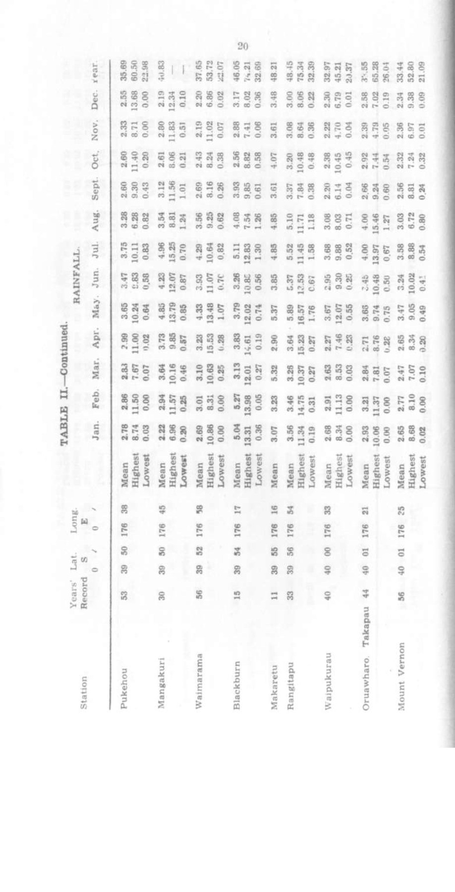
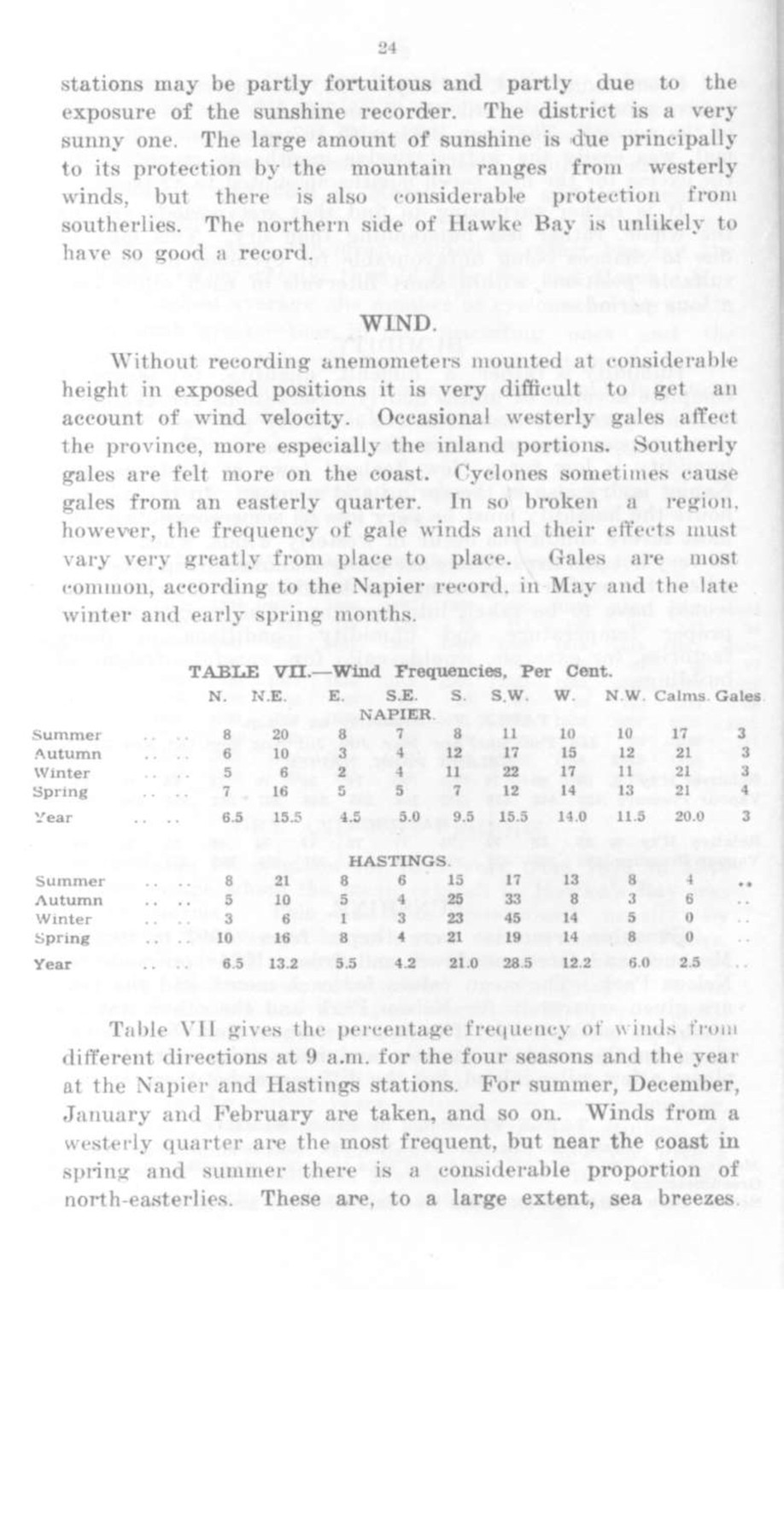
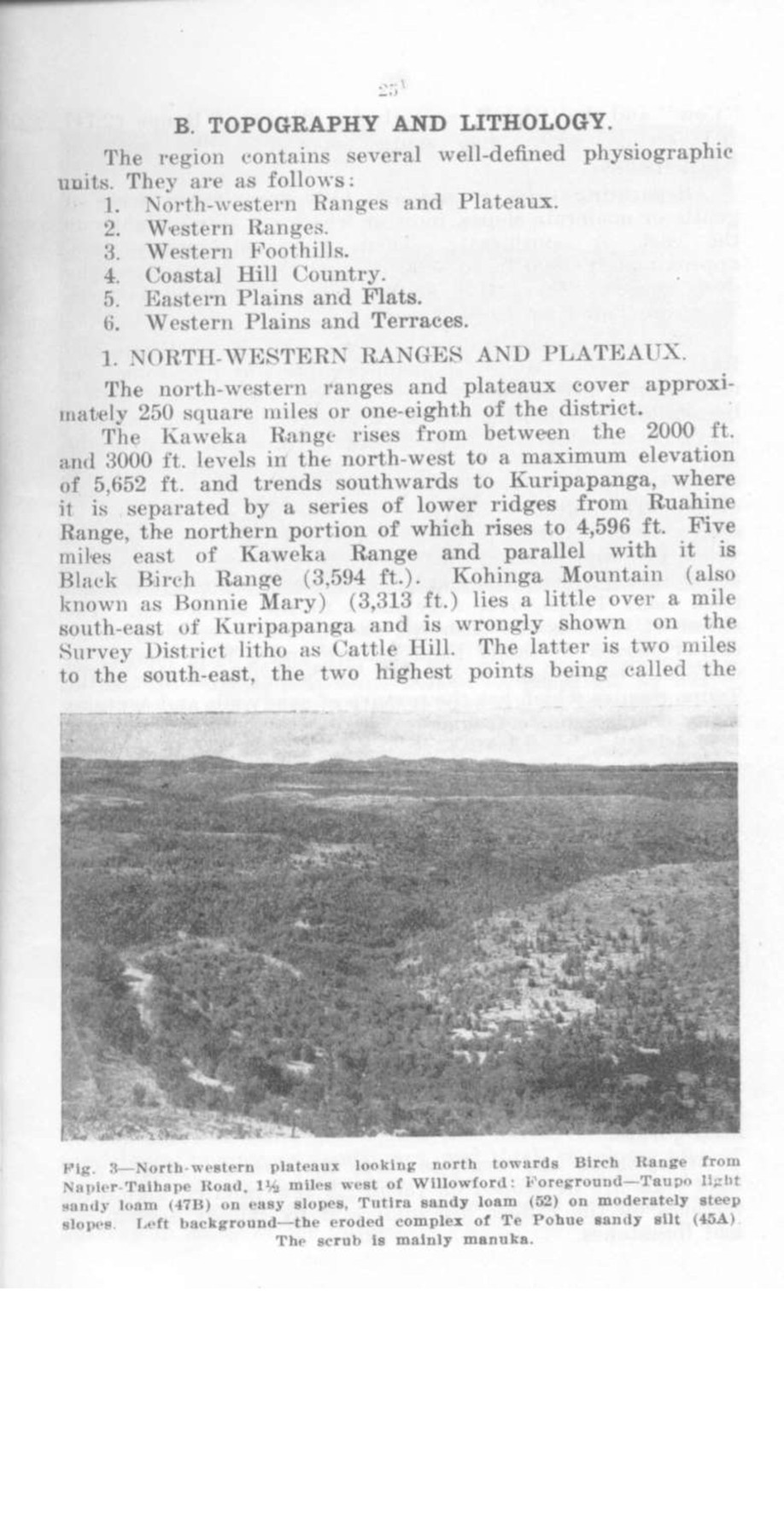
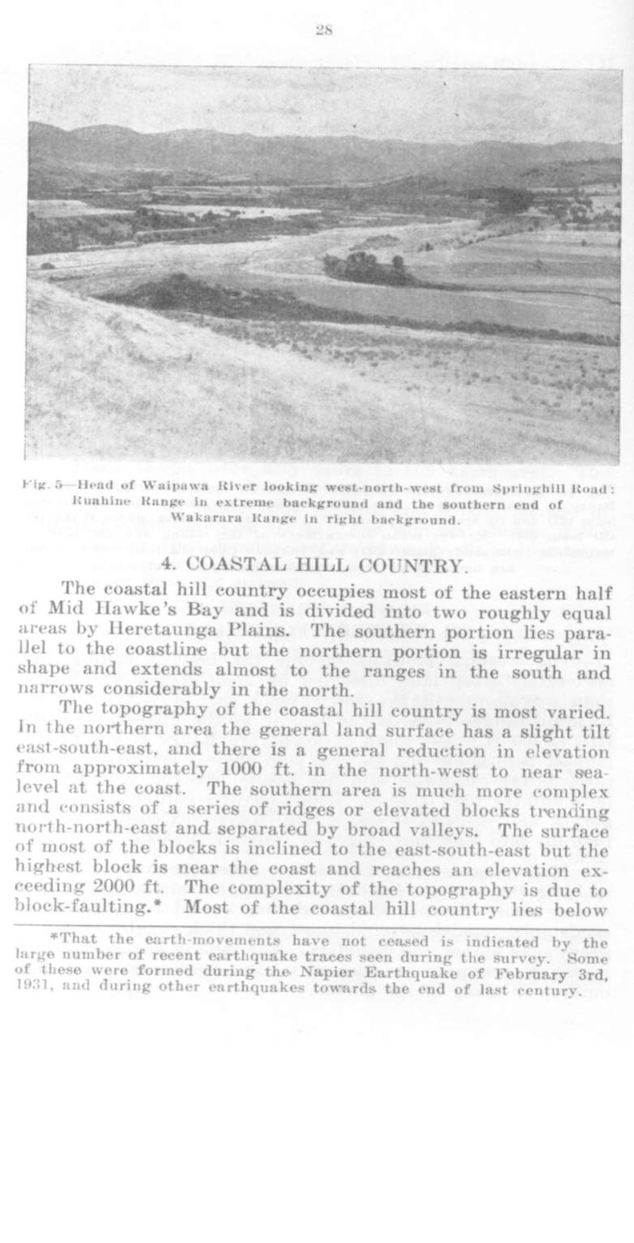
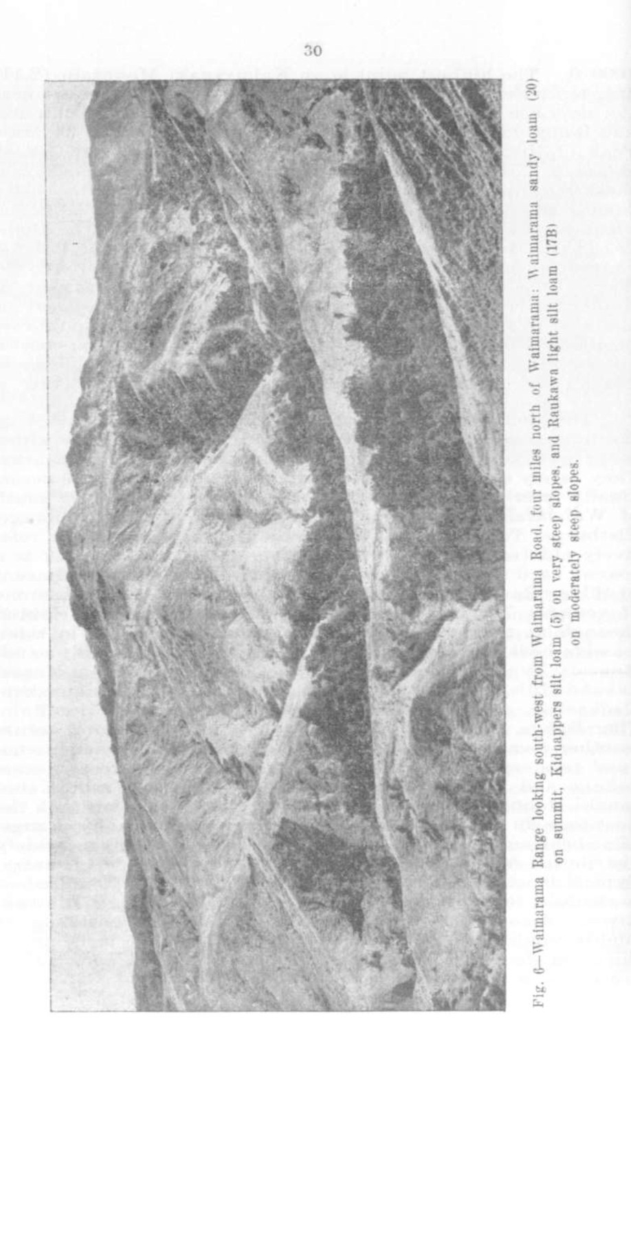
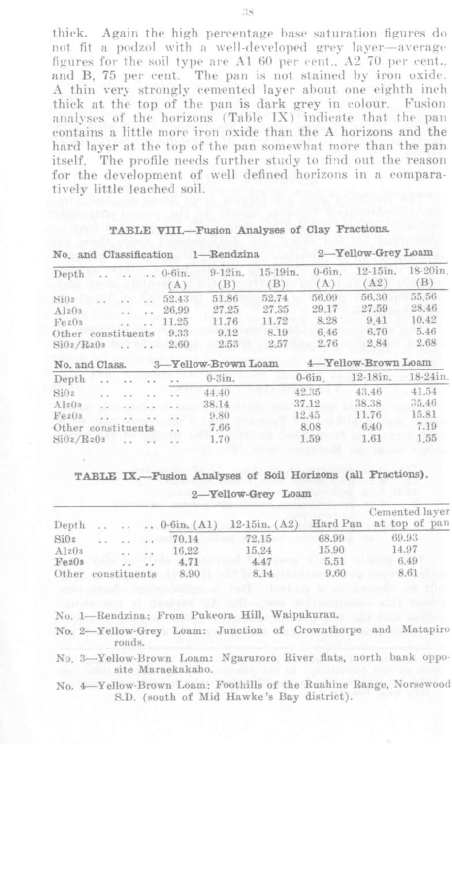
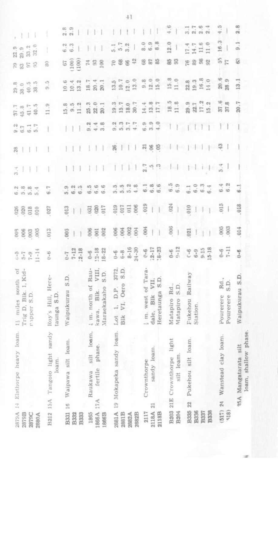
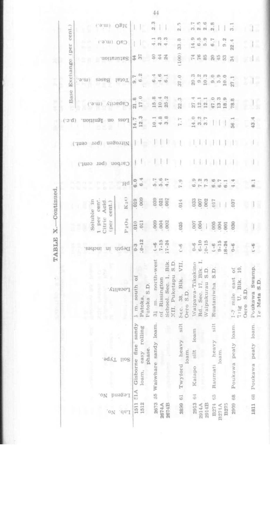
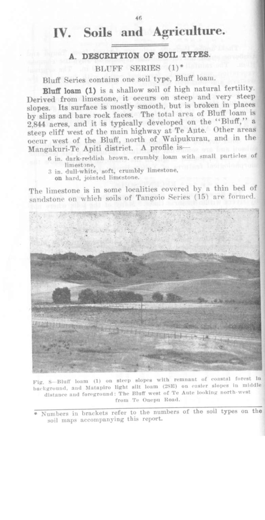
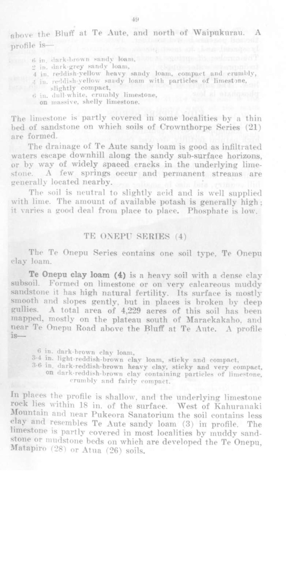
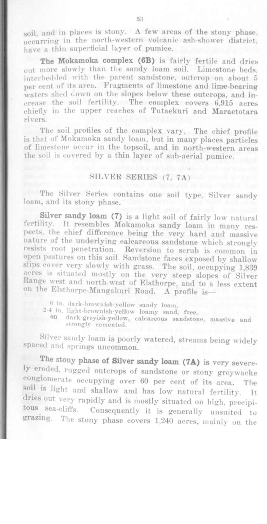
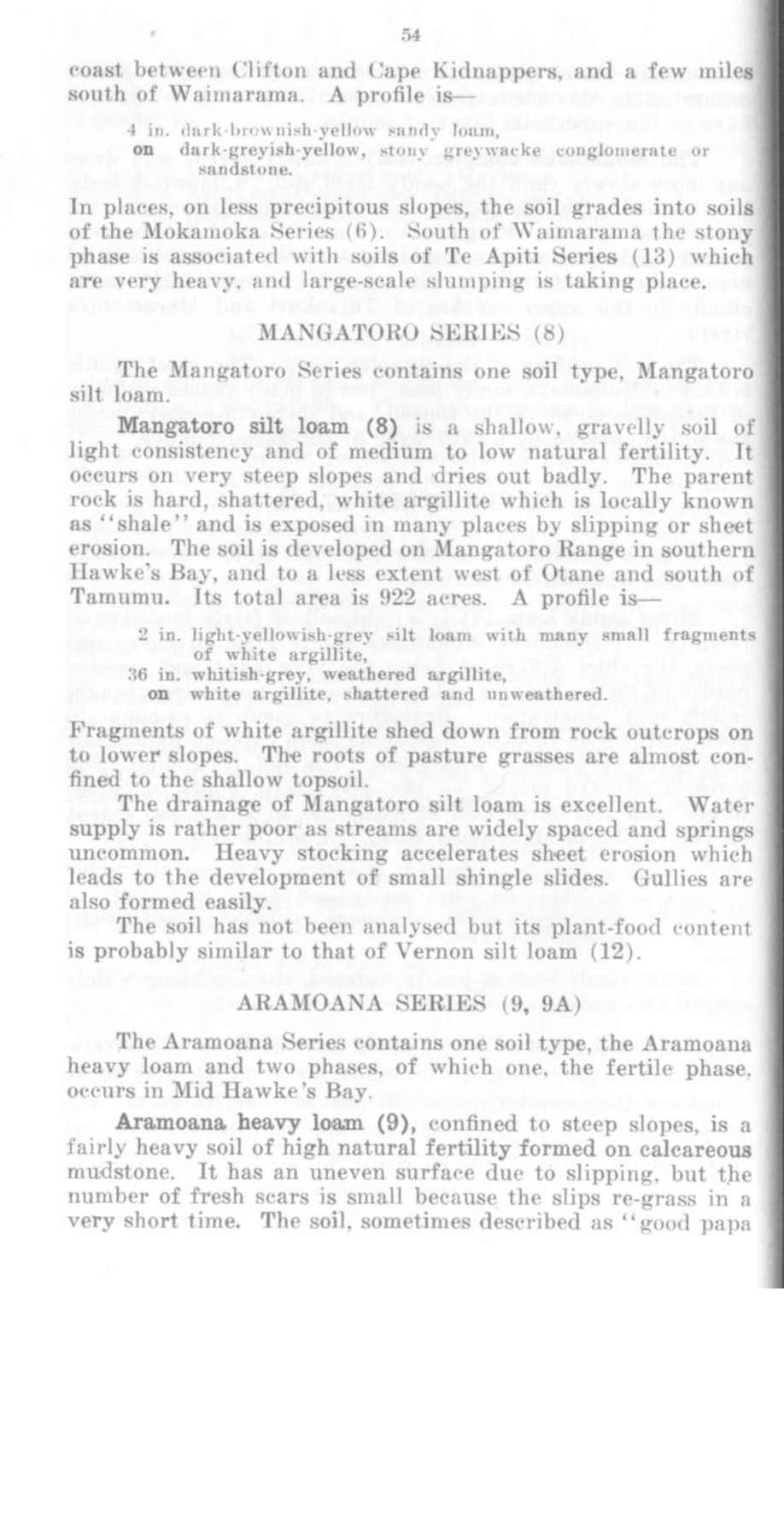
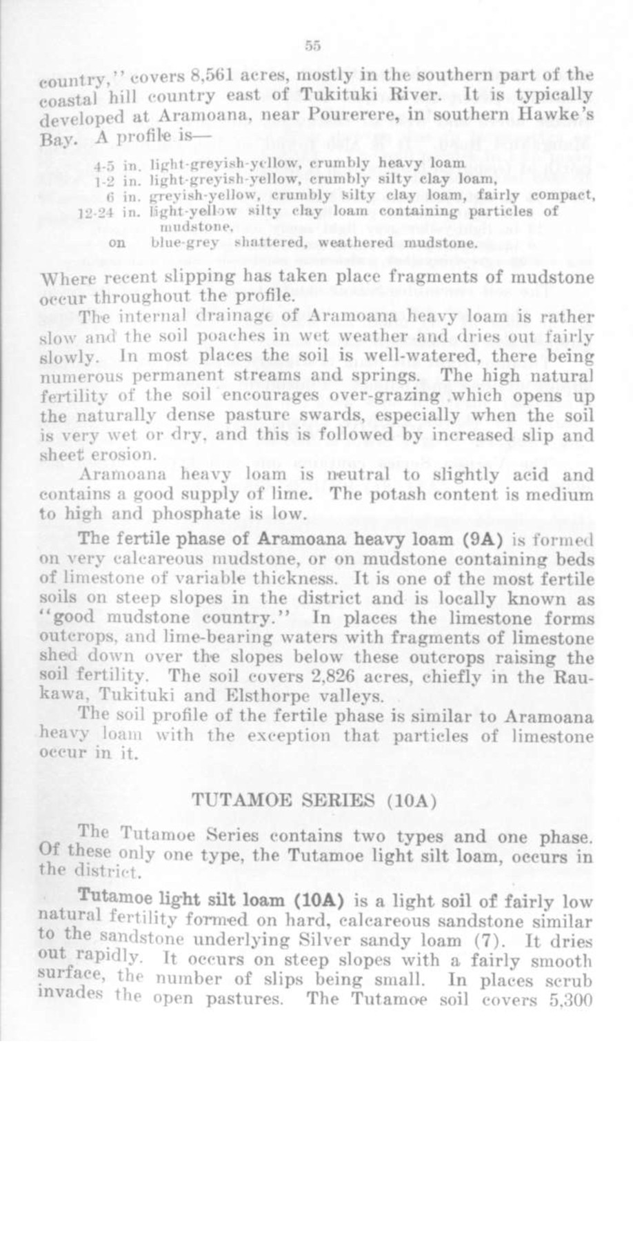
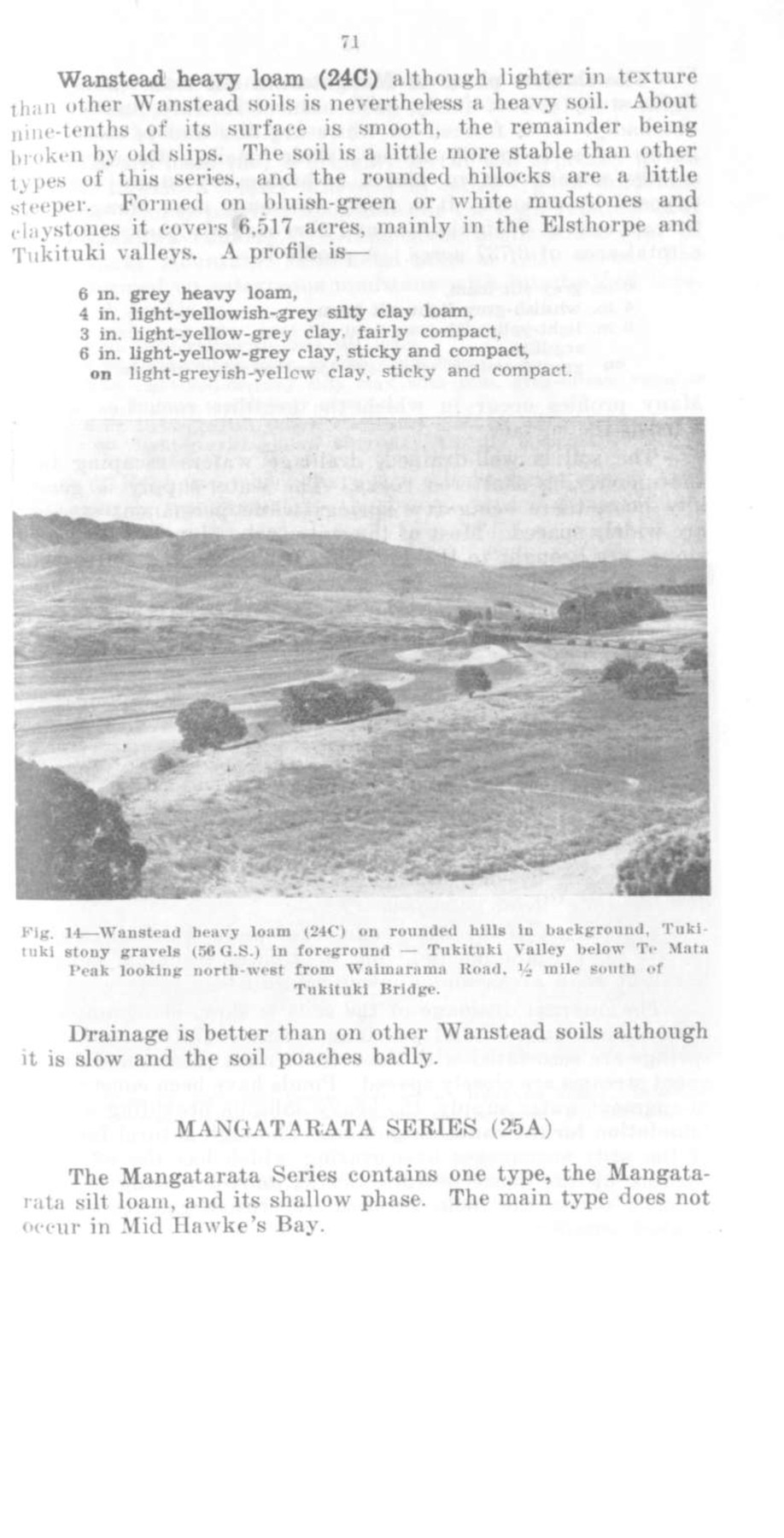
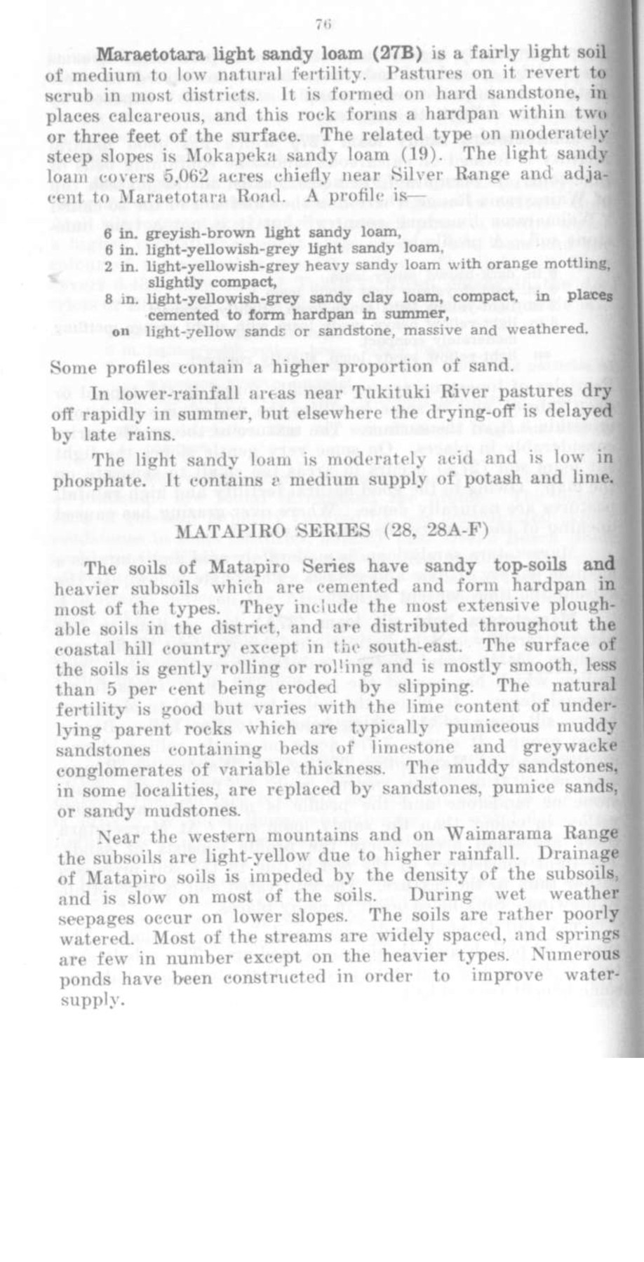
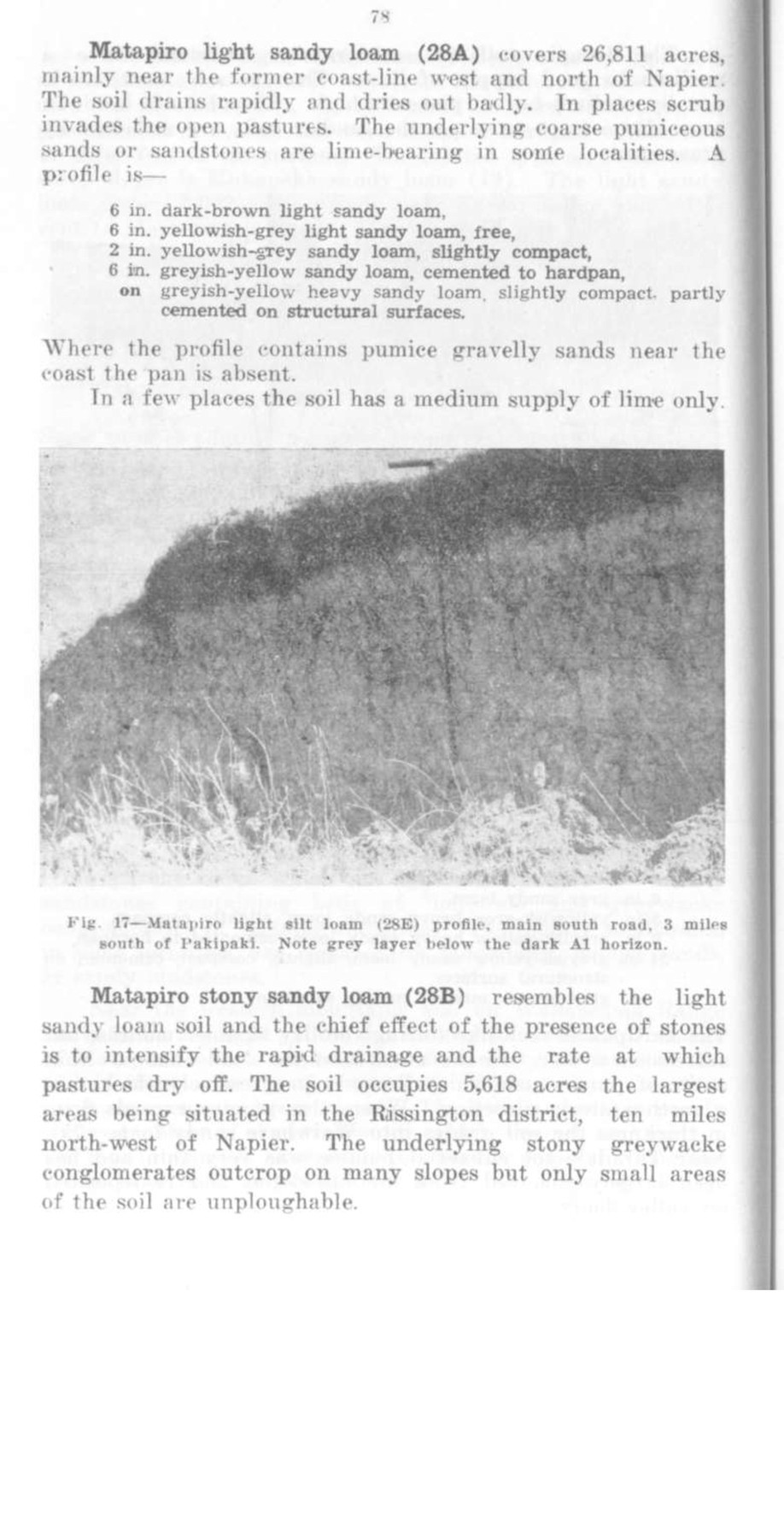
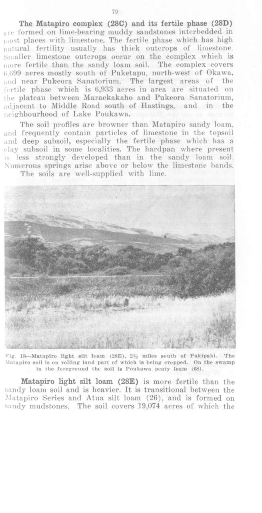
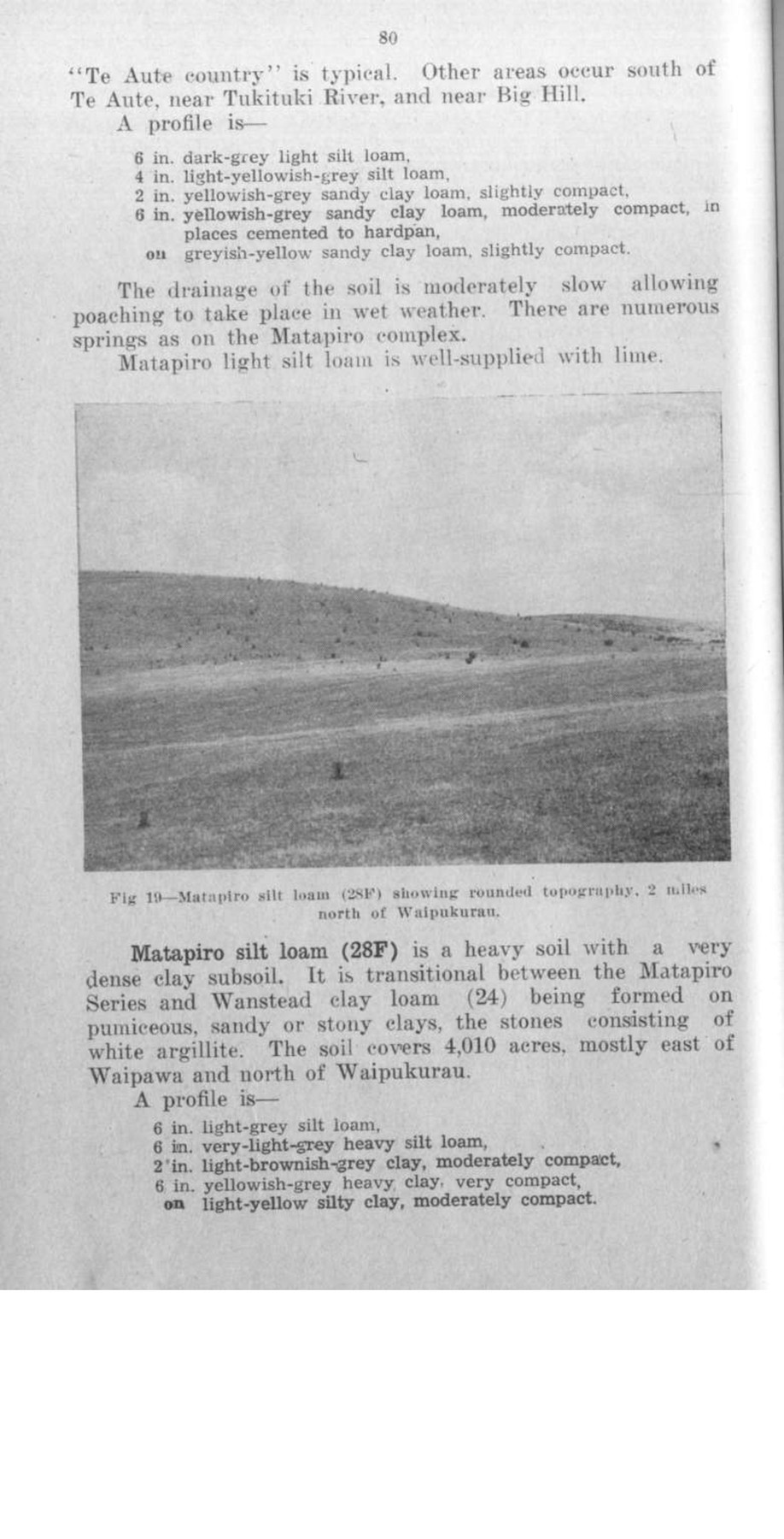
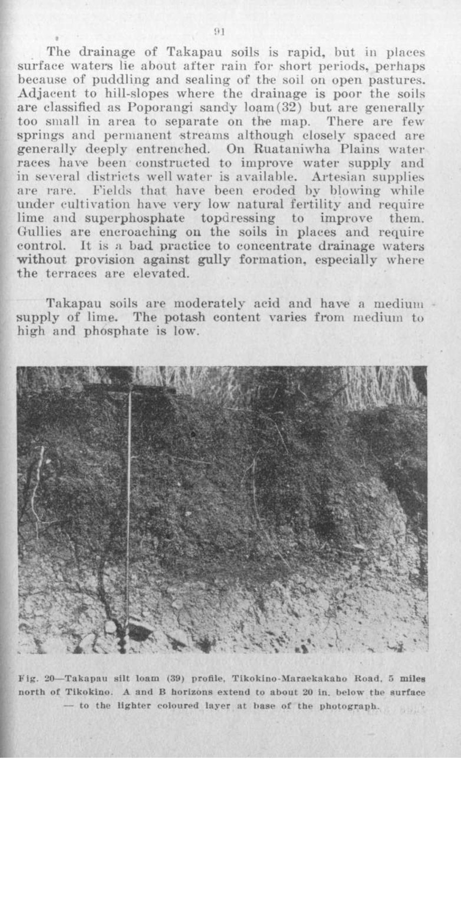
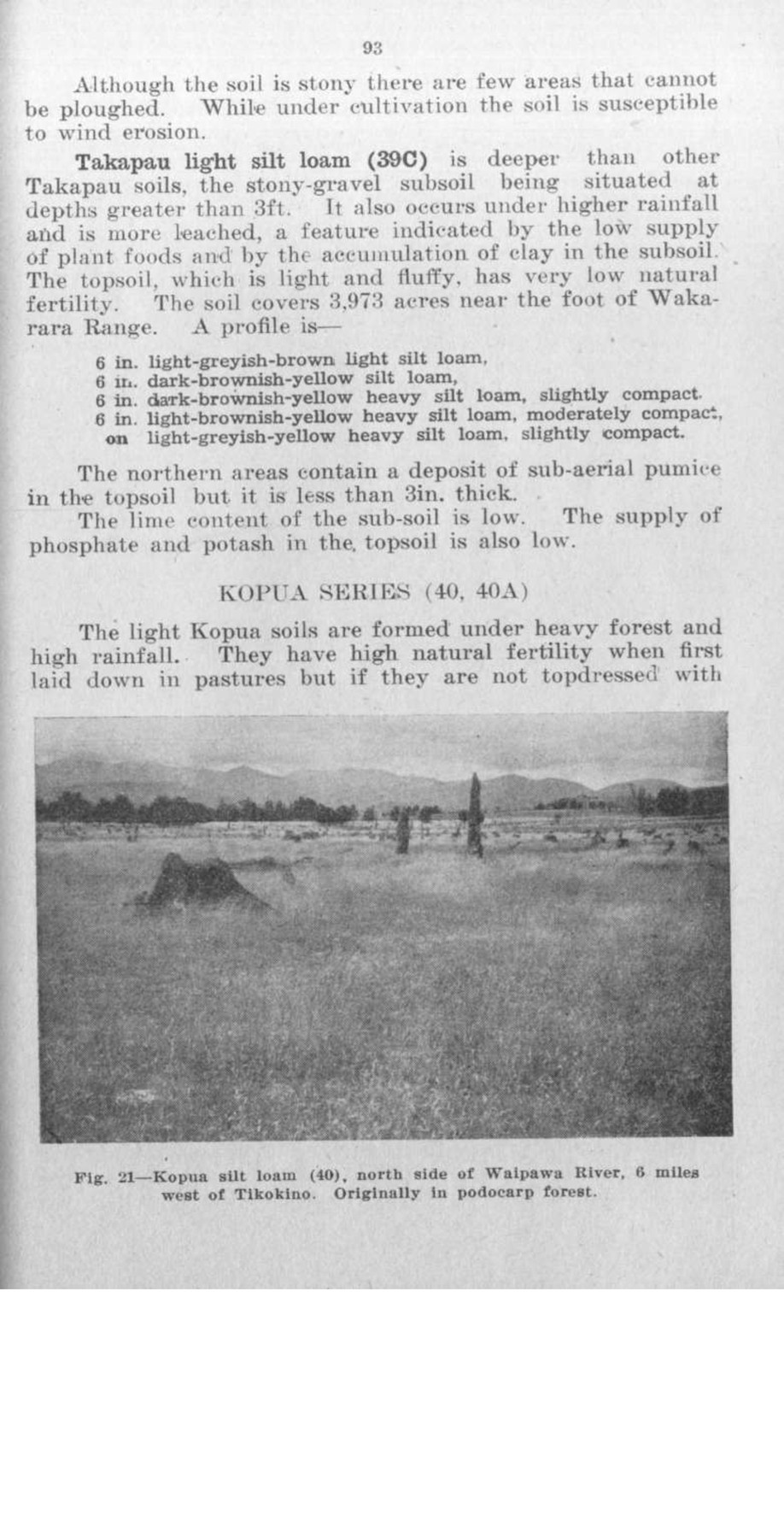
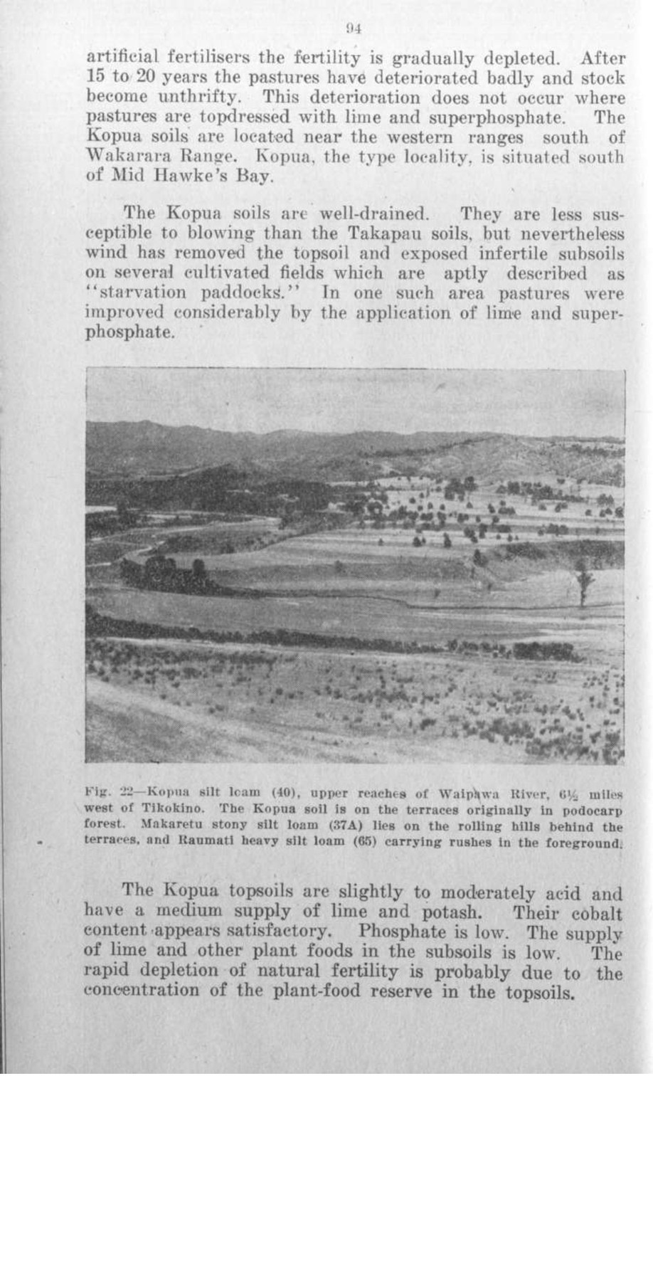
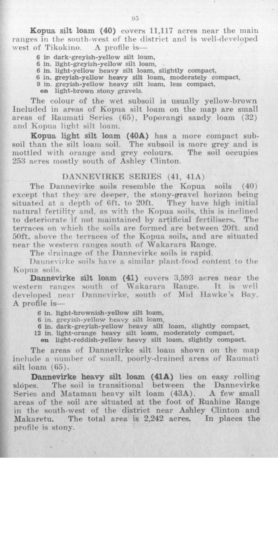
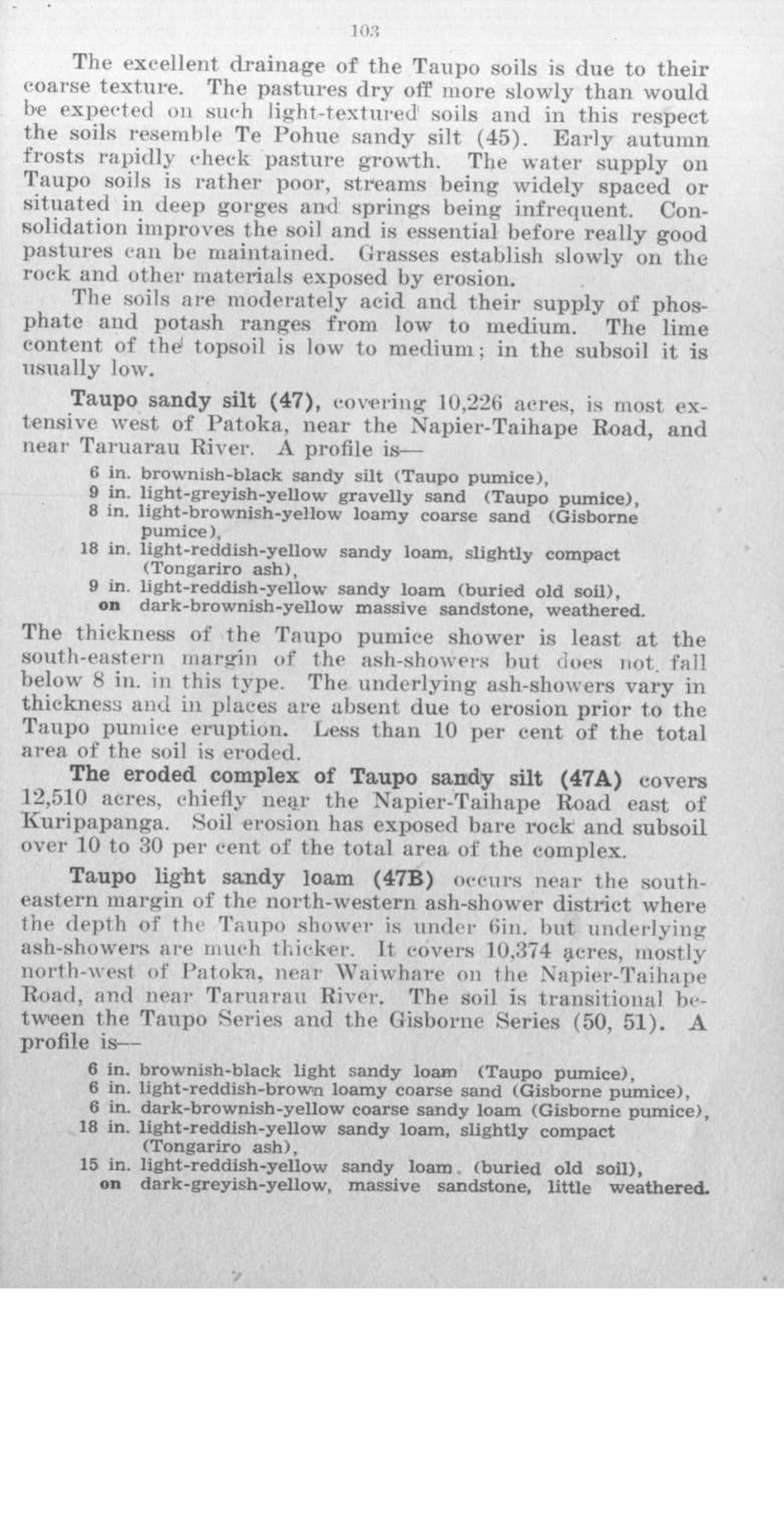
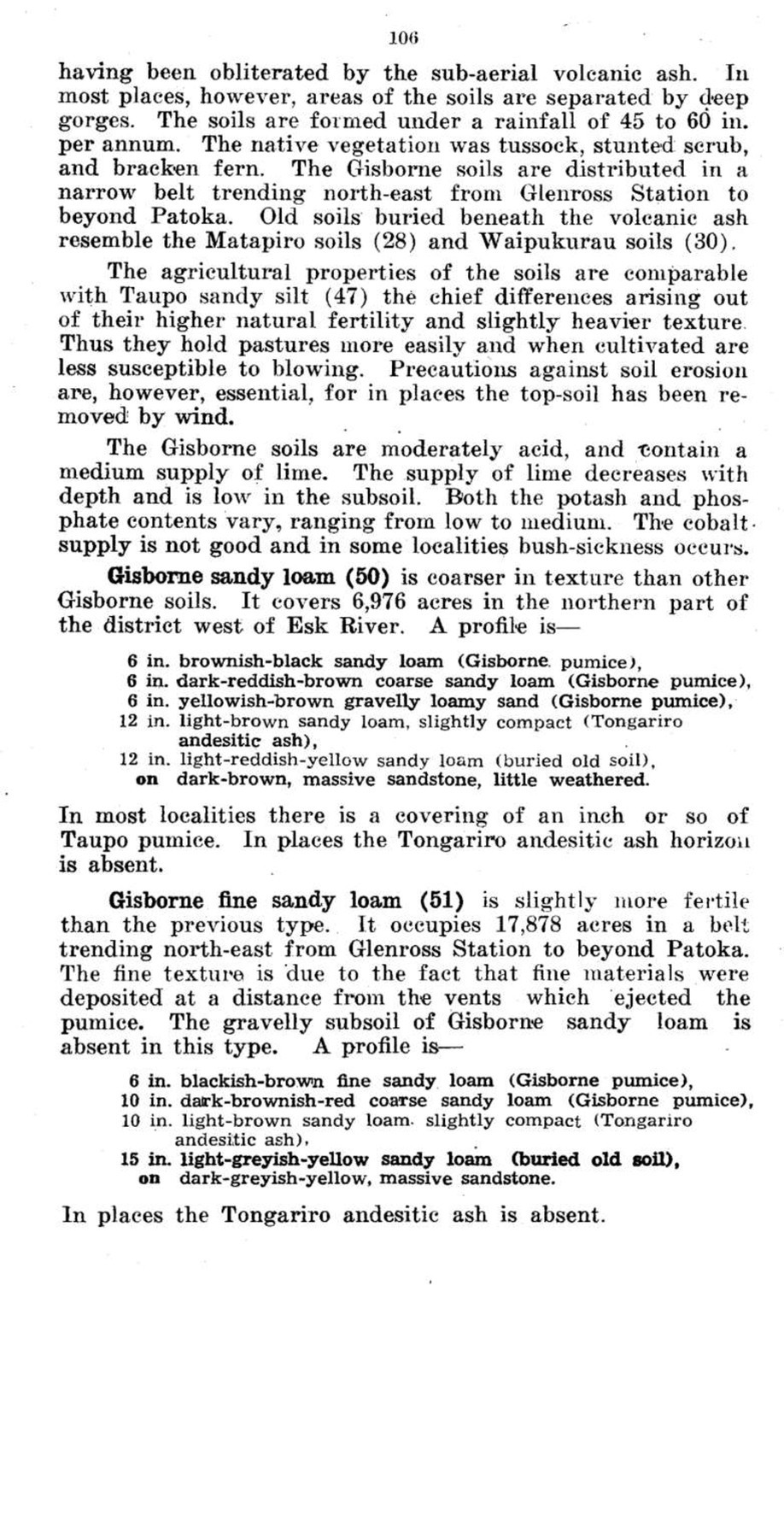
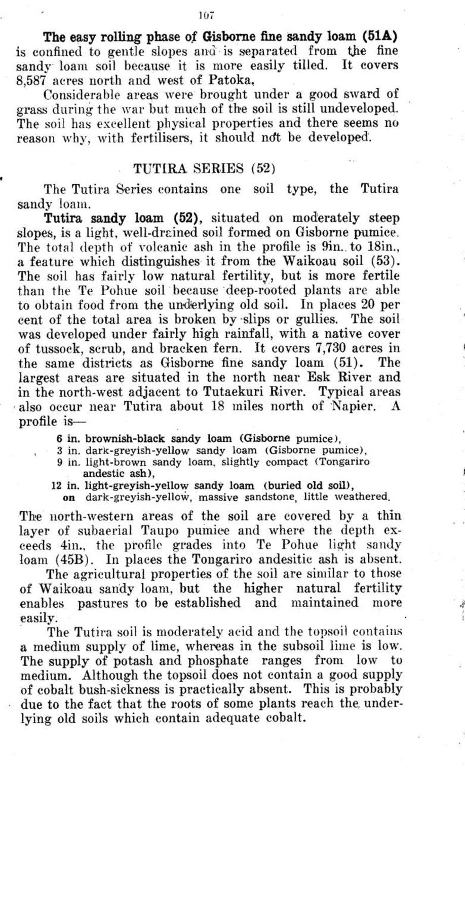
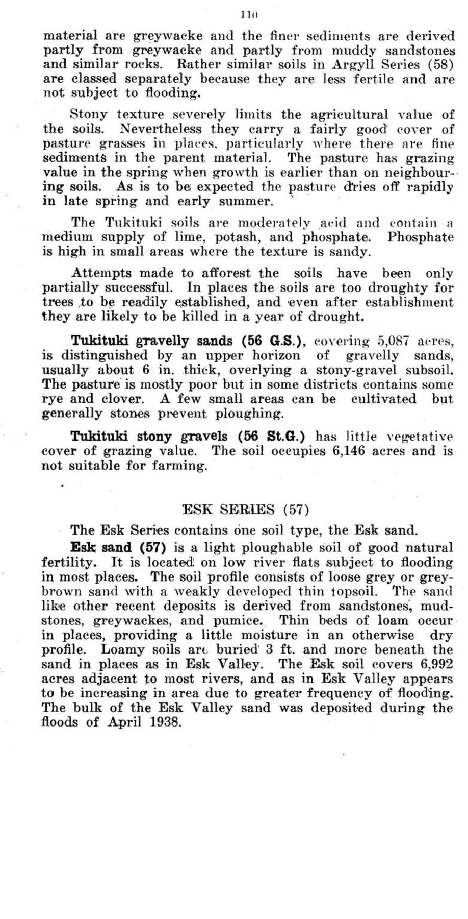
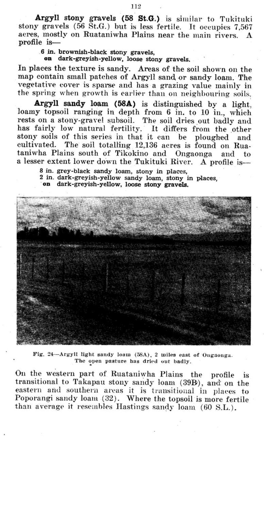
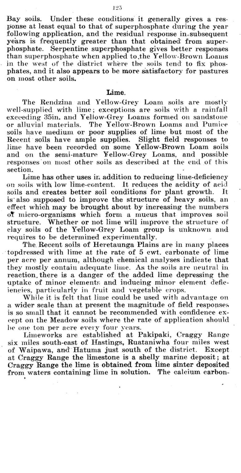
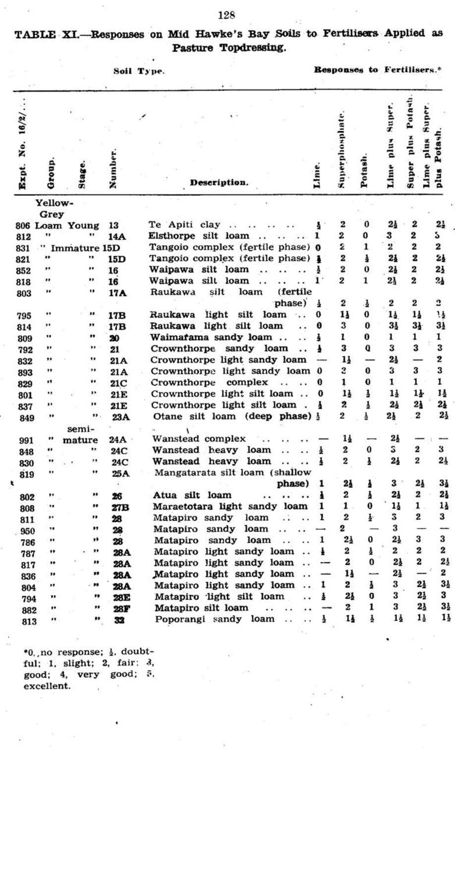
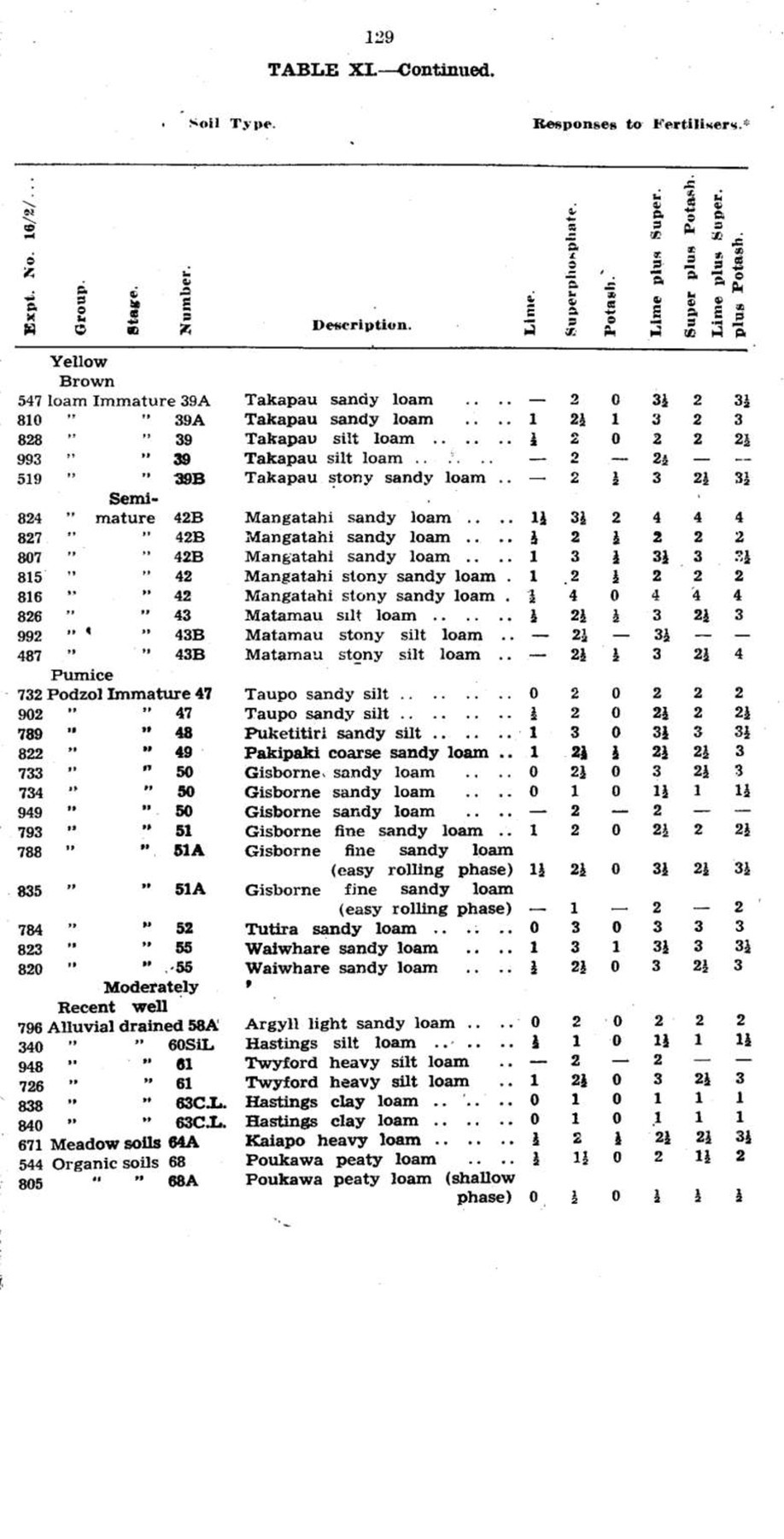
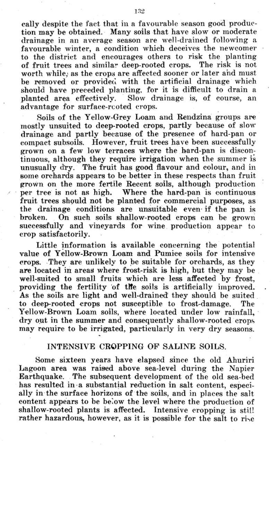
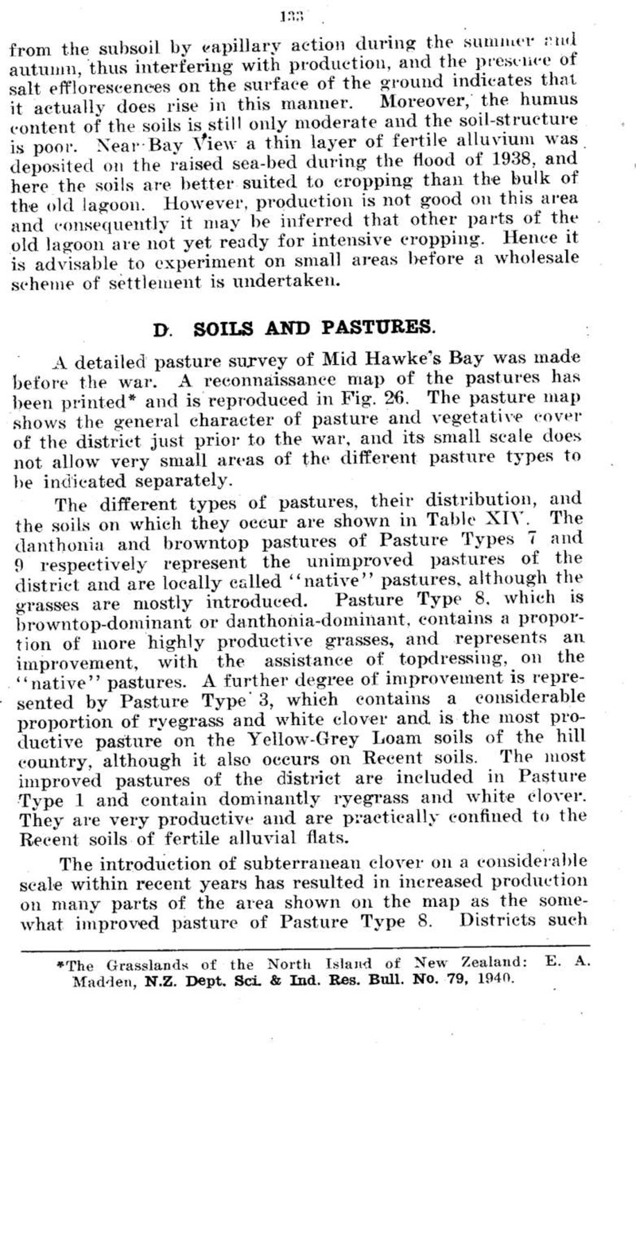
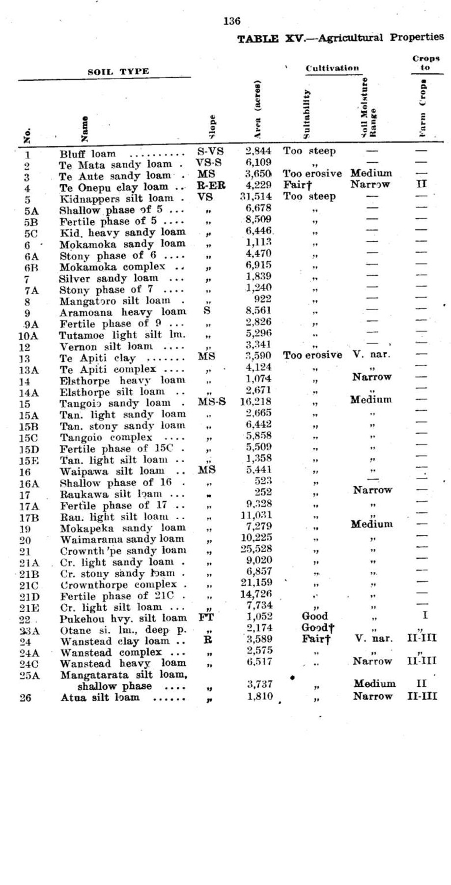
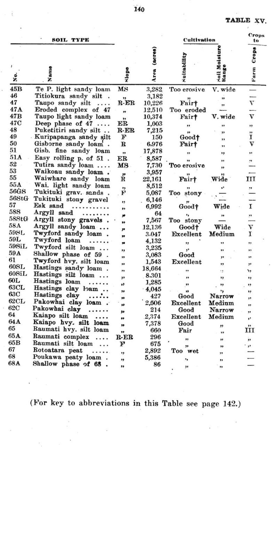
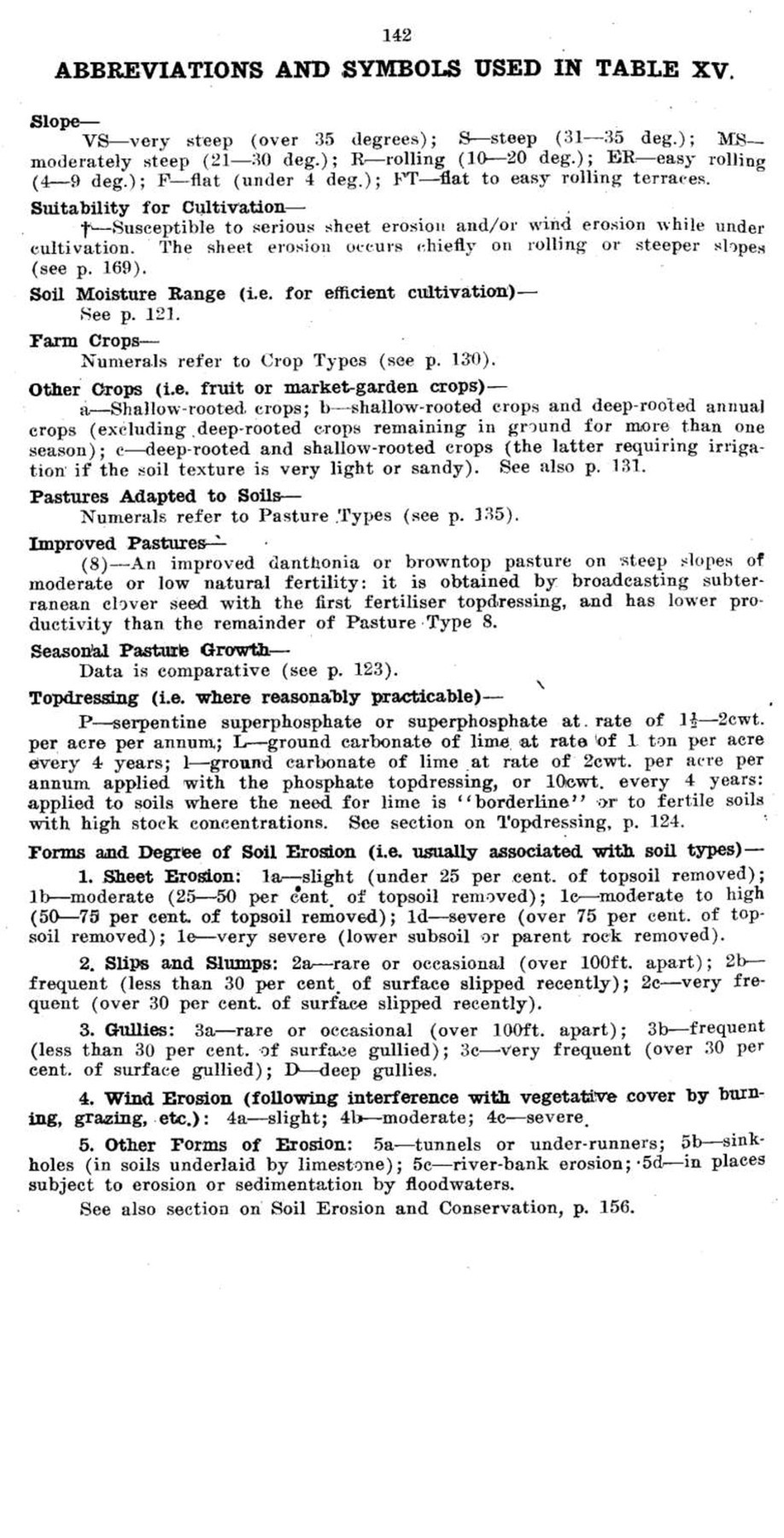
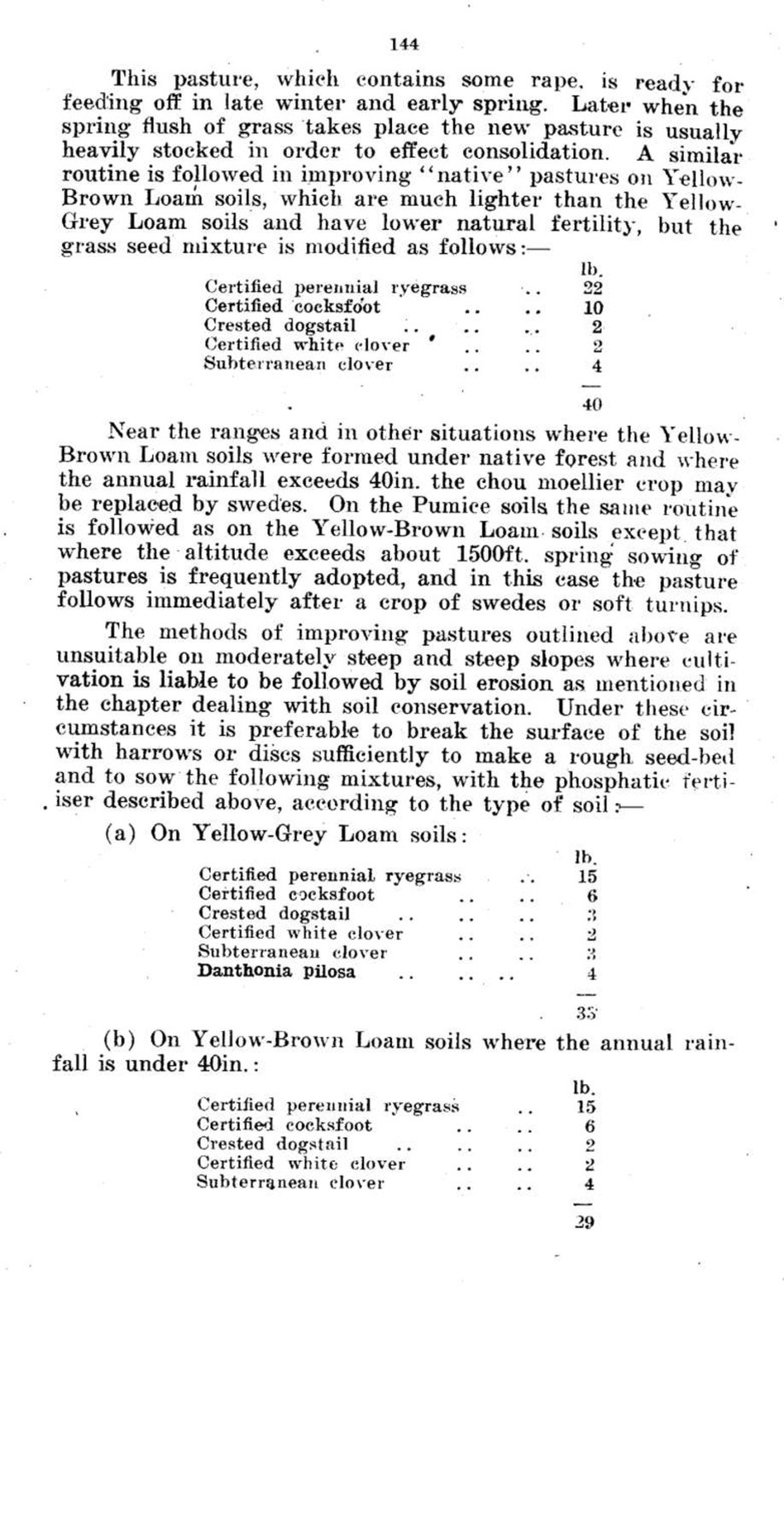
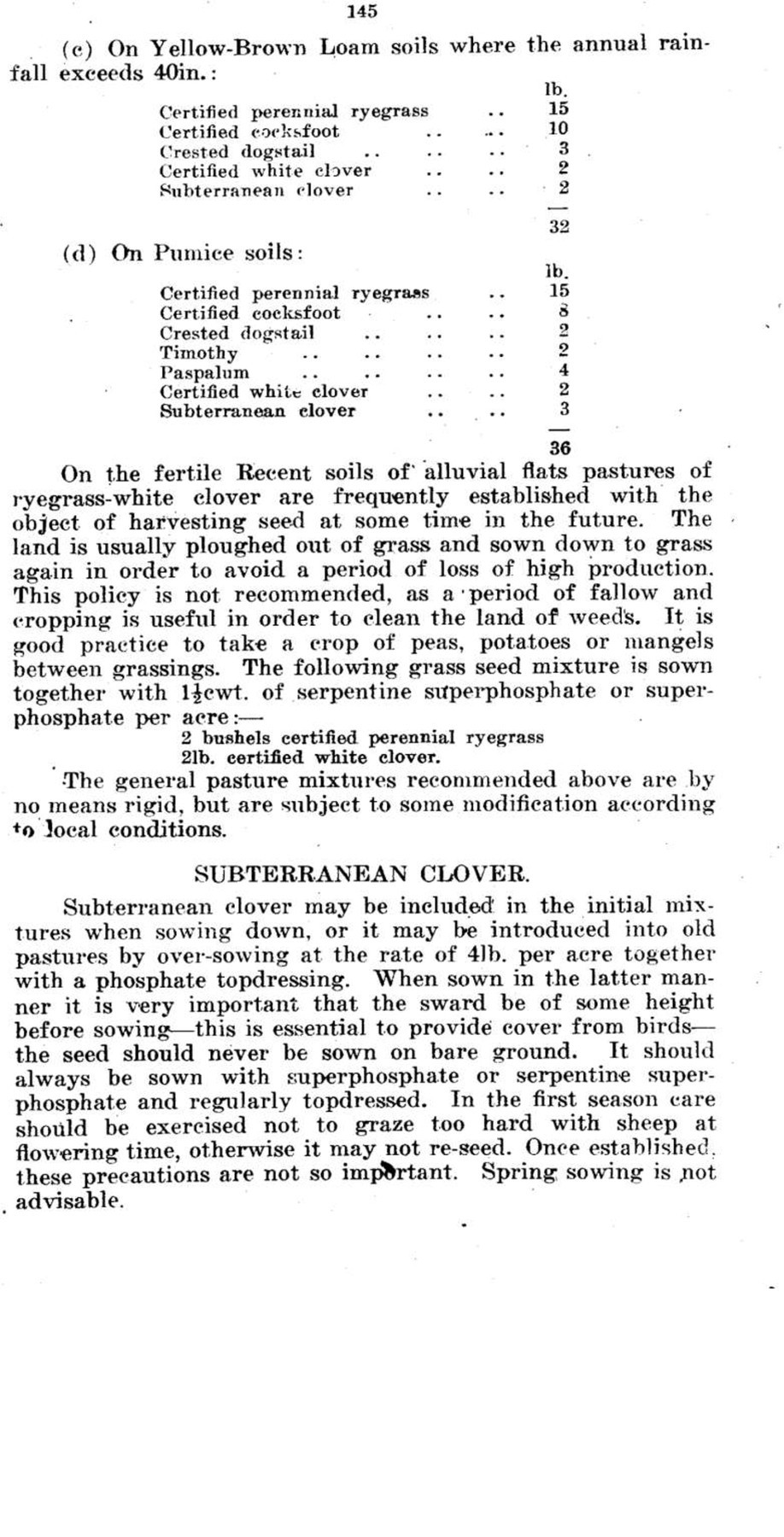
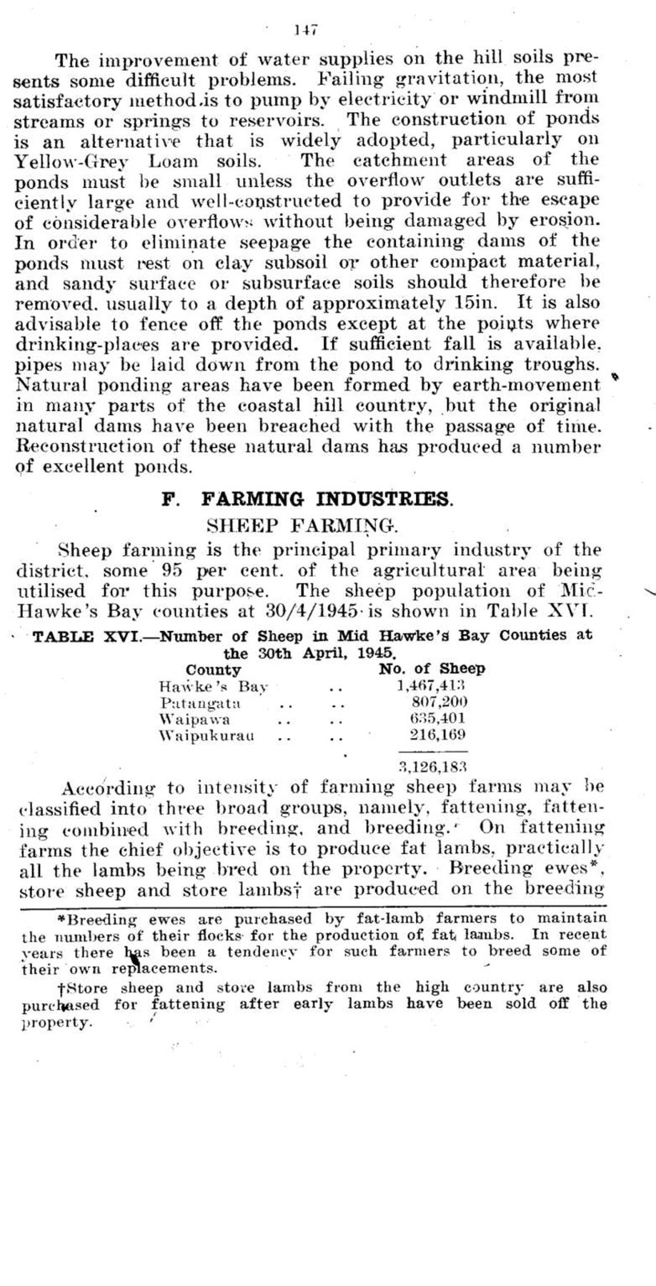
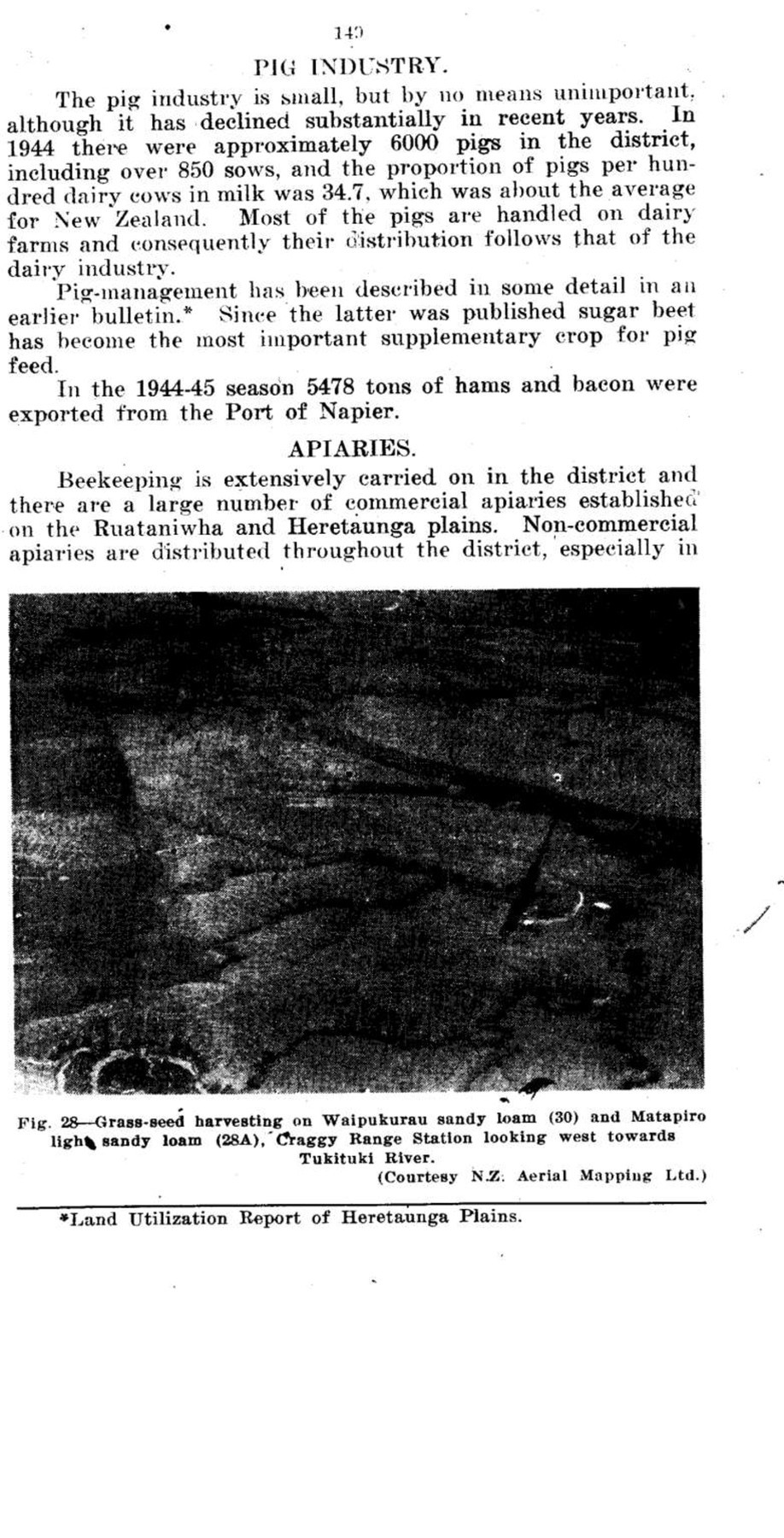
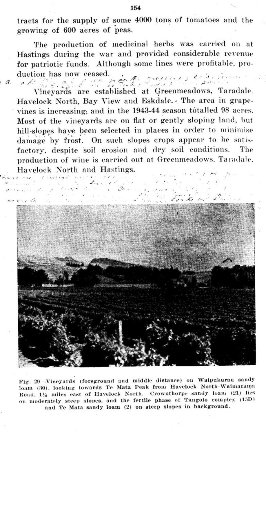
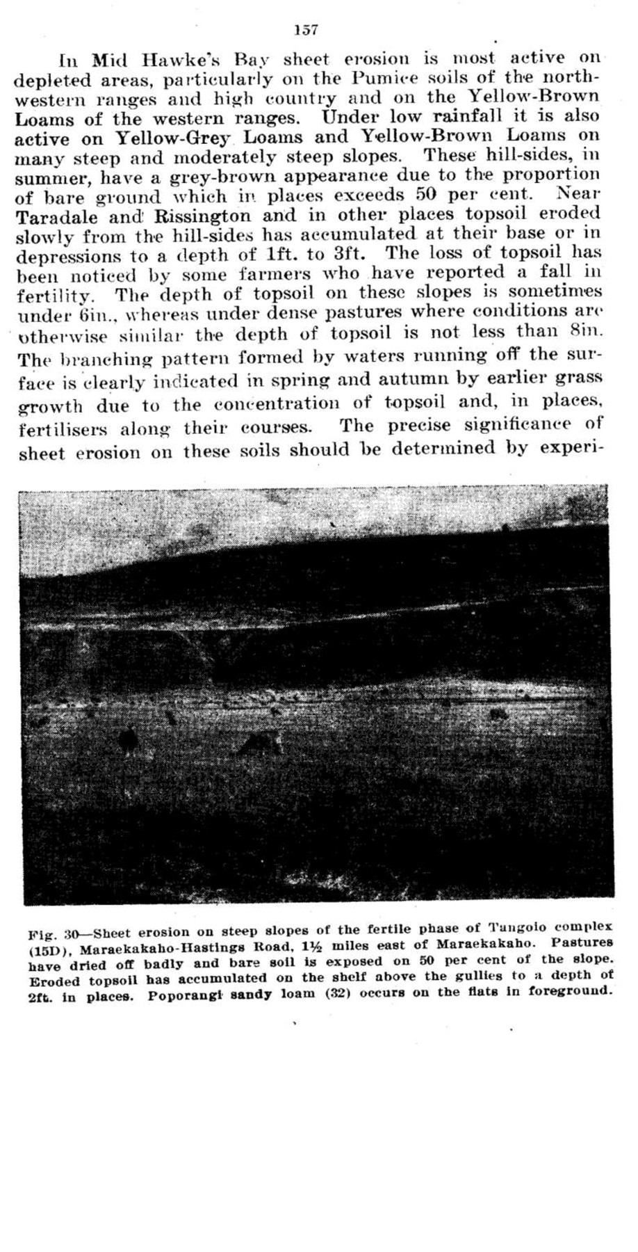
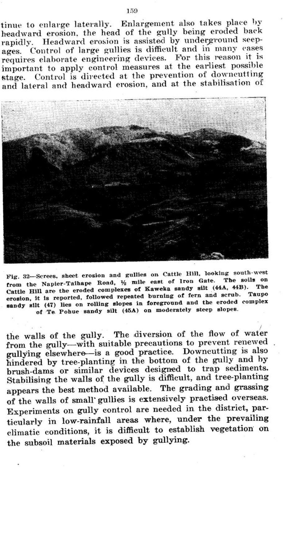
Page 161
Gullying has developed to a serious extent on the northwestern ranges and high country and on the western ranges where the soils belong to the Pumice and Yellow-Brown Loam groups respectively. In these areas almost 50 square miles have been mapped as severely eroded and an additional 170 square miles are in the process of developing to this stage. Deep gullies also form on the Mangatoro (8) and other soils developed on white argillite, and on Kidnappers (5) and related soils on mudstone. Shallow gullies form on most of the other hill-soils of the district, but are still relatively few in numbers. Soils of the Yellow-Brown Loam and Yellow-
Fig. 35 – Gully at the lower end of a blown paddock, 1 mile west of Willowford, Napier-Taihape Road. The gully is actively eroding. The soil on the blown paddock is Gisborne fine sandy loam (51).
Grey Loam groups formed on terraces are susceptible to deep gullying, as the terraces are situated many feet above river-level and the sediments underlying them are unconsolidated. Some of the gullies are formed by the entrenchment of artificial drains. Mangapoho Stream, an entrenched, shingle-bearing stream in the south-west of the district, was, according to local farmers, formed in this manner following the drainage of flax swamps. The gullies destroy arable land and drainage should be accompanied by precautions against their formation.

Page 162
Slip and Slump Erosion – Slipping on a spectacular scale occurs periodically in Mid Hawke’s Bay. The slips are of two types. Shallow slips, a few square yards to more than a square chain in area, are confined to the upper layers of the soil which are removed to a depth of about 18in. and in places 3ft. Deep slips are similar to the shallow slips in area, but remove the soil, subsoil, and underlying weathered materials to depths exceeding 4ft. and in places 20ft. Slumps, extending over many acres, are much larger than slips, and move on a deep-seated sheer-plane. Slips are an important cause of deterioration of steep land in the district. The deterioration is not always permanent, for, on fertile, mudstone soils such as the Kidnappers Series (5), the materials exposed by slipping re-grass within a few years and new soil is formed on them. However, on the less fertile, sandstone soils such as the Mokamoka (6) and Tangoio (15) series, re-vegetation of slips is very slow and they remain uncovered for many years.
Fig. 36 – Shallow slip on Crownthorpe light silt loam (21E). Waimarama Road 3 miles south of Ocean Beach turnoff. The slipped scar is small and most of the debris, has been deposited behind the fence.

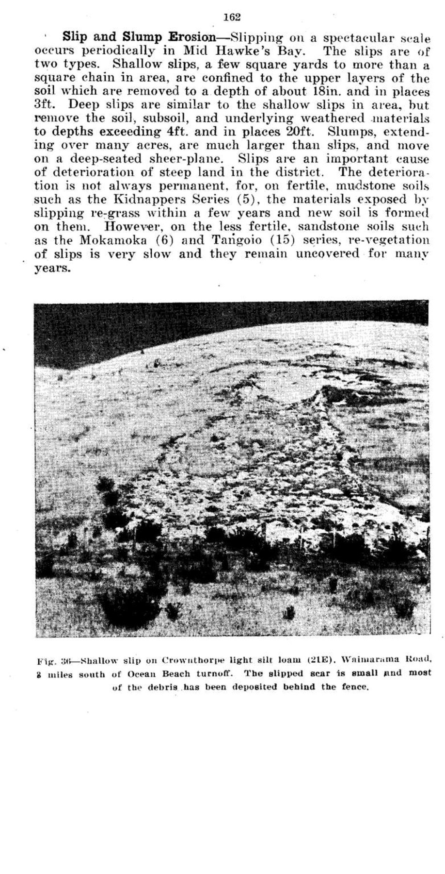
Page 163
Fig. 37 – Shallow slips on the fertile phase of Kidnappers silt loam (5B), Devil’s Elbow, Napier-Wairoa Road, ½ mile north of Mid Hawke’s Bay. The slipping occurred during heavy rains in 1938. Some gullies have developed.
(Courtesy N.Z. Aerial Mapping Ltd.)
The origin and mechanism of shallow slipping are complex. It is held by some observers that slips are due to the soil becoming saturated with water and fluid, in which condition it flows off the hill-sides. This explanation is not entirely satisfactory in Mid Hawke’s Bay, where spectacular slipping rarely, if ever, occurs during the winter months and is most frequent in the coastal hill country with an average annual rainfall of under 50in. and, over a large area, under 35in. The cracking and disturbance of hill-slopes during the Napier Earthquake of 1931 is locally thought to have created favourable conditions for the spectacular slipping of 1938. but some of these slopes were less affected by slipping than undisturbed ones. A large number of slips were examined in an endeavour to discover the nature of the slipping process, and as the mechanism of slipping is important in determining control measures details of the process, together with some observations, are recorded here.
The soil, in shallow slipping, slides as a block; it does not flow as a fluid mass. The block frequently comes to rest almost unbroken a few yards from its original site. Minor slipping only, occurs during average winter rains. Slipping on a spectacular scale, such as that which occurred in 1893 and 1938, occurs during intensive rains which, according to

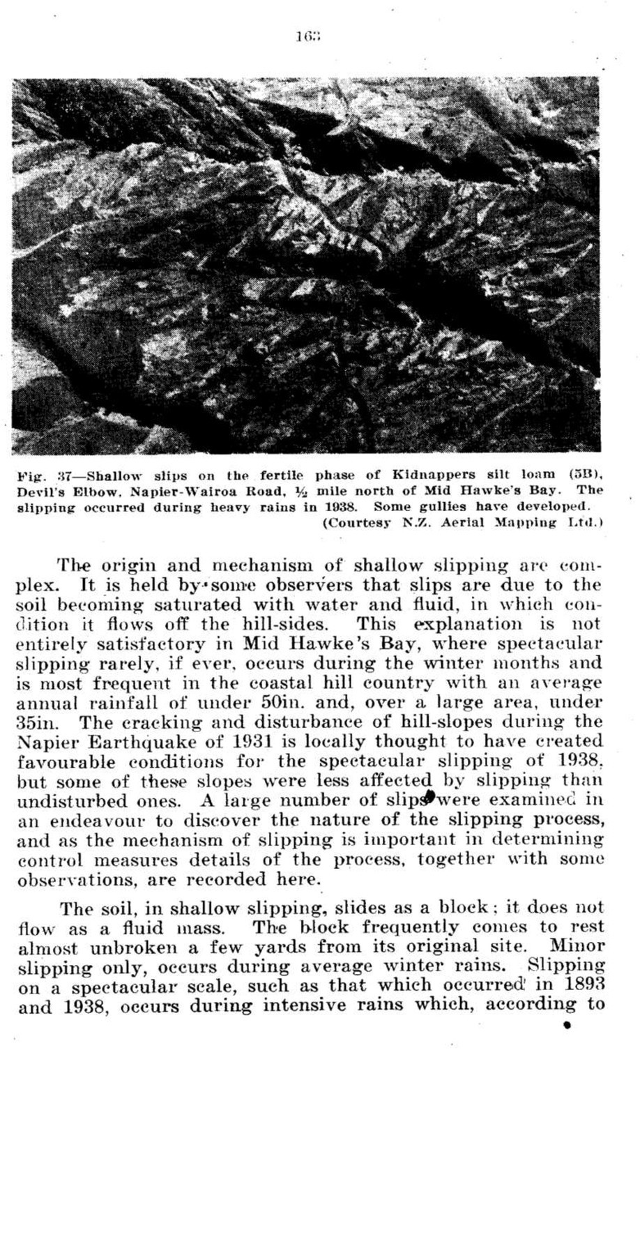
Page 164
climatic records, appear invariably to follow a dry spell in the spring, summer or autumn months. The force tending to move the slipping block downhill, which is that part of its weight acting downhill, is less than half its total weight on slopes of less than 30 degrees, and is opposed by considerable forces tending to keep the block in place. The latter are exerted by supporting blocks, by the cohesion and interlocking of soil particles, by the binding effect of plant roots, and by friction. They are overcome in the following manner:-
(1) Prior to slipping the soil is partly exposed in open pasture swards, especially where sheet erosion is active, and due to dessication by the sun and drying winds it cracks deeply. A network of cracks may surround the slipping block.
(2) During intensive rains surface run-off flows into these cracks, which also receive infiltrated waters seeping downhill in the subsurface soil. Water thus gains entry to the soil at depth.
(3) Water from the cracks flows laterally downhill along permeable strata, usually the subsurface soil, and these strata become saturated and partly fluid.
(4) At the foot of the slipping block water rises to the surface along cracks lubricating the junction with supporting blocks.
(5) The block slips as the forces tending to hold it in place have been rendered ineffective. On gentle slopes friction quickly brings the block to rest. On very steep slopes the block slides for some distance, leaving an ‘apron’ of muddy debris on the grassy slopes it over-rides.
The shallow slips common on Yellow-Grey Loam soils are produced in this manner and are not necessarily associated with earthquake cracks. On rolling or moderately steep slopes these soils have a heavy or hardpan subsoil overlaid by a permeable subsurface horizon. On steep slopes they are sandy in texture or have good crumb structure and are underlaid by hard rock. Some of the deep slips on Kidnappers silt loam (5) and other heavy soils formed on mudstones and claystones originate in the same way as shallow slips, water gaining access to the soil at depth along deep soil cracks. Others are related to earth-faulting, a relation that has been followed for some miles between Clifton and Craggy Range, and on the hills east of Te Mata Peak. The deep-seated sheer planes on which the movement of slumps takes place are, in many places, formed by earth-movement. Between Clifton and Cape Kidnappers, for example, numerous large slumps occur on the sites of recent earthquake traces.

Page 165
As slipping is caused by water gaining access to the soil at depth, control measures must be directed at preventing or minimising soil cracking and fissuring. On grassland this is achieved by an improvement in the density of pastures. The number of slips on moderately steep and steep slopes under dense pastures is known to be lower than on similar slopes under open pastures. Severely slipped slopes have been stabilised in places by willows, but in these cases the willows have encouraged the development of a dense grass sward beneath them. However, single trees do not, on the whole, control slipping effectively on the Yellow-Grey Loams, and have been observed to accelerate it. The roots of a single tree do not bind the slipping block to the underlying soil, as the tree adopts a shallow-rooting habit due to the hardpan or heavy subsoils. Moreover, the weight of the tree, combined with the weight of the slipping block, greatly increases the force tending to cause the block to slip. On land unsuitable for farming the best method of stabilising slopes appears to be block tree-planting. The control of deep slips and slumps sometimes requires elaborate engineering measures. Methods used include tree-planting over the zone where water gains access to the slipping plane, and the diversion of water from this area. Fencing off the area from stock and allowing the grass to grow tall has also been practised with some degree of success. Research into methods of controlling slipping in the district is required, and in particular into methods of establishing vegetation on the soil materials exposed by slipping where these are unfavourable for plant-growth under the prevailing conditions of low rainfall.
Tunnel Erosion – Tunnels or ‘underrunners’ beneath the surface of the soil range in diameter from a few inches to over three feet and form a branching pattern. They are common on Yellow-Grey Loam soils, especially on moderately steep slopes, and they occur, in places extensively, on the Pumice soils. In most cases the tunnels are located in the subsurface horizon, but they have also been noticed in the underlying rock. They are eroded by water which, having gained access to the soil at depth, percolates downhill above an impermeable horizon and is concentrated into defined channels by irregularities in slope, by soil cracks, or by other differences in permeability of the soil horizon in which it flows. The tunnels continue to enlarge until the roof collapses, when they are a danger to stock and a forerunner of gullying. Methods described for the prevention of slipping are likely to be effective against tunnelling, as the object in both cases is to prevent water from gaining access to the soil at depth. Once commenced tunnels are difficult to control. One method used is the blocking of the channels at different points.

Page 166
Wind Erosion – The chief type of wind erosion in the district occurs on land cultivated in situations unprotected from wind. Pumice soils, Yellow-Brown Loams, and Recent soils of sand texture are subject to wind erosion under these conditions. A blown paddock near Willowford on the Napier-Taihape Road is an example of this form of erosion. Before cultivation the soils should be adequately protected from wind by shelter-belts.
Fig. 38 – Gully erosion on the eroded complex of Taupo sandy silt (47A). The Blowhard, Napier-Taihape Road. Gullying sometimes follows wind erosion of the topsoil, attacking the subsoil and weathered underlying rock.
The severe erosion of the Pumice soils on the northwestern ranges and plateaux is generally regarded as wind erosion, but it is not due to wind erosion alone, for the subsoil is Tongariro ash, a loamy horizon not readily removed by wind. Erosion commenced with the depletion of the vegetative cover, begun prior to European settlement and intensified during the subsequent period of extensive farming. This allowed the strong winds of the exposed district to remove the light, sandy topsoil in places. Wind erosion, supplemented by washing during wet weather, caused the soil to be removed to a depth exceeding 4ft. On the bare surfaces thus exposed gullies and sheet erosion developed, and these are now the chief forms of erosion.
River-bank Erosion – Lateral erosion by streams in Mid Hawke’s Bay destroys fertile, flat land, and causes slips and slumps where the streams flow in gorges. At Pa Flat, Waipukurau and in other places, river-works have been established to minimise this type of erosion.

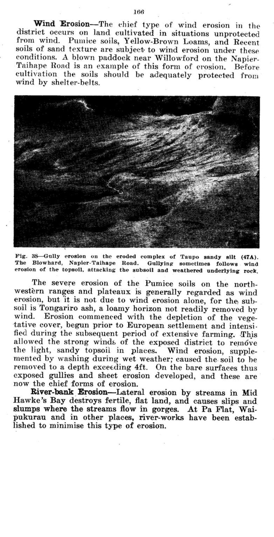
Page 167
Fig. 39 – Remnant of Taupo sandy silt (47) left by wind erosion, summit of The Blow hard, Napier-Taihape Road. The soil is the eroded complex of Taupo sandy silt (47A).
Fig. 40 – A blown paddock, 1 mile west of Willowford, Napier-Taihape Road. The soil is Gisborne fine sandy loam. (51). Wind removed the topsoil from the bare, cultivated field, and wind and sheet erosion have since removed the soil to a depth of over 3 ft. Gullying has commenced in the subsoil and underlying rock.

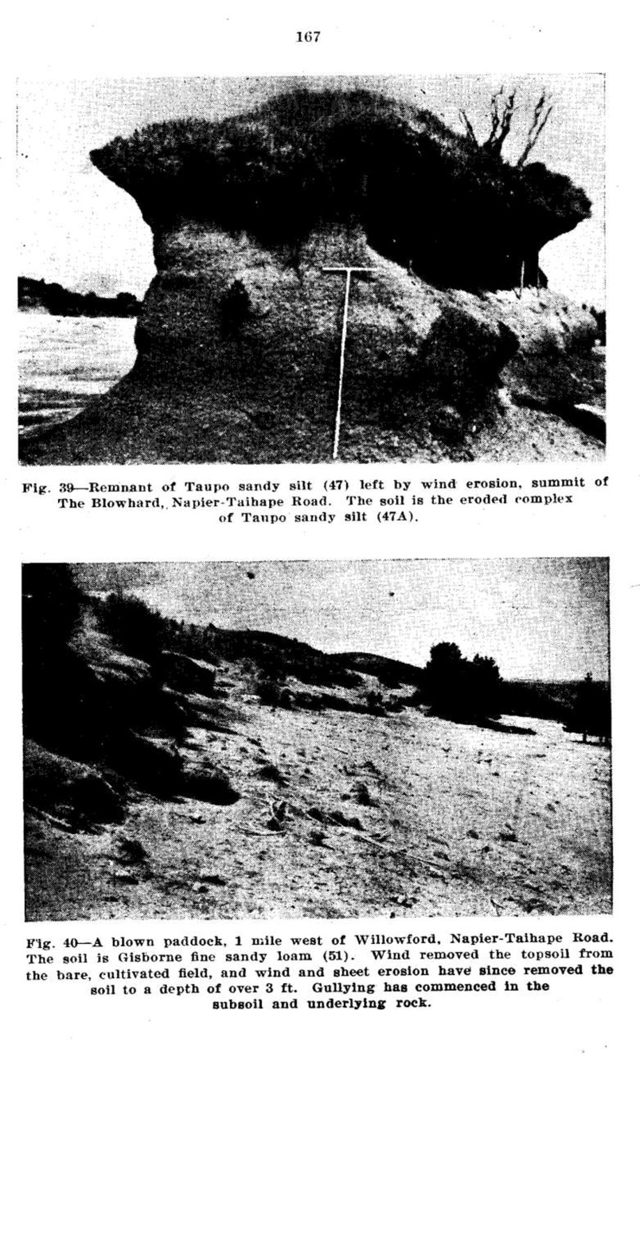
Page 168
Fig. 41 – Another view of the low paddock illustrated in Fig. 40. The eroded area exceeds 20 acres.
SOIL EROSION AND AGRICULTURE.
The distribution of soil erosion on the soils of Mid Hawke’s Bay is shown in Table XVIII. Significant erosion has
TABLE XVIII. – Distribution of Erosion on Mid Hawke’s Bay Soils,
Degree of Erosion Proportion of Surface Area Eroded* Area (Acres) Percentage of Total
Very severe Over 30 per cent. 31,105 2.6
Severe 20-30 per cent 179,144 15.3
Medium 10-20 per cent 83,345 7.1
Slight 1-10 per cent 318,291 27.1
Nil to slight 0-1 per cent 562,350 47.9
1,174,235 100.0
occurred on the soils of more than half the district. Of the remaining area 30 per cent. is low, flat land that has been affected by flooding and sedimentation in recent times.
The Table suggests, at first sight, that soil erosion has had a severe impact on agriculture, but this is not altogether correct. The very severely eroded land, which occurs mainly on the western ranges and north-western high country, would have little agricultural value if uneroded. At least 110,000 acres of the severely eroded land are in the same category, and only 30,000 acres are good farming land. Nevertheless the erosion on this country, by increasing flooding and sedimentation,
*Subsoil or rock is exposed: areas subject to sheet erosion, where the topsoil is not entirely removed, are classified as “slight” or “nil to slight.”

Page 169
produces important indirect effects on the agriculture of fertile bottomlands.
From the point of view of deterioration of agricultural land, areas of medium and slight erosion, which occur mainly on steep and moderately steep slopes, are more important than the severely eroded areas because they are mostly good farming land and the erosion on them is increasing. There is, moreover, some prospect of holding the soils in place under a system of soil conservation farming. The importance of reducing slips and gullies which result directly in land deterioration and loss of production is evident. Less obvious is the importance of sheet erosion, which appears to be reducing the depth of topsoil under open pastures on steep and moderately steep slopes.
The maintenance of dense pastures is, as already described, of chief importance in preventing the various forms of erosion on grassland. This requires some modification of modern farming practices and research is necessary to develop the best methods, particularly on land too steep to plough which comprises 46 per cent. of the district (see Table XIX). The establishment and maintenance of dense pastures on steep slopes presents many difficulties, especially in the low-rainfall areas.
TABLE XIX. – Percentage Distribution of Slope Classes in Mid Hawke’s Bay (including Heretaunga Plains).
Slope Class Per Cent.
Very steep 23.0
Steep 1.8
Moderately steep 21.0
Total (land too steep to plough) 45.8
Rolling 28.6
Flat (higher terraces) 10.3
Flat (low river flats) 15.3
Total (land of ploughable slope) 54.2
On cultivated areas of rolling slope severe soil erosion has occurred in parts of the district. Many hill-farms lack sufficient flat land for supplementary cropping which is being forced on to rolling and steeper slopes as farming becomes more intensive. Cropping of rolling slopes, as now practised, is a temporary expedient: many farmers realise that it cannot continue indefinitely, for Mid Hawke’s Bay is periodically subjected to intensive rains which cause severe sheet erosion on cultivated slopes. Rolling land will be removed entirely from cultivation by erosion of this type if existing practices continue for a sufficiently long period. To conserve the land

Page 170
experiments should be laid down to determine the extent to which it can be cropped while retaining the soil in place. While no soil conservation practices may be effective against unusually intensive rains, the following measures, extensively practised overseas, should be tested to determine their efficiency under average heavy rains.
Contour Cultivation – Ploughing and other cultivation practices are carried out on the contour, i.e. at right angles to the direction of slope. To facilitate this, subdivisional fences are constructed on the contour. The object of contour cultivation is to impede the flow of run-off.
Strip Cropping – Rolling land is sometimes cropped in contour strips separated by strips of pasture. The width of the strips varies according to the angle of slope. Run-off is impeded by strip cropping, and soil eroded from the cultivated strips is deposited on the grass strips.
In addition to these measures the soil is not worked fine, as the presence of clods helps to reduce erosion. Special implements have been devised to bring clods to the surface.
On gently sloping land the danger of erosion is less than on rolling land, but it is always present and erosion-control practices should be adopted. On moderately steep slopes cropping should be avoided. If ploughing is undertaken in order to renew pastures the pasture mixture should be sown down directly, so that the soil lacks vegetative cover for a minimum period. Cropping is not recommended on the steeper parts of the rolling country where the slope exceeds 15 degrees, but if undertaken it should be restricted to one season, after which the land should be returned to permanent pasture.
The necessity for providing adequate shelter on soils susceptible to wind erosion has been mentioned. These soils should not be worked fine, as clods reduce the erosive effect of the wind. After cultivation a vegetative cover should be re-established with a minimum of delay.
In planning details of erosion-control measures along the lines indicated above, farmers should make use of the advisory service recently established by the Hawke’s Bay Catchment Board.
SOIL EROSION, FLOODING AND SEDIMENTATION.
Flood peaks in the lower reaches of a river, under natural conditions, usually subside before the arrival of floods originating in the headwaters. Some seventy years ago floods originating upstream in Mid Hawke’s Bay took three days or

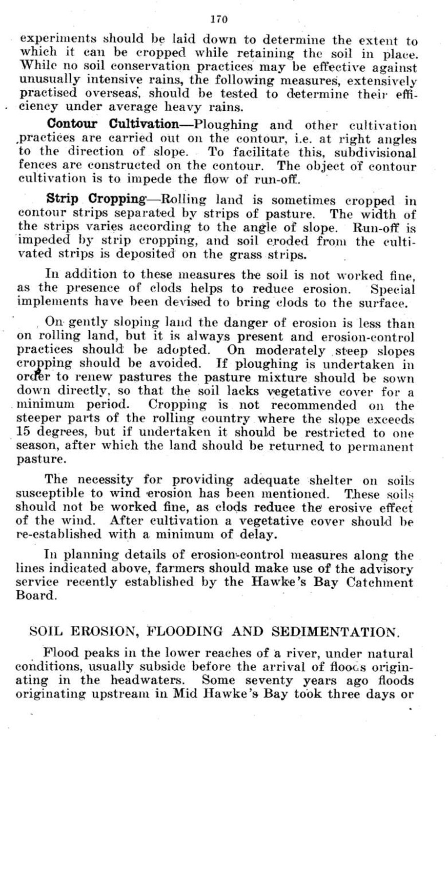
Page 171
more, according to old settlers, to arrive downstream. To-day they travel down the river in a few hours. Consequently there is a coincidence of flood peaks downstream and the maximum head of modern floods is greater than in the early days of settlement.
A high rate of run-off is favoured by the slope of the land surface of Mid Hawke’s Bay (Table XIX). Any increase in the natural rate of run-off therefore creates serious problems. The increase in run-off that has been observed is due partly to clearing and drainage of land, but mainly to soil erosion. From denuded and gullied land all the run-off and most of the eroded debris is discharged directly into the rivers. The supply of increased run-off and debris to the rivers from slips depends greatly on the location of the slips. It is high when the slips are adjacent to streams or gullies, but is much lower when they are located on hill-sides at a distance from a water-course, like many of the slips in the district.
An increase in run-off above the present-day level would endanger downstream river-control structures which are designed to cope with estimated maximum flood-flows based on existing run-off. For this reason it is important to prevent the extension of soil erosion, particularly gullying, and to control soil erosion that has already developed.
Esk Catchment Area – The Esk Valley was the site of unprecedented flooding in April, 1938. The catchment area totals approximately 115 square miles, and data on flooding and sedimentation are available in respect to it. The slope of the land surface is shown in Table XX. The proportion of very steep country is near the average of the district (see
TABLE XX.- Distribution of Slope Classes in the Esk Catchment Area.
Slope Class Area (Acres) Percentage
Flat 2,330 3.2
Flat terraces 442 .6
Easy rolling 1,912 2.6
Rolling 25,634 34.8
Moderately steep 24,924 33.9
Steep 3,662 4.8
Very steep 14,800 20.1
73,704 100.00
Table XIX), but the percentage of moderately steep and rolling country is higher than average. The average depth of siltation in 1938 on the Esk Valley flats (1750 acres)* was 3ft. 6in.

Page 172
and the maximum depth about 10ft. The total volume of silt represented an average depth of 7 in. over the whole catchment. The total run-off was estimated at 80 per cent. of the rainfall. The much increased run-off was due to the intense rainfall and to the amount of bare land exposed on steep slopes by soil erosion. It was discharged into the river mainly by way of gullies, many of which were formed on fresh slips.
Fig. 42 – Esk Valley, April, 1938. Photograph taken a few days before the “Anzac Day” flood of April 25th, 1938, showing Twyford heavy sandy loam and sandy loam (59 S.L.) on the flats and a narrow strip of Esk sands (57) near the river. (Photo R. P. Hill)
Tutaekuri Catchment Area – This catchment occupies some 382 square miles. In the headwaters of the river the area of severely eroded country, from which run-off is very high, exceeds 60 square miles. In the lower reaches of the river soil erosion on the walls of deep gorges and other steep slopes provides the major run-off problems. The river flows through the Heretaunga Plains where extensive river-works have been constructed to control it.

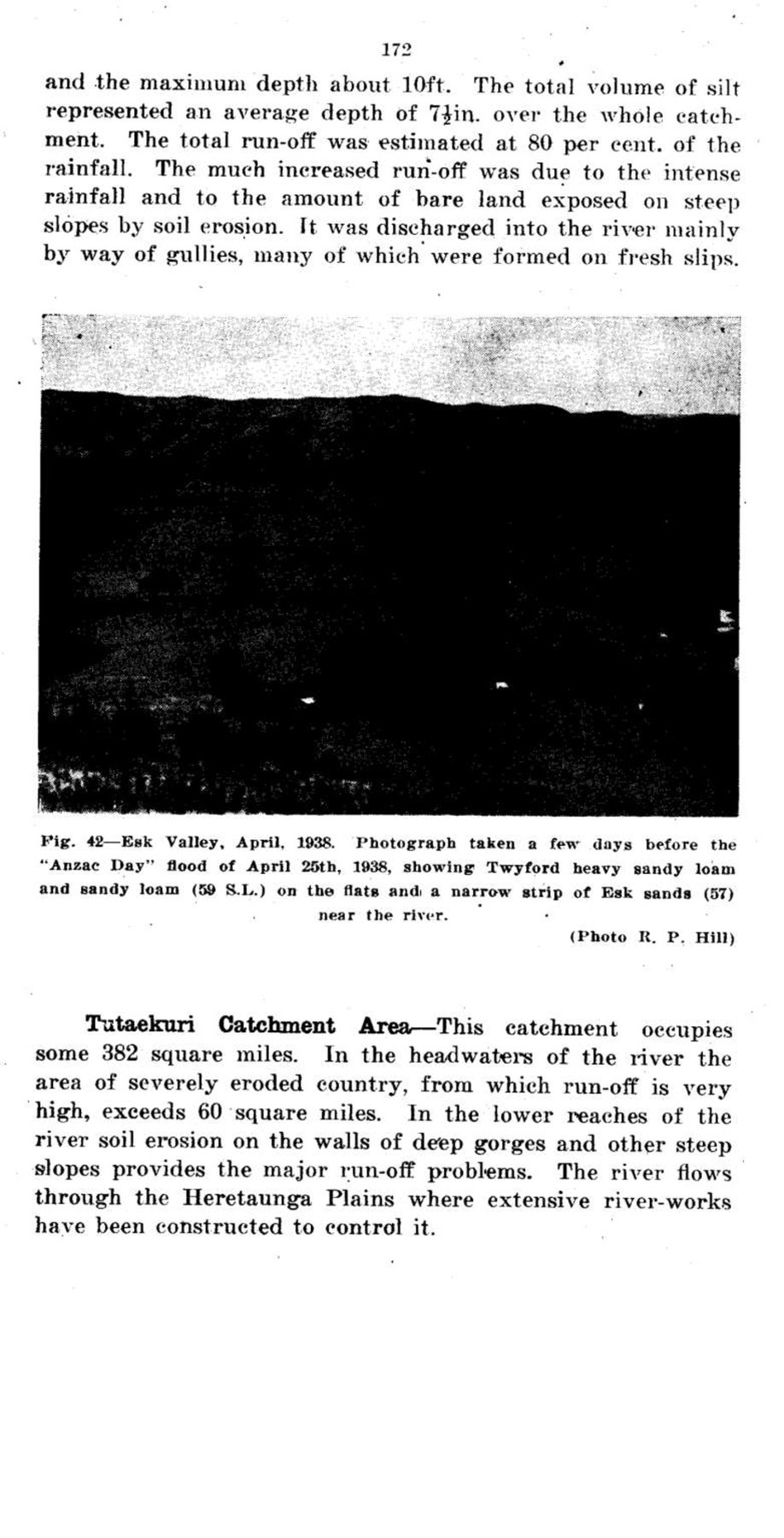
Page 173
Fig. 43 – Esk Valley, April 1938. Air-photograph taken immediately after the “Anzac Day” flood showing the freshly-deposited sands covering practically all of the flats, burying the road and railway, and partly burying fences and buildings. A bridge over the river on the left of the photograph has been destroyed.
(Courtesy N.Z. Aerial Mapping Ltd.)
Fig. 4. – Esk Valley, February. 1947. Photograph covers most of the area in Fig. 42. The soils on the flats are Esk sand (57). A lucerne crop is shown in the centre of the photograph. The pastures are drying off.

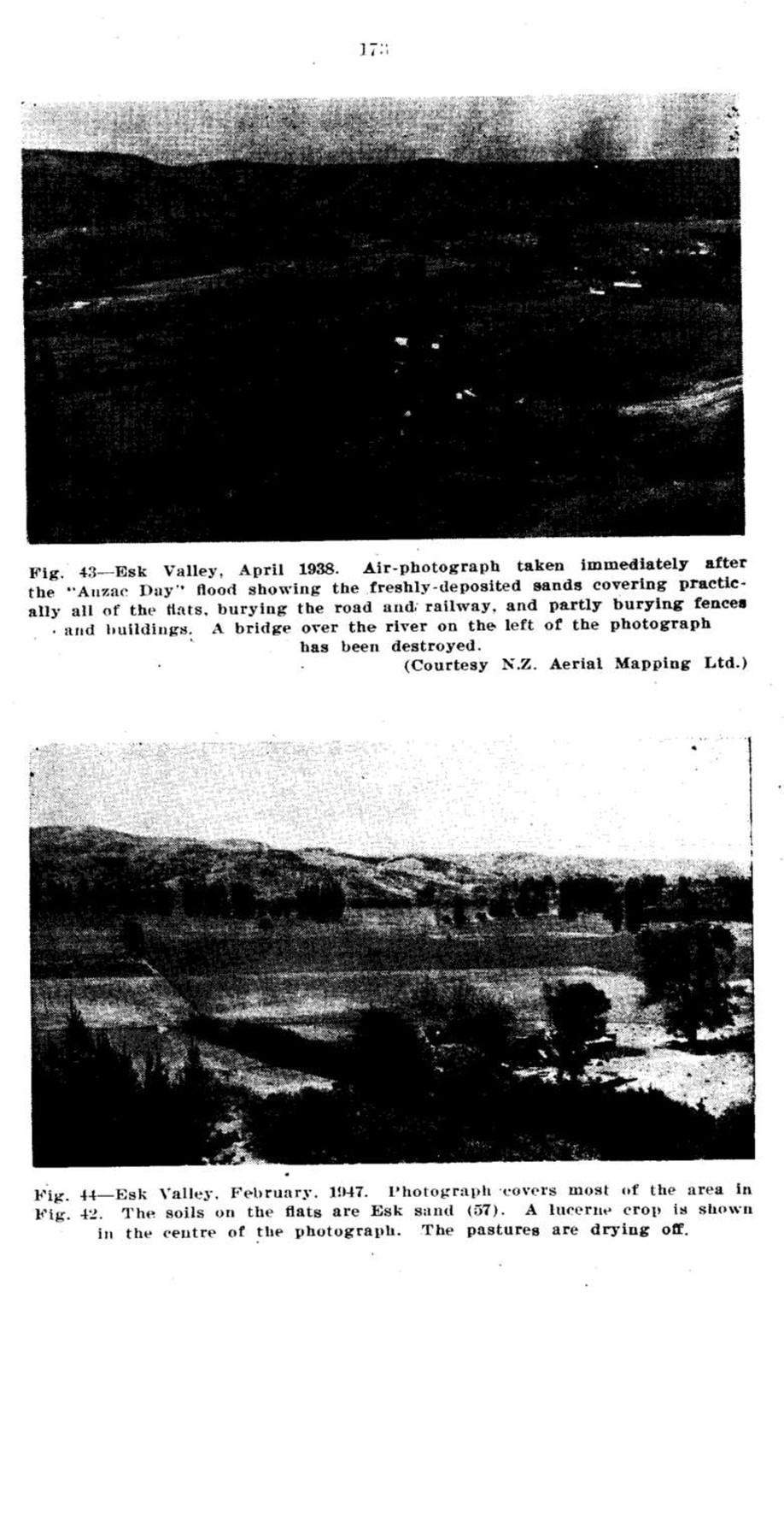
Page 174
Fig. 45 – Catchment Board’s Cut, Tukituki River looking upstream from Waipukurau Bridge. The first major works of the Hawke’s Bay Catchment Board formed in 1944 to “minimise and prevent damage by floods and by erosion.”
Ngaruroro Catchment Area – The Ngaruroro Catchment covers approximately 938 square miles. Of this area more than 130 square miles, situated in the headwaters of the river on Kaweka, Ruahine and Wakarara ranges, is very steep and severely eroded. The excessive run-off from the eroded land is the main problem of the catchment. In the lower half of the catchment there are some severely slipped areas, but the topography is mainly rolling or flat, and the run-off problems are localised. The river has built up most of the Heretaunga Plains where it is artificially controlled by river-works.
Tukituki Catchment Area – This is the largest catchment of the district, totalling about 964 square miles. In the headwaters of the river on Wakarara and Ruahine ranges there are some 40 square miles of eroded country from which the run-off is very high. The foothills of the ranges and the lower reaches of the river are traversed by many gorges, the walls of which are eroded, but much of the lower land is rolling. The river passes through the eastern part of Heretaunga Plains. Its main floodplain is the Ruataniwha Plains, where flood problems require to be overcome.

Page 175
The chief river problems of the catchments of the district have their source in the eroded areas of the western and north-western ranges and the north-western high country. Much of this land is grazed by stock and is subjected to periodic burning and other practices which accelerate erosion. Table XXI shows the extent of erosion on the soils of these areas. About half the area of the Ruahine Series is little
TABLE XXI – Distribution of Erosion on the Soils of the Ranges.
Soil Series Area. (Acres)
Total Main Types (little erosion) Eroded Complex Severely Eroded Complex
Ruahine 101,856 61,664 23,708 16,484
Kaweka 91,493 12,305 72,485 6,703
eroded, as it is under forest which, owing to lack of access, has not been removed. Of the remaining area, namely 48,392 acres, 34 per cent. is classified as the severely eroded complex, 49 per cent. as the eroded complex, and 17 per cent. as little eroded. All of the Kaweka Series not under forest has been mapped in the eroded complexes. The area under forest is 13 per cent. of the total, the eroded complex contains 79 per cent., and the severely eroded complex 8 per cent.
These figures show that grazing under existing methods has notably failed to hold the soil in place on the ranges. Stock-carrying capacities are reported to have fallen very considerably,* and there seems little doubt that the reward obtained from grazing is insufficient to offset the damage caused to fertile bottomlands by increased flooding and sedimentation following on increased erosion. Under these circumstances the western and north-western ranges and the severely eroded part of the north-western high country should be further investigated and a decision made as to whether parts should be closed to grazing.
This problem is one requiring immediate investigation and action. Land unsuitable for grazing should be used for other purposes, and soil conservation methods should be adopted on the remainder.
*For example, a farm of several thousand acres was valued in 1930 at approximately £26,000. It was revalued in 1937 and 1946 at approximately £18,000 and £8,000 respectively. The deterioration, mostly permanent, was due to the weakening of pastures by grazing and by rabbits, followed by sheet, gully and slip erosion and by invasion of scrub.

Page 176
Acknowledgments.
The writers wish to record their appreciation of the co-operation of the farming community and local bodies of Mid Hawke’s Bay during the Survey.
Assistance in the compilation of the Bulletin was received from many private individuals and Departmental officers and is gratefully acknowledged. Among those who contributed to the text are:- N. G. Robertson, Officer-in-Charge, Climatology Section, Meteorological Branch of the Air Department (Climate); P. B. Lynch, Crop Experimentalist, Fields Division, Department of Agriculture (Table of Fertiliser Responses, etc.); W. K. Dallas, Director, Horticulture Division, Department of Agriculture (Table of Fruit Production in N.Z. Fruit Districts); A. D. M. G. Laing, Veterinarian, Livestock Division, Department of Agriculture (Dairy and Pig Industry); D. S. Robinson, Apiary Instructor, Horticulture Division, Department of Agriculture (Apiaries); G. H. Hocking, Assistant Forester, State Forest Service (Forestry); Officers of the Census and Statistics Department (Population): Officers of the Heretaunga Co-operative Dairy Co. Ltd.. Stortford Lodge (Distribution of Dairy Farms); N. L. Elder, Havelock North (Nothofagus Forest); H. A. McLean, Hastings (Artesian Water Supplies), and P. Van Asch, N.Z. Aerial Mapping Ltd. (Air Photographs). Other photographs were prepared by A. J. Metson, Soil Bureau.
Erratum.
An error occurs on the soil map south of Pakipaki, three miles south-west of Hastings. Adjacent to the main road, for a distance of 3½ miles south of Pakipaki, the soil boundaries are displaced slightly to the west relatively to the road and other base data. In this area Soil Type 68 should lie between the main road and Poukawa Stream.
The Cliff Press.
HASTINGS. NEW ZEALAND.
1947.
1800/7 /47.

Original digital file
SoilsAndSomeRelatedAspects.pdf
Non-commercial use

This work is licensed under a Attribution-NonCommercial 3.0 New Zealand (CC BY-NC 3.0 NZ).
Commercial Use
Please contact us for information about using this material commercially.Can you help?
The Hawke's Bay Knowledge Bank relies on donations to make this material available. Please consider making a donation towards preserving our local history.
Visit our donations page for more information.
Format of the original
BookDate published
1947Publisher
DSIRAccession number
912/998/35881Supporters and sponsors
We sincerely thank the following businesses and organisations for their support.


Do you know something about this record?
Please note we cannot verify the accuracy of any information posted by the community.