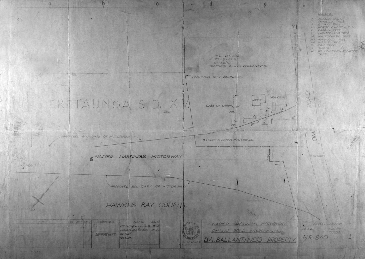
Stoneycroft Property Map

HERETAUNGA S.D. X V.
LEGEND
1. ACACIA TREE
2. CAMELLIA TREE
3. GINKO [GINGKO] TREE
4. HORSE CHESTNUT TREE
5. LAWSONIANA TREE
6. MACROCARPA TREE
7. MAGNOLIA TREE
8. MAPLE TREE
9. OAK TREE
10. SHRUB
11. WELLINGTONIA REDWOOD TREE
PT 6 D. P. 285
23 – 3 – 07.05
DIAMOND ALLAN BALLANTYNE
HASTINGS CITY BOUNDARY
EDGE OF LAWN
HOUSE
DRIVEWAY
3 ACRES 0 ROODS 9.3 PERCHES
PROPOSED BOUNDARY OF MOTORWAY
NAPIER-HASTINGS MOTORWAY
PROPOSED BOUNDARY OF MOTORWAY
HAWKES BAY COUNTY
RECOMMENDED
APPROVED
NAME DATE
DRAWN Yvonne Porter 9.72
TRACED Y.D. Porter 9.72
DR. CHKD.
SUPERV’D
MINISTRY OF WORKS NEW ZEALAND
C/- H. MACKY.
Commissioner
NAPIER-HASTINGS MOTORWAY.
OMAHU ROAD INTERCHANGE.
D. A. BALLANTYNE’S PROPERTY
100 FEET TO AN INCH
F.B. 361
FILE NO.
72/m/4
N.R. 840
Original digital file
BallantyneDA620_PropertyMap.jpg
Non-commercial use

This work is licensed under a Attribution-NonCommercial 3.0 New Zealand (CC BY-NC 3.0 NZ).
Commercial Use
Please contact us for information about using this material commercially.Can you help?
The Hawke's Bay Knowledge Bank relies on donations to make this material available. Please consider making a donation towards preserving our local history.
Visit our donations page for more information.
Subjects
Format of the original
Architectural planDate published
September 1972People
- Diamond Allan Ballantyne
- H Macky
Accession number
733106Supporters and sponsors
We sincerely thank the following businesses and organisations for their support.


Do you know something about this record?
Please note we cannot verify the accuracy of any information posted by the community.